
-
 5626 Hits
-
 81.18% Score
-
 13 Votes
|
|
Mountain/Rock |
|---|---|
|
|
46.33697°N / 10.43083°E |
|
|
Skiing |
|
|
10158 ft / 3096 m |
|
|
OVERVIEW
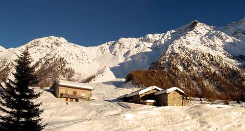
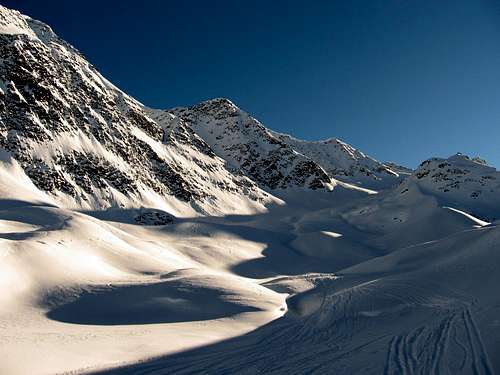
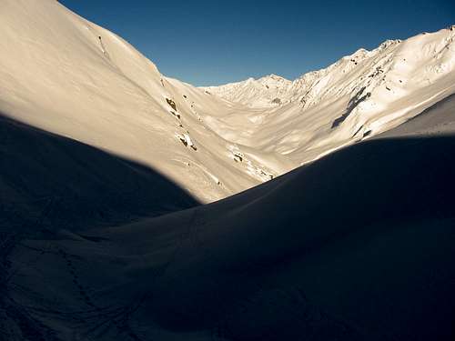
Cima di Savoretta from Valle di Rezzalo.
Cima di Savoretta is one of the highest peaks of the group "GAVIA-SOBRETTA-SEROTTINI".
This group is indicated in the SP page, as a part of the Ortles/Cevedale group.
This is true, but precisely, it's a bit apart from Ortles group that start from the Pizzo Tresero above the "Passo del Gavia".
This group is indicated in the SP page, as a part of the Ortles/Cevedale group.
This is true, but precisely, it's a bit apart from Ortles group that start from the Pizzo Tresero above the "Passo del Gavia".
The group is located on the west side of the Gavia pass, and confined between the "Alta Valtellina" and "Valcamonica", and the mountains of "Bormio"
The main peaks of this group are "Monte Sobretta"(3296m), "Monte Gavia"(3223m), "Monte Vallecetta"(3148m), "Monte Serottini"(2961m) and "Punta di Pietra Rossa"(3283m).
It doesn't stand out in height among the other peaks, but it offers an impressive rocky cliff and also a small glacier that withdraws more and more for global warming; both on the north side.
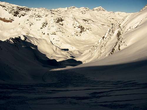
The approach is usually along the beautiful "Val di Rezzalo", that can be reached from the hamlet of "Fumero" in Valtellina, or from the road of the Gavia pass (open only in summer).
It is possible also approach it from south, along from "Valle delle Messi" in Valcamonica. But the path doesn't take to the summit, but only to the Passo di Pietra Rossa(little bit below).
GETTING THERE
FROM MILAN BY CAR: statal route "Vallassina" number 36 to Lecco and then to Colico (north side Como lake) and then Stelvio statal route to Morbegno, Sondrio, Tirano and then to Bormio (three hours). Before Bormio, take the gate called "Le Prese" and follow the small road to the hamlet "Fumero". (car park)FROM MILAN BY TRAIN AND BUS: take a train in the Milan Central station destination Tirano and then a bus to Bormio (4 hours).
FROM SUDTIROL BY CAR THROUGH STELVIO PASS: from Bozen (Alto Adige on the highway between Innsbruck and Verona) to Merano by main route and the by local route through Venosta Valley follow the signals to Stelvio mountain pass (2700 meters, the highest mountain pass reaching by car, open only in the summer period). From here to Bormio (3 hours and half from Bozen, Stelvio pass requires 44 bends to go up and 15 to go down).From Bormio, take the gate called "Le Prese" and follow the small road to the hamlet "Fumero". (car park)
FROM SAINT MORITZ (CH) BY CAR: go to Pontresina and then follow the signals to Bernina pass. Turn left when you look the indication to Livigno (I) through Forcola pass (open only in summer period) and then from Livigno through Foscagno pass (2200 meters, open all the year) to Bormio (3 hours).
FROM SANTA MARIA (MUNSTERTAL - CH) BY CAR: follow the signals to Giogo di Santa Maria (Pab Umbrail) on the border between Switzerland and Italy and then to Bormio (1 hour and half, border near Stelvio pass, open only in the summer period).
FROM GERMANY OR AUSTRIA BY CAR: on highways via either Innsbruck or Bregenz to Landeck and then following Staatsstraße S 13 to the italian border at the Reschenpass / Passo di Resia . There the Vinschgau / Val Venosta valley starts that represents the northern border of Ortles-Cevedale group. At Prad the Trafoi valley starts that leads either to Sulden / Solda or via Stilfser Joch / Passo di Stelvia to Bormio.
FROM VALCAMONICA: From the village of "Ponte di Legno" follow the road to Passo del Gavia(2618m open only in summer) and from the hamlet called "Santa Apollonia" take the path along the "Valle delle Messi".
The Gavia pass can be reached also from S.Caterina di Valfurva.
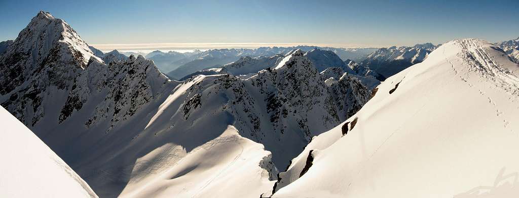
The summit and the Punta di Pietra Rossa
From the summit to the Ortles group
SKI ROUTE
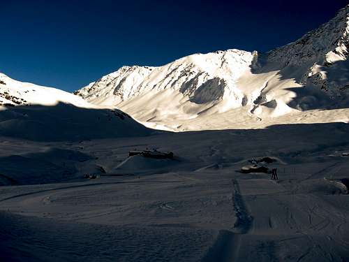
Here will be explained the ski route from Valle di Rezzalo, which is in my opinion the most interesting:There are 2 chance to approach the base of the mountain:
The first is taking the cable car from S.Caterina di Valfurva and get the "Costa Sobretta". Descent the pist above Val di Rezzalo and ski down untill the group of small wood houses called "S.Bernardo" 1860m.(faster choice)
Otherwise, starting from the car park of the hamlet called "Fumèro"(1465m).
Follow the small road usually covered of snow untill spring, up to "S.Bernardo".(longer choice)
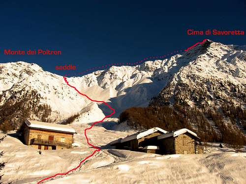
The ascent route.
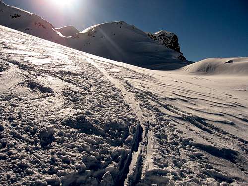
From S.Bernardo, leave the main pathway to south direction, and go up on the snow slopes that get steeper and steeper along the way.
Point the saddle between the Cima di Savoretta and the Monte dei Poltron(2702m).
From here, the slope at the base of the glacier di Savoretta is visible down on the opposite side.
Ski down on the opposite side, loosing 50/60 meters. Put the skins again and climb all the easy slope, when the inclination increase a bit for few meters.
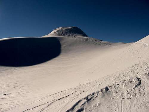
Over this point, the summit is visible as a snow calotte on the right side.
Otherwise, is possible to go across the ridge on the left side, and reach the very panoramic point at the and of it(for someone considered the real summit). Advisable, beacause from here very impressive view to the Val di Rezzalo 1500 meter drop lower!
For the descent, ski down on the same slope of the ascent, passing the saddle and touch the base of the valley untill the original pathway.
From here go back to Fumèro or to the pists of S.Caterina di valfurva.
The itinerary of descent can be done even for the ascent. But it is much more long and tedious of the previous route.
The route across the saddle is more steep, fast and amusing; and also permit to climb the Monte dei Poltron during the same day.
PHOTOS OF THE ROUTE
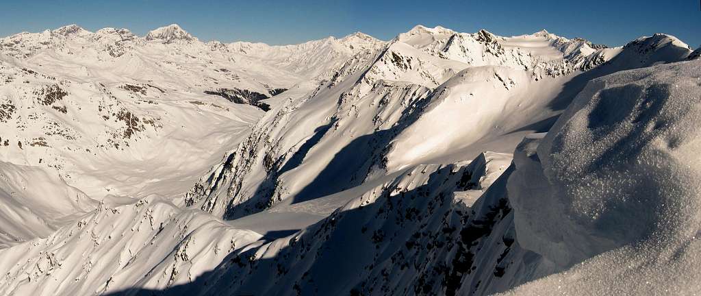
The glacier of Savoretta
The secondary summit
The glacier of Savoretta
The steeper part before the summit
The base of slope
The hamlet of "Clev"