
|
|
Mountain/Rock |
|---|---|
|
|
35.26328°N / 120.87158°W |
|
|
San Luis Obispo |
|
|
Hiking |
|
|
Spring, Summer, Fall, Winter |
|
|
1347 ft / 411 m |
|
|
Overview

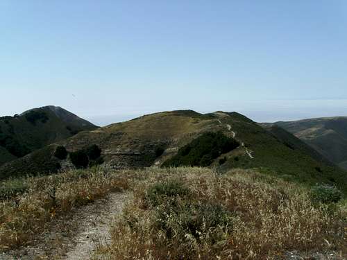
Looking Southwest (by Tarol)
Rising sharply from the San Luis Obispo county coastline is the striking pyramid shaped Valencia Peak. While not the highest, Valencia Peak is certainly the most striking peak in Montaña de Oro State Park, one of the largest state parks in California. The summit offers some of the best views on the California central coast, with a sweeping panorama of nearly 100 miles of coastline, rugged hills, bluffs, canyons and the parks signature eucalyptus groves.
Montaña de Oro State Park has some of the best hiking in San Luis Obispo County. The coastal climate is suitable for year-round recreation. Montaña de Oro translates to Mountain of gold, so named for the awesome display of wildflowers in the springtime.
The peak presents a classic example of marine terracing. The rock in this region is predominately sedimentary, Monterey Shale being most common. Over millions of years layers of sediment built up along this section of the coast, at the same time plate tectonics drove the layers downward, tilting them back into the sea. The result is a series of plateaus one climbs over on the hike to the summit. The present day “tilt” of these layers is seen in the obvious stripes that run through the mountain on its east and west faces.
Getting There
Valencia Peak From Oats Peak
From San Luis Obispo
From US 101 take Exit 202A for Los Osos Valley Road. Continue on for 11 miles to the city of Los Osos. Continue straight through town on the main street, eventually the road becomes Pecho Valley road. 4 miles on Pecho Valley road will put you at Spooners Cove, where the main trailhead is located. If you want to begin your hike from the Coon Creek trailhead, drive another mile on this now single lane road.
 |  |  |  |
From Moro Bay
From State Route 1, take Exit 277 for South Bay Blvd. After four miles turn right on Los Osos Valley road. Continue on Los Osos Valley road through town on the main street, eventually the road becomes Pecho Valley road. 4 miles on Pecho Valley road will put you at Spooners Cove, where the main trailhead is located. If you want to begin your hike from the Coon Creek trailhead, drive another mile on this now single lane road.
 |  |  |  |
Summit Routes
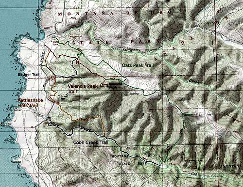
Trail Map
Given the abundance of great hiking in this park, there are numerous ways to approach this peak. Some of the better routes are shown on the map below, and explained in detail.
Valencia Peak Trail
As the name might imply this is the shortest and most direct route to the summit. The trailhead is just up the road from Spooners Cove and the ranger station. It's just over 2 miles to the summit one way.
Oats Peak Trail
This trail begins behind the ranger station near the main park campground. It leads over the ridge to the summit of Oats Peak, which is slightly higher than Valencia but with an inferior view. Prior to cresting the ridge are two link trails to the Valencia peak trail. The trail then plunges into Coon Creek Canyon and links with the Coon Creek Trail.
Rattlesnake Flats Trail
This trail parallels the park road and can be accessed through any of the pull-outs between the Valencia peak trailhead and the Coon Creek trailhead. To get to the summit, simply follow the Rattlesnake Flats Trail north until it links with the Valencia Peak Trail, then follow the Valencia Peak Trail to the summit.
Badger Trail
Beginning from a pullout a quarter mile south of Spooners cove, The Badger Trail links the Rattlesnake Flats trail with the Valencia Peak trail.
Coon Creek Trail
This option follows the riparian habitat along Coon Creek before linking up with the rattlesnake trail and the oats peak trail. This is a good option for a loop.
Having hiked throughout the park the I think the best way to get a taste of the everything the area has to offer is to combine the trails detailed above into a loop. Follow the Valencia Peak trail to the upper link with the Oats Peak trail, then follow the Oats Peak trail along the ridge to the summit of Oats Peak. From there descend into Coon Creek canyon, and follow the Coon Creek trail to its junction with the Rattlesnake trail. Then follow the Rattlesnake trail back to the Valencia Peak trailhead. The loop is about 11 miles round-trip with 2400 feet of elevation gain.
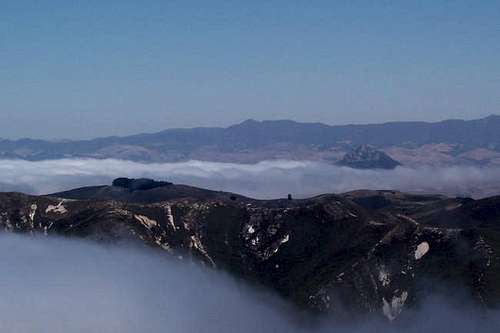 Summit View North (by Keema)
 | 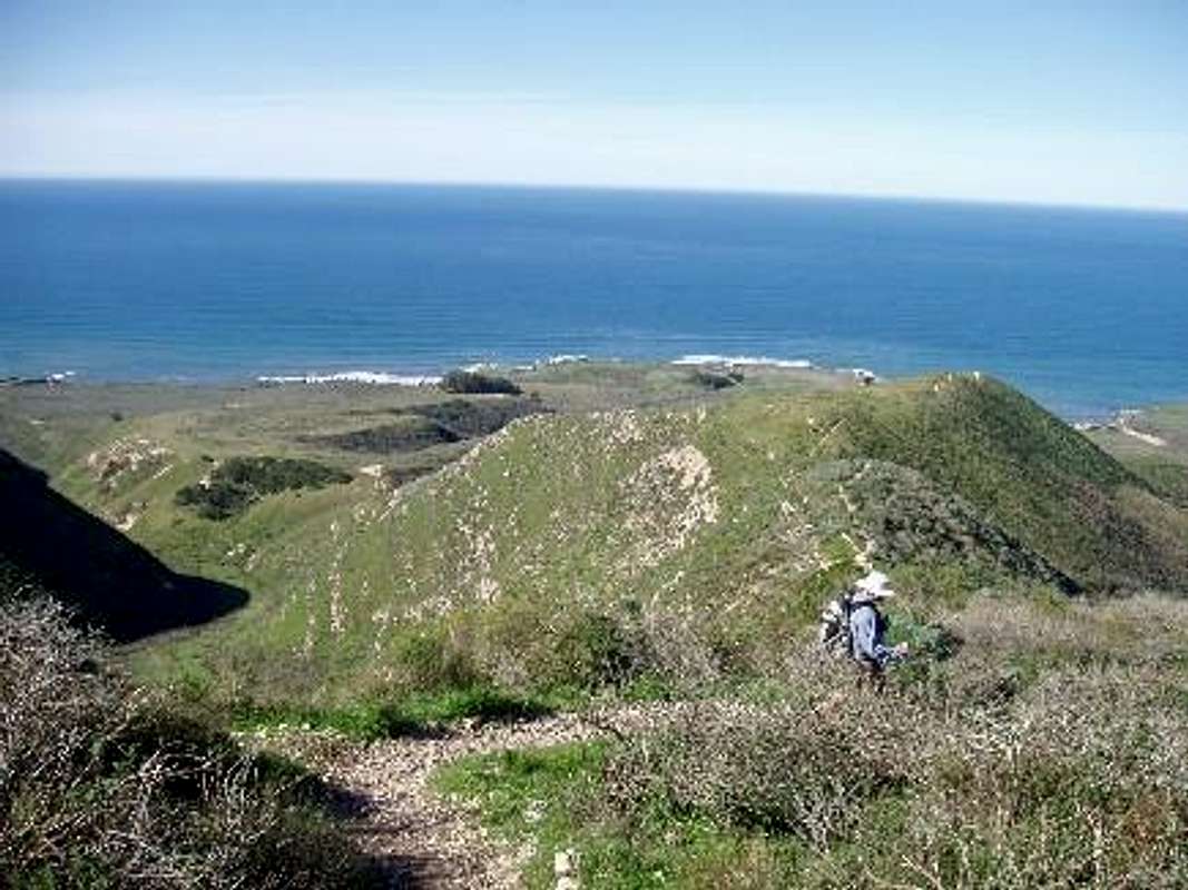 Looking West (by Tarol)
 |
Red Tape

Valencia from the west (by Keema)
The park is closed from sunset to sunrise, any vehicles parked outside designated campgrounds after dark will be cited. Each Trailhead has a sign explaining “Siren Info”, and describes what to do if you hear it, but none of these signs mention what the siren is for (likely to not scare tourists away). The park is adjacent to the Diablo Canyon Nuclear power plant. So in the event of a nuclear meltdown try to not be in this area.
Camping

Valencia From Spooners Cove (by Socalhiker)
Camping reservations
In addition the park also has several “environmental” campsites, which offer a more primitive camping experience, in various locations throughout the park. Reservations can be made at the link above.
Camping is prohibited outside designated sites.
Contact and Links
Montana de Oro Visitor Center Phone: (805)528-0513Official Page for Montaña de Oro
Socalhikers page for Montaña de Oro
SLO County Website For Montaña de Oro
davidsanger - May 5, 2015 11:25 am - Hasn't voted
new trail alignmentThe trails have been realigned since this was written. Oats Peak trail leaves from the campground and is now a very windy, gradual uphill mountain bike trail, over a mile longer than the Valencia Peak Trail. There is new signage. There's a trail linking the two called the Beebe trail. There are new maps of the state park at the Spooner Ranch, and they are more up to date than the pdf brochure you can download from the State Parks website.