
-
 12499 Hits
-
 88.19% Score
-
 26 Votes
|
|
Mountain/Rock |
|---|---|
|
|
37.91766°N / 115.61145°W |
|
|
Nye |
|
|
Hiking, Scrambling |
|
|
8968 ft / 2733 m |
|
|
Overview
|
|
|---|
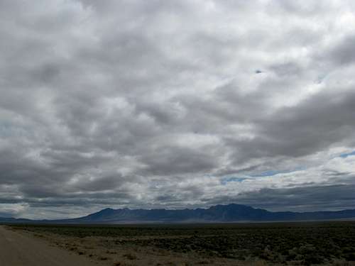
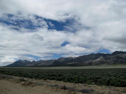
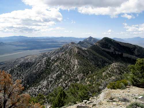
Rising like a ship in the middle of the desert, the small and compact Worthington Range north of Rachel, Nevada gets little attention. Perhaps it’s because these mountains, never cresting over 9,000’, are lower than their neighbors, especially the vaster Grant and Quinn Canyon Ranges to the north. Perhaps it’s because most people who traverse up to this remote area of Nevada are either truckers or UFO fanatics, this being Area 51 country. The range, though isolated, are not much more so than other more popular Nevada peaks (popular being a relative term), and wide and easily drivable gravel roads will take you most of the way towards the mountains.
 Meeker Peak Meeker Peak |
 Storms and Quinn Canyon Range to N Storms and Quinn Canyon Range to N |
|---|---|
 Worthington & Rd leading in Worthington & Rd leading in |
 Worthington Massif Worthington Massif |
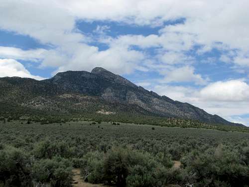
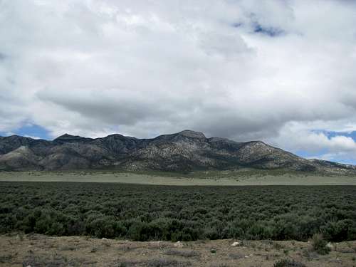
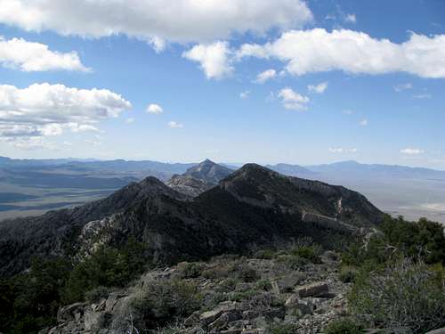
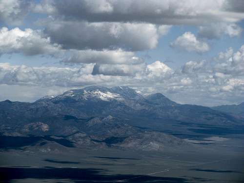
And what striking mountains. Meeker Peak stands a dominant sentinel over the Spring Valley. Its cliffy summit block presents a climbing challenge ranging between class 2-4, and you can find out more about that peak here. The range continues north through, one cliff lined summit after another, until it crests near its northern terminus at Worthington Peak, at 8,968 ft, beating out Meeker by 200 ft to claim the range highpoint status, as well as a place in the Nevada 2K Prominence lists. Views from this rarely visited perch are tremendous, the vast valleys dominating the east and west while higher mountains rise in the distance; looking south, you see the steep and rugged spine of the Worthingtons stretching all the way to Meeker, sitting in a window between two more proximate peaks. Worthington Peak itself sits a little to the north of the Worthington Mountains Wilderness, which covers the southern 2/3rds of the range, but observe all LNT rules regardless.
|
|
|---|---|
|
|
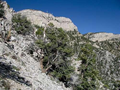
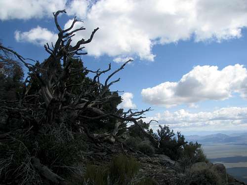
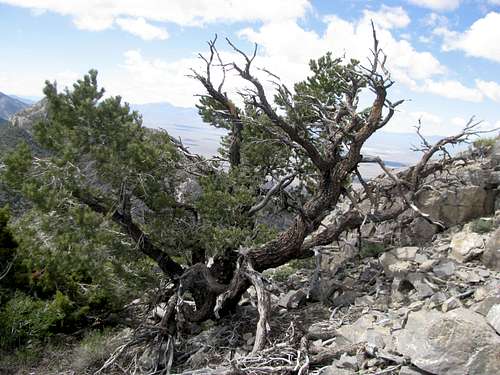
Note the ancient Bristlecone pines on the upper reaches of the range.
Getting There
A couple of roads between Rachel and the Queen City Summit along NV 375 will take you to the Worthington Mountains. One lies about a mile west of town and the other, the signed Gunderson road, lies four and a half miles west of Rachel; I chose to drive and measure this approach because it seems more straightforward.Turn north onto Gunderson Road from NV 375. This gravel road is wide, graded, and in excellent condition for all types of cars until you reach the Freiburg Mine.
Reach an abandoned ranch cabin at 11.5 miles. Here the road bears right. Follow it. At 14.8 reach a junction and take a left onto another wide and well graded road. This is the one of the branches of the road that leaves the highway closer to Rachel. Bear right at an intersection at mile 19.3, and as the road curves east and then south around the northern end of the Worthingtons bear another right at 26.6. As the road merges into another wide gravel road coming in from the northwest the main gravel road should be pretty easy to follow.
At mile 29 take a right onto a fainter track leading in to the mountains. You should be able to see this road going up the slope towards an old mine from the distance. Arrive and drive through the Freiburg mine. Though the last 1.7 miles have been a little rougher most passenger cars should be able to make it to the mine, and maybe a little further. As you drive through the mine look for a dirt road perpendicular to you on your left at mile 30.7 or so. This should be a fairly wide road. Be careful though; there’s an outer and an inner road in this area encircling the range’s eastern slopes. This is the outer, and make sure you stay on this, as the inner one is much rougher, narrower, and more confusing.
Bear left at a junction at mile 31.2, and finally, at mile 31.9, bear right and drive into the canyon right below the cliffy east face of Worthington Peak. Go up this road as far as you can. It gets rough, but your biggest obstacles are downed and overgrown trees. I parked around 6,600’ but you can keep going if you think moving aside the trees blocking your progress is worth the effort. If you’re planning on ascending the east ridge route make sure you don’t overshoot the ridge itself.
Another road branches in from the right (north) as you drive up into the canyon. Make sure you don’t take that branch road when you’re driving back down; bear right when you're driving back, or else you’ll end up on the inner encirclement roads.
Getting Up
Worthington can probably be climbed from its western side. This side is likely less cliffy but will require a longer approach from the road as well as more elevation gain. From the east there are likely several routes that can be ascended via a 4WD road that goes up the canyon below its East face. You can ascend what looks like a brushy ravine to the notch north of the main summit block, and maybe be able to avoid serious cliffs by trying to traverse to the west side of the range from there. I’m not sure whether this route would cliff out or not.
 Route Options from S Notch Route Options from S Notch |
 Route Options from S Notch Route Options from S Notch |
|---|
Another option is to gain a notch around 8,250 ft south of the main summit block, where the mountain’s east ridge merges with its south ridge. You can get to this point by ascending a ridge running SW from the canyon to meet the East Ridge. These ridges are rocky and airy though, with some narrow spots. You can also gain the saddle by following the scree and talus chutes leading up to it. This option can be confusing as there are countless different chutes and ravines branching off from one another between the canyon and the notch. I personally took the ridge route on the ascent and went down the chutes and washes, since on the descent you don’t have to worry about different chutes branching up.
East Ridge
 East Ridge leading to saddle East Ridge leading to saddle |
|---|
If you don’t mind some brushy class 3+ ish moves with minor exposure and some narrow yet still thistly ridge walking the East Ridge of Worthington offers an exciting way to ascend the peak. Drive or walk the 4WD road leading up to the basin below the east face of the peak while keeping an eye on your left (south). Pass a clearing in that direction, and around 7000’ along the road will see hilly terrain winding next to it to the south. This is the base of a ridge that runs southwest to merge with the east ridge. Pick a line up the steep and sparsely brushed terrain and ascend cross-country. Around 7,500-7,600’ you might hit some open areas that allow you to see the terrain ahead. Several rocky bumps separate you between the main 8,250 saddle you’re aiming for. Follow your way around or over the small bumps along the ridge. The ridge crest features more rocky terrain and pinnacles that you can easily scramble up and over. If you choose to contour along the side of the ridge you will find scree and talus traverses as you climb higher. In some places short but narrow sections of the ridge crest may be tough to avoid.

|

|

|

|

|
|---|
The right (north-ish) side of the ridge gets steeper if you try to contour around the last pinnacle before the saddle, and scattered clumps of rock means that scrambling is unavoidable whether you keep to the ridge crest or not. The left (south-ish) side of the ridge crest may offer some slightly gentler terrain. Expect brush wherever you go, even if atop the ridge crest.

|

|

|

|

|
|---|
Make a minor descent after passing by the last pinnacle to find yourself along the saddle. Keep going up the gentler slopes to a point where it steepens a little and you can see small bands blue-ish rock in the slopes above you as the ridge leads seeming directly to a point south of the main summit.

|

|

|
|---|
These blue-ish rocks need to be overcome sooner or later. To avoid what could be cliffy terrain to your right either climb the bands of blue rock directly or contour left along the sloping and sometimes talus strewn south side of the east ridge. Try to find a place where you can climb up and over the band of blue rocks, but if the terrain is too difficult keep trailing left. A good point to overcome this band is right before or after an obvious pinnacle (top left pic) on the south side of the ridge. Careful not to contour too far to the left; you want to avoid the obvious orange-ish cliff band that lines the east side of the south ridge. Keep working your way up. Another small band of yellow rocks block your way as you near the crest of the south ridge. Pick a good spot to climb through them and find yourself on easy terrain as you walk north towards the open, terraced summit, traversing over some minor rocky areas.

|

|

|
|
|---|---|---|---|

|

|

|

|
Ravine/Gully Variation
If you want to avoid the slightly airy east ridge you can ascend some chutes to the saddle area anywhere between 8,200 and 8,400 ft. Note that this route is not just a walk in the park. Countless downed trees block your way across the sometimes very narrow lowers sections of the ravine, and as you ascend further countless drainages branch off and up to various points higher. Veer too much to your left and you’ll hit the difficulties of the east ridge anyway, and veer too much to the right and you might cliff out near the massive east face of the peak. There are rocky sections along the way too, and the upper chutes are steep and filled with rocky, loose rubble.
Follow the road as it contours right beside the SW spur of the east ridge to an open area right below the massive east face of Worthington Peak. As the road veers right away from the hilly sections on the left bear left and follow a wash filled with downed trees and dead branches (1st Pic belwo). You should soon see a large rock formation to the left of the wash (4th Pic below). Go through this rocky tunnel and continue up as the ravine gets steeper and steeper.

|

|

|

|

|
|---|
In general try to bear left early; as you ascend further the terrain gets rockier, and you might have to scramble up some rocky class 2-3 sections. As you get closer to the saddle ascend one of the many talus slopes to crest the ridge near some pinnacles along the ridge crest. (They are hidden by trees until the very end on the way up, but make for an excellent landmark to mark your departure from the ridge if you choose this route for the descent.) Join the East Ridge route right below the blue rockbands mentioned in the previous route and follow it to the summit.

|

|

|

|
|---|
Again, note that routefinding may be a hassle if you ascend via the ravines and washes, but this option makes for a great alternative to a full ridge descent (just follow the gullies down until you rejoin the 4WD road).
Stats for either (or both) option will be around 5-6 miles round trip and range around 2,000-2,300 ft of elevation gain.
Red Tape & Other Considerations
BLM land. Stay on the roads and follow all LNT principles.You will be hours away from any paved road and even further from any gas stations. (The closest ones would be in Tonopah or Alamo). Bring at least one full gas tank and spare tire; backups of either would not hurt.
The Worthington Range is surrounded by higher ranges. It is also separated from them by vast valleys. This means that snowpack might melt faster here compared to its neighbors, but be aware that cold and wintry conditions will last well into May. Additionally note that due to the rocky nature of the climb any snow may complicate your ascent. Summers are hot will bring thunderstorms that last well into the fall. Mountain lions are known to roam the range. Watch out for snakes, scorpions, and other creepy crawlers as well during the summer months.
As the range is trailless topo maps will not hurt your cause. A state atlas (such as DeLorme) would be helpful too to help you navigate your way through the networks of dirt roads in the area.
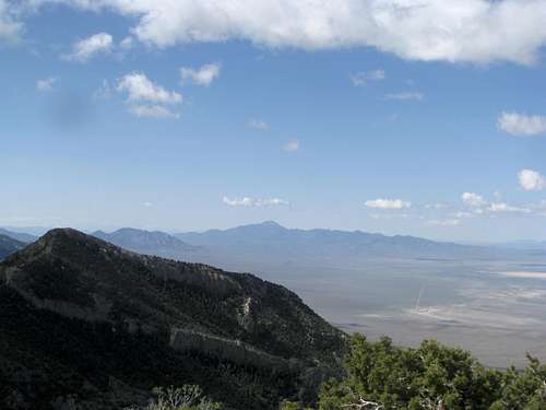
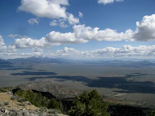
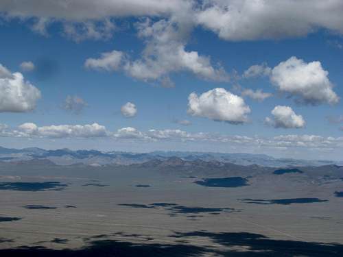
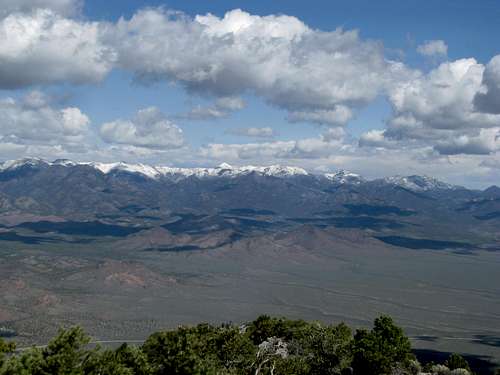
Views
|
|
|---|---|
|
|
|
|
|
|
External Links
Links for the Worthington Mountains WildernessBLM
Another BLM
Friends of Nevada Wilderness
Wilderness.net
Sangres.com
There are not a lot of books about Nevada Mountains. Here are a few, though they may not mention the Worthington Range:
Deserts Summits: A Climbing & Hiking Guide to California & Southern Nevada - by Andy Zdon
Hiking Nevada's County High Points - by Bob Sumner
Hiking the Great Basin: The High Desert Country of California, Nevada, and Utah - by John Hart
Nevada Wilderness Areas and Great Basin National Park: A Hiking and Backpacking Guide - by Michael C. White
Backpacking Nevada - by Mike White