
|
|
Mountain/Rock |
|---|---|
|
|
38.83823°N / 106.37057°W |
|
|
Chaffee/Gunnison |
|
|
Mountaineering |
|
|
Summer |
|
|
12956 ft / 3949 m |
|
|
Overview

Peak 12956 ft, SE face
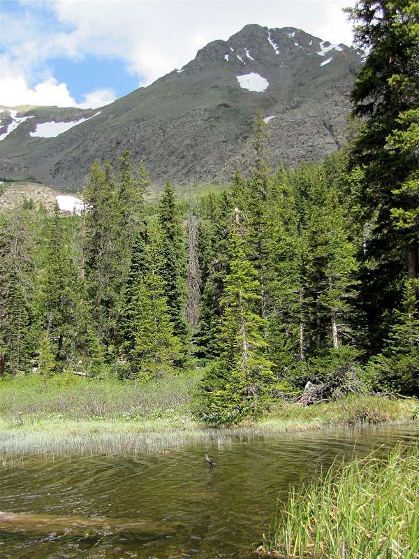 Peak 12956 ft & Hartenstein Lake | Rank: Colorado’s 664th highest peak Colorado’s 27th highest 12er Prominence: 576 ft Peak 12956 ft rises on the continental divide in the Sawatch Mountains of Central Colorado near the famous 14er Mt. Yale. To the south of Peak 12956 ft you will find a high alpine bowl that houses the 11451 ft Hartenstein Lake. Turner Peak (13233 ft) and Point 12739 ft rise on the south side of the bowl. Hartenstein Lake is a local hiking destination and has a well-established trail that branches off of the Mt. Yale Trail. The southern slopes of Peak 12956 ft rise steeply above Hartenstein Lake giving the peak a rugged appearance. After snow melt, you could hike up the steep slopes to reach the summit of Peak 12956 ft. |
Getting There
The trailhead for Hartenstein Lake is the same as the Denny Creek Trailhead for Mt. Yale.From the only traffic light in Buena Vista (the junction of Route 24 and Cottonwood Pass Rd), turn west onto Cottonwood Pass Rd (County Rd 306) and drive 12 miles to the well signed Denny Creek Trailhead. There is plenty of parking at the trailhead. Cottonwood Pass Rd is paved.
Route
All distances are per my GPS. Map |
Hike up the well signed Mt. Yale/Hartenstein Lake/Browns Pass Trail. You will go through a pine forest.
 Trail |
You will cross Denny Creek and then reach another well signed junction. Right goes to Mt. Yale. Continue straight (left). As the forest thins out, you will see Peak 12956 ft rising majestically to the northwest.
 First View of Peak 12956 ft |
You will then reach another signed junction. Right goes to Browns Pass. Turn left and cross the creek. The trail will take you onto the southeastern slopes of Peak 12956 ft. Turner Peak will also come to view.
 Turner Peak |  Peak 12956 ft |
Continue east on the trail until you reach the end of it on the northern shores of Hartenstein Lake.
 Hartenstein Lake & Point 12739 ft |
You will then have to find your own way to the top of Peak 12956 ft. On the topographic map, the slopes to the west of Hartenstein Lake appear gentle. I had planned to go up these slopes to the saddle between Turner Peak and Peak 12956. Once I reached the lake, the slopes on the west side of the lake appeared to have a growth of bushes on them. I did not want to risk getting stuck in an impenetrable growth of bushes so I decided to just go up the steep southern slopes of Peak 12956 ft.
At a spot where the forest was thin, I began to go up the southern slopes of Peak 12956 ft. I got great views of Mt. Yale.
 Mt. Yale & Hartenstein Lake |
And Turner Peak.
 Turner Peak |
Once the forest ended, I noted that the slopes were covered by bushes. I had to choose paths that minimized bushwhacking but in a few places, I ended up forcing my way through the bushes.
 Summit/Bushwhacking |  Summit/Bushwhacking |
Farther up, the bushes ended. The slopes were steep.
 Below Summit |
The view of Hartenstein Lake was wonderful.
 Hartenstein Lake |
The southern slopes below the very top of Peak 12956 ft seemed to be rocky and nasty. I went to a 12780 ft saddle between Peak 12956 ft and Point 12900 ft.
 From the 12780 ft Saddle |
I then went to the northern slopes of Peak 12956 ft and followed the ridgetop just below the crux of it to reach the summit.
 Point 12900 ft & the 12780 ft Saddle |
Views from the summit of Peak 12956 ft:
 Huron Peak, Ice Mountain & The Apostles/NW | ||
 Mt. Harvard/North |  West |  Cottonwood Pass/SW |
 Mt. Yale/East |  Turner Peak/South |  Mt. Princeton/SE |
 Hartenstein Lake/South | ||