
|
|
Mountain/Rock |
|---|---|
|
|
36.15340°N / 136.75781°E |
|
|
Hiking |
|
|
Summer, Fall |
|
|
8865 ft / 2702 m |
|
|
Overview
Mt Haku is located on the borders of Gifu, Fukui and Ishikawa prefectures in Japan. It is one of the three sacred mountains of Japan. Actually it is a volcano and has some lakes around the peaks.It offers different landscapes according to the season.
Hakusan National Park establishes the hiking season from late July to late October.
Since this is one of the sacred mountains in Japan, and there is many Japanese people interested in outdoor activities Mt. Haku gets crowded between mid July and mid August.
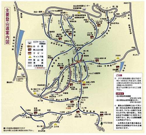
There are several routes and peaks, there are signs and maps on all the courses, so getting lost would be a little bit difficult. The most popular route is the one beginning at Betodei 別当出合登山口.
This route is marked in red on the map.
Getting There
From Kanazawa, the easiest way is taking the Hokutestu shuttle bus, this bus usually departures from track number 1 in East exit of Kanazawa station.
東口のりば1.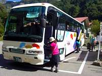
Hokutetsu bus going back to Kanazawa station
Timetable can be checked here.
Timetable.
This bus, is a special bus for hikers and goes from Kanazawa station 金沢駅 to Betodei 別当出合, it runs only during the hiking season.
The trip on this bus takes around 1:50 and costs 2000 yens each way.
From Komatsu airport the best option is going to JR Komatsu stationand then, from there take the shuttle bus to Mt Haku.
If going by your own, take the route 157, reach one of the Hakusan visitor's center, you can park there for free. These visitors centers have a lot of information in Japanese about routes, wildlife and hosting. Visitor's centers are marked as grey houses on the map, usually they are open only while the season is open (July - October).
Ishikawa visitor's center 076-255-5321.
Shino visitor's center 076-259-2504
Depending on the plan and time available, you can trace your own course. The shortest course can be done in one day, it would take around 6 hrs climbing up, from Betodei to the nearest peek via Murodo, and around 3 and half hours going down.

Signs like this can be found along the trials
However most of the people going to Mt Haku stay overnight and wake up early morning to see the sunrise from one of the peeks. Sunset time can be checked here.

Murodo Post Office
In the Murodo there is a post office open during August, from there you can send post cards.
Camping
There are several sites to stay.There are camping sites, free/cheap huts, and cabins.
You can locate the huts in the map above, look for the kanji 無 and the hut sign on the left side of the map, then you will be able locate them.
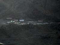
The most accessible camping site from the Betodei route is the MinamiRyuBaba 南竜ヶ馬場 one, it is open from July to October, reservations are recommended 076-259-2022. There you can pitch your own tent or even rent one, there is an assigned place to each tent.
Near to the camping site there is big cabin where, meals, beer, tea and snacks are available.
A popular camping site on the Gifu side is the Big White River (大白川), they charge a cleaning fee of 900 yens for person. Usally this site is open from June to October. Their phone number is 057-6961-311.
This is a good camping site if you are on on the Shirakawa side.
Oshirakawa camping site.
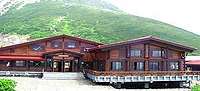
Probably the most convenient cabin in Hakusan is the Murodo 白山室堂, it is near from one of the peaks and lakes, there is a plan with meals included. There is package hosting plus 2 meals 7700 yenes. Reservation is required.
There is a special coupon available when getting into Hokutetsu bus that includes two meals, hosting at Murodo and round trip in Hokutetsu bus, with this coupon you can save about 2000 yens. Anyway independent reservation is required at Murodo.
There are more hosting options around Mt. Haku
External Links & further information
Web page with a lot of information(Japanese)Wikipedia
You can simulate your route in Mt Haku with animated characters on this page.
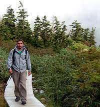
Walking on Hakusan's trail