
-
 11502 Hits
-
 82.48% Score
-
 15 Votes
|
|
Mountain/Rock |
|---|---|
|
|
43.28480°N / 109.68527°W |
|
|
Hiking, Mountaineering, Scrambling |
|
|
Spring, Summer, Fall |
|
|
13062 ft / 3981 m |
|
|
Overview
Point 13,062 is along the continental divide in the northern Wind River range in Wyoming. This peak is one of Wyoming's 35 ranked 13ers but oddly enough, it doesn't have a name. At 442 feet of prominence it is a respectable peak.
Situated just to the east of Bear Basin, it can be seen hiding slightly behind Point 12,975. This peak is actually very gentle along with most of the peaks along the divide in this part of the Wind Rivers. They hard part is getting to the divide which is a chore in itself.
It would be impractical to make the trek to this area just to climb this peak. Probably everyone who summits this mountain does so on a long multi-day trek. The continental divide "trail" follows the divide perfectly here since the area is so gentle. Further south towards Gannett and other core Wind River 13ers, the Wind Rivers are very rugged and backpackers trekking across the divide either descend Tourist Creek or drop off the east side of the crest towards the Dinwoody Glacier along what is now called the Wind River High Route to detour around these peaks.
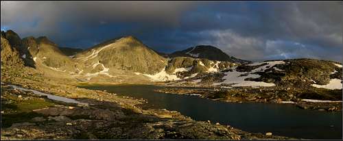
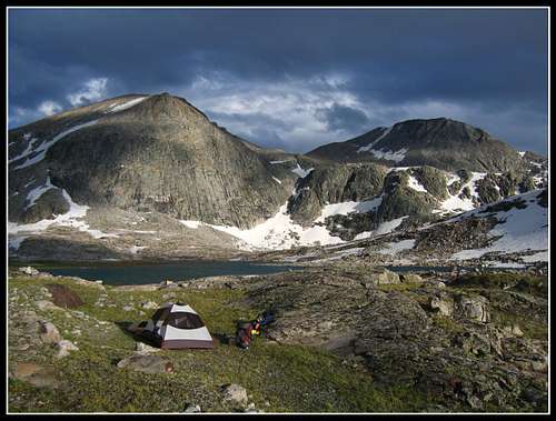 Camp spot in Bear Basin. Point 13,062 is the peak on the right.
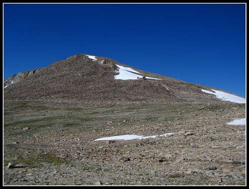
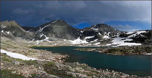 Point 13,062 from Bear Basin
Making Bear Basin part of your trek through the Winds will potentially provide you with a life-changing experience. This place is the most beautiful place I've ever seen.
Getting There
There are many ways to get to Point 13,062. If you are doing your trek in the northern part of the Wind River Range it makes sense to start at Green River Lakes. From Pinedale, Wyoming head west out of town on US 191 for 6 miles and turn right (north) onto Wyoming road 352W. The pavement ends soon after the small town of Cora. Continue for 25 miles from US 191 and continue 18 more miles on the Green River Lakes Road until the road ends at the Green River Lakes campground. This road is passable for any vehicle although it gets very wash-boarded.
From here your choices are almost endless, although you have only three options to choose from right at the start. You could take the nice trail south past the Green River Lakes for 14 miles to Three Forks Park. You could conceivably hike the trail up to the Clear Creek Natural bridge but then continue onward through horrible blowdowns and bush-whacking to Clear Lake and beyond to Bear Lake. I would highly discourage this unless you get pure enjoyment of self inflicted torture, as the reports of the bushwhacking in the upper part of this drainage are quite harrowing. Your third option is to take the trail northwards from the campground. This long trail then turns east and follows the Roaring Fork around the north side of Osborn Mountain. This is the route I took to start my trek and it was very enjoyable.
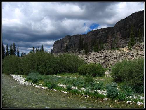 Looking down the Roaring Fork Valley
If you take the trail heading south, your trek will start easy but once you get to three forks park you have to leave the trail and follow a boot path through the marsh and grass to the Green River. Find a shallow place to cross the bright green waters and start the grueling ascent of Tourist Creek. I can only imagine how hard this ascent is as I descended it on my trek. Come prepared with lots of food!
 Crossing the Green River
Continue ascending Tourist creek, which involves some acrtual 3rd and maybe even some 4th class scrambling to pass through some huge boulders where the canyon narrows. The final climb will be up a loose and steep boulder/scree slope to a low point on the continental divide just north of Pedastal Peak. From Here you can follow the divide north until you reach Point 13,062.
 Point 13,062 seen from the south.
If coming from the Roaring Fork valley, continue until the trail ends. Beyond this point you are entering true untouched wilderness. Ascend to Native Lake and continue to Crescent Lake. Published maps show a trail leading all the way to Crescent Lake but that isn't true. From Crescent lake you can either hit the divide right away and traverse south over Downs Mountain or do a windy traverse south over many small ridges and through many valleys to the west of the divide.
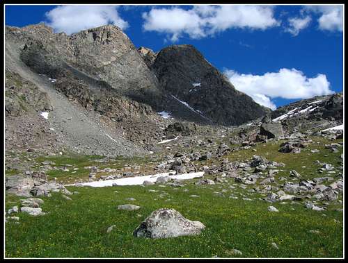 Looking at the divide from near Crescent Lake
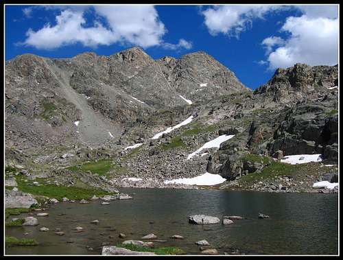 Crescent Lake
Doing this, you will pass by many spectacular lakes including Daphne Lake, Bear Lake and Bear basin. From bear basin, you can hit the divide by climbing up the obvious drainage at the basin's east end. There is a waterfall you'll have to climb around on the south side that gets really loose. Once above this waterfall continue up the drainage as it curves left (north) and climb around another waterfall on the west side before the terrain flattens out just below Downs Mountain. From here you can climb the talus to the summit of Downs Mountain and continue south to Point 13,062 on easy terrain along the divide.
 Point 13,062 from Bear Basin
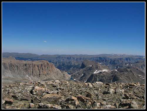 Summit view (east) from Point 13,062
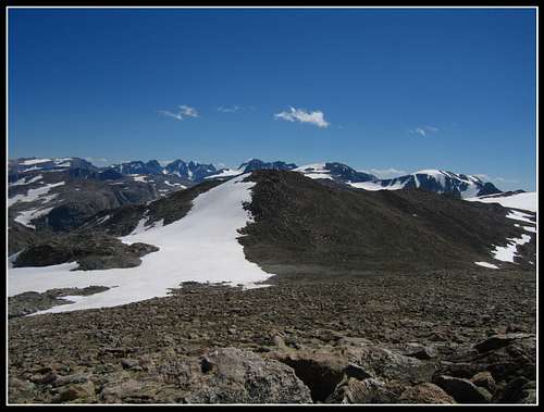 Summit view (south) from Point 13,062
Red Tape
This area is so remote. There's no red tape...just don't kill yourself out there! Please practice Leave No Trace techniques when choosing a camp spot and cooking food. You may be the only person here for weeks.
External Links
See Joe Kelsey's "Climbing the Wind River Range" guidebook for more route info on Point 13,062 and many other peaks in the area.
Great Outdoor Shop
Weather Forecast
See my Trip Report here.