
|
|
Mountain/Rock |
|---|---|
|
|
33.67980°N / 111.8004°W |
|
|
Maricopa |
|
|
Hiking |
|
|
Spring, Fall, Winter |
|
|
4067 ft / 1240 m |
|
|
Overview
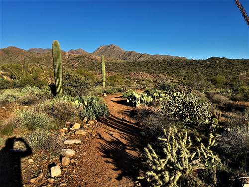 East End from the south
Despite the popularity of the McDowells, only a tiny percentage go to the top of East End. The log book averages out to about 10 visitors a month in the cooler seasons, and only a handful in the hotter summer months. Nevertheless, the hike to the top is short, steep with some minor scrambling, and quite fun. The views are outstanding.![East End AZ]() Southeast view from summit, looking at the fountain in Fountain Hills.
Southeast view from summit, looking at the fountain in Fountain Hills.
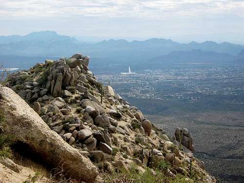 Southeast view from summit, looking at the fountain in Fountain Hills.
Getting There
The trailhead for East End is the very popular Tom's Thumb Trailhead located at 23015 N 128th St, Scottsdale, AZ 85255. It is located off of Pima Road via Happy Valley Road which swings to the north where you take Ranch Gate Road eastbound to 128th Street.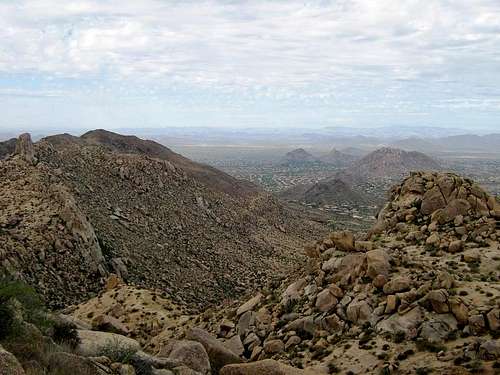 Northeast view: Tom's Thumb (left) and Pinnacle Peak
Route to top
From the parking area, take the Tom's Thumb Trail. Go west about 0.3 mile to a junction, then left, and left again about 0.5 mile later, always going up. The trail gains steeply but is an easy hike overall.In time, the trail levels a little, traverses across the rocky west-face of the East End massif. Keep going until you descend about 60 feet, directly below the summit itself.Leave the main trail at the lowpoint and follow a rougher trail and small cairns up a steep, rocky slope. You gain about 200 feet to come to a saddle. Keep an eye out for the cairns.At the saddle, follow the trail through the big boulders another 200 feet. It ends at a small saddle and a solar-panel collector. The summit is an easy walk on your left. The USGS benchmarks are set in some lower rocks. The map says 4,057 feet elevation, assuming these to be the BM. If so, the real summit is about 10 feet higher, or 4,067 feet elevation.The views are great in all directions: McDowell and Thompson Peaks to the southwest, Tom's Thumb spire and Pinnacle Peak to the northwest, the New River Mountains to the north, Mount Ord and Browns Peak are to the east, and the Superstitions, Goldfield and Usery Mountains are to the southeast. The fountain in Fountain Hills may be jetting if you catch it at the right time.The one-way distance is 1.5 miles, with about 1,100 feet of gain. Summer gets hot, but people still hike it. Go early and watch for snakes. Wear long pants and beware the usual desert obstacles. You can easily combine this hike with a trip to Tom's Thumb, The Lookout, or The Lookout Trail high point.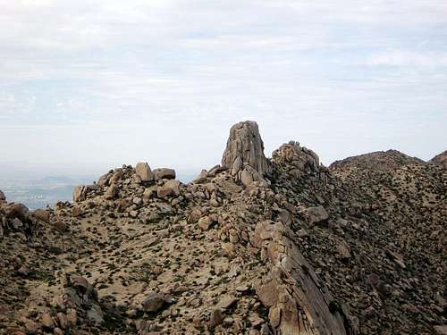 Tom's Thumb, across the way from the summit.
Red Tape
None. The park is open sun-up to sun-down only. No overnight parking or camping allowed.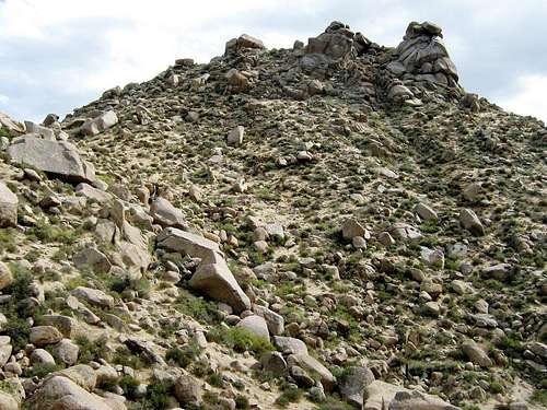 Looking up at the top.
External Links
http://www.surgent.net/highpoints/az/range/eastend.html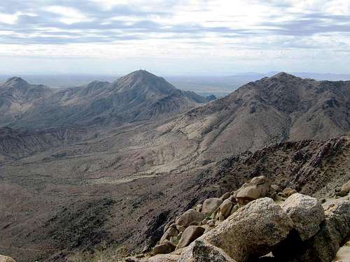 Thompson Peak and McDowell Mountain, southwest view.