
|
|
Mountain/Rock |
|---|---|
|
|
47.56160°N / 122.80843°W |
|
|
Kitsap |
|
|
Hiking |
|
|
Spring, Summer, Fall, Winter |
|
|
1700 ft / 518 m |
|
|
Overview
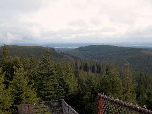
View from the northern false summit
Green Mountain , the second highest summit in Kitsap County, is a well known hiking destination in that area. With much of neighboring and slightly Gold Mountain closed due to being in the Bremerton Watershed, Green Mountain just to the north receives much of the traffic. In reality you have both bike, mountain bike and hike to the summit. Though this peak is not as popular as some of I-90 summits (IE Tiger and Si) you will find a number of people on the trail and at the summit at any time.
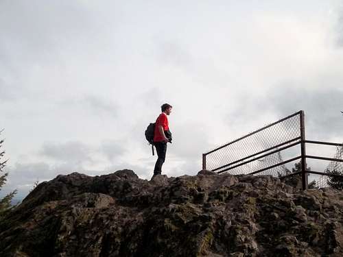
Josh Lewis taking in the views
The summit area of Green Mountain has two peaks on it. The northern false summit about 10 feet shorter but commands a good view east towards downtown Bremerton, Seattle and the Cascade front. It is where most people stop and where think that they have achieved the true summit. The point is fenced off on top due to being at the foot of a 30-50 foot cliff. The southern true summit is a little hard to get to in that once take the road to near the summit you have to maneuver around a cell phone tower area in order to hit the true summit on the other side. Views on the partially here and not nearly as dynamic as the false summit to the north.
True summit views; Not as good
The best most reliable way to the summit of Green Mountain is from the Gold Creek Trailhead down at the bottom by Gold Creek. A discovery pass is required at this trailhead. The best least confusing way to the summit of Green Mountain is to take the Gold Creek Trail all the way until it reaches Vista Trail near the summit. From there take the Vista to the false. For the true head south on the fire road and take it right to the cell phone towers. Maneuver around the side fences of the cell phone tower until you reach the summit rocks on the other side.
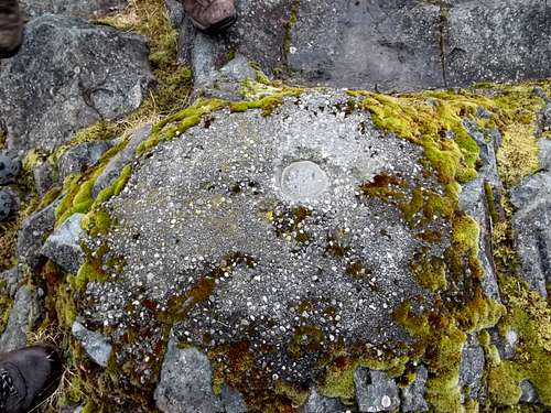
The summit marker; Few will ever see this
There is even a quicker way but it is steeper. Take the Gold Creek Trail all the way to where a cable line pass the trail. It will be well marked by a chair. From there is a trail that follows the cable line all the way until where it intersects the trails right by the summit. It is recommended though to take the Vista Trail to the Gold Creek Trail on the way of descent.
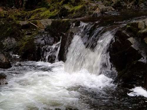
Waterfalls near the bottom of the trail
Getting There
VIA THE GOLD CREEK TRAILHEAD FROM BREMERTON: Take Route 310 roughly three miles until Kitsap Lake. Make a left onto Northlake Way and stay on it until you reach the Seabeck Highway. Mak a left there and head three miles until Holly Road. Make a left there and stay on the road for three miles. Make another onto Tahuya Lake Road. Head a little over a mile to a fork in the road. From there fork left onto Gold Creek Road where the trailhead will be about two miles on the left hand side.Red Tape
A Discovery Pass is required which is $10 for the day and $30 for the year.Camping
No camping allowed. Trailhead only open dawn to dusk.External Links
One of the best websites on this mountain is from one of our other SP contributors.Another good website on the region
The WTA site for this mountain