
-
 15274 Hits
-
 89.01% Score
-
 28 Votes
|
|
Mountain/Rock |
|---|---|
|
|
47.82859°N / 123.1102°W |
|
|
Jefferson |
|
|
Hiking, Mountaineering, Scrambling |
|
|
Spring, Summer, Fall |
|
|
6826 ft / 2081 m |
|
|
Overview
 The Upper Southwest Face
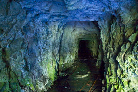
Iron Mountain is located on a high ridge in the eastern Olympics between Buckhorn Mountain and Mount Worthington. It is about 100 feet lower than it's neighbors, and for that reason is very seldom visited. In the early 1900's there was a mining craze in the immediate area and many claims were staked out on Iron Mountain. In fact the Tubal Cain trail that provides access to the area was named after the Tubal Cain mine which is still present today. But in those mining days it seems that Mount Worthington was also known as Iron Mountain, so there is some lasting confusion.
 On The Summit
One thing is certain, the naming of Iron Mountain is no mystery. Several large veins of red iron ore can be found on the mountain including one very near the summit. Unfortunately, all the hype generated for mining in the area amounted to no great discovery. Most of the claims turned out to be completely worthless.
 Tubal Cain Mine, Photo Credit: © Lee Rentz |
Iron Mountain has failed to strike it big in terms of mountaineering as well. It has never been a popular destination and likely never will be. But there are just enough perks to draw the well-rounded peakbagger. The main perk is that it can easily be combined in a day with Mount Worthington. But the other attractions have to do with the approach. On the way to Buckhorn Lake, the trail passes near the Tubal Cain mine and also the wreckage of a B17 bomber which crashed in 1952. Please see the Mount Worthington page for more information.
The Route - Tubal Cain
There are possible ways to climb Iron Mountain. All of them involve off-trail travel. Only the easiest route, Tubal Cain, will be described here in detail. It should be noted that the only route which the Olympic Mountains Climbing Guide mentions is a direct ascent of the south face, with over 1900 feet of seemingly endless scree and loose rock. If you want to try that, then leave the Big Quilcene trail one mile past Shelter Rock camp and leave the trail as soon as it is out of the trees. East Buckhorn Seen From Near The Summit
For those coming from Marmot pass, it is possible to traverse the crest of the ridge along both summits of Buckhorn Mountain to Iron Mountain, but several sections of this route are confusing and dangerous. Downclimbing the east face of East Buckhorn is exceptionally difficult and not recommended.
Standard Route - Tubal Cain
The Tubal Cain trail starts at 3300 feet. It crosses Silver Creek and eventually climbs 2000 feet passing through coniferous forest and wild rhododendron to the junction with a spur trail to Buckhorn Lake at 5.6 miles. Before the Buckhorn Lake junction, 3.2 miles from the car, keep to the right as you pass the Tull Canyon spur trail. Tull Canyon is where the airplane wreckage can be found. At 5.6 miles on the main trail there should be a sign pointing down and to the left for Buckhorn Lake. The trail portion of the route ends at the lake.
|
|
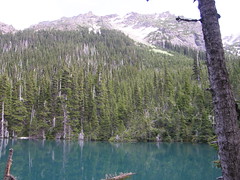
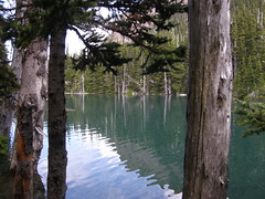
Cross the inlet waterfall at the head of the lake and enter the trees proceeding off-trail in a southwest direction, bushwhacking up towards a rocky, scree-basin. Many of the trees around the lake are broken by avalanches and the going may be rough at first. At 5800 feet, 700 feet above the lake, you will rise above the tree line. Depending on your line of travel there may be some light scrambling at this point.
 The North Face With Notch Visible At Center
The next goal is to reach the notch just east of the summit of Iron Mountain. Ascend loose scree slopes which may be snow covered depending on the season. At 5900 feet the small upper basin has a flat somewhat level bottom. This little basin is where two routes diverge. If you have the time during your return journey, Mount Worthington can also be accessed from this point.
 Above The Notch
Above the basin, as you ascend in a southern direction, try to stay far to the right (east) as you near the top. This will ensure that you emerge east of the notch between the summit and the main false summit. There will be a couple of places where the use of hands is necessary but the slope should not exceed Class 3. If it does you are off route. Be careful because the slope is loose in many places.
 Gullies On The South Face
Scramble as high as you can above the notch until the terrain above appears too steep, then scramble around to the south side of the summit block without gaining any elevation. The remaining 50 feet to the summit can be ascended safely in gullies on the south side. The true summit is a knob formation just north of a minor false summit.
 The Summit And Mount Worthington
Getting There / Driving Directions
Tubal Cain Trail (Buckhorn Lake)From the Hood Canal bridge drive west 13.5 miles to Highway 101. Turn right (north) and follow 101 for 16 miles to the turn off on the left for Louella Road. After one mile, turn left at the T onto Palo Alto Road and proceed for another 6 miles.
Bear right at the junction marked as Forrest Road 2880. The road descends steeply to a crossing of the Dungeness River. A mile beyond the river, proceed left onto Forrest Road 2870 and continue to follow signs for 2870. Continue to follow 2870 for 8 miles to the Upper Dungeness trail parking area. This trail is only mentioned as a reference. Continue on 2870 for another 3 miles beyond the Upper Dungeness trail to the Tubal Cain Mine trail where there is a small parking lot on right.
 Buckhorn Lake Seen From The Summit
Big Quilcene Trail (Marmot Pass)
From the town of Quilcene, go south on Highway 101 for 1.5 miles, and turn right (west) onto Penny Creek Road passing by a big rock quarry. At 1.4 miles keep left onto Big Quilcene River Road which later becomes Forest Road 27. After 9 miles turn left on Forest Road 2750, and continue 4.5 miles to the trailhead located at 2500 feet.
External Trip Reports
- August 2011 report by Ian B - Iron and Worthington
- November 2008 report by the Schmidt's - Iron and Worthington
 Summit Panorama