
-
 13119 Hits
-
 81.18% Score
-
 13 Votes
|
|
Mountain/Rock |
|---|---|
|
|
39.53970°N / 105.6043°W |
|
|
Park |
|
|
12444 ft / 3793 m |
|
|
Overview
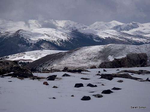
 Clouds over the Tanglewood drainage
Bandit Peak sits on the southern toe of a ridge of mountains radiating southeasterly from the Mount Evans Massif. It is a subsidiary peak of the graceful Thirteener Rosalie Peak and is uniquely positioned to provide fine views from its summit of the dramatic cirques surrounding Frozen Lake and Abyss Lake below Fourteeners Mount Bierstadt and Mount Evans. From the top of humble Bandit Peak, the visitor can take in scenes of Deer Valley and gaze at nearby Twelvers Kataka Mountain and Mount Logan. Safely nestled into the Mount Evans Wilderness, Bandit Peak provides a special, quiet place to contemplate the solitude of this vast wild area so close to the city…and to peer up at Rosalie Peak towering above.
Rank: Unranked
Prominence: 224 feet
USGS Quad: Harris Park
Planning Map: Trails Illustrated Map # 104 | Idaho Springs & Loveland Pass
Rank & Prominence: Lists of John
Getting There
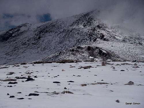
 At the summit
 Eastern slopes
Bandit Peak sits roughly 30 miles west of Denver and is easily reached via US 285. Primary access is from the Deer Creek Trailhead (CR 43 to FS 100). FS 100 is accessible in dry conditions to all vehicles. In wet or snowy conditions, 4x4 / AWD would be important to have (high clearance is not necessary). The road will be impassible after a heavy winter storm, extending your hike as well as making parking more difficult (due to lack of public parking along the narrow approach road).
I will post a detailed circuit route here in a bit...
Red Tape
 |  |
Bandit Peak is located in the Mount Evans Wilderness. Wilderness regulations apply, and include, per the Wilderness Act of 1964:
• Only foot traffic is allowed in the wilderness and all dogs must be on a leash.
• Motorized equipment is prohibited, including chain saws, battery powered tools, generators, etc.
• Mechanized transportation is prohibited, including, including bicycles, hang gliders or carts.
• Aircraft, including helicopters, are prohibited from landing, or dropping off/picking up any materials, supplies or persons.
• Please follow LNT (Leave No Trace) principals.
There is no fee for using this area, nor is any pre-registration necessary. Be courteous to land management professionals, and wise with an eye toward your own safety should anything go wrong, and register your party at the self-service kiosk at the wilderness boundary.
 Western Talus Slopes Western Talus Slopes |  Mount Logan Mount Logan |  Frosty Aspen Frosty Aspen |  Mount Bierstadt Mount Bierstadt |
Camping
 Sunlight on Kataka
| Deer Creek Campground, operated by the U.S. National Forest Service, is extremely convenient to Bandit Peak if accessing the peak from the Deer Creek Trailhead. Elevation: About 9,000 feet Facilities: Vault toilet and water Number of sites: 13 | The nearby Meridian Campground, also operated by the USFS, is a convenient alternate camping area in the out of Harris Park vicinity. Elevation: About 9,000 feet Facilities: Vault toilets and water Number of sites: 18 |
 Pegmatite Points from eastern slopes Pegmatite Points from eastern slopes |  Clouds building Clouds building |
Weather & Seasons
 Uprooted evergreen on western slopes
 Click for weather forecast | Thanks in part to private property holdings along the Deer Creek drainage road that require winter access, Bandit Peak is accessible year round. Summer: The crowds from nearby Denver may border on unbearable for the hiker accustomed to solitude. While the summit of Bandit Peak may see very few visitors, the feeder trails will be full of day-tripping visitors and weekend campers. Winter: Bandit Peak makes for a delightful snow season destination. Expect some huge post holing in drifts for a solid workout. |  Click for weather forecast |