
|
|
Mountain/Rock |
|---|---|
|
|
35.39340°N / 82.7743°W |
|
|
Hiking |
|
|
Spring, Summer, Fall, Winter |
|
|
5340 ft / 1628 m |
|
|
Serving Up the Views...
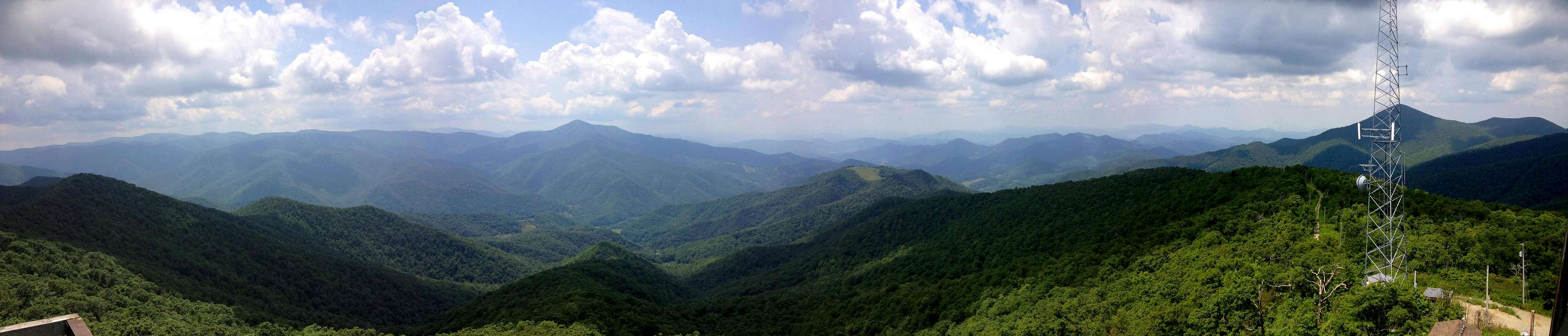
 Cold Mountain Vista
Fryingpan Mountain (there’s no clear story behind the name, though I’m sure you could make something up) sits along the Blue Ridge only a few miles south of Mt. Pisgah. Its location couldn’t be better as it rises above the East Fork Pigeon River Valley directly across from Cold Mountain and the Shining Rock Ridge. Many have said it owns the finest views of Cold Mountain, and I’m here to tell ya, they’re right! Standing a respectable 5,340’ high, the mountain itself is not a standalone giant but rather a fairly nondescript, tree-covered bump along the Blue Ridge. Something happened though in the 1940’s to make this peak even more interesting.
The Tower...
 70' Above
 Trusty Rusty
In the early 20th Century the war against forest fires was being waged, full strength, by the US Forest Service. A wave of construction swept over the North Carolina mountains as fire lookout towers of every shape and description started popping up on, literally, hundreds of peaks large and small. Fryingpan wasn’t one of the early towers, typically built of stone or wood, but rather it was a more modern tower of steel construction. What helps make Fryingpan’s lookout so unique is its impressive height. It rises 70-some feet above the summit making it one of the highest towers in the southern mountains. It’s unclear why the USFS thought they needed such a commanding tower but obviously they wanted to see a long, long way. They succeeded. The tower was manned until the 1990’s at which point it was decommissioned but, thankfully, left standing. Soon thereafter, the tower was placed on the National Register of Historic Places.
 Graffiti Hell
Today the tower remains and, as far as I know, is open to the public throughout the year. You can’t get up into the cab, or living quarters, of the tower but the stairs get you plenty high above the trees. Aside from needing a good paint job I was surprised, upon visiting, how sturdy the old lookout was. It was quite a breezy the day I visited and you could hardly feel a movement. Considering it has spent 70 years atop a mountain ridge, 20 of those abandoned, it’s quite a testament to the men who built it.
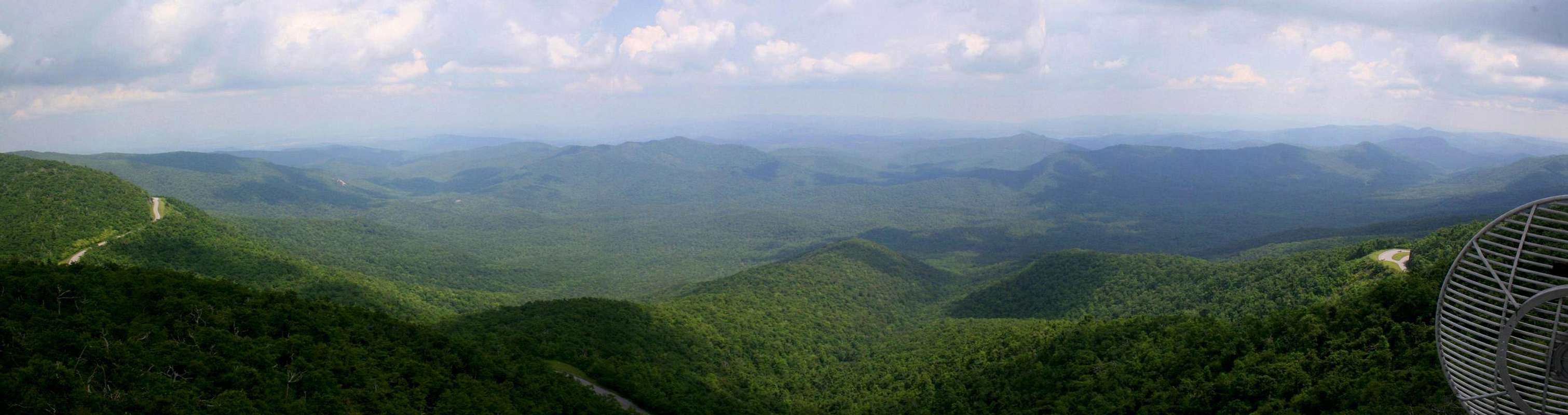
The view though, oh the view…everywhere you look from the upper landings you’ll see a sea of ridges and valleys stretching off in every direction. The commanding bulk of the Great Balsams dominates the skyline to the west. Across the 3,000’ depth of the East Fork Pigeon River Valley rises the 6,040’ pyramid of Cold Mountain. To the east is the familiar cone of Mt. Pisgah with (on a clear day) the Black Mountains visible beyond. South is the deep green bowl of the South Mills River Valley which is home to the famous Pink Beds and the historic Cradle of Forestry. Your camera will get a workout here…
Summit Video & Panorama's...
  |
 |
Getting There...
Fryingpan Mountain sits astride the Blue Ridge Parkway between Mt. Pisgah (Milepost 407.6) to the north and Wagon Road Gap (Milepost 412) to the south. From either approach you will spot the fire tower atop the ridge before you reach the trailhead. FR-450
-The quickest access to the peak is via Forest Road 450, which is located at Parkway Milepost 409.6. It is gated but there is parking enough for about half a dozen vehicles. ***DON’T BLOCK THE GATE!*** From the gate it’s a 0.7 mile hike up the old road to the top.
-A slightly longer route starts you out at Milepost 408.5 and allows you a bit more time in the woods as it parallels the Parkway for around a mile before joining FR 450 for the final climb to the summit.
Elevation gain for the shorter route is about 500 feet, for the longer route it’s about 1,000 due to the climb you make over Big Bald Mountain along the way.
Red Tape
 Towers Everywhere
None.
There are a few neighboring communication towers that you should stay away from but they don’t restrict access to the summit. Also, the section of the Blue Ridge Parkway along which Fryingpan sits is frequently closed in the winter during snow and ice. Check the Parkway website for current conditions.
Other Info...
Blue Ridge Parkway - official NPS Blue Ridge Parkway site. The best place to get closure info.NC Lookouts - North Carolina Chapter - Forest Fire Lookout Association (blog format)
Hiking North Carolina's Lookout Towers - A book I've found indespensible for pursuing my new fire lookout addiction. Includes info on accessing 26 North Carolina Fire Towers acessible to hikers.
Click for weather forecast