
|
|
Mountain/Rock |
|---|---|
|
|
39.15388°N / 119.89963°W |
|
|
Carson City |
|
|
Hiking, Bouldering, Scrambling |
|
|
Summer, Fall |
|
|
8738 ft / 2663 m |
|
|
Overview
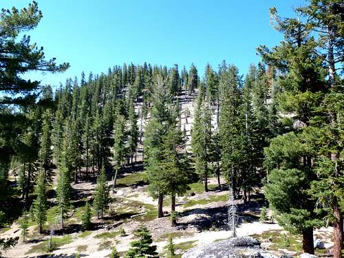
The unnamed Peak 8738 is a jewel of a summit. Completely overshadowed by its higher neighbor Snow Valley Peak, it goes unnoticed from most vantage points. However, with a prominence of about 595’ it is most definitely its own mountain. Views of Lake Tahoe are absolutely stunning. Ditto to Marlette Lake. That, and its tremendous accessibility, make it a worthwhile destination.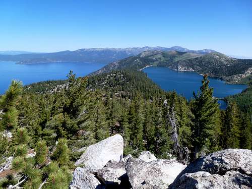
View of Lake Tahoe and Marlette Lake from Peak 8738
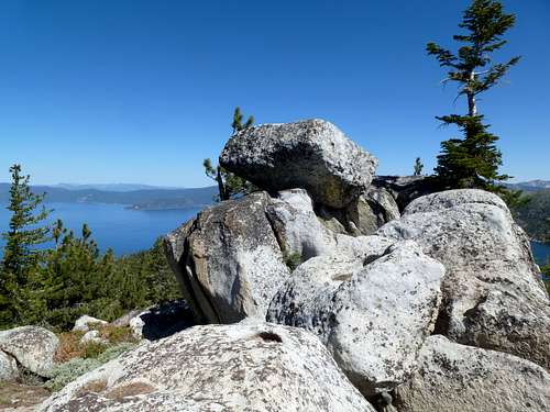
Summit with Lake Tahoe behind
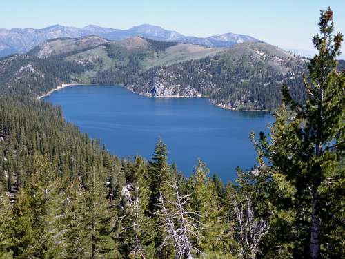
View to Marlette Lake and Northern Carson Range
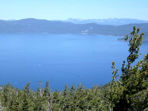
Lake Tahoe from the summit
There is no formal trail to the summit, which is located about 365’ above a forest service road. However, it is a great add-on to a hike to Marlette Lake, or Snow Valley Peak if hiking via North Canyon Road. It can also be reached from the Chimney Beach Trailhead. Mountain bikers can get to the foot of the north face, within a few hundred feet of the summit.
Typically the best time to hike or bike on the forest roads in this area is July through October. It is better in fall when the weather is a little more temperate. Late June is usually okay for hiking, since snow levels will be light, but biking is not recommended at that time.
Getting There
There are three primary trailheads. Spooner Summit off of US 50, which is free, the Spooner Lake parking area, which you have to pay, or the Chimney Beach Trailhead, which is free. There used to be parking on the south side of Spooner Lake, just at the junction between US 50 and Highway 28, but as of July 7, 2012 this was blocked off.The Chimney Beach Trailhead is located about 7 miles south from the junction between 431 and 28. It is about 5 miles north of the junction between US 50 and 28. From Reno, head over the Mount Rose Highway (431), then take Highway 28 for 7 miles south to the trailhead, on the east side of the road.
From the south, the Spooner Lake parking area offers the shorter route. Hiking from Spooner Summit adds a little over a mile each way.
Getting to either trailhead is easy. If you are coming from the Reno-Carson City area, you need to reach U.S. Highway 50. Take it towards Lake Tahoe. About 3/4 of a mile before reaching the junction with State Route 28, the trailheads for Spooner Summit (both north and south) are clearly marked. If parking at the Spooner Lake parking area, continue to the junction and take SR 28 north for about ½ mile. Head right to the entrance, and look for the sign to Spooner Lake. Once parked, head downhill to the start of the North Canyon Road.
Route Information
Peak 8738 is best accessed via the Chimney Beach Trailhead or the North Canyon Road.For the North Canyon Road - if starting at the Spooner Lake parking area, simply head downhill towards Spooner Lake, and there is a sign before you get to Spooner Lake to North Canyon Road towards Marlette Lake. This route goes north away from Spooner Lake.
If starting at Spooner Summit, head from the trailhead to a sign towards the Spooner Lake loop. Take the trail as it descends to Spooner Lake, and follow the loop around the north side of the lake. You will see a sign for a trail heading towards the North Canyon Road. Take the trail it until it hits the road.
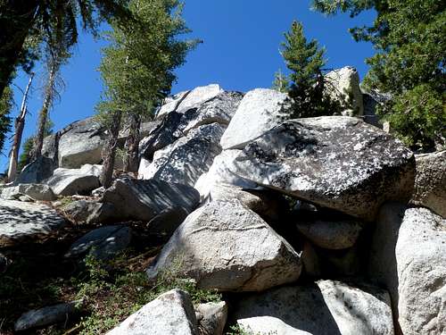
North Canyon Road heads gradually up for its first three miles, and then gets steep heading up to the highpoint of the road. Just before the highpoint of the road is a junction with the route to Snow Valley Peak. The sign says Snow Valley Peak is 1.1 miles. Just 100 feet or so past this junction is Forest Service Road 39 on the left. You will take this road to Peak 8738. Once on the road, you can go up the hill towards the north face, and approach the summit on the west side, or the more challenging east side, which involves some more bouldering. The road loops around Peak 8738. You can head straight up the north face, or wind around a little more and hit the west face. Some scrambling is required to get to the true summit.
North face
East face
From the Spooner Lake parking area, the round trip hiking distance is about 8 ½ miles, with a one way elevation gain of about 1800 feet. If starting from Spooner Summit, the round trip hiking distance is about 10 ½ miles, with a similar elevation gain.
From the Chimney Beach Trailhead, continue up the trail for about 4 miles, as it winds up the trail. Once you see a couple signs, Peak 8738 is on the right. Head straight up to the summit. The round trip is about 8 ½ miles, with an elevation gain of 2,300'.