
|
|
Mountain/Rock |
|---|---|
|
|
48.05642°N / 121.56745°W |
|
|
Snohomish |
|
|
5111 ft / 1558 m |
|
|
Overview
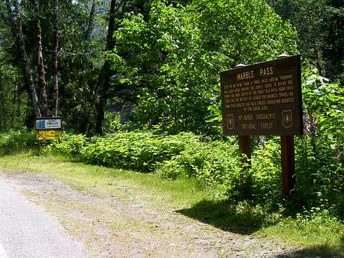
Marble Peak is a minor summit located 19 miles east of Granite Falls, WA. While not nearly as impressive as its big brother (Hall Peak), it offers many of the same views for far less effort. Marble Peak makes an excellent ascent in early season, or any time the brush above 3800' is snow covered. The most difficult portion of the climb starts within 20 paces of your car - crossing the South Fork Stillaguamish River. Park near the interpretive sign for Marble Pass.Update: Guard rails have recently been installed near the Marble Pass sign, which will require parking a short distance up or down the road.
![Parking for Marble Peak]()
The 'old' parking location for Marble Peak. The county has installed guard rails at this location, which will make it necessary to park just west or east of this location.
When the water is not too high, one could wade across the river at this point, but I found it much easier to float across in my $15 inflatable raft. (At this point, according to the Cascade Alpine Guide, you have the option of heading upriver and taking Marble Gulch/Marble Pass to complete the climb. To me, the ridge on climber's right of Marble Gulch looks much simpler and safer, so that is the route described here.)
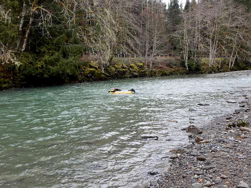
Fording the South Fork Stilly after climbing Marble Peak
After stashing your hip waders or raft, just plunge into the woods and start heading straight up. It is fairly open forest without too much brush to contend with. The most challenging portion on the lower part of the ridge will be a number of large windfalls between 1500' and 2500'. The ridge will be consistently steep from its beginning, until reaching a relatively level portion of the ridge at 3800'. There will be a couple of steep steps in the ridge between 3500' and 3800', but these are easily negotiated to the left or right. In early season, when the route is snow covered, the relatively level portion of the ridge between 3800' and 4000' provides easy travel. In late season, or in a low-snow year, expect a brutal battle with blueberry bushes through this section.
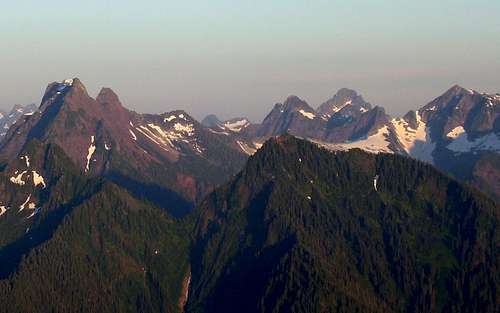
Preferred route is ridge just right of center - Marble Gulch just left of center
Marble Peak from Anaconda Peak - March 2010
Once above 4000', you have two options: 1. Stay on the ridge, making minor detours to the right to avoid rock steps*, or 2. Drop off the ridge to the right, and make a rising traverse to climber's right in the basin below the summit block. From here you can join the SW trending summit ridge for an easy scramble to the top. Option 2 is probably easier, but the basin below the summit should be avoided if there is any avalanche potential.
*The biggest detour off the ridge (to the right/southwest) will be made between waypoints 66 and 64 on the map below.
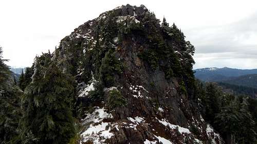
Marble Peak summit block from the east. This is the view you can expect if choosing 'Option 1' (class 3).
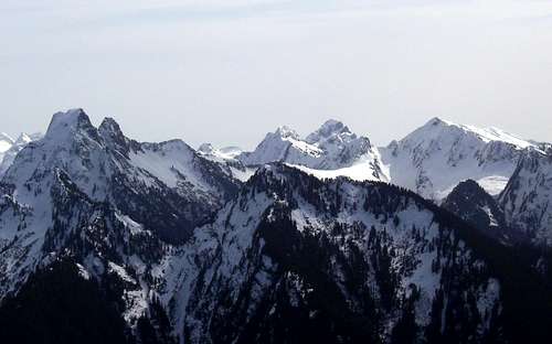
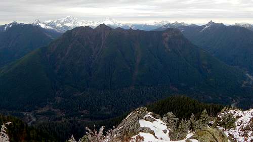
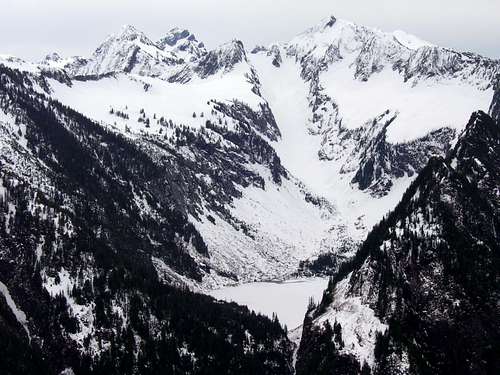
Despite its short stature, Marble Peak provides nice views, including a good look at Copper Lake and Vesper Glacier.
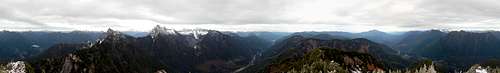
Marble Peak pano - 3-21-15
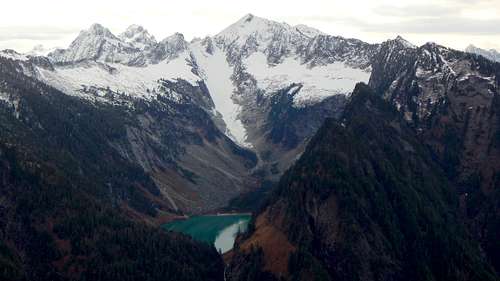
Vesper Peak and Copper Lake from Marble Peak - 3-21-15
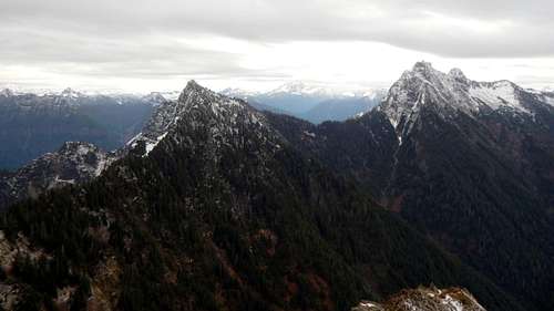
Hall Peak and Big Four from Marble Peak
Looking north from Marble Peak
Marble Peak summit pano
Getting There
Take the mountain loop highway east from Granite Falls for 21 miles, and park near the interpretive sign for Marble Pass. The very best parking is probably on the north side of the highway just a few hundred feet to the east of the sign. If you see the town of Silverton, you have gone too far.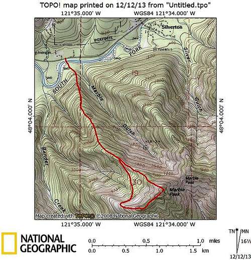
Marble Peak route map. Which variation you choose will likely depend on snow conditions.
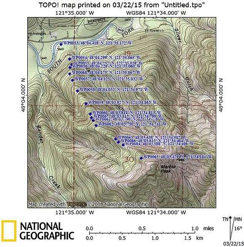
Marble Peak route map