
-
 22670 Hits
-
 94.82% Score
-
 49 Votes
|
|
Mountain/Rock |
|---|---|
|
|
37.98975°N / 107.74932°W |
|
|
Hiking, Mountaineering, Big Wall, Mixed |
|
|
Spring, Summer, Fall, Winter |
|
|
13786 ft / 4202 m |
|
|
Overview
Potosi Peak is the southeast termination of the Sneffels Range crest, and worthy of being a part of it. The peak looks very intimidating, and even the easiest route involves steep scree approach and an exposed class 3 scramble.I would like to mention that his peak used to have a page on SP, it was recently erased. I will try my best to renew this page. Thank you.
Rank in Colorado: 113 (I have seen ranks from 113 to 127 in different web sources - I guess depending what peaks/points you count as a separate peaks, but it does not fit into Colorado’s Centennial peaks = the highest one hundred, but definitively is in Colorado’s Bicentennials = highest two hundred peaks). Anyway, most sources give it rank 113.
Distance from Mt. Sneffels: 2.52 miles
Other 13ers in the area: Teakettle Distance: 0.99 miles away
Cirque Mountain Distance: 1.55 miles away
"Coffeepot" Distance: 0.59 miles away
Mt. Ridgway Distance: 1.66 miles away
Whitehouse Mountain Distance 2.48 miles away
13ers across the Yankee Boy road:
Gilpin Peak You will get some great views of this peak. I would recommend parking higher up on Yankee Boy road for climbing Gilpin.
Mount Emma Mount Emma is right behind Stony Mountain.
Mendota Peak Just follow the Saint Sophia ridge from Mount Emma east, it ends with Mendota peak.
and a lovely 12 thousand peak Stony Mountain
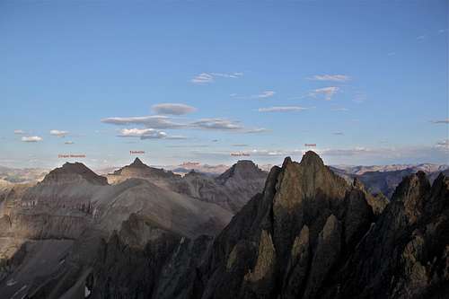 Orientation as seen from Mount Sneffels - please enlarge for seeing the captions Orientation as seen from Mount Sneffels - please enlarge for seeing the captions | 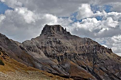 Potosi Peak Potosi Peak |
Potosi Peak has a formidable looking summit block from Coffeepot - Potosi saddle, and is more easily climbed from the east, where there is a break in the cliffs. For this, ascend the saddle to below the summit block, and traverse to the east side of the mountain, where the route to the top occurs. Note your route for a return. The route home is tricky because the ash grey cliff and spire-band that make photographer’s plates so striking, stand as an awaiting danger. retrace your steps to the Potosi-Coffeepot saddle, and descend until you veer right onto the upper grass slopes. Stay high, and traverse until the grassy bottom of the cirque south of Teakettle comes into the view, where you began your route earlier. Descend staying right, retracing your earlier steps to the road. This information is from Colorado Mountain Club book about Colorado Mountains. I did not have much more description than the above, and was told that you have to skirt along the mountain towards its east side. It is a long and exposed traverse, be prepared.
I have done 3 different routes on Potosi, and my favorite one is the North Couloir snow climb. If conditions are right, you should avoid scree, and the snow climb is spectacular.
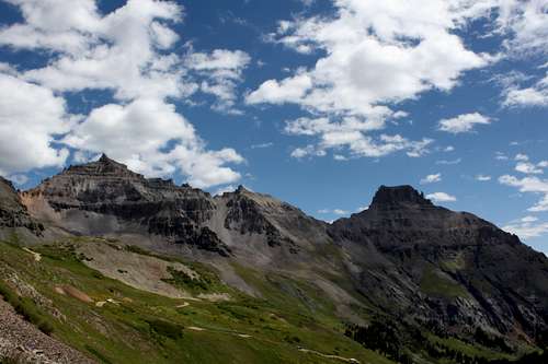 View from Yankee Boy Basin View from Yankee Boy Basin | 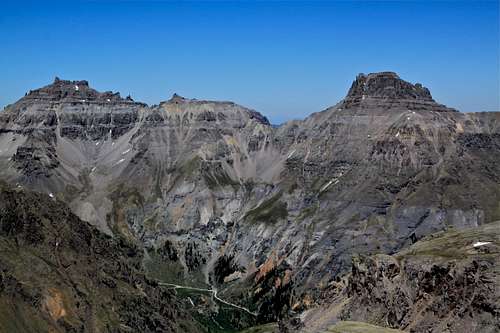 Yankee Boy Trio of 13ers as seen from Mendota Peak Yankee Boy Trio of 13ers as seen from Mendota Peak |
If you are bagging peaks, and your weather co-operates, then you can consider climbing all three 13ers: Potosi, Coffeepot and Teakettle in 1 long day. Hope you can cope with the loose scree well :).
Getting There

Scenic road

Toilet trailhead
From the town of Ouray, head south on US. 550, and turn right onto the Camp Bird Mine road. Cross the upper bridge over the Box Canyon at continue on the dirt road up Canyon Creek to a junction at 4.9 mile. Take the right fork (marked for Yankee Boy Basin), and head up Sneffels Creek to a parking area after 8.3 miles, at 11,350 feet. Note the road becomes progressively rougher as you proceed, and to drive to the parking area mentioned requires a four-wheel drive vehicle. There is a composting outhouse at the parking (= toilet trailhead). This would also be a start of your climb to Teakettle and Coffeepot. If you continue further up the road, it will lead you to the end of Camp Bird Road, high up in Yankee Boy Basin, and just below Mount Sneffels, Kismet, Cirque, and Gilpin Peak.
I would like to mention that the road is very popular with jeeps and 4WD vehicles in the summer, and many companies based in Ouray operate trips into Yankee Boy Basin. Weekends can be pretty busy with traffic (and loud too). I prefer exploring this area off season or in the middle of the week. Also, the road is narrow at the higher sections and passing other vehicles is nearly impossible, so be prepared that you can get stuck in a traffic on summer weekends.
The road is usually open to Senator Gulch in the winter - about 4.5 miles in. They start to snow plow it to Toilet Trailhead in May, and later based on snow conditions it gets cleared up to a high parking lot (dead end) below Kismet and Mount Sneffels.
Red Tape
There is no fee to climb Potosi Peak. There is no fee to drive on Yankee Boy Basin and to park at the "Toilet Trailhead". However, keep in mind that this road is very popular with jeep adventures, so it can be pretty busy in the summer.Routes
The east flanks of Potosi = Standard Route - this is the easiest route up Potosi peak. It is still very exposed and involves 3rd class moves. It is easy to get off route, the trail is barely visible and disappears often, cairns are not very frequent.You start (actually the start for all routes is the same) at Toilet Trailhead, and scramble up to the Coffeepot-Potosi saddle. You have to skirt along the southern flanks of the peak and be patient here. I happened to be inpatient and ended up on possibly new route - very exposed and requiring 5th class climbing. So, keep going around the mountain for a long time, pass the semi-detached pinnacle. Look for infrequent cairns. When you are facing east (not southeast, but truly east), there should be a faint trail up zigzagging between cliffs. I found more frequent cairns on this section. Again, there are some 3rd class moves, and it is exposed, but this is the easiest way up.
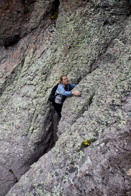
The southeast gully/chimney system - This is not a recommended route. I did it by mistake, and started to climb up the mountain just pass the semidetached large pinnacle. It required a lot of low 5th class moves, which was interesting, and extreme exposure. I found a gully leading west, then it turned into a chimney leading northeast, and finally a face climb on loose bad quality rock, which tops out on the south part of the summit. The advantage is that this is the shortest route up. The rock is extremely loose, you cannot trust most of your holds.
North Couloir - my favorite, this is a seasonal climb, best time is usually May, June. This climb is described in Colorado Snow Climbs. You can approach it via Weehawken trail (a long approach), or what most people do is they climb into Coffeepot-Potosi saddle, drop down on Potosi's north side, climb up the couloir. Descent: the standard route or via the couloir. I descended part of the couloir down, and traversed back into the saddle, lots of exposure.
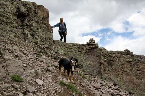
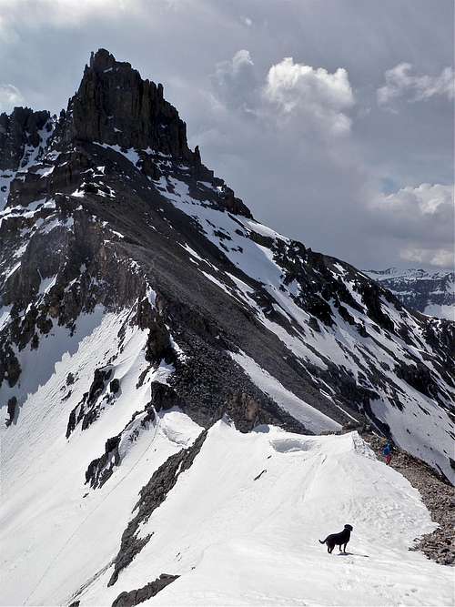
Would not recommend pets for any of these routes, but have to admit that Duchess did all 3 routes above with the SE gully/chimney system being most scary one. For the climbing route, I was in the chimney, and she "sat" on my thighs while I was wedging myself up. Would not do it again.
Descent: it is very tempting to go straight down from the saddle between Coffeepot and Potosi, but way low you will encounter cliffs and a small waterfall. Luckily, you can always see the road and your parked car. Try to head in that direction and stay high up until you get below Coffeepot, then start to descent.
Be careful on the loose scree. And consider a helmet for this scramble.
Hiking/scrambling/climbing images
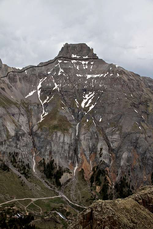 Illustration of the part of the climb Illustration of the part of the climb | 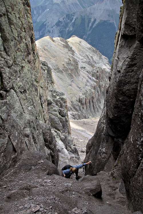 Scrambles in southern gullies Scrambles in southern gullies |
 Standard route - marked with cairns Standard route - marked with cairns | 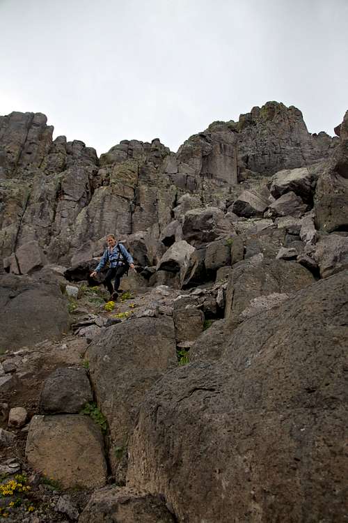 Standard route - east side of Potosi Standard route - east side of Potosi |
 Potosi Peak as seen from the slopes of Coffeepot Potosi Peak as seen from the slopes of Coffeepot | 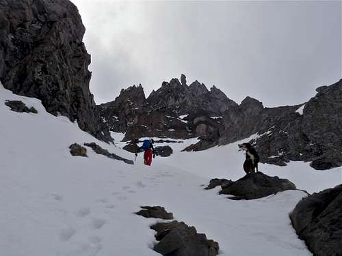 North Couloir on Potosi North Couloir on Potosi |
 Exposed climb on southern route Exposed climb on southern route |  Loose scree - Coffeepot Potosi saddle Loose scree - Coffeepot Potosi saddle |
Camping

snow camping below Yankee Boy Basin
Camping is not officially allowed in Yankee Boy Basin, but I have spend a few nights in my car parked along the road, and even at the high parking lot at the end of the Camp Bird Road. I have camped in Governor Basin - below Yankee Boy basin in winter (had to snow shoe in since the roads were closed).
There are two official campgrounds in the lower section of Camp Bird road:
Thistledown Camground
Angel Creek Campground
And remember, the town of Ouray offers plenty of different style of accommodations, including soaks in hot springs.
External Links
Potosi Peak on 13ers.comPotosi Peak ON Peakbagger