
|
|
Mountain/Rock |
|---|---|
|
|
48.37986°N / 121.91604°W |
|
|
Skagit |
|
|
4349 ft / 1326 m |
|
|
Overview
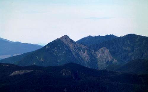
Big Deer Peak from the southeast
Update: (10-3-15) Unfortunately, it looks like the Weyerhaueser Company now has control of the area behind the access gate, and a permit is now required.
Big Deer Peak from SE. Route starts from road just left of photo center.
My route of ascent came in from the Lake Cavanaugh area, and finished via the south ridge - that is the route described here. There does exist the possibility that an easier approach exists from the north (coming over Little Deer Peak), but I will leave that to someone else to figure out. I can't say I necessarily recommend Big Deer Peak as a climb, but it may be just the ticket for the climber who's done everything. This approach is really not practical without a mountain bike, and it will be assumed that anyone doing this approach is on a mountain bike. Just to clear up one point of confusion: Big Deer Peak is actually lower in elevation than Little Deer Peak. Why these peaks were labeled "backwards" is anyone's guess. Little Deer Peak's summit is completely covered with large trees, and does not look like it provides much in the way of views.
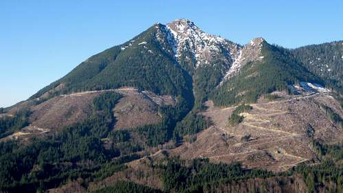
From the intersection of Lake Cavanaugh Road (from Highway 9 southbound) and Finn Settlement/Granstrom Road (from Highway 9 northbound), follow Lake Cavanaugh road another 5.2 miles to a logging road turning uphill to the left (Elev. 918' N48 20.628 W122 03.692). Park in such a way as to not block the gate, or better yet, park on the other side of the road. Do not enter with your vehicle if the gate is open - this gate may be locked at any time. Start biking up this road, which after the first hill will be mostly flat. Stay on the main road, and ignore branches coming in from the left at 1.0 and 1.5 miles. You will generally be paralleling Pilchuck Creek heading east. At 5.5 miles, take the left fork, which will start uphill (Elev. 1350' N48 21.930 W121 57.508). In a quarter mile, turn right. Follow this fork 2.0 miles to an intersection with roads coming in from both sides of Day Lake (N48 23.065 W121 56.276). As you approach this intersection, you should have a view of your objective that looks something like the photo below.
Big Deer Peak from the west
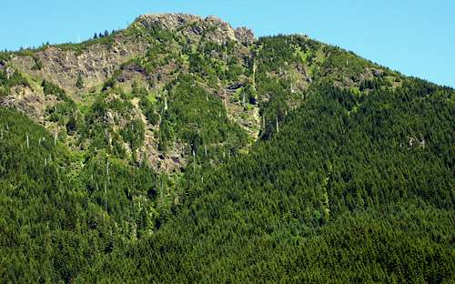
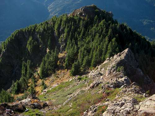
At the intersection, stay on the right fork, which will quickly head uphill on Big Deer's west flank. Continue until on the south side of the mountain at an elevation of 2236' (N48 22.161 W121 55.348). Total distance from the gate at this point should be about 9.0 miles, and now its time to lock up the bikes and start walking. Find an old roadbed which starts a slow climb in an east direction on Big Deer's south flank (this road is identified on the USGS map with a dashed line). This road will eventually switchback up the peak to about 3600' on the south side - expect it to be quite brushy in places. Once the road fades out, scramble straight up to the 4240' false summit on the south ridge. From here, you have a great view of the scramble route to the summit.
Big Deer Peak from false south summit
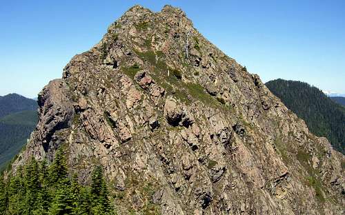
Take your time here to study the route before starting up. There are a number of variations possible, and it should be possible to finish the climb at class 3.
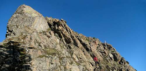
Starting up the final scramble on Big Deer Peak
Looking down final scramble on Big Deer Peak
Once on the top, you will find the views are pretty good for a 4349' peak.
Big Deer Peak summit pano
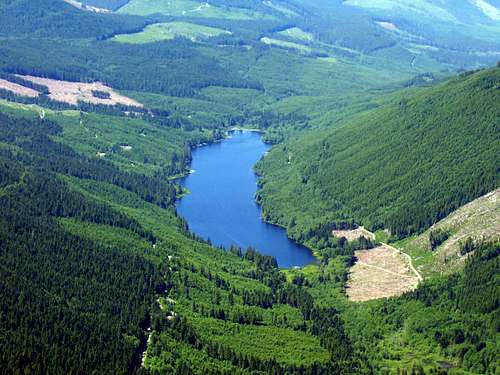
Day Lake from Big Deer Peak
Getting There
If coming from the south, take Highway 9 north from Arlington. Turn right onto Finn Settlement/Granstrom Road shortly after crossing the Pilchuck Creek bridge. Follow Granstrom Road to Lake Cavanaugh Road. Follow Lake Cavanaugh Road 5.2 miles to the parking area. If coming from the north, follow Highway 9 south to the Lake Cavanaugh Road (just south of Big Lake). Follow Lake Cavanaugh Road east. Parking area will be 5.2 miles past the intersection of Lake Cavanaugh Road and Granstrom Road. If you end up at Lake Cavanaugh, you have gone too far.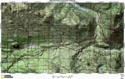
Big Deer Peak route map. The side trip to Day Lake is also shown on top of map.
Red Tape
This approach is on private timber land. I have never had any problems biking on this road in the past, just follow the rules posted by the gate.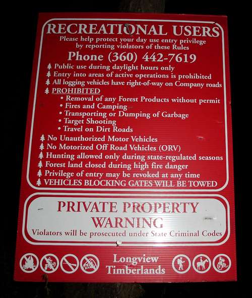
Picture stolen from beaudaddy85