
|
|
Mountain/Rock |
|---|---|
|
|
37.29676°N / 118.81649°W |
|
|
Mountaineering |
|
|
Summer |
|
|
12866 ft / 3922 m |
|
|
Overview
Gemini is a relatively remote peak situated in the John Muir Wilderness of the Central Sierra Nevada between Yosemite NP and Kings Canyon NP. It sits mostly within the watershed of Piute Creek and is about midway along an unnamed divide that separates Piute Creek to the south, from the various branches of Bear Creek to the north. Gemini has a prominence of about 800 feet.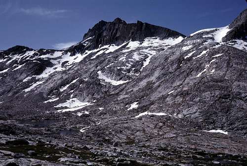
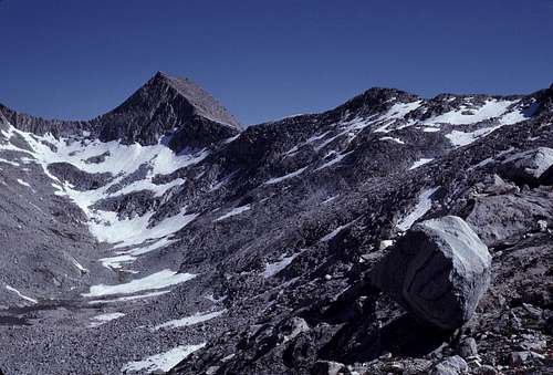
Gemini from the Northeast
This peak is on the SPS list, but it doesn't seem to get that much attention probably due to its famous, higher, and far more striking neighbor to the north: Seven Gables. Both peaks are accessible and easily climbed from "Seven Gables Pass" which occurs along the ridge connecting the two peaks.
 Seven Gables | 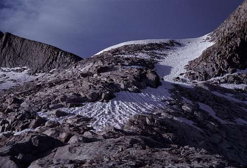 Seven Gables Pass |
There are great views to be had from Gemini, however, and an ascent should not be overlooked if one happens to be in the vicinity.
Etymology
As testimony to its neglect, the mountain had its first ascent relatively late in the High Sierra "Golden Age". Its first recorded ascent was in July, 1953 by Jim Koontz and Rosemary Lenel (R.J. Secor, The High Sierra Peaks, Passes, and Trails). That same year the name, Gemini, was suggested by Chester Versteeg, Oliver Kehrlein, and Toni Ganero. Undoubtedly the name was derived from the distinctive twin summits which define the peak. The name became official in 1957 (Peter Browning, Place Names of the Sierra Nevada).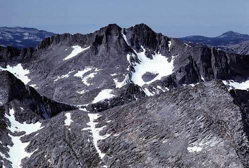
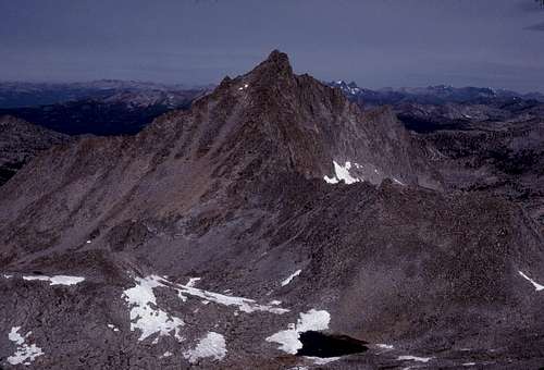
Zoom From Royce Peak
Getting There
From the West:Bear Diversion Road, about 16.5 miles- one way. There's about a 5900 foot gain. Minimal elevation gain on the return trip.
Total: 33 miles of hiking (28 miles if starting from Bear Diversion Dam) with about 5900 feet of climbing.
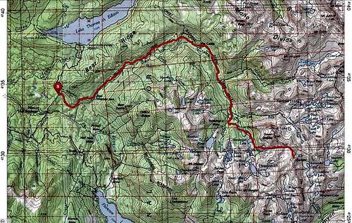
From Bear Creek
This is a long route, but there are no passes or ridges to cross. Take highway 168 east from the Fresno/ Clovis area and follow it several miles past Shaver Lake and scenic Huntington Lake. The road becomes a narrow, but paved one lane road as it crosses Kaiser Pass and drops down into the Lake Edison- Florence Lake region. If you intend to camp overnight, stop by the High Sierra Ranger Station for your permit. Continue past the turnoff for Florence Lake and proceed for another 2.5 miles to Bear Creek Diversion Road.
Parking may be found at the junction of Lake Edison Road and the Bear Creek Diversion Road. If you are lucky enough to own a 4x4, 2.5 miles can be eliminated from the hike by parking at the dam making a total hike of only about 14.5 miles- one way. Hike or drive the road to the dam and then follow the beautiful Bear Creek Trail for several miles to its junction with the John Muir Trail. Follow the JMT for approximately 4 miles to a junction with a trail to Lou Beverly Lake. The trail becomes rather indistinct beyond Sandpiper Lake. That's okay, though, because cross country travel is very easy in this timberline region. There are several picturesque lakes surrounded by beautiful alpine meadows and granite slabs. The final approach to Gemini begins just beyond Medley Lake and climbs easy canyons and slopes to the east. There are many options.
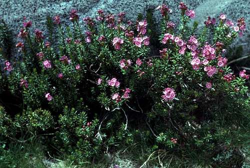 Flowers | 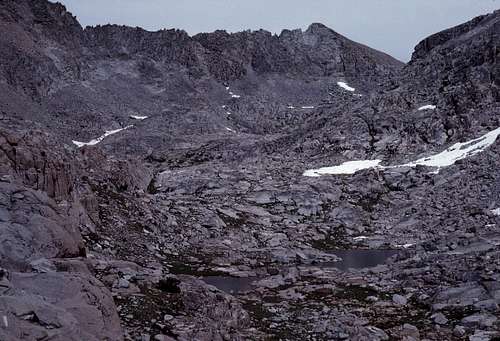 West of Seven Gables Pass |
Florence Lake. This seems to be a viable alternative to the Bear Creek approach. One can take a boat ferry across Florence Lake thus eliminating a few miles of hiking. From there, one can follow the Muir Trail over Selden Pass (okay) or explore the approach up West Pinnacles Creek (interesting). I believe that either route will involve more than a dozen miles each way and several thousand feet of climbing. It would be interesting to see a trip report or route report regarding this approach.
From the East:
Pine Creek Trail Head, about 15.0 miles- one way. There's a 6840 foot gain with about a 1660 foot gain on the return trip.
Total: 30 miles of hiking with about 8500 feet of climbing.
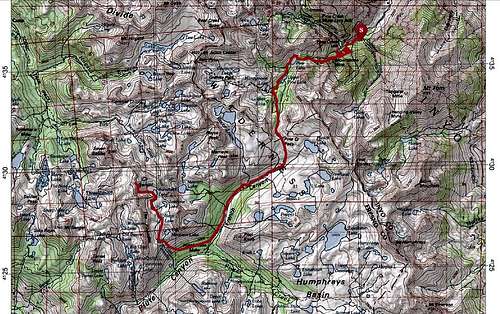
From Pine Creek
This route is not as long, but may be much more arduous than the Bear Creek Trail. Pine Creek Pass (el. 11,060+ feet) must be crossed both on the approach and the retreat.
About 8 miles north of Bishop on US 395, head east on Pine Creek Road. The trailhead is about 9 or 10 miles to the east near the Pine Creek Tungsten Mill. Follow the trail several miles up the canyon past several lakes and cross Pine Creek Pass. After dropping down into French Canyon the trail continues downstream to where is crosses East Pinnacles Creek. At this point the trail is left behind for a steep cross country climb to the north up East Pinnacles Creek to the hanging valley above. Follow the basin north past several beautiful alpine lakes to the foot of Gemini's southeast face.
Piute Pass Trail Head, 14.0 miles- one way. There's a 5600 foot gain with about a 2000 foot gain on the return trip.
Total: 28 miles of hiking with about 7600 feet of climbing.
This is probably the easiest route from the east, but there is still Piute Pass (el. 11,423 feet) to cross both to and from the peak.
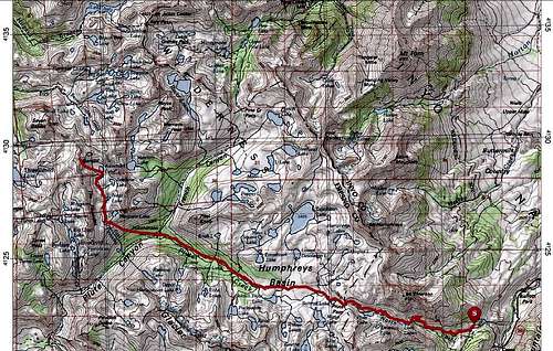
From North Lake
From Bishop take highway 168 east toward Lake Sabrina. Just before the lake, make a right turn onto the narrow road to North Lake. The trailhead is just past North Lake. Simply follow this popular trail over Paiute Pass and continue down to its junction with the Pine Creek Pass Trail in French Canyon. The rest of the journey follows the same route up East Pinnacles Creek as the above description from Pine Creek.
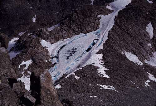
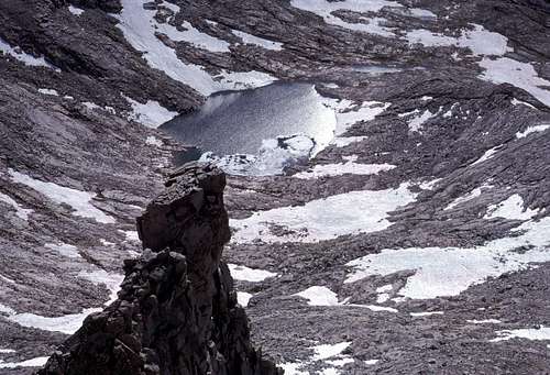
Frozen Tarn on East Ridge
Red Tape
Wilderness Permits are required year round for all overnight camping in Sierra National Forest (western approaches) or Inyo National Forest (eastern approaches). Permits are not required for day hiking.For detailed information and online permit applications:
Sierra National Forest
Inyo National Forest
There are bears in this area. Common enough to inspire the naming of a major creek plus many of the lakes in this region. Bear canisters are not required, but proper food storage is a must.
Campfires are okay in both Inyo and Sierra National Forest, but they are strongly discouraged above 9,000 feet. Use the drown, stir and feel method to put them out. Please use preexisting fire rings whenever possible. By exploring the above mentioned links, one can find the latest regulations regarding campfires.
No Trundling
Camping
Camping is allowed throughout this region. The rules seem to be pretty universal for High Sierra camping:Routes
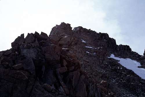
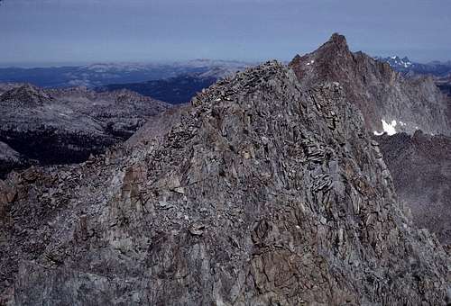
(NOTE: The north summit is the high point.)There appear to be any number of class 2 or 3 routes on all sides of this peak. Like many Sierra peaks, most of the easiest routes are on the west or south sides. The east side does appear to have some class 4 and possibly even class 5 routes, but none seem to have been recorded in the usual sources.
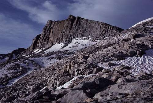
Northeast Face
Probably the most popular route is the northwest slope from Seven Gables Pass. This is mostly class 2, but may have a class 3 move or two.
 Upper Northwest Chute | 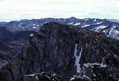 South Summit |
According to Secor, there is another established class 2 route that starts from Aweetsal Lake. This route ascends to the south ridge from the east and this is followed to the top.
Aweetasal Lake
SP's own Bob Burd has an excellent trip report on his site that describes an ascent of the north ridge after a long approach from the east.
North Summit