-
 21712 Hits
-
 84.82% Score
-
 19 Votes
|
|
Mountain/Rock |
|---|---|
|
|
45.07825°N / 109.61712°W |
|
|
Hiking, Mountaineering, Scrambling, Skiing |
|
|
Spring, Summer, Fall, Winter |
|
|
12047 ft / 3672 m |
|
|
Overview
Sky Pilot Mountain is one of the lowest 12,000 foot peaks in the Montana Beartooth Mountains. It does have 587 feet of clean prominence though and the view from the summit is nothing short of spectacular. Looking north towards Castle Mountain and Castle Rock Spire and east towards Whitetail Peak give this peak the feeling of being right in the middle of the best peaks in the Beartooths. Actually, Sky Pilot Peak is right smack in the center of all the best Beartooth Mountain summits despite having a lower elevation. Also nice to know is that an ascent doesn't take any technical knowledge. Although the approaches are long, they are also very scenic.
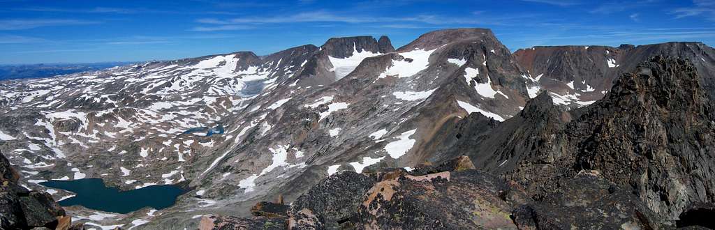
 Sky Pilot Mountain Sky Pilot Mountain |
 Sunset over Sky Pilot Sunset over Sky Pilot |
 Sky Pilot Mountain from west Sky Pilot Mountain from west |
Getting There - From the South
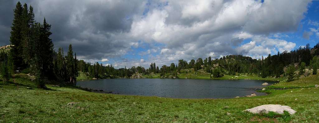
This peak is most feasibly approached from the south or the west. If coming from the south over the Beartooth Plateau you have two trailheads you can use to approach this peak, both are long. You can either start at the Clay Butte trailhead or the Beartooth Lake trailhead. Since the trail heading around the east side of Beartooth Lake is very marshy, the Clay Butte trailhead may be better, however you will have to start your hike with a 600 foot descent going this route so pick your poison. No matter which trailhead you choose, you need to get to Native Lake.
Beartooth Lake Trailhead: From the MT 308/US 212 junction at the south end of Red Lodge, Montana head west on US 212 for 40.5 miles going over Beartooth Pass and turn right on the signed turnoff for Beartooth Lake and campground. Take this gravel road and stay straight after 0.3 miles and pass the boat launch. At 0.6 miles from the highway, turn left to the trailhead marked with a sign with room for no more than 10 cars.
Clay Butte Trailhead: From the Beartooth Lake turnoff, continue west on US Highway 212 for 1.5 miles towards Cooke City and turn right on the gravel Clay Butte Road. Drive this good road for 1.5 miles to the signed trailhead on the roads' left side right before a sharp switchback at 9,580 feet in elevation.If you start at the Clay Butte trailhead, start hiking the nice trail and reach a signed junction with the Granite Lake trail after 1.1 miles at 9,260 feet. Continue on the trail as it weaves up and down small hills and cross many tiny creeks along the west side of Beartooth Butte. After 1.9 miles from the Granite Lake junction, the stream descends a short ways to a larger creek at a little 3 foot waterfall. Continue across the stream here and follow a cutoff trail for 0.3 mile that meets the main Beartooth High Lakes trail at the southern end of Native Lake. This cutoff saves roughly 20 minutes and bypasses the signed trail junction at the northern end of Beartooth Butte. If you start at the Beartooth Lake trailhead, walk around the lakes' east and north sides through a large swamp (bring waders) OR above the swamp on many game trails in the trees to the east. Horrible bushwhacking, creek crossings and route-finding is insured if you do this. Take the swamp and deal with it. At 1 mile from the trailhead, the swamp ends and the trail climbs gently through beautiful meadows along the east side of Beartooth Butte for 1.9 miles to the signed junction with the Island Lake trail. Stay straight for another 0.7 miles to the north end of Beartooth Butte and a signed junction with the Clay Butte Trail. Stay right onto the Beartooth High Lakes trail and go 0.5 mile to the south end of Native Lake.
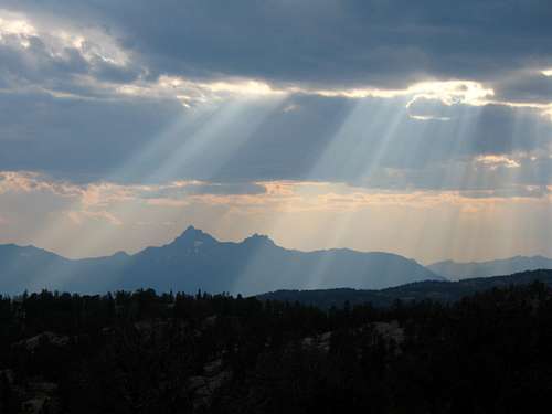 Sunbeams over Pilot Peak from the Clay Butte Trail
From Native Lake, stay on the trail as it contours around Surprise Lake, then descends about 400 feet to a creek crossing and an unnamed lake at 9,320 feet, 2 miles from Native Lake. There is good camping here which is located only a few feet south of the Montana/Wyoming border. Do not follow an obvious trail heading steeply up the hill next to the meadow but instead hike around to the north side of this small lake and catch the main trail just out of view from the meadow. Contour around Thiel Lake and descend slightly to the creek draining Throop Lake at 9,400 feet.
Shortly after this crossing continue up steep switchbacks for 300 feet to a flat meadow at 9,750 feet where the slope eases. This part of the trail has substantial horse damage and is slick. Cross the Marmot Lake outlet stream (good camping and fishing) at 9,860 feet and cross over a small saddle just above Kidney Lake. Hike along the shore of Kidney Lake and make another 300 foot descent to Wright Lake. Great Camping can be found at Wright and Martin Lakes. Leave the trail here and walk north for 0.3 mile around the left (west) side of Martin Lake to its northwest corner. Continue up a small valley from here and climb to a small 10,040 saddle, with fantastic views of the Castle Group, 0.5 mile from the northwest corner of Martin Lake.
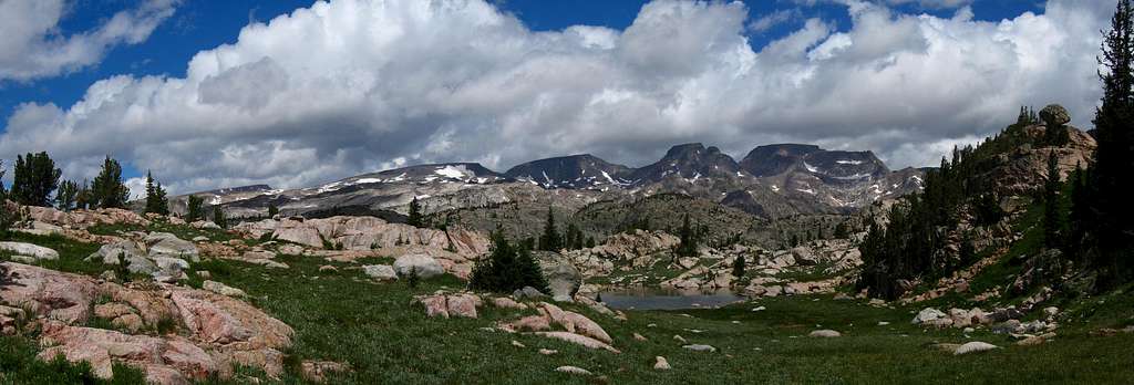
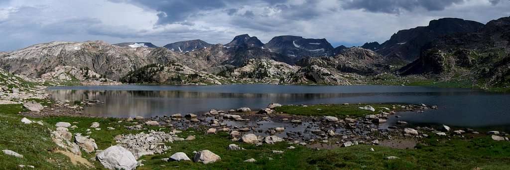
From this saddle, descend slightly passing a very small tarn and begin contouring right at 10,000 feet and up a prominent valley to the northeast towards Crystal Lake. Walk around the right (east) side of Crystal Lake on talus and grass to its north side at 9,900 feet with some of the best camping around, 0.8 miles from the small saddle. The approach is over (well...kind of). Continue north around the Pleiades Lakes and contour west around a small knob. Descend to the creek draining Flat Rock Lake and follow it to the lake, 1.2 miles from Crystal Lake.From this saddle, descend slightly passing a very small tarn and begin contouring right at 10,000 feet and up a prominent valley to the northeast towards Crystal Lake. Walk around the right (east) side of Crystal Lake on talus and grass to its north side at 9,900 feet with some of the best camping around, 0.8 miles from the small saddle. The approach is over (well...kind of). Continue north around the Pleiades Lakes and contour west around a small knob. Descend to the creek draining Flat Rock Lake and follow it to the lake, 1.2 miles from Crystal Lake.
Getting There - From the West
Use the Lake Fork Rock Creek trailhead to approach from the west. From the Montana State 308 and US Highway 212 junction in Red Lodge, go 10.8 miles west on US 212 towards Beartooth Pass and turn right onto the Lake Fork Road. Go 1.8 miles on this paved road to its end at the trailhead with ample parking. The elevation at this trailhead is 7200 feet. From the trailhead, follow the trail along the south side of the creek for 4.7 miles to the junction with the Lost Lake trail. This spur trail leads 0.2 miles to Lost Lake with good camping, but poor fishing. Lost Lake sees a lot of day hikers so don’t expect much solitude here. Continue past the junction 0.3 miles to the nice footbridge crossing the Lake Fork at 8440 feet and cross it.Continue one mile up the trail to the junction with the Keyser Brown Trail. This part of the trail is steeper as it begins climbing up towards Sundance Pass. Take this side trail heading left (west) and follow it 0.5 mile as it descends back to the creek and reaches Keyser Brown Lake.
Continue another quarter mile to the lakes’ west end with great camping spots. This is the end of the maintained trail. From here, catch a boot path that continues west on the north side of the creek and head 0.75 miles to First Rock Lake at 8850 feet. This path can be very hard to follow as it is very faint and there are many other small paths and game trails in the area. You’ll likely need to do some bushwhacking and rock hopping on large talus. From First Rock Lake, hike 0.2 mile around its right (north) side on swampy grass and talus staying close to the shore. Reach the west end and locate a use trail heading around and to the right of a large talus field. Follow it as it comes close to the creek, then veers further to the right to avoid some waterfalls, reaching an open meadow at 9,140 feet which is 1 mile from the west end of First Rock Lake. This part of the climb can be a grueling bushwhack if this path isn’t found. Walk through the meadow a short ways and reach Second Rock Lake. Hike around its right (north) side for 0.6 mile through bushes and on talus and continue through dense trees well to the right of the creek generally heading southwest, using game trails when possible. After 1.8 miles from the upper end of Second Rock Lake, reach Throop Lake, which is more of a swampy area, at 9,700 feet. This lake has two inlet streams. Walk around the north side of this lake avoiding swampy areas to the first inlet stream coming in from the north. Cross this stream and continue southwest to the second inlet stream (which drains Sky Pilot Lake) and follow alongside this stream on its north side for 1.1 miles to Sky Pilot Lake, heading around to the left (south) and at the base of some cliffs coming down the southeast face of Whitetail Peak.
Route Options
South Ridge via Crystal Lake: Ratings: YDS - Class 2+, Exposure - 2, Bushwhacking - 1, Time: 2.5 hours one way from Crystal Lake
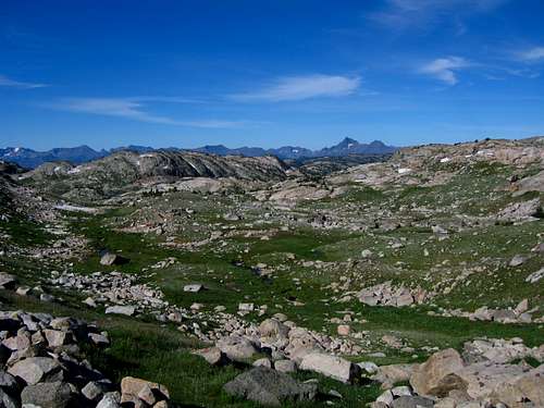
From the north end of Crystal Lake, hike northeast up a grassy valley above the Pleiades Lakes for 1 mile to a notch at 10,400 feet just to the right of the cliffs dropping down the southwest face of Sky Pilot. Continue 0.5 mile up the valley in a northeast direction on talus to the base of the headwall at 10,800 feet. Climb talus and ledges up the headwall of the valley and reach the crest of the Beartooth Mountains at 11,400 feet after 0.3 mile. This 600 foot climb is the crux. Turn left and hike north for 1.2 miles along the crest to the summit at the north end of the summit plateau.
RT Distance: From Crystal Lake - 6 miles
RT Elevation Gain: From Crystal Lake - 2,200 feet
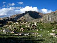
 Views from the climb Views from the climb |
 Castle Group from Sky Pilot Castle Group from Sky Pilot |
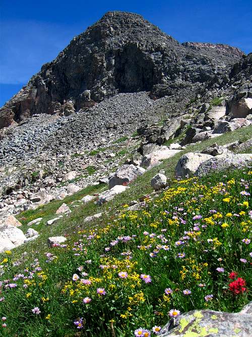 Wildflowers on Sky Pilot
South Ridge via Sky Pilot Lake: Ratings: YDS - Class 2+, Exposure - 2, Bushwhacking - 4, Time: 2 hours one way from Sky Pilot Lake
Hike around the north side of Sky Pilot Lake and climb the permenent snowfield just above and west of the lake. It reaches an angle of about 40 degrees at the steepest if you stay to the left. Reach the crest of the Beartooth Mountains at the same 11,400 foot tiny saddle as if you came from the west at Crystal Lake and follow the ridge north for 1.2 miles to the summit. For an additional challenge, try one on the steep snow couloirs further to the right and hit the south ridge slightly further north.
RT Distance: From Sky Pilot Lake - 4.5 miles
RT Elevation Gain: From Sky Pilot Lake - 1,600 feet
 Second Rock Lake Second Rock Lake |
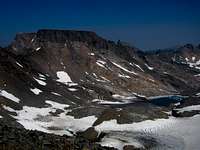
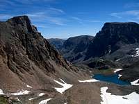 Sky Pilot Lake Sky Pilot Lake |
 Whitetail Peak from Sky Pilot Whitetail Peak from Sky Pilot |
Map
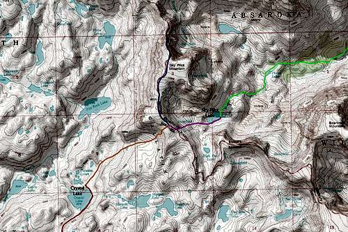
RED: Crystal Lake approach from the South
GREEN: Sky Pilot Lake Approach from the West
ORANGE: South Ridge via Crystal Lake climb (Class 2+)
PINK: South Ridge via Sky Pilot Lake snow climb (Class 2+)
BLUE: South Ridge (Class 2)
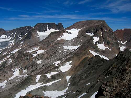
Summit Views