
-
 16903 Hits
-
 87.11% Score
-
 24 Votes
|
|
Mountain/Rock |
|---|---|
|
|
40.23498°N / 115.5406°W |
|
|
Elko |
|
|
Hiking |
|
|
10848 ft / 3306 m |
|
|
Overview
Pearl Peak sits at the southern end of Nevada’s great Ruby Range. Due to the low saddle at Harrison Pass between Pearl and Tipton Peak as well as the rest of the rest of the Ruby Crest to the north, Pearl finds itself with 3,608 ft of prominence despite being one of the lower peaks in the Rubies; this is enough to make Pearl the 38th most prominent peak in Nevada.
 |  |
|---|
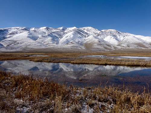
The Southern Rubies are a much more gentler version of their rockier northern brethren, closer in type to the dryer sagebrush low and bristlecone high adorned ranges of Nevada and the rest of the Great Basin. However, this section of the Rubies still serves as a scenic backdrop rising above the marshes of Ruby Lake National Wildlife Refuge, and one will find the southern half of the range much less crowded than the more popular areas up north (popular in Nevada being a relative term). The mountain is a long ways from civilization but can easily be reached by even passenger cars, and views are expansive stretching from Northern through Central Nevada; on a clear day you might even be able to see the Deep Creek Range in Utah.
 |  |
|---|
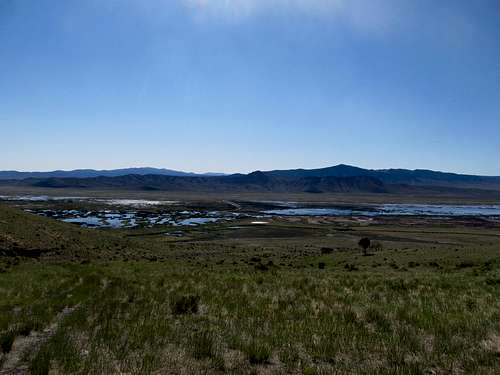 Ruby Lake NWR Ruby Lake NWR |
|---|
Getting There
Ruby Lake NWR:NWR PDF Map
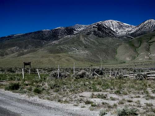
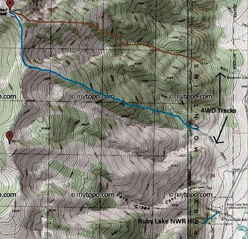
Obtaining a map for Ruby Lake NWR may be helpful to find the various access points along the eastern side of the range. From Ely or Wells take NV 229 to the its junction with NV 767. One can also take NV 718 over Harrison Pass from Elko, but note that the pass maybe be closed during winter months. From the south one can travel the gravel road through Long Valley from Ely or NV 719 then the gravel road over Overland Pass from Eureka. The NWR visitor center/headquarters, located around 10 miles south of the junction between 767 and 718, is where one can park and scope out the route from the east.
Less than a half mile north of the visitor center is a rough 4WD track that ascends west from the main road for about less than a mile or so before disappearing around 6,588 ft. This will save you around 500’ feet of elevation gain. The road is unmarked but there is a wider road leading east towards the marshes branching off at the same place (marked Long Dike Access Route on the NWR map) that creates a four way intersection. You can access the east ridge of Pt. 10,547 to gain the south ridge of Pearl.
About 1.5 miles north of the NWR is Bressman Cabin (east of the road). A narrower jeep track branches west from here supposedly up to 6,600 ft based on topo maps. We did not travel this road so be wary that conditions on the ground may not always match topo maps from prior years. Regardless, this road will be rough. Driving up this road will provide shorter access to the direct east ridge of Pearl.
The signed road into Indian Creek is located around 3 miles north of the visitor center. This road goes up to 6,800’, and one can climb Pearl in a long day from the north over several northern subsummits.
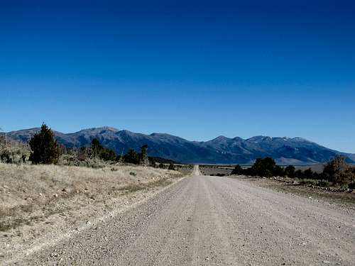 Driving towards Southern Rubies & Pearl Driving towards Southern Rubies & Pearl |
|---|
Routes
 Possibilities from the East Possibilities from the East |
|---|
The ascent of Pearl from the east is steep but straight forward. Without four wheel drive expect to gain around 4,700-4,800 ft from the NWR, with approximately 6-8 miles RT. Driving up either dirt track from near the visitor center will save you around 500’ of gain and less than a mile each way.
 up open ridges up open ridges |  lower slopes lower slopes |  Ruby Lake Ruby Lake |  Bristlecone Forest Bristlecone Forest |  Bristlecone Pine Bristlecone Pine |
|---|
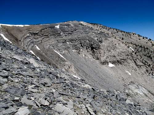
We took the East Ridge leading up to Pt. 10,547, a minor subsummit directly to the south of Pearl. From the end of the dirt track descend and cross the small gully to your right (north) and ascend the bare lower slopes leading steeply upward. 2,000 feet of climbing through the sagebrush and dry grass will lead you to a wooded (bristlecone) area around 8,500’. Continue ascending straight up the ridge, where you will run into some talus below 10,000’. The rocky fault lines around the circle directly below and southeast of the summit should be in view on your right. Boulder hop to the ridge crest and the top of 10,547. From here descend negligible elevation and 400’ or so to the top of Pearl and its unparalleled views.
 Down towards Ruby Lake Down towards Ruby Lake |  High Rubies High Rubies |  Cool Rocks Cool Rocks |  Nearing Ridge Crest Nearing Ridge Crest |  Traverse N to summit Traverse N to summit |
|---|
Alternatively one can ascend the direct east ridge of Pearl as well. From the end of the 4wd track leading up from the Bressman Cabin one can continue straight up the small gully to a bench around 8,000’, then traverse slightly northwest to gain the East Ridge. Aim for a rocky outcrop around 10,400 along the ridge, then continue up another 400’ to the top of Pearl.
We noted entries in the summit log too by parties who had ascended from the west, as well as a few who drove up pretty close to Cass House Peak to the south and traversed along the crest of the Rubies to the top of Pearl.
Really, approaching form the east this is open country, and taking any ridge up will eventually get you there. Some ridges may be rockier and looser than others, but you’d be hard pressed to cliff out or anything. Just keep going up until there’s no more up to go.
Views
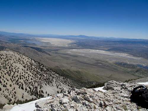
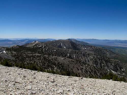
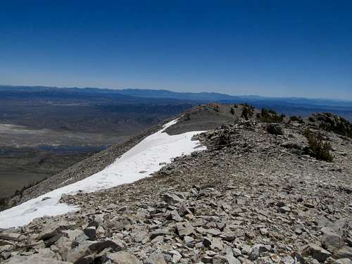
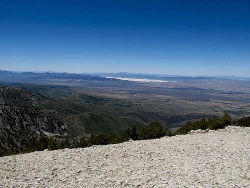
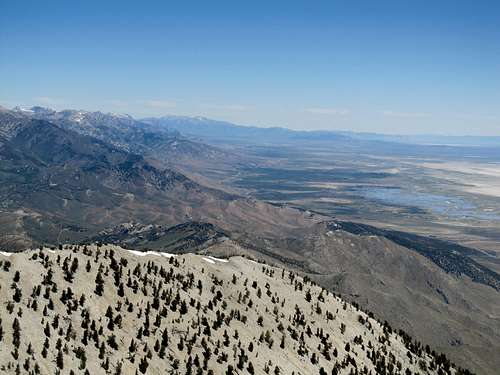
Views from the top are magnificent. One has views of Ruby Lake below (especially in early season before it dries out), and to the north the entire expanse of this great range stretches before you, as well as the East Humboldts further up towards Wells. Southwest you will glimpse range after range leading into the Monitors and the Toquimas. Pilot Peak, the Pequops, the Schell Creeks, and all the other ranges of this special part of northwestern Nevada greet your eyes, and on an exceptionally clear day you can see all the way to Ibapah and the Deep Creeks across the border in Utah and Wheeler Peak in Great Basin National Park.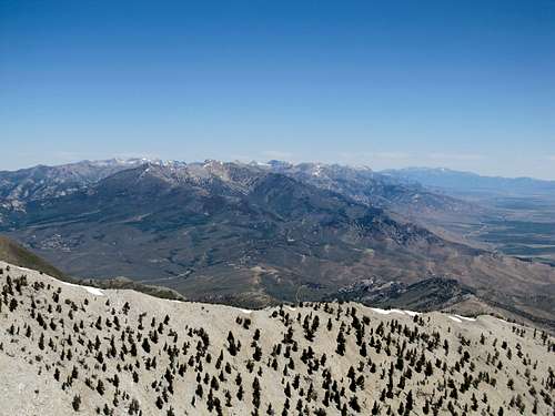 | 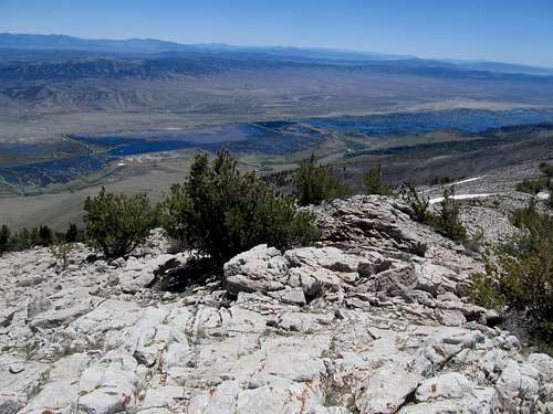 |
|---|---|
 |  |
 |  |
Et Ceteras
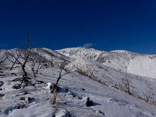
This is open country, so in the surrounding BLM land you can really just pull off along a side road and camp responsibly with minimal impact. Within the boundaries of the Ruby Lake NWR there is a designated campground south of the Visitor Center and Refuge Headquarters as well. Motels are far off; one can stay in Wells or Elko to the north, as well as Eureka or Ely to the south, but expect at least 90 minutes of driving if not more to the trailhead from these towns, mostly along good gravel roads. As such, make sure you gas up well before venturing forth on your endeavor.As long as roads are clear of snow to the NWR (call for current conditions) this should be an all-seasons peak. Bring crampons and an ice axe in case you run into icy conditions. Avalanche danger here is probably lower than the higher peaks of the Rubies and East Humboldts; still, exercise caution and assess conditions carefully. You may want to stick to the ridge crest and avoid drainages when you have heavier and more potentially unstable snowpacks.
 |
|---|