
-
 12865 Hits
-
 86.85% Score
-
 23 Votes
|
|
Mountain/Rock |
|---|---|
|
|
47.57296°N / 120.48869°W |
|
|
Download GPX » View Route on Map |
|
|
Chelan |
|
|
Hiking, Scrambling |
|
|
Spring, Fall, Winter |
|
|
4119 ft / 1255 m |
|
|
Overview
Tibbetts Mountain is located near the city of Leavenworth just north of the city of Cashmere. This mountain offers a nice view of the Enchantments and of some hills along highway 2. This peak is a good choice when the weather is not looking great on the west side or even for a casual outing. The trailhead of this mountain is located in the Peshastin Pinnacles State Park which has a well maintained trail. However, later on the trail becomes less obvious. But navigation is very easy on this mountain considering that it's mostly a ridge walk. The standard route is about 7 Miles Round Trip, has 3,268 feet of Elevation Gain and the mountain has 995 feet of Prominence.Getting There

3 Paragliders Above
Getting there from Seattle: Head East on highway 520. Turn onto I-405 heading North. In Woodinville take a right onto highway 522. Take another right onto highway 2 until Leavenworth. From Leavenworth head east for 9 miles, take a left onto North Dryden Road. Peshastin Pinnacles State Park will be on your right after the road curves. (elevation 1050 ft)
Getting there from Wenatchee: Head west on highway 2. In about 9.8 miles turn right onto N Dryden Rd. Take a right once the road curves which arrives at the trailhead.
View Google Maps Directions here. [127 Miles | 2 Hours & 23 Minutes]
North Side Variation: Similar instructions as above except that after Leavenworth turn left onto Alice Ave (6.2 miles after Leavenworth). Turn left onto main st. Turn right onto N Road which turns into N Dryden road. Turn left onto NF-7410/Olalla Canyon Rd/Ollala Canyon Rd. After 4.5 miles Tibbetts Mountain road will be on your right. You can follow this road almost all the way to the summit.
Standard Route
The route starts out on a nice dirt trail. Enter though the gate which you will soon see a fork in the trail, go right. At the second fork soon after the first one, go right again. The trail slowly goes around the Peshastin Pinnacles which will be on your left, the trail gets steep in a few spots.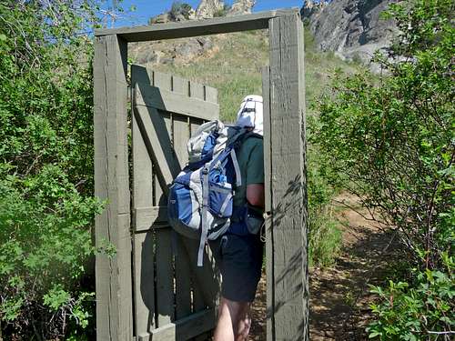
Entering the Gate to Tibbetts
Eightmile Peak in the Distance
Don't be disappointed because of the fields below you, the trail takes you away from all this and you'll get your mountain views soon enough. Near the top of the Peshastin Pinnacles take a right which for the most part goes due north. The trail then follows the ridge and turns into a road continuing to go North. On the way you should be seeing fields of beautiful flowers and mountains.
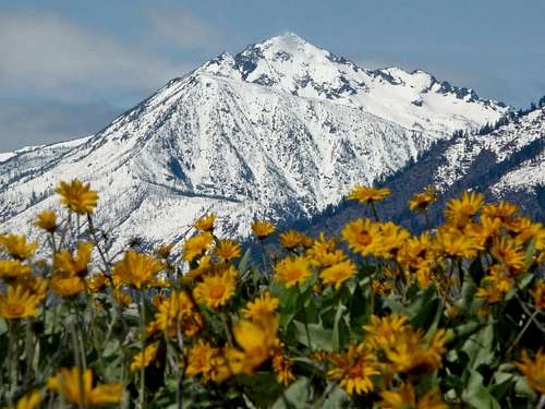
Cashmere Mountain with Flowers
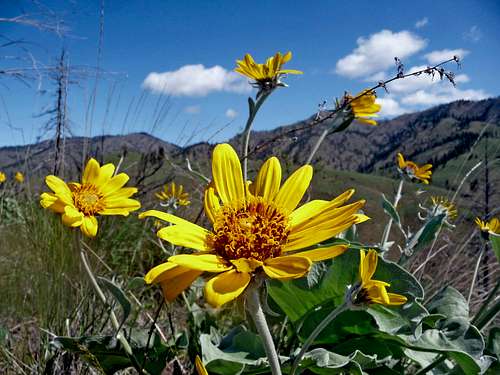
A Good Looking Flower
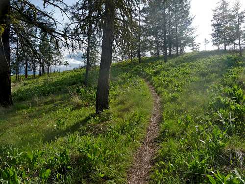
Green Scenery along the Trail

Bee Up close
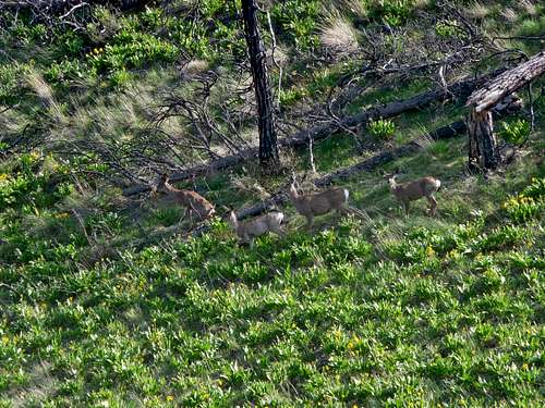
A Family of Deer
The road then turns back into a trail following the ridge for a long ways. Eventually the ridge curves which goes up Tibbetts west ridge. The Summit is farther than it looks, but is no problem for your average mountaineer. You might have very minor scrambling along the ridge depending on whether there are fallen over trees or how you go about this part. Soon you arrive on the summit.
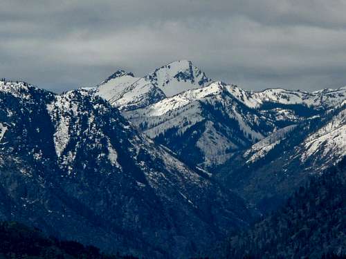
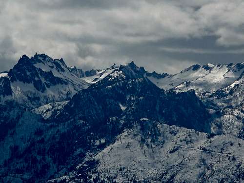
McClellan Peak with Little Annapurna
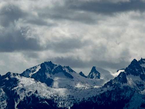
The Template, Enchantment Peak, and Cannon
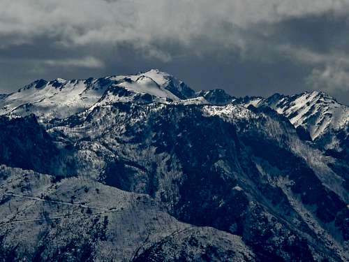
Cannon Mountain with Gloomy Weather
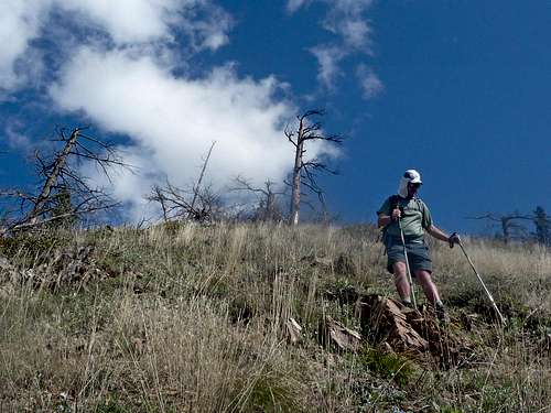
Hiking Down the West Ridge
Red Tape
A Discovery Pass is required for this trailhead which are 30$ annually and 10$ for a day pass.
The standard route's trailhead is located in Peshastin Pinnacles State Park which is opened Summer: 6:30 a.m. to dusk. During winter it is closed from November 15 until March 15.
![The Zig Zag Trail]()
The Zig Zag Trail
The standard route's trailhead is located in Peshastin Pinnacles State Park which is opened Summer: 6:30 a.m. to dusk. During winter it is closed from November 15 until March 15.
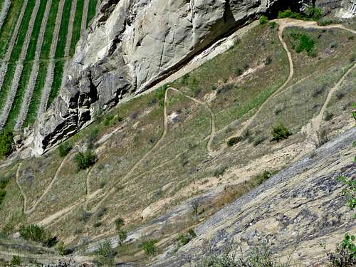
The Zig Zag Trail
Current Conditions
For current weather information on Sherman Peak check in with the Noaa Forecast.
For Avalanche Conditions, check in with the Northwest Avalanche Center. (Limited based on the season) Typically this mountain does not have avalanche danger, but it doesn't hurt to check.
![Cloud over the Valley]()
Cloud over the Valley
For Avalanche Conditions, check in with the Northwest Avalanche Center. (Limited based on the season) Typically this mountain does not have avalanche danger, but it doesn't hurt to check.
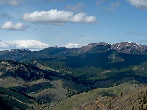
Cloud over the Valley
Topographic Maps
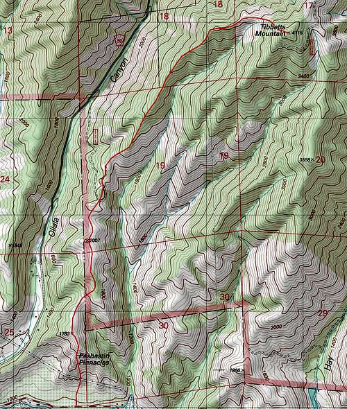
Tibbetts Topographic Map
External Links
- Peshastin Pinnacles - WTA talks about the hike around the Peshastin Pinnacles. This link also includes TR's attached to the page.
- Standard Route May 9, 2010 - Nwhikers Report showing many pics of the easy to follow route
- North Side Short Cut January 29, 2009 - Another Trip Report from nwhikers except that this one shows the shortest route up the Mountain. But you miss out on all the wild flowers and wildlife.
- North Side Road Walk - Shows flowers you see along the Road walk