
|
|
Mountain/Rock |
|---|---|
|
|
47.86811°N / 121.54525°W |
|
|
Snohomish |
|
|
5150 ft / 1570 m |
|
|
Overview
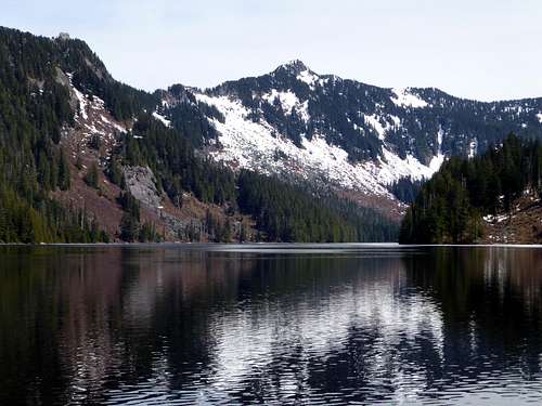
Point 5150 - Ragged Ridge High Point from Lake Isabel
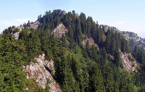
Point 5150 - Ragged Ridge High Point from the south
This climb starts from the Deer Creek Flat area, which is accessed from Reiter Road (just east of Gold Bar on US2). After 3.5 miles on Reiter Road, look for a gravel road on the left, and a blue sign for "Reiter Foothills Forest". This is a DNR access, and will require a Discovery Pass. Follow this gravel road for about four miles to the unmistakable creek drainage located at N47 50.273 W121 33.740 (Elev. 1900').
Note: Please see the Washington State DNR web site for the most current road information.
Begin following the creek bed uphill - it is mostly large granite boulders and granite slabs.
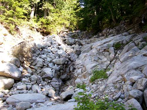
Stream bed on Point 5150 (Ragged Ridge) approach
Note: I did this climb in September with low water. I have no information on the feasibility of this route in early season when water levels are higher.
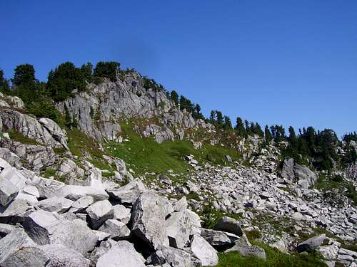
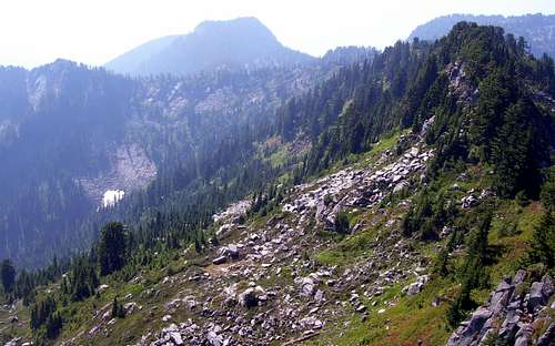
For the most part, it is possible to stay in the creek bed. I avoided one small waterfall at about 2200' by diverting into the woods to the left. At about 2500', the creek bed splits into two waterfalls. Here, I scrambled up the wooded rib between the two falls with no difficulty. Continue up the creek bed to about 3500', where the creek will abruptly flatten out. Continue upstream about 200', then turn uphill to the left. In about 100', you will arrive at the base of a talus slope. Head north along the base of this talus (paralleling the creek) - it will open up into a large talus slope after several hundred yards.
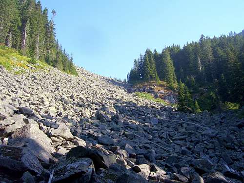
Talus slope on Point 5150 (Ragged Ridge)
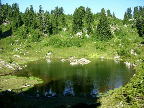
Continue following the talus slopes uphill and north - you are generally heading towards the small lake (I'll refer to this lake as "Lake #1") located at N47 51.302 W121 32.984 (Elev. 4350').
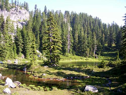
"Lake #1" on Point 5150 (Ragged Ridge) climb
"Lake #1" on Point 5150 (Ragged Ridge) climb
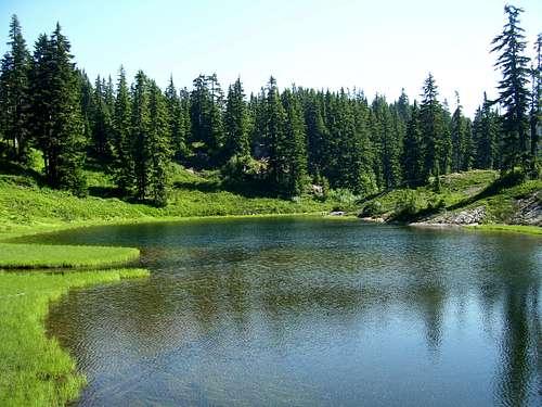
From here I scrambled up to Lake #2, located at N47 51.408 W121 32.797 (Elev. 4430').
"Lake #2" on Point 5150 (Ragged Ridge) climb
"Lake #2" on Point 5150 (Ragged Ridge) climb
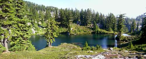
From here, continue up to Lake #3, located at N47 51.478 W121 32.949 (Elev. 4590').
Note: It is possible to scramble directly from Lake #1 to Lake #3, but who would want to skip Lake #2?
"Lake # 3" on Point 5150 (Ragged Ridge) climb

"Lake # 3" on Point 5150 (Ragged Ridge) climb
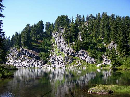
From Lake #3, scramble up 200' to the top of Point 5150's south ridge.
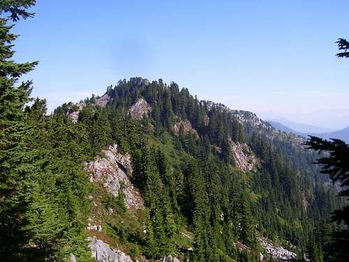
Looking towards summit of Point 5150 (Ragged Ridge) from the south
Follow the south ridge about 0.7 miles to point 5150's summit, generally staying close to the ridge crest on the right (east) side. About 0.2 miles from the summit, I ran into a small cliff band that I wanted to avoid. I dropped down on the right side of the ridge about 200', traversed, and came back to the ridge crest at a small saddle about 400' south of the summit. From here, it was easy scrambling to the top. I'm not sure if it would be feasible to bypass the cliff band on the left (west) side of the ridge to avoid the altitude loss, as I did not explore this option.
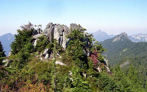
Summit of Point 5150 (Ragged Ridge)
Here are a few views from the top. Sorry about the image quality - it was a very hazy day.
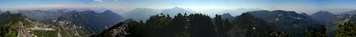
Point 5150 - Ragged Ridge pano
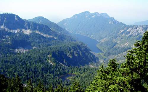
Lake Isabel and Zekes Peak from Point 5150 (Ragged Ridge)
South Ridge of Point 5150 (Ragged Ridge) from summit
The summit of Point 5150 (Ragged Ridge)
Getting There
Turn north on Reiter Road just east of Gold Bar on US2. Follow Reiter Road 3.5 miles to the DNR access for "Reiter Foothills Forest". Follow this gravel road for about four miles to the obvious creek bed at the beginning of the route.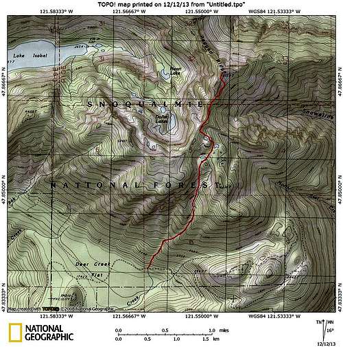
Point 5150 - Ragged Ridge High Point route map