
|
|
Mountain/Rock |
|---|---|
|
|
48.11887°N / 121.72219°W |
|
|
Snohomish |
|
|
4454 ft / 1358 m |
|
|
Overview
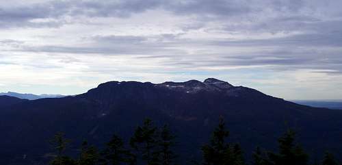
Green Mountain is a seven mile long, east/west trending ridge roughly ten miles northeast of Granite Falls. It is bound on the north side by Canyon Creek, and on the south side by the South Fork Stillaguamish River. Covered with clear cuts, logging roads, and quarries, it's not much to look at, but it does offer views of more attractive mountains from several vantage points. Green Mountain can be fairly popular on summer weekends, so a visit to this area would probably be best enjoyed on a weekday. Green Mountain has three summits that exceed the 400' prominence threshhold, and I will refer to these as the east, middle, and west peaks. Each has its own unique qualities, so I will give a brief description of each.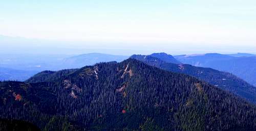
Green Mountain from Fletcher Peak
To access Green Mountain, follow the Mountain Loop Highway east from Granite Falls for 6.8 miles to FR41. Turn left onto FR41, and follow it to the first major intersection at 1.8 miles. Take the right fork (FR4110), and follow it 4.2 miles to the start of the west summit road/trail (Elev. 2913'), or to the end of the road at 7.6 miles for the middle and east summits (Elev. 3744').
East Summit - 4454'
Green Mountain's east summit is the highest of the three, but unfortunately, has the most disappointing views. It is also the most difficult of the three to access, so it does not see many visitors. It does, however, have a respectable 1640' of prominence (#25 in Snohomish County), so peak bagger types may head for this one (or really bored people with way too much free time). From the "parking area" at the end of FR4110 (driveable portion), take the right fork (undriveable portion of FR4110), which is tank trapped. Follow it for 3.1 miles to a point 0.4 miles SW of the east summit - the road will follow closely to the ridge crest, or just south of the ridge crest, and will alternate between easy walking and nasty brush. Turn left off of the road, and head straight up the hill NE towards the summit. It will start out as second growth, then give way to open old growth. There was one area of small cliff bands as I followed the ridge to the summit. These were easily avoided on the right, just remember them on the way down to avoid getting cliffed out.
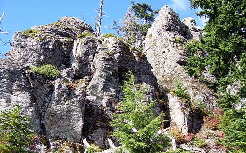
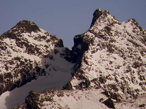
Cliff bands near Green Mountain's east summit
Once on the summit, it was possible to get a few small views through the trees.
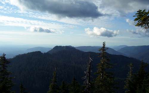
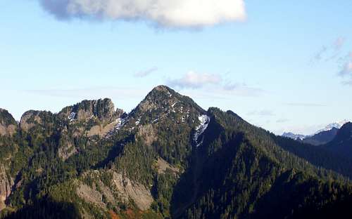
Looking west from Green Mountain's east summit
On the descent, I took a slightly different route, which kept me away from the cliff bands, and brought me back to the road at a point due south of the summit. It seemed that this route was a little less brushy than taking the ridge from the SW. The views were actually pretty good from the road at this point.
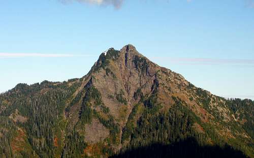
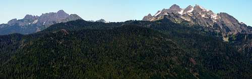
Liberty Mountain from Green Mountain
Fletcher Peak from Green Mountain
Middle Summit - 4040+'
Green Mountain's middle summit gives the best views for the least amount of work. From the "parking area" at the end of FR4110, simply walk the gated left fork for 0.5 miles and 300 vertical feet to the top. There is no place on the top to get a full 360 degree view, but you can piece most of it together by standing in about four separate spots on or near the summit.
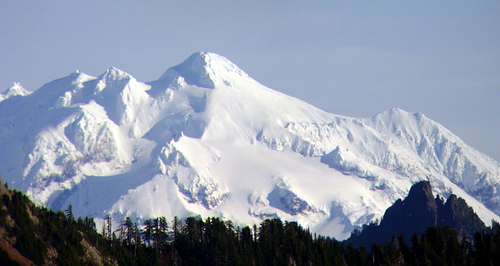
Glacier Peak and Devils Peak from Green Mountain's middle summit
Three Fingers lookout from Green Mountain's middle summit
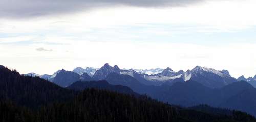
Looking SE from Green Mountain's middle summit
Mount Pilchuck from Green Mountain's middle summit
West Summit - 3810'
Green Mountain's west summit has fairly good views, and will usually provide some solitude, in exchange for a 1.8 mile road walk. On FR 4110 at 4.2 miles, you will notice an old roadbed on the right side of the road that is blocked by large boulders. Simply follow the road to its end, where it terminates in a large flat spot on top of the ridge. The views directly to the east and west are blocked by trees on this summit. The west view can be expanded a bit by taking a brushy spur that turns off to the right about 0.2 miles before the road end. This summit makes a great winter snowshoe trip, provided you can drive most of the way to the "parking area".
Whitehorse and Three Fingers from Green Mountain's west summit
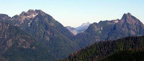
Big Bear and Liberty from Green Mountain's west summit