* Jul 28, 2017 - Ownership switched by andrea * Dec 5, 2019 - Overhaul of the page
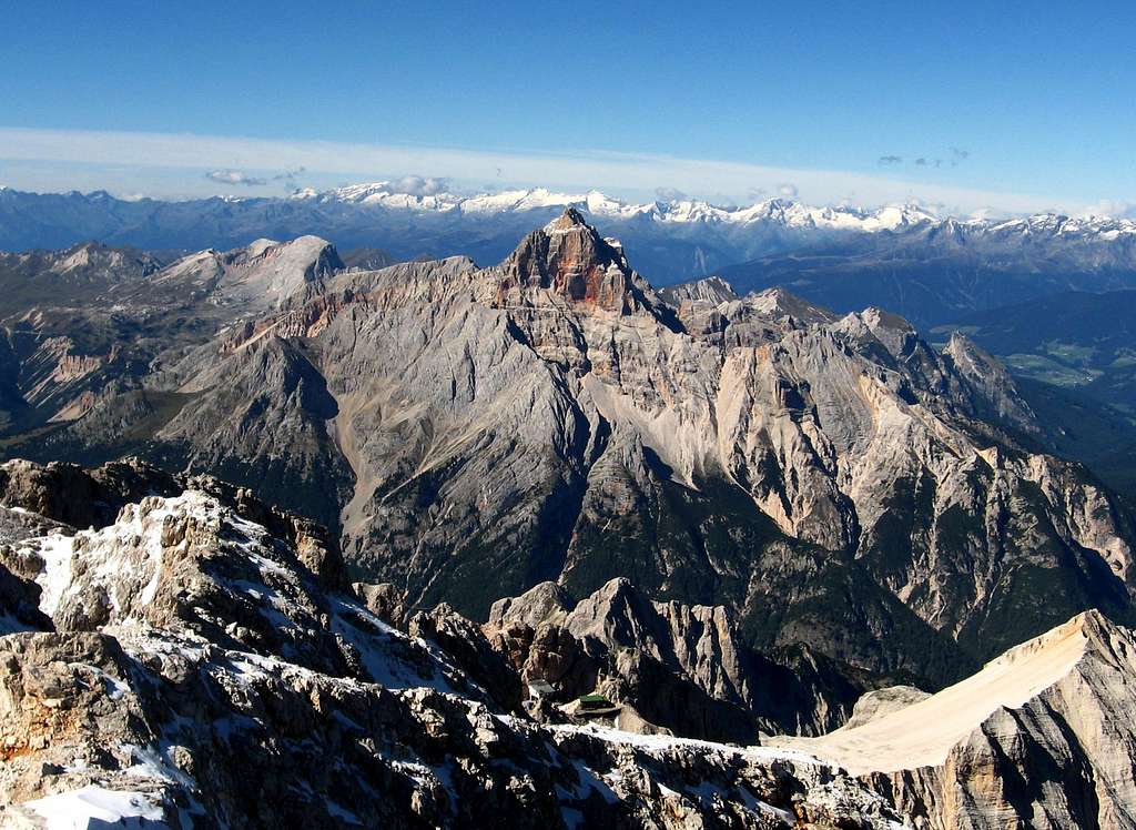
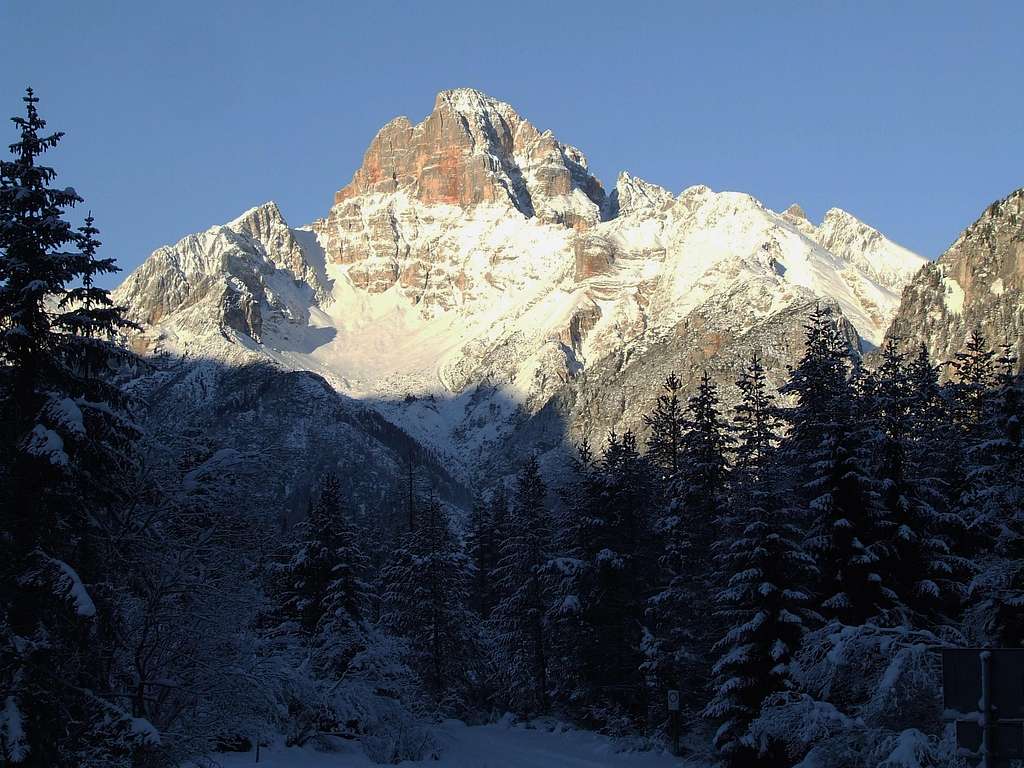
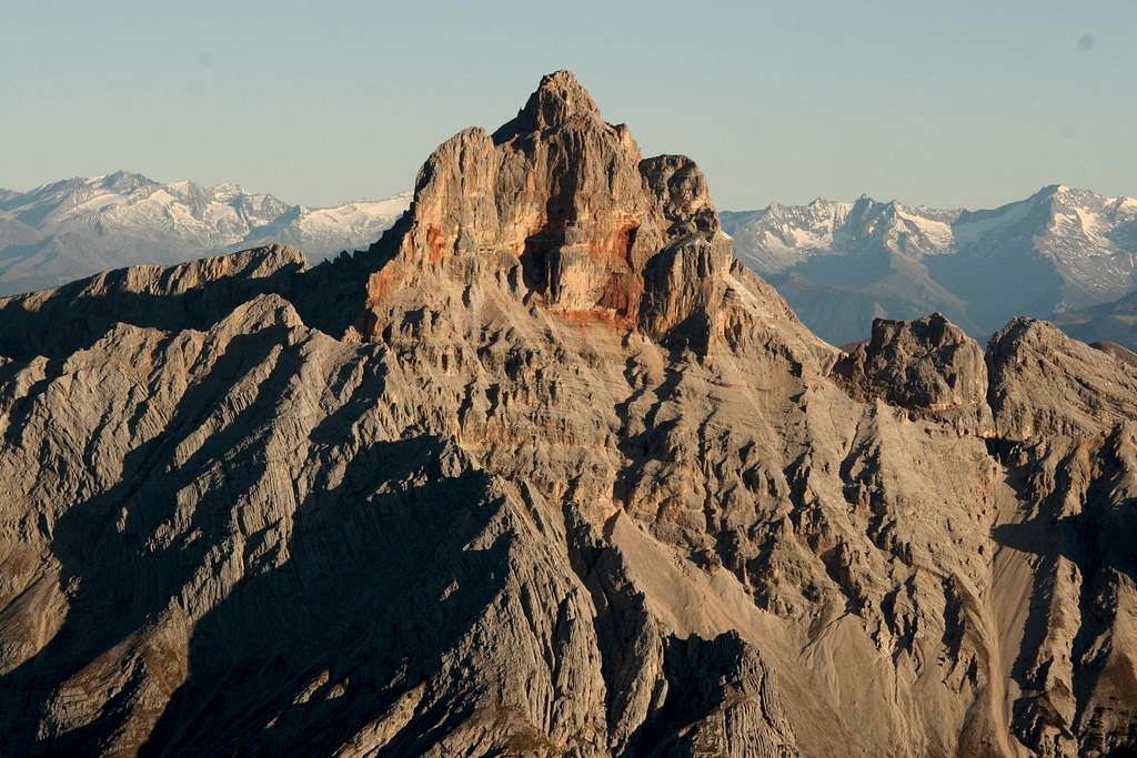
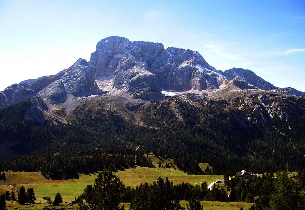
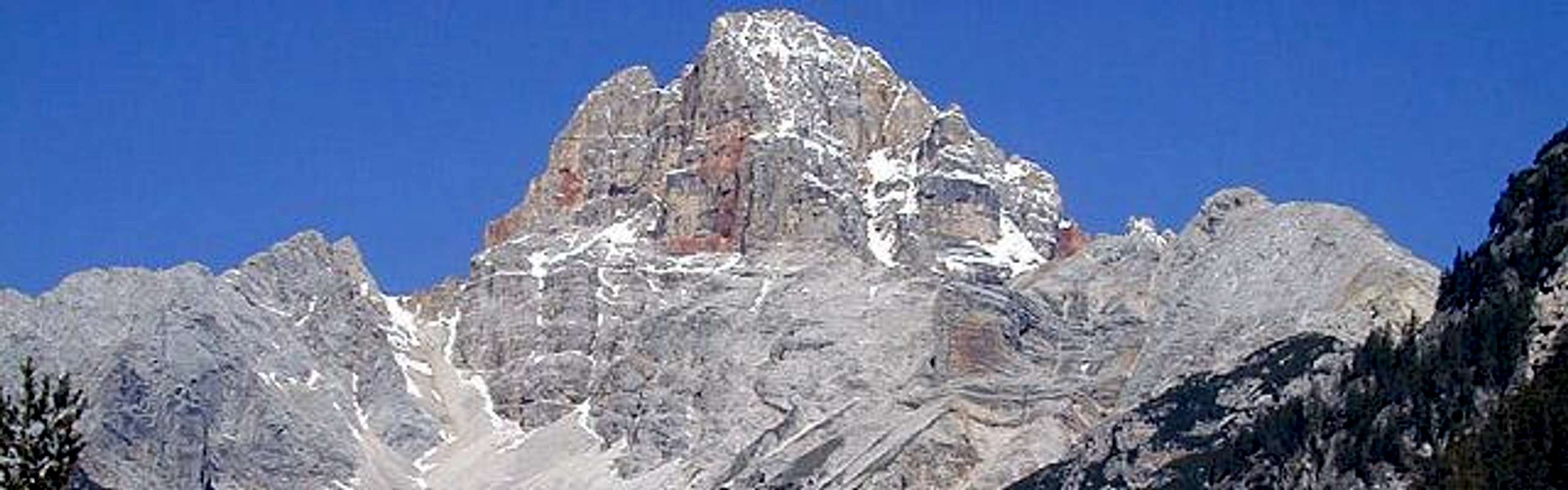
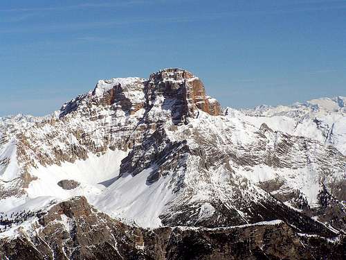
"Croda Rossa d'Ampezzo" - in German Hohe Gaisl, in ladin dyalect Croda Rósa or Crep Checio - is a 3146 m high mountain which lies between the Val di Braies and the Val di Landro, on the border between Bolzano province and Belluno province (Veneto) within the "Parco Naturale delle Dolomiti d'Ampezzo". Croda Rossa d'Ampezzo is also known to be a very rugged mountain, with crumbly rock and difficult to climb. It's definitely the wildest summit amongst all the 3000 meters peaks in the Dolomites. Not to be confused with the nearby "Croda Rossa di Sesto", it stands as an imposing and isolated summit amongst lower and inconspicuous mountains. Its main feature is to have the walls colored of deep red color unique in the Dolomites. This characteristic gives the mountain a bloody appearance when seen from far. If you approach it and climb on its slopes, the color red takes shades of yellow, orange and sometimes purple.
Croda Rossa
However, the quality of the rock is quite poor. The climbing routes are sometimes exposed to falling rocks, so the mountain is generally very rarely climbed. It is more known in reason of its beauty rather than its mountaineering interest. Croda Rossa d'Ampezzo has an elongated north-south shape and, when viewed from the south, it looks like a pyramid. Instead the east and west sides have long smooth walls stained of red. The highest point is located at the southern end. The shape of the mountain may remember the "Croda dei Toni".
The first attempt to climb was undertaken in 1865 by Paul Grohmann with the guide Angelo Dimai and the hunter Fulgenzio Dimai along the north-west wall, but unfortunately it failed a few steps from the summit. The team stopped the ascent on the Northern fore-summit of the mountain. The summit was then climbed in the year 1870; the first summiters were the climber "Whitewell" and the local guides "Siorpaes" and "Laneuer" up the West gully in 1870, June 20th.
Getting there
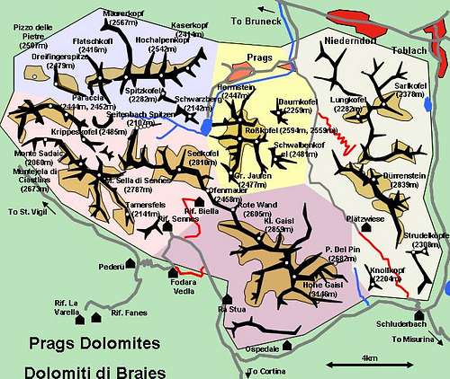
The Braies group is located between the regions Veneto and Alto Adige. Usually most of the routes start from the locality "Prato Piazza" 1991m. Easily reached by car and bus services from the village of "Villabassa" 1159 m along the main "Val Pusteria". From the motorway A22 that connect Austria to Italy across the "Passo del Brennero", take the gate "Brunico/Brunek", follow the indication to "Val Pusteria/Dobbiaco", and than shortly to "Villabassa".
Croda Rossa d'Ampezzo photo from Piku
From Austria (east) Take the motorway A12 to exit "Kufstein". There turn onto 178, later 161 south in direction "Kitzbühel". At Mittersill 161 turns into 108 which heads through Felbertauern Tunnel. Take 108 until "Lienz" were you turn right (west) onto E66 which on the border crossing turns into SS49 to Toblach/Dobbiaco and Bruneck/Brunico.
From Venezia Take motorway S27 north towards its end near Belluno. Turn into SS51 towards Cortina d’Ampezzo and on to Toblach/Dobbiaco.
Exposure: NW First ascent: P. Grohmann, A. Dimai, F. Dimai 1865
Starting point: Malga Ra Stua 1668 m
This route from the North-West side is the route having the easiest orientation and less difficulties. The upper part of the itinerary - from the fork to the summit - is pleasant, marked by faded red stamps and cairns. Unfortunately the lower stretch of the route follows a steep, slippery and landslide basin of debris and reddish rocks with possible stone-fall in case of bad weather. Along the basin there are several pegs, however the ground is insidious. The climb of this basin becomes much easier in the presence of solid and well-laid snow, so the best conditions occur in late spring when the rock in the upper part of the route is snow-free, but snow is still present in the basin. In this case however the difficulties increase, you need the necessary experience to face a steep slope with ice-axe and crampons up to 50°. In this conditions the climb is reserved to skilled alpinists.
Via Innerkofler
Via Innerkofler
Summit altitude: 3146 m
Difficulty: AD+, UIAA IV-
Route length: 500 m, + 650 approach
Exposure: E First ascent: M. Innerkofler, J. von Schlogel-Ehrenkreuz 1883
Starting point: Rif. Pratopiazza 1991 m
This route taking place along the East wall is definitely more difficult than the Normal route, but the terrain is safer. It's a classic climb reaching the grade IV- UIAA. The route runs on discrete rock, good at times.
Croda Rossa
Other important routes
Croda Rossa South-West side
- West couloir - E.Whitwell/C.Lauener/S.Siorpaes - 610m III/IV
No fees no permits required. The whole group is included among the nine ones acknowledged as an UNESCO World Heritage Site in 2009. More info about Dolomiti Unesco World Heritage here:
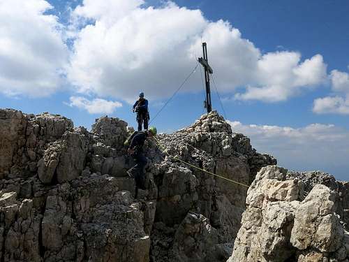
The main point of support for the ascent to Croda Rossa d'Ampezzo was the Bivouac "Helbig-Dall'Oglio" (nine places) standing in a panoramic position 2,253 meters above the threshold of the solitary valley Montejèla, in the group of Croda Rossa d'Ampezzo, founded in 1964 by the Fondazione Antonio Berti, with the logistical and financial help of Marino Dall'Oglio, academic of Cai and a great connoisseur of the Croda Rossa d'Ampezzo, who dedicated the structure to the deceased consort Pia Helbig and donated it to the section CAI Cortina. In 2013 the CAI section of Cortina d'Ampezzo, owner of the bivouac, demolished the structure. The main points of support are the refuges Malga Ra Stua and Rif. Pratopiazza.
Parents refers to a larger category under which an object falls. For example, theAconcagua mountain page has the 'Aconcagua Group' and the 'Seven Summits' asparents and is a parent itself to many routes, photos, and Trip Reports.

 12855 Hits
 91.97% Score
 37 Votes