
|
|
Mountain/Rock |
|---|---|
|
|
33.61010°N / 111.782°W |
|
|
Maricopa |
|
|
Hiking |
|
|
Spring, Summer, Fall, Winter |
|
|
3063 ft / 934 m |
|
|
Overview
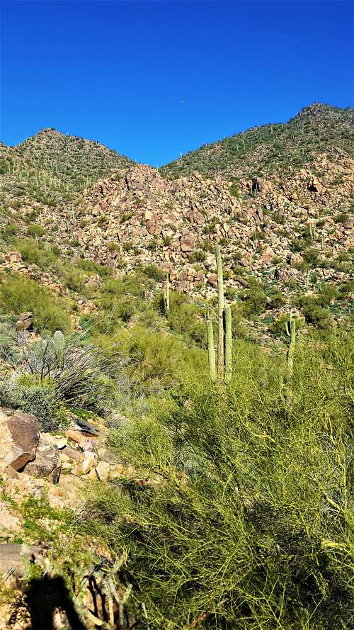
Sunrise Peak is a lesser summit of the McDowell Mountains in Scottsdale, Arizona. However, it features an excellent trail to its top, with beautiful Sonoran Desert flora such as the saguaro and cholla cactus, ocotillo, palo verde and spotty scrub grasses, and lovely views from the summit. From the primary trailhead, the one-way hike is just under 2 miles with about 1,140 feet of net gain (about 1,250 when the ups and downs are accounted for). It's a popular "locals" peak used for training. Although homes abut the range in places, the hike has a nice wilderness feel once you get up the trail a little bit.
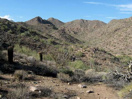
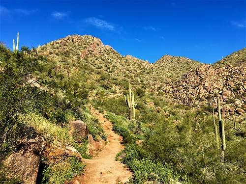
 Sunrise Peak as seen from the trailhead.
Getting There
The primary trailhead is at the end of Via Linda Drive in east Scottsdale, not far from the Fountain Hills city limits. From the Loop-101 freeway in Scottsdale, take Shea Boulevard east a little over two miles to Via Linda. Go left and follow Via Linda north and east about 6 miles to its end at some gates leading to a development. A trailhead is immediately to the left, with room for about 20 vehicles. Overflow parking is a quarter-mile south on the right.
You can also hike from the Lost Dog Trailhead, which is a little longer. To reach the Lost Dog Trailhead, instead follow Via Linda for 2 1/2 miles and turn left on 124th Street. There are minor trailheads at 128th Street and 136th Street that connect with the trail system from Lost Dog.
A new trailhead called Adero Canyon is located just outside of Fountain Hills at the end of Eagle Ridge Drive. Sunrise Peak can be reached via this trailhead in just over 3 miles.
 Beautiful Sonoran Desert scenery.
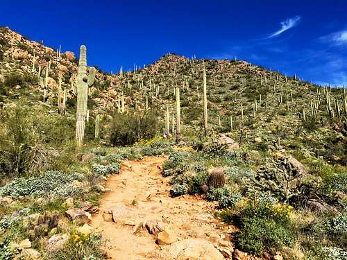
Red Tape
None. The trailhead is closed at night, and hikers discouraged to hike at night due to the proximity to some homes.
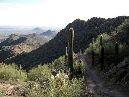 Looking down from the high saddle.
External Links
Trip Report (www.surgent.net)
McDowell Mountains Regional Park
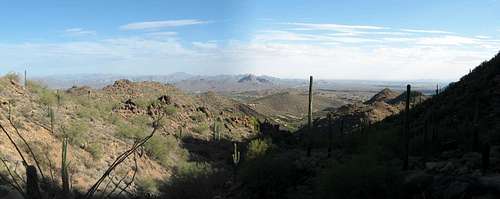 Panorama looking east.
The Hiking Route - Primary Trail and Lost Dog
For the primary trailhead, follow the trail northeast into a canyon, and stay on the trail as it slowly rises above the canyon floor. Sunrise Peak's summit is directly ahead of you, rising above the headwall.
After 1.2 miles, the trail achieves a scenic overlook. The turn off to the summit is another half a mile further up, and has a short loop trail. To add some distance, take the east loop up and the west loop down. Both sides are steep, but easy going for pretty much any hiker.
The hiking is easy and fun, and offers a nice workout. This is a good peak to hike if in town for business and you don't have a whole lot of time. Fast hikers take about 90 minutes round trip. Two hours is common for most people. If parking below at the overflow parking, add a quarter mile each way, with an additional 50' of elevation gain.
From the Lost Dog Trailhead, hike past the main entrance building for about 1/4 mile and go down into a wash. Turn right, and then left up the Sunrise Trail. The trail switchbacks up to a ridge, and then heads cross-country to the next ridge over. At this point you will head southeast to Sunrise Peak. It is about three miles to the summit gaining over 1,300'. This is a bit longer - maybe 2 hours for faster hikers to 3 hours for slower hikers.
From Adero Canyon, the trail loops around for 2 3/4 miles and connects to the Sunrise Peak Trail not far from the summit trail. It is just over 3 miles from the trailhead to the summit, gaining nearly 1,000' one way with all the ups and downs.
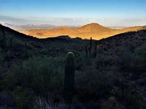
Regardless of the route, the views are fantastic. Four Peaks in the Mazatzal Range is seen northwest, and the jumble of peaks in the Goldfield, Usery and Superstition Mountains rise east. Weaver's Needle may be seen just left of the Superstition massif.
People hike the peak all year, but in summer, the heat can be oppressive. If you still are motivated, get a very early start, take lots of water, and monitor yourself. Despite being within Scottsdale city limits, I found that my cell phone had no reception for long segments of the hike.
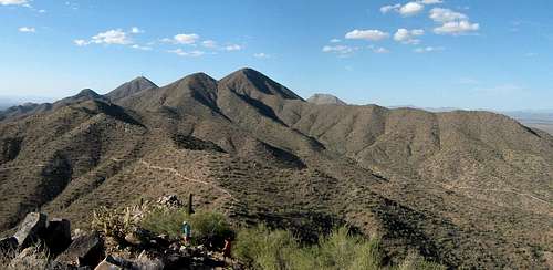 Panorama looking north, with Thompson, McDowell and East End.