
-
 39277 Hits
-
 90.81% Score
-
 33 Votes
|
|
Mountain/Rock |
|---|---|
|
|
48.60357°N / 120.73258°W |
|
|
Download GPX » View Route on Map |
|
|
Okanogan/Skagit |
|
|
Hiking, Mountaineering, Scrambling |
|
|
Summer, Fall |
|
|
8366 ft / 2550 m |
|
|
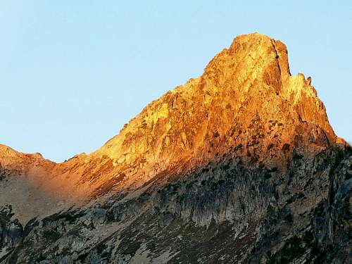
Overview

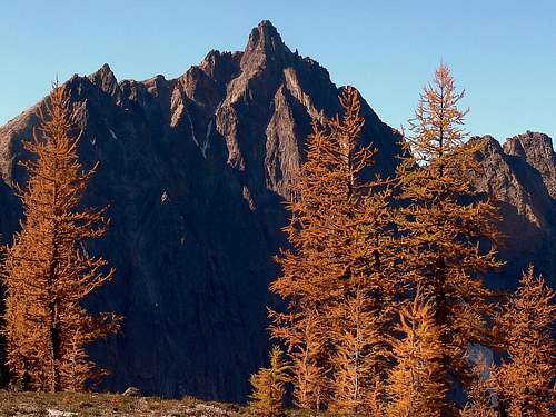
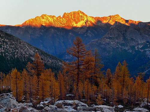
Alpenglow on Golden Horn
Golden Horn is listed under the Washington Top 100 and is located in the Okanogan National Forest in the eastern North Cascades just north of Rainy and Washington Pass. As evident from its name the peak's rock has a striking color as well as beautiful golden larches during the fall. This mountain offers great views of the Pasayten Wilderness, the surrounding Washington Pass area and to the south the Glacier Peak Wilderness. Golden Horn is a relatively easy climb but with a lot of approach miles and a few low 5th class moves at the end. Most do this peak in two days although if your speedy you can do it in one. Tower Mountain is located just south of Golden Horn and can be climbed in the same trip.
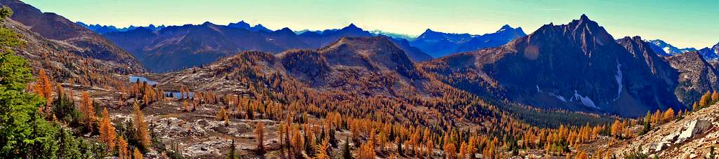 Golden Horn Panorama taken October 2, 2010
Getting There

Diablo Lake on the Way

Golden Larches on the way
From Winthrop (East Side of the Cascades): Drive East on Highway 20 for about 35 miles, on the way you head over Washington Pass which is an excellent stop for views and photos. At Rainy Pass take a right onto National Forest Development Road 600 which is a short distance to the trailhead.
If you prefer a bushwhacking approach you can start from the pull out at Swamp Creek on Highway 20 (3 miles before you get to Rainy Pass). If you are coming from the east, you can park at the Cutthroat Lake trailhead and follow Cutthroat Lake trail to PCNST.
Route Information
The adventure starts out as a nice trail walk through the woods with clearings which you can see Black Peak, Corteo Peak, and a few others. There is only one main creek crossing on the entire trip near the beginning which is easy (last time I was here there was a log crossing).
 The Trail
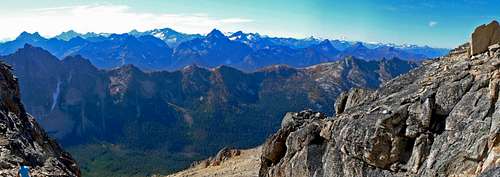
As you're hiking along, you may encounter many hikers trekking to Canada, after all your on the Pacific Crest Trail. The trail remains nice and smooth all the way to Cutthroat Pass, about a mile before the Pass there is a nice place for camping with a creek for filtering water. At the pass alone you are rewarded with great views of the North Cascades extending from Hinkhouse Peak, Silverstar, Cutthroat Peak, and in the distance you can see Dome Peak.
 Just before the Pass
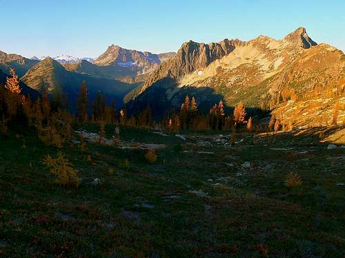
 Sunrise near the Pass
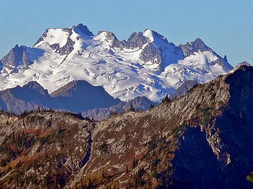 Dome Peak in the Distance
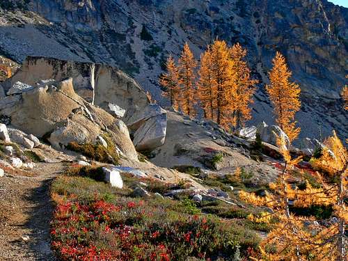 The Golden Pathway
 Tower Mountain
From Cutthroat Pass be sure to go left (North East) which now traverses Point 7331. Eventually after traversing onto the other side of the mountain you start to lose elevation going down to Granite Pass, since the trail zig zags a lot.
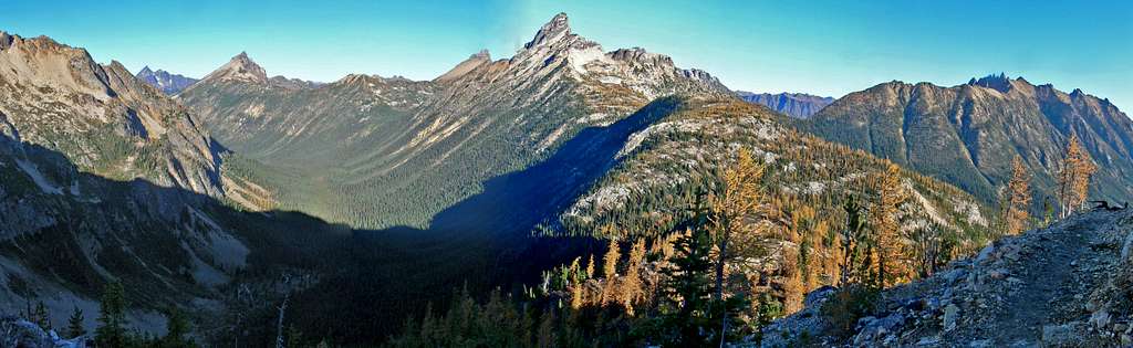 Tower Mountain Panorama looking North
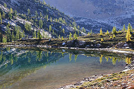
After Granite Pass the trail gently traverses the bottom of Tower Mountain. The trail eventually dips towards Snowy Lakes (North) where there is an unlabeled turn off trail. From here the trail takes you to snowy lakes which I give the nickname "Snowy Lakes Basin". There are some excellent choices for camping here, as well as a nice place to relax and enjoy the good views. But don't stop here, the views get better on Golden Horn (although you loose some of the fall Golden Larches as you go higher).
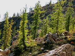
 Mount Hardy with Golden Larches
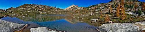 Lower Snowy Lake Panorama
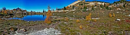 Upper Snowy Lake Panorama
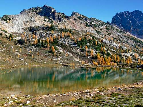 Snowy Lake with Tower Mountain
Beyond the lakes the trail goes away (although you might get small traces of it for a little while), head in the general direction of Golden Horn staying lower to avoid some upper rock scree and such. The way I climbed Golden Horn was diagonally going across the scree field. Then once you get to the final ridge you may be intimidated by Golden Horn's steep face. I know I sure was, but keep going. Traverse around the edge of Golden Horn until you're on it's Southwest side. Here's were it gets interesting, this part is a class 2-3 scramble which takes the gully on the left, I made the mistake of taking the one on the right and traversed a sketchy part to go around the East Face of Golden Horn. Once you're next to the summit you may notice some rappel rings, if you brought a rope, now is the time to use it. If your feeling comfortable enough you can climb this without a rope, but remember there is also the way down you have to deal with. Although I did touch the summit of Golden Horn, I never actually stood on it due to how unflat it is and the exposure all around. From the summit your rewarded with great views of the North Cascades. Congrats, you earned it!
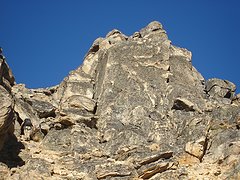
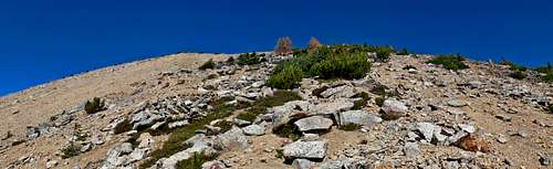 The Ridge up Golden Horn
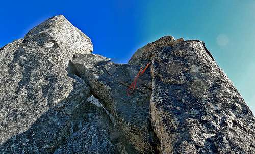 The Last Few Feet
 Looking West
 Views of Silver Star Peak during Sunset on the way Back
Red Tape & Camping
Red Tape: A Northwest Forest Pass is required at the trailhead. There is no need for a backcountry permit because this peak is not located in the North Cascades National Park.
Camping: There are excellent campsites along the PCNST and especially at the Snowy Lakes area right at the base of the mountain.
Camping: There are excellent campsites along the PCNST and especially at the Snowy Lakes area right at the base of the mountain.
Gear to Bring

Roped up for the Summit

Gear for the Climb
-10 Essentials
-Rope and Harness (optional) Keep in mind this is Fred Beckey's Class 3 which means 10-15 feet of low class 5. I did this part unroped but had to carefully descend the top and hold on to the rappel slings. The rest of my group did not feel comfortable without a rope to summit.
-Ice Ace (if early season)
-Tent (if your staying overnight as well as over night gear)
-Helmet (optional) You do travel into a gully section near the summit which I've seen people bring helmets.
When To Climb
Most folks climb this peak July though October. It can be done in May-June but may be snowy at the top making the summit more difficult. The road is closed at least half the year making it important to check the road conditions before climbing this peak. During summer it's usually open. Late September and early October is prime time to be here considering the golden larches are at their peak.
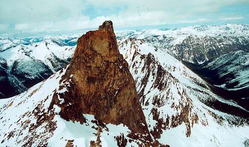
![Aerial View from Helicopter,...]() Aerial View from a Helicopter during April
Aerial View from a Helicopter during April
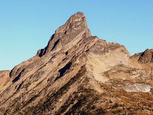
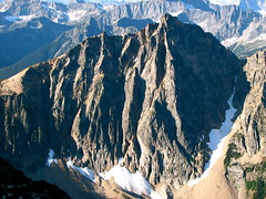
![Golden Horn fr Methow Pinnacles]() Golden Horn from Methow Pinnacles
Golden Horn from Methow Pinnacles
 Aerial View from a Helicopter during April
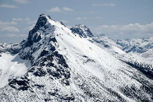 Golden Horn from Methow Pinnacles
Mountain Conditions
For Weather information check in with the Noaa Forecast.
For Avalanche forecast's check in with the North West Avalanche Center.
Click here for road conditions for Rainy Pass and Washington Pass.
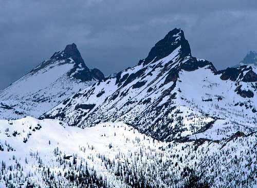
![Stormy Towers]() Stormy weather over Tower and Golden Horn
Stormy weather over Tower and Golden Horn
For Avalanche forecast's check in with the North West Avalanche Center.
Click here for road conditions for Rainy Pass and Washington Pass.
 Stormy weather over Tower and Golden Horn
Topographic Maps
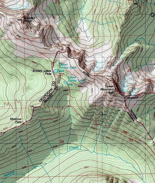 Upper Golden Horn Map Upper Golden Horn Map |
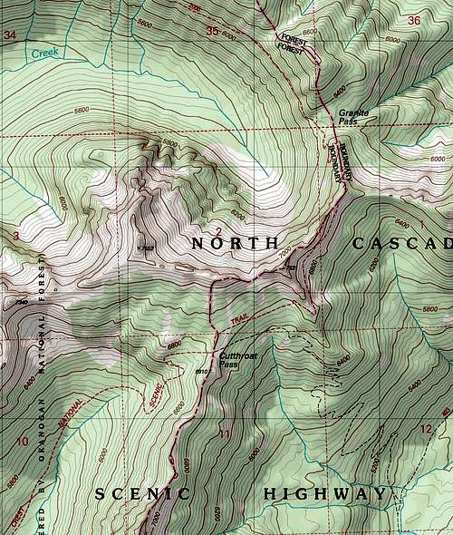 Lower Golden Horn Map Lower Golden Horn Map |
Video
Tower and Golden Horn Video by Gimpilator
External Trip Reports
|
Images |
Trip Report Title |
Author |
Description |
    |
Opus | Good information and photos | |
    |
Golden Horn during September of 2008 | Hans | Portrays some Decent Photography |
    |
Golden Horn and Tower Mountain during August of 2007 | Roald | A good Report on doing both Golden and Tower Mountain |
    |
golden horn + tower mt 10/11/06-10/13/06 | b00 | Another Tower and Golden Horn Trip |
Also for more trip reports here are some from Washington Trails Association's website.