-
 13839 Hits
-
 85.36% Score
-
 20 Votes
|
|
Mountain/Rock |
|---|---|
|
|
35.71641°N / 82.35746°W |
|
|
Buncombe |
|
|
Hiking |
|
|
Spring, Summer, Fall, Winter |
|
|
5930 ft / 1807 m |
|
|
Overview
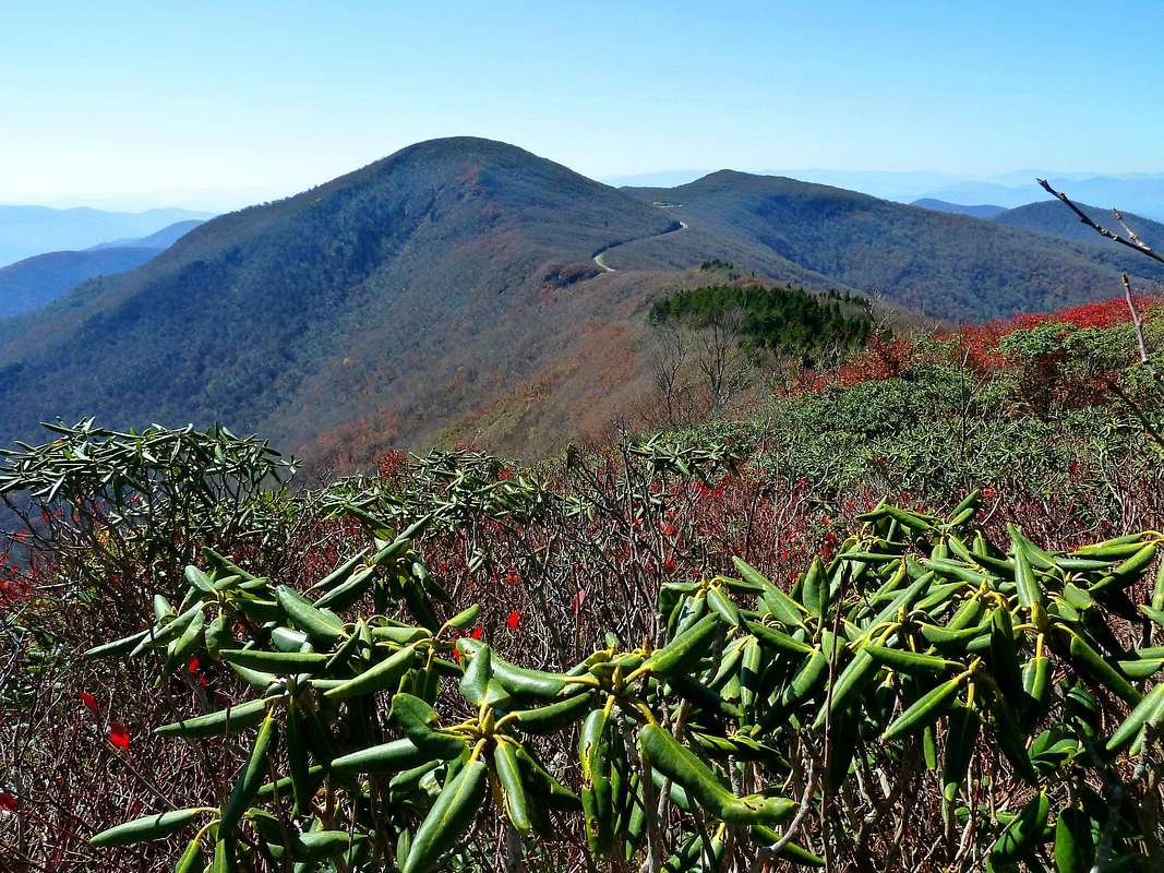
 Bullhead Mountain as photographed by Bob Sihler
Bullhead is the Rodney Dangerfield of major eastern summits. Topping out at 5930 feet, with 338 feet (103 meters) of prominence above Bullhead Gap to its south, it oughta be at least a little bit famous--in fact, of peaks with 100 meters of prominence it's well inside the top 30 in eastern North America.
But Bullhead can't get no respect. Craggy Dome, Craggy Pinnacle, Craggy Gardens get all the signs and overlooks and National Park Service reverence along the Blue Ridge Parkway, while folks in the valleys below proudly pick them out for visitors. Not Bullhead. Nobody's heard of poor Bullhead. The Mountains-to-Sea Trail wanders within a hundred vertical feet of its summit but can't be bothered, and heads on down without visiting the top. If you do take the trouble to crash though to the summit, you'll be all by yourself.
Getting to the Trailhead
The trailhead that is specific to Bullhead is at Bullhead Gap, about 20 miles north of Asheville on the Blue Ridge Parkway at milepost 363.4. The Greybeard Mountain Overlook is in this gap, and you can park there.Those interested in climbing Bullhead from the bottom (or at least, from pretty far down) can do so from a trailhead above Dillingham, reached by this road and described here.
Getting to the Top
 Where the bushwhack starts
Done this way, Bullhead is about a 5.2 on my handy-dandy bushwhacking scale, described here. Other methods may get you into heavy laurel (5.6) or thorny tangles that are even more unpleasant.
Ownership and Red Tape
The watershed of the North Fork (Burnett) Reservoir, representing the whole southern and eastern flank of Bullhead, is Asheville Watershed land off limits to hiking of any kind. Hiking the crest, along the boundary of this restricted region, is permissible.The upper northern/western flank of Bullhead is National Park Service land, the Blue Ridge Parkway right-of-way. Camping is not permitted except in designated campgrounds, and there aren't any along this section of the parkway. Lower down on this flank the land is mostly owned by Pisgah National Forest, whose regulations are found here.
Summit Views