Overview
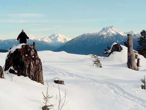
![Glacier and Whitehorse]() Views of Glacier Peak from the summit.
Views of Glacier Peak from the summit.
Mount Cavanaugh, located in the foothills of the northern Cascades is another low elevation summit that many locals in region would refer to as a dumpster dive. Located on private timber land, this mountain is not very popular except with locals and peakbaggers in the region. The area is under video surveillance and it should be note that the road up to near the summit is open seasonally as of 2020 (thanks Redwic). Adding on to the lack of desire of people wanting to do this summit is the constant gun fire that can be heard from a nearby fire range. That all being said that doesn't meant Mount Cavanaugh is not a worthy summit to go up.
![View of Lake Cavanaugh from the summit area]() Lake Cavanaugh
Lake Cavanaugh
In 2009 the whole entire summit of Mount Cavanaugh was logged off which has now opened up incredible views off its summit that would normally be associated with higher mountains in the region. It should be noted that the summit in 2020 is now becoming overgrown and the view is starting to fade. The summit itself does not look desirable in summer but in winter under a cover of snow this mountain looks a whole lot more desirable and the views off the summit towards Lake Cavanaugh and Glacier Peak are very beautiful. From the pictures I have seen there is starting to be a lot of brush on the top (per Redwic and others). Off the road is a 70 foot bushwhack to the true summit (2020)
![BearQueen heading down]() Looks a lot better in winter
Looks a lot better in winter
From an author's standpoint the ideal time to be on this mountain is in winter after a large amount of low elevation snow in the Puget Sound Region. There are a couple reasons for to go up this peak at that time. The first reason is because all of the views are heavily enhanced by the snow and this mountain looks a lot more desirable to climb.
The second even more important reason is that the road up to Mount Cavanaugh is owned by a private timber company and is subject to closures during the logging season. These seasonal closures are much less likely to happen in the winter.
![Bald Mountain (Cavanaugh)]() Nearby dramatic rise of Bald Mountain
Nearby dramatic rise of Bald MountainRoute Up To Mount Cavanaugh
![BearQueen heading down]() BearQueen going down the forest road
BearQueen going down the forest road | ![Route Up Mount Cavanaugh]() Map of Route
Map of Route |
The route up to Mount Cavanaugh is an easy Class 1 road-walk all the way up to the summit. Follow the well maintain private forest road roughly a mile and a half up. You will see an obvious forest road to your right that heads uphill. Head up this forest road as it will take you all the way to the summit. There will be an excellent view of Lake Cavanaugh roughly halfway up on incline to the summit. Continue on to the forested summit where more and better views await.
Getting There
FROM THE LAKE CAVANAUGH ROAD: From the south in Seattle there are number of way you can take to Route 9 in order to get to Mount Cavanaugh and all of them reach Lake Cavanaugh Road at nearly the same time. For this page purposes here is the way I took to Mount Cavanaugh.
From I-5 get of on exit 221 on Route WA-534 east toward the town of Lake McMurray. Stay on the road for 5 miles and then make a left on WA-9 and head north for 4.3 miles. Make right onto Lake Cavanaugh Road and take it 9.1 miles. You will notice a gated road on your right.
FROM THE BELLINGHAM AREA:
Get off of exit 227 and make a left onto WA-538/College Way. Stay on the road for 3.7 mi until you reach a traffic circle. At the traffic circle, merge onto WA-9 south toward Lake McMurray or Arlington. Stay on the road 5.5 mi until you reach Lake Cavanaugh Road on your left. Take Lake Cavanaugh Road 9.1 miles. You will notice a gated road on your right.Red Tape
![Bald Mountain]() This is the common sign on most Longview Timberland properties.
This is the common sign on most Longview Timberland properties.![List of regulations at the trailhead.]() The sign we encountered at the roadway
The sign we encountered at the roadway Camping
Prohibited. This is private forest land.
External Links
Peakbagger Page on Mount Cavanaugh

 Views of Glacier Peak from the summit.
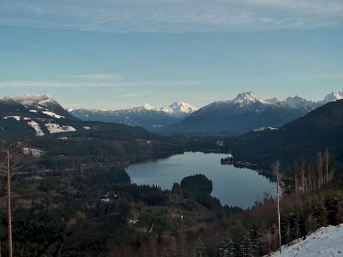 Lake Cavanaugh
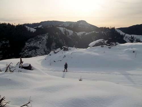 Looks a lot better in winter
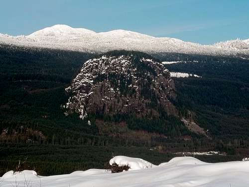 Nearby dramatic rise of Bald Mountain
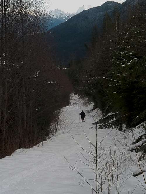 BearQueen going down the forest road
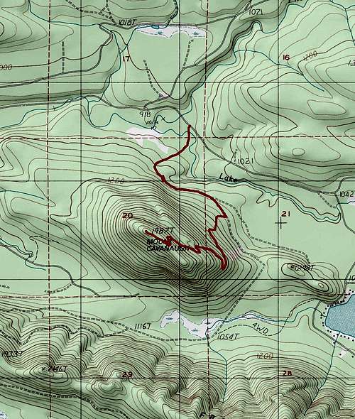 Map of Route
 This is the common sign on most Longview Timberland properties.
 The sign we encountered at the roadway
Redwic - Oct 1, 2020 10:09 pm - Hasn't voted
2020 UpdateI was surprised to find the entrance gate, unlike many in the area, is actually a seasonal gate. For Year 2020, it opened on September 23 and will remain open through November 30. The gravel road was smooth, wide, and brushed-out on the sides... No potholes! I was able to drive my ultra-low clearance vehicle to the false summit as well as backtrack slightly back to the spur leading towards the true summit. At this time, the main road leading up the mountain to the final spur road is suitable for any street legal vehicle. Regarding the last spur road, the entrance to that road is very overgrown and bermed (first with boulders, then with large stumps); a way trail goes around this first section. Then an easy, open road walk going up to a final super-short bushwhack. It is only 0.2 miles and ~70' of gain from the entrance of the spur road to the true summit. The true summit is not on the road at all, but rather a short jaunt to the side of it.