
|
|
Mountain/Rock |
|---|---|
|
|
46.78923°N / 121.85232°W |
|
|
Pierce |
|
|
Hiking, Mountaineering, Scrambling, Skiing |
|
|
Spring, Summer, Fall, Winter |
|
|
6010 ft / 1832 m |
|
|
Overview
Mount Ararat of Mount Rainier National Park, not to be confused with the great Mount Ararat in Turkey, is another great summit destination in Mount Rainier National Park. The summit is relatively obscure compared to other summits in the region but is still a very worthwhile destination in the region.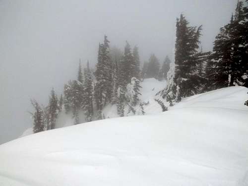
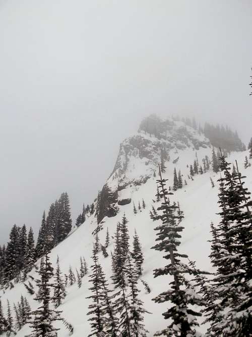
View from the summit on a not so sunny day.
The summit itself has about 600 feet of prominence and is at worst Class 2 during the summer and a steeper snowshoe hike in the winter This summit can be reached in all season though it does require some effort. At a little under 12 miles and 4000 feet of elevation gain this mountain usually takes anywhere from 6-12 hours depending on the shape of the climber and the conditions he or she will face.
 Landscape as we reach the final summit block (Photo courtesy of Pat Sloan) | 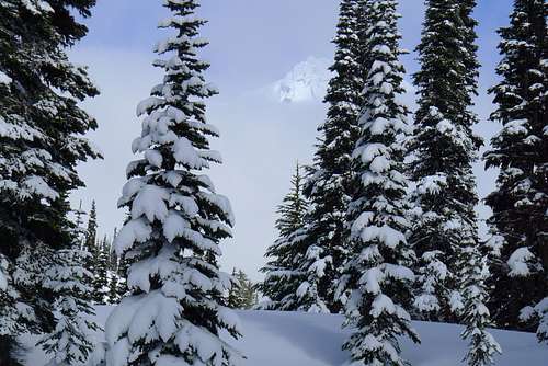 Rainier through the trees and clouds (Photo courtesy of Pat Sloan) |
Despite Mount Ararat have some trees on the summit area, the summit is home to great views on a clear day. To the west Mount Wow and Gobbers Knob can be easily seen from Mount Ararat. To the south one can see Mount Saint Helens and many of the other mountains and foothills in the region. To the east the great Mount Rainier dominates the skyline along with Copper Mountain and
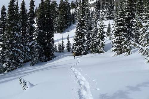 Heading up the last section to the summit. (Photo courtesy of Pat Sloan) | 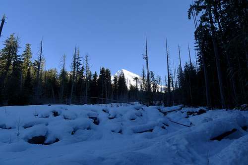 Rainier from the Kautz Creek Basin on the way up to Mount Ararat. (Photo courtesy of Pat Sloan) |
Getting There
From Puyallup and the Seattle and Tacoma Metro Area: Take WA-161 South "Meridian Ave" for 23 miles until you reach Eatonville. Once in Eatonville turn left onto Center St and go a 1/2 mile. From there continue onto Alder Cutoff Rd for 6.5 miles. You want to then turn left onto WA-7 Mountain Highway. This road will turned to National Park Highway for 18.5 miles. Stay on Washington 706 "Paradise Rd" for 3.3 miles where your tralhead will be on your right.Route
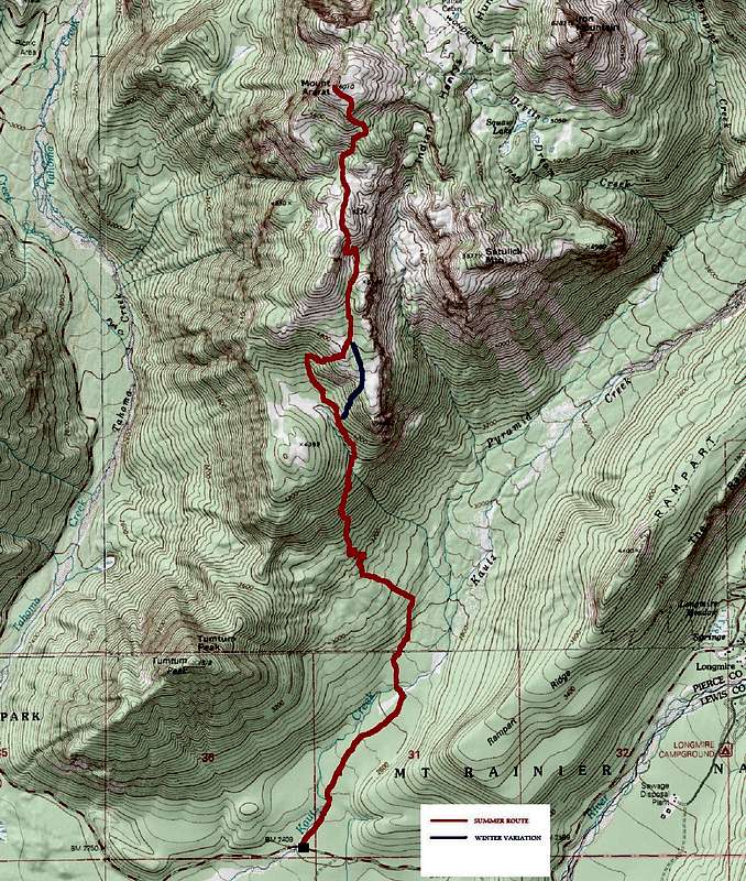 |
Unlike most mountains in Washington the winter and summer route to this summit are actually pretty much the same. There some variations depending on avalanche danger but for the most part the route is very similar in both winter and summer. Some in winter like to
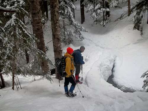 Snow-covered bridge on the Kautz Trail | 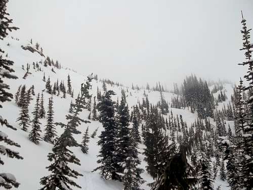 The gap for where you attain the ridge |
Once you cross the creek the trail becomes a little more difficult. There are two fairly steep sections of the trail. One section between 3200 and 4000 feet and the other between 4400 and 4800 feet. If this section is icy then climbing here can be a great
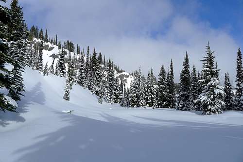
 Towering unnamed ridge which to traverse below. Use caution here because there is some avalanche risk in this area | 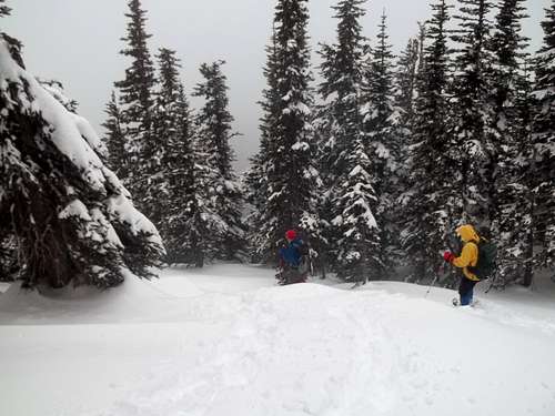 Typical winter conditions on this mountain |
Red Tape
National Park rates for the park are $15 for a 7 day period; $30 for the year at ONLY Mount Rainier National Park or the $80 for all National Parks in the United States.When to Climb
This is a year round mountain, though wintertime can be more challenging than summer due to variable conditions of the trail. On my encounter of this area in winter I encountered everything from icy slopes to very deep powder.Camping
Camping can be done in Mount Rainier National Park and the area around this peak is not a bad spot to camp, especially if one is interested in combining multiple summits in one day. A wilderness permit is required for camping in the national park. For more information about back-country camping at the national park CLICK ON THIS LINKExternal Links
WTA website on Mount Ararat.Mount Ararat Peakbagger home page
INCREDIBLE MULTIPLE DAY-MULTIPLE PEAK TRIP THAT CONTAINED MOUNT ARARAT AS THE CAMPING DESTINATION
Early summer trip report on Mount Ararat