
-
 43849 Hits
-
 93.1% Score
-
 41 Votes
|
|
Mountain/Rock |
|---|---|
|
|
37.97965°N / 105.60262°W |
|
|
Hiking, Mountaineering, Trad Climbing, Ice Climbing, Aid Climbing, Mixed, Scrambling, Skiing |
|
|
14165 ft / 4317 m |
|
|
Overview
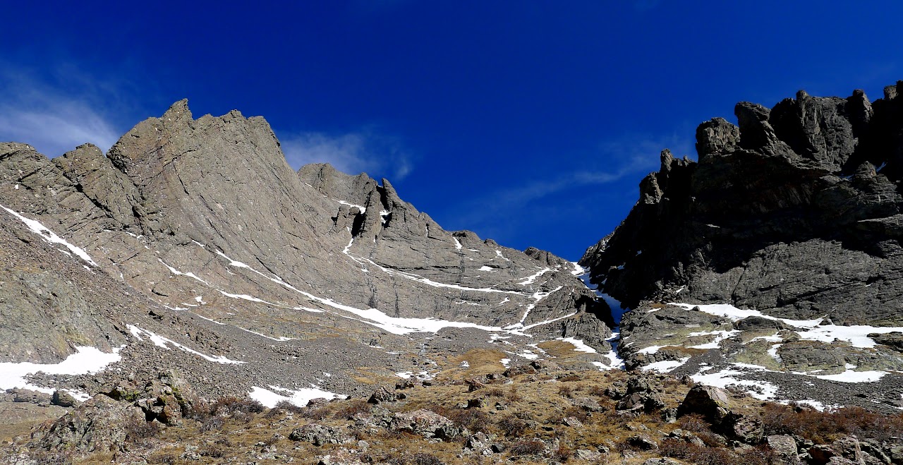
Kit Carson Mountain is the highest point on the massif just north of the Crestones in Colorado's Sangre de Cristo mountains. It is the 23rd highest ranked peak in Colorado and one of the famous 14ers. The Kit Carson massif has two other named, ranked peaks known as Columbia Point and Challenger Point which were both named in honor of the two space shuttle incidents. Memorials are found at the top of each. Sitting between these two peaks sits the Kit Carson Mountain summit which is a fine peak offering many good routes. It is one of the finest 14ers in Colorado with great views all around. The standard route up Kit Carson traverses from Challenger Point and across a wide ledge around the south side of the mountain leading to a gully heading up the east face above the saddle connecting it to Columbia Point. Other routes like the north ridge offer challending and exposed adventures for the more seasoned climber. The rock found on this mountain is the Crestone Conglomerate which is known for its nubby and solid holds making for excellent scrambling and climbing. Whatever route you use, a climb of Kit Carson will surely be an exciting time.
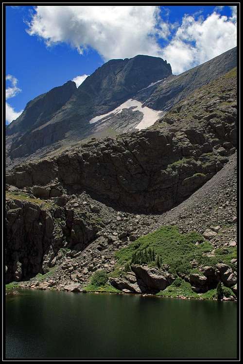 Kit Carson from Willow Lake
 | 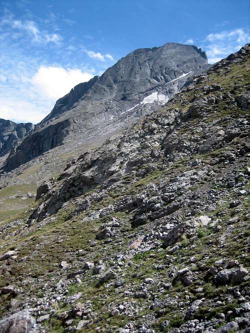 Kit Carson Peak from the base of Challenger Point
 | 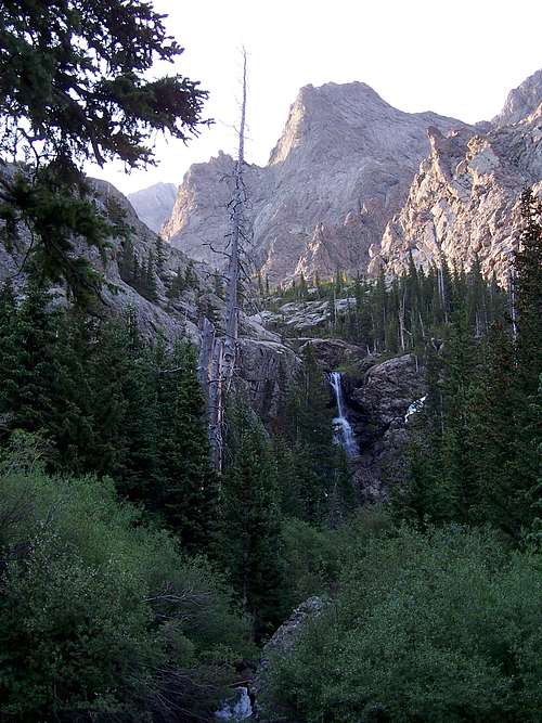 Roughly half way up the trail to Willow Lake
 |
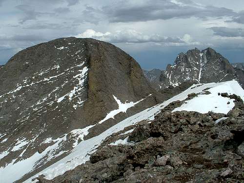
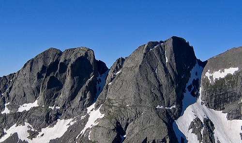 Columbia Point & Kit Carson from the ridge traverse on opposite side of Willow Lake basin
Approaches
There are a few options for approaching Kit Carson, all of which start at vastly different trailheads. Keep in mind there are no roads crossing the crest of the Sangre de Cristo mountains other than a couple rough 4WD summer tracks. To get from the west side to the east side of this mountain range requires at least a couple hours of driving. The standard approach is using the Willow Creek Trail which starts at the Willow Creek Trailhead near the tiny town of Crestone on the west side of the mountain range. For approaches from the east side of the range like the South Colony approach, you will have to get to Westcliffe.
Willow Creek Trailhead (AKA South Crestone Trailhead)
At 8,840, this is one of the higher Sangre trailheads. From the US 285/CO 17 junction on the northern margin of the San Luis Valley, go 13.3 miles south on CO highway 17 to the small town of Moffat. This highway is straight as an arrow and quite boring to drive. Continue a half mile past the center of Moffatt and turn left (east) onto Saguache County Road "T" and continue on this road for another 12.5 miles to the town of Crestone. The high Sangre de Cristo Peak will appear to be growing as you get closer to them. In the center of town, measure from and locate the Galena Street/Alder Street junction and head east on Galena Avenue, entering the Rio Grande National Forest after 1.1 miles. The road is paved to this point. Once you enter the national forest it becomes unpaved. Reach the end of the road and the trailhead at mile 2.3 where the final quarter mile of this road becomes pretty loose and steeper which will push some passenger cars but if driven carefully most people should be able to make it.
Willow Creek Approach - One way distance to Willow Lake: 3.8 miles and 2,800 feet
This trail is quite scenic and starts from the large parking area. You will quickly cross a small creek and come to a junction within a couple minutes of the trailhead. Be sure you take the left fork in the trail. You will cross an additional creek and break out into an open sandy area as the trail gently climbs. Soon the sand ends and it becomes a rocky hike up through the forest on a series of switchbacks until you crest a small ridge where you will get some views of Challenger Point. Descend slightly and pass by a wide open grassy/marshy area to the right (south) side of the trail. Views along this stretch are spectacular! The trail begins climbing again aiming for the headwall in the valley and switchbacking up all the way until you reach the big waterfall. Cross to the south side of the creek at the base of the waterfall on a series of well placed logs and continue up a rocky section until you top out above the headwall and the trail flattens out considerably. Walk the nice flat valley bottom and cross the creek back to its north side on more longs and continue the last 3/4 mile to Willow Lake. Great camping can be found at this beautiful lake and a large inlet waterfall plunges into the lake on the opposite shore. In recent times as of 2012 there was a canoe at the lake free for anyone to use but please exercise caution if you do so. Drownings have occurred here from the canoe flipping.
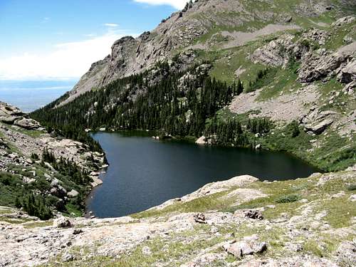 Willow Lake from the top of the waterfall
 | 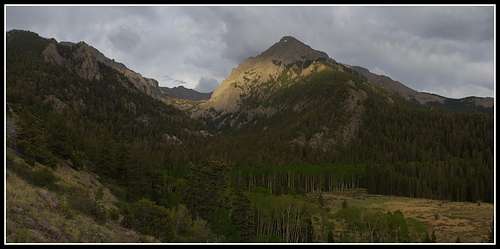 Challenger Point from the open area along the trail
 |
Spanish Creek Trailhead
This trailhead provides access to the south face winter route (Cole's Couloir) on Kit Carson via Spanish Creek. This trailhead has been on private property and has been closed so be sure to check before heading out on this approach. As of early 2013 this trailhead was being used however permission should be sought before parking along the road and hiking across the private property. If you do use this approach please respect the landowners. From the tiny town of Moffat on Colorado Highway 17 (see above), continue a half mile further south and head left (east) onto Saguache County Road "T" and go 11.8 miles to the enterance of the Baca Grande Chalets Grants. Turn right (south) and measure from here. Head on the paved Camino Baca Grande through the neighborhood and cross over Crestone Creek after 0.8 mile. After 2.2 miles the road becomes dirt and at mile 3.5 the road crosses Spanish Creek where the unsigned trailhead is located. About 100 feet north of Spanish Creek locate the unmarked Spanish Creek Trail which starts the approach. You can park here as well but there is probably only room for 1 car.
Spanish Creek Approach - One way distance: 3.5 miles and 2,750 feet
Use this approach for the Cole's Couloir route on Kit Carson. Follow the rough trail into the Spanish Creek drainage. Since this approach starts basically in the San Luis Valley it can be a hot one in summer. It's mostly on the north side of the creek but does briefly cross to the south side twice enroute. Once you hit 9,600 feet elevation you enter a large burn area and the trail climbs steeply for 1,000 feet through the burn where deadfall is very common. Be prepared to climb over a bunch of logs! Hit treeline around 11,000 feet where you can set up camp. The route is north of here.
 Upper Spanish Creek drainage
 | 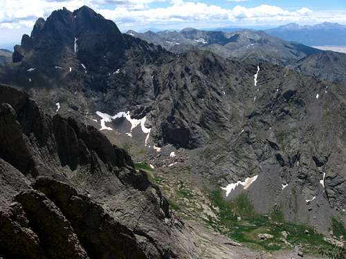 Looking down into Spanish Creek
 |
South Colony Lakes Trailhead
This trailhead starts on the east side of the range at 8,780 feet elevation. From the junction of Colorado highways 69 and 96 in the center of Westcliffe, head 4.4 miles south on Highway 69 and turn right (south) onto Custer County 119 (Colfax Lane). Follow this paved road to a T junction at mile 10 and turn right (west) onto the South Colony Road. Continue another mile and a half on this dirt road and park low clearance cars at mile 11.5 on the north side of the road. 4WD vehicles can continue on the now much rougher road to the gate after another 2.6 miles where there is a large parking area. Some passenger cars may be able to make this drive as this section of road has been improved somewhat but the road is permanently closed beyond the gate.
South Colony Lakes Approach - One way distance to Lower South Colony Lake: 4 miles
Starting at the closure gate, hike the old road for 2.6 miles to the upper gate where the road ends and cross a bridge marking the start of the trail. Follow the trail along the left (south) side of the creek as it makes a big turn to the right and contours up the slope through the forest and arrives at Lower South Colony Lake 1.4 miles from the upper gate. Views of the south face of Humboldt are striking from the trail. From this approach you cannot see Kit Carson.
 Humboldt peak from South Colony Lakes
 | 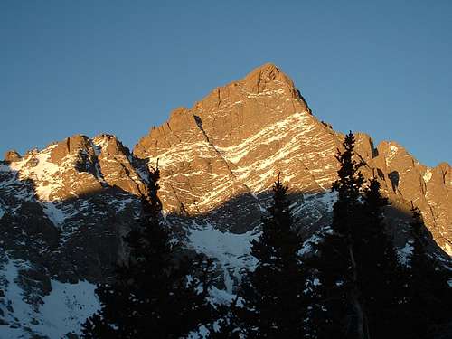 The classic Crestone Needle view from the lakes
 |
Route Options
The Avenue Standard Route (West Ridge) - Class 3 - One way distance from Willow Lake: 2.6 miles and 2,900 feet
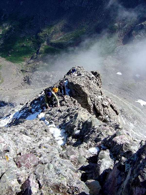
Use the Willow Creek approach for this route and ascend the North Face of Challenger Point standard route. You will walk around the north side of Willow Lake on a boot track and reach the top of the inlet waterfall. Cross the creek just above the waterfall and find a trail through the willows heading up into the upper basin. Once above the willows, ascend the north face of Challenger Point. I found it the best to climb the face just to the left (east) side of the deep couloir cutting the face. You could also climb the couloir if snow covered. From the summit of Challenger Point, descend 300 feet east on the ridge to the saddle between Challenger and Kit Carson. Locate the obvious Kit Carson Avenue heading to the right and rounding the south side of the mountain. This avenue is wide enough for a semi-truck to fit so exposure shouldn't be too bad. Walk across the avenue as it heads uphill slightly to its end, then descend slightly to get around the southeast side of the mountain and hit a spot just above the saddle between Kit Carson and Columbia Point. Finish the climb up a gully on the east face of Kit Carson which can have some class 3 scrambling and loose rock so use caution. Views from the summit are some of the Best in Colorado with the north faces of the Crestones right in front of you. Keep in mind that when the avenue is still covered in spring snow it can be a very dangerous assault as you only have an instant to arrest a slip or you'd fall down the cliff. Consolidated spring snows covering the avenue increase the difficulty immensely.
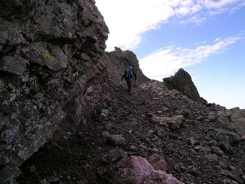 Walking on the Avenue
 | 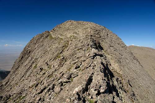 Final stretch to the summit of Kit Carson Peak
 |
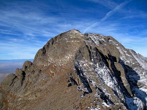
North Ridge - Class 4 - One way distance from Willow Lake: 2 miles and 2,650 feet
Use the Willow Creek approach for this route and continue further into the upper basin until about 12,200 feet shortly before you reach the 12,325 foot upper lake. You will notice a cliff face and a large pile of huge boulders below the cliff face. It's recommended you stay closer to the creek and pass below both the cliff face and the boulders. Once you get around these features, veer to the right and ascend south, then southwest up a moderate east facing slope with grassy ledges and gain the crest of the north ridge at about 13,000 feet. Follow the exposed crest directly to the summit.
 Climbing Kit Carson's north ridge
 | 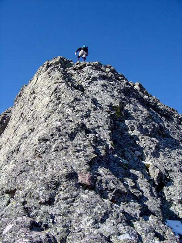 Ascending the airy north ridge
 | 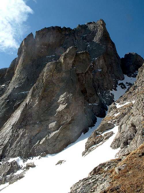 Columbia Point and the Outward Bound couloir from the north ridge
 |
Outward Bound Couloir - Class 3/Steep Snow - One way distance from Willow Lake: 2.3 miles and 2,600 feet
This beautiful snow route ascends a steep 45-50 degree snow couloir leading right to the Kit Carson and Columbia Point saddle. Use the Willow Lake approach and follow the same route above Willow Lake as described above for the north ridge. At 12,200 feet, instead of climbing west up the slope leading to the north ridge, climb south up the obvious couloir to the left (east) of the north ridge. The couloir starts open and mellow but steepens and becomes much narrower. Just below the saddle take the left branch of the couloir which is the steepest part. It can often be icy so crampons and an axe are a must. Reach the 13,620 foot saddle and finish the climb via the west ridge gully (standard route) to the summit.
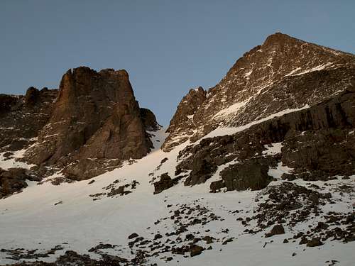 View of the Outward Bound Couloir from upper Willow Creek basin. North ridge on the right
 | 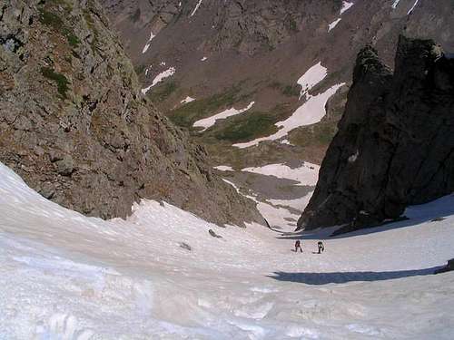 Climbing the couloir
 | 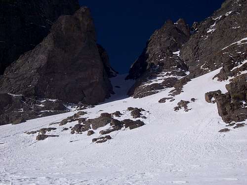 Looking up into the couloir from the base
 |
Kirk Couloir - Class 3/Steep Snow One way distance from Willow Lake: 1.8 miles and 2,600 feet
This is another snow route best done in spring that climbs to the saddle between Challenger Point and Kit Carson. It is slightly easier than the Outward Bound Couloir but still presents steep snow challenges with a maximum angle of about 48 degrees. Use the Willow Lake approach and follow the same route above Willow Lake as described above for the north ridge. Instead of continuing up the valley to 12,200 feet, veer slightly right and to the south before you reach the north ridge route and climb the nice couloir. It is a little more open than the Outward Bound and likely has somewhat less rockfall danger. As for any snow route, be sure to have crampons and an axe.
 Kirk Couloir route
 | 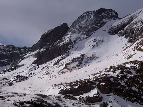 Kit Carson Peak and the Kirk Couloir
 |
The Prow - Class 5.8 - One way distance from camp at 11,000 feet in Spanish Creek: 3 miles and 3,000 feet
The Prow is the premier climbing route on Kit Carson. Great rock and a remote location provide an excellent technical rock climbing experience. The only downside to this route is that you must approach from Spanish Creek. Good camping can be found at 11,000 feet near treeline in Spanish Creek along the north side of the creek. From here hike 0.5 miles eastward to 11,600 feet in the valley and locate the sweeping south ridge of Kit Carson. Scramble up to the base of the fin (The Prow) and begin the climb. See the linked page for detailed pitch descriptions. The crux is midway through the second pitch to climb over a bulge rated at 5.8...try to stay on the ridge crest the entire climb as it becomes much harder (5.11+) if you don't.
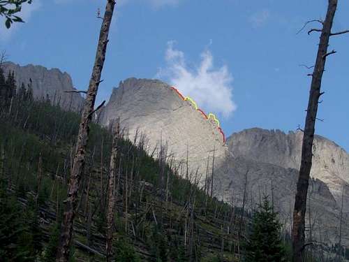 The Prow on Kit Carson Peak and the five roped pitches shown in alternating red-yellow. Pitch 2 is the crux
 | 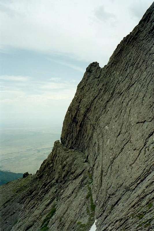 Photo of the route, the notch toward the bottom is the 5.8 crux
 | 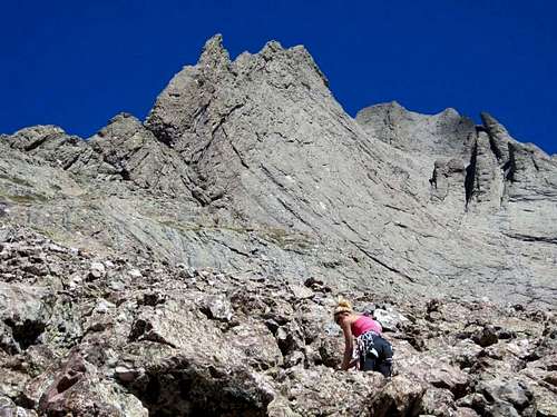 Approaching the base of the Prow
 |
South Couloir (Cole's Couloir) Winter Route - Class 3 - One way distance from camp at 11,000 feet in Spanish Creek: 3.2 miles and 3,000 feet
This is probably the best winter route on Kit Carson since it is a south facing couloir and less likely to cross serious avalanche terrain. Use the Spanish Creek approach and camp at 11,000 feet in the valley along the north side of the creek. From here, hike eastward for 0.7 miles and locate the couloir just right (east) of the sweeping south ridge known as the Prow. Ascend this couloir directly to the 13,620 foot Kit Carson/Columbia Point saddle and finish the climb on the standard route by climbing 500 feet up the gully on the east face. This is the same gully you finish the standard route on after crossing the Avenue.
 The south (Cole's) couloir just in the shade to the right of The Prow
 |
Traverse from Columbia Point - Class 3
This route starts on the east side of the range at South Colony Lakes. From South Colony Lakes, hike the trail leading up towards the west ridge of Humboldt Peak. When you reach the saddle turn left and scramble the Class 3 ridge crest (much route-finding required) to the Bears Playground. Ascend Obstruction Point, descend down the other side and then ascend the standard East Face of Columbia Point. The crux of this route is down-climbing Columbia Point to reach the saddle above the Outward Bound and Cole's couloirs. Start this descent by following the direction the space shuttle points towards on the memorial (should be to the south) and walk down a short ridge a ways. Do not descend directly west from the summit as this leads to an impassible area. After you descend maybe 60 feet to the south, locate broken terrain to the east and down-climb large blocks to the saddle and meet the same east gully on the standard route to finish. This descent off Columbia Point is very tricky when snow covered.
 Columbia Point and its east face from Obstruction Peak
 | 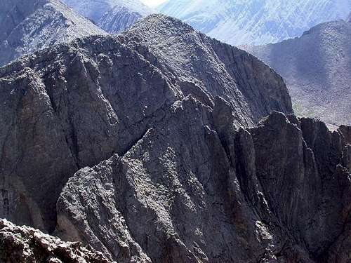 View of the descent off Columbia Point from the Kit Carson summit
 |
Map
Shown below is a map of the routes on Kit Carson.
When to Climb
Kit Carson can be climbed any time of year but keep in mind that climbing it in winter increases both difficulty and time required. Summer is the standard time to climb this peak but spring ascents up the various snow routes can offer a great experience for those comfortable on steep snow. Be sure to monitor the weather at all times. Summer afternoon thunderstorms are known to be hanieous in the Sangres so plan to be off the summit and ridges by noon. Lightning is a real danger in Colorado and outside Florida, Colorado has more lightning strikes than any other state. In winter, freak winds and snow storms can cause hyperthermia and cause serious problems for unprepared parties. Bottom line - prepare for the worst!
In summer the high temperatures above treeline can be in the 50's but the lows will still hover around freezing. In winter the temperatures rarely get above freezing anytime and the nighttime lows can often be below zero. The Sangre de Cristo range does get less snow than other mountains in Colorado since they are further south but the winds are known to be some of the worst in the state.
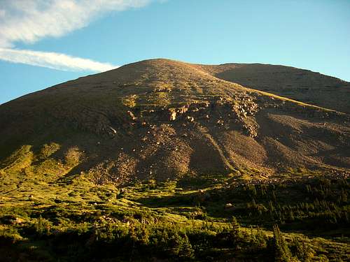
 Late spring conditions
 | 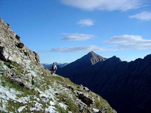 Summer conditions
 | 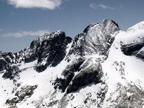 Winter conditions
 |
Red Tape/Camping
Camping can be found in many places including all the lakes found of the approach hikes. Willow Lake in particular is a fantastic place to camp but it can get crowded in summer. The upper Willow Creek basin can have good camp spots near the upper lake. Really you should camp anywhere you feel necessary to. The only place you are not allowed to camp is within 300 feet of Willow Lake but that is more of a guideline as I have never seen this enforced. There is no permits or fees to climb Kit Carson but it lies in a wilderness area so there is no motorized travel and no pets allowed. Please practice leave no trace policies and avoid having campfires. Usually campfires are banned all summer anyways.
External Links
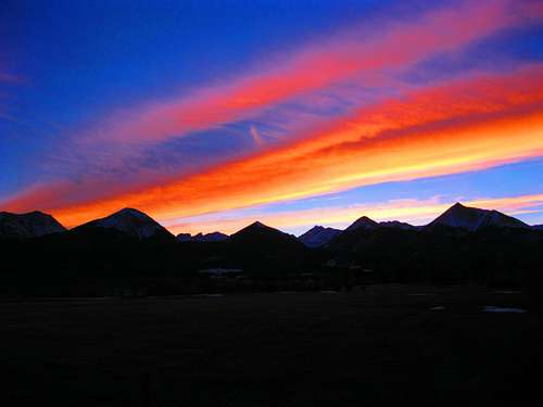 Sangres Sunset
Great Trip Report for the Spanish Creek/Cole's Couloir route
Current Willow Creek Trailhead conditions