
-
 25862 Hits
-
 87.2% Score
-
 24 Votes
|
|
Mountain/Rock |
|---|---|
|
|
48.53405°N / 120.589°W |
|
|
Hiking, Mountaineering, Scrambling, Skiing |
|
|
Spring, Summer, Fall, Winter |
|
|
8330 ft / 2539 m |
|
|
Overview
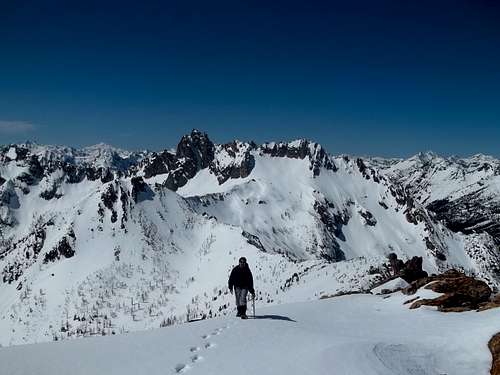
Big Snagtooth is one of the Washington Top 100 (Bulgers) located near Washington Pass in the North Cascades. It's the highest point on Snagtooth Ridge which is the line of towers between Silver Star and Big Snagtooth. It is a short ways off Highway 20 however it sees few ascents due to the rough nature of the Willow Creek valley requiring much bushwhacking to approach. With 590 feet of clean prominence, it provides a stunning view of many big peaks in the North Cascades and offers a challenging summit slab to climb in order to reach the summit. A climb of this peak during the summer may test your tolerance of thrashing through bushes and trees however a climb in spring may test your tolerance for sinking up to your knees or more in snow so pick your poison. No trails lead anywhere near this peak so you will be travelling in remote country with little evidence of people. Solitude is more than likely, it is definite!
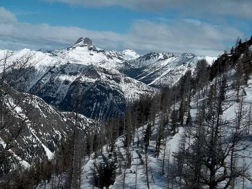
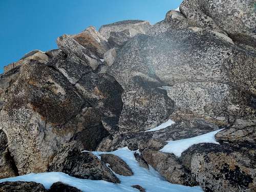
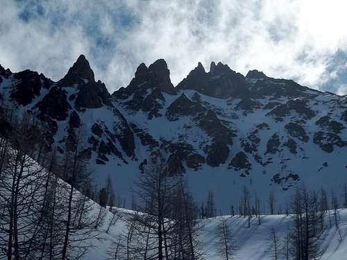 Looking up at Snagtooth Ridge Looking up at Snagtooth Ridge |
Getting There - Standard Route West Ridge
Approach
Big Snagtooth is climbed from the North Cascades Highway. From the summit of Washington Pass (3 hours from Seattle) continue east on Highway 20 for 3.5 miles and pull off at a pull-out on the right side of the road at 4,320 feet. There is a long area to pull out and you can see right up the Willow Creek valley all the way to the summit of Big Snagtooth and much of the route will be in view. Begin by walking up the road a short ways (maybe a few hundred feet) then drop down to the left (SE) and descend through trees for 120 feet to Early Winters Creek at 4,200 feet. Locate a place to cross the creek on a log making sure you are near the mouth of Willow Creek. Continue following along the north side of Willow Creek steeply up the valley for about 3/4 of a mile until you reach 5,000 feet in elevation where the slope eases up. In the summer this section can be very brushy and require lots of bush whacking so be prepared for that. Continue southeast up the valley following the left side of the creek and weaving your way through the trees until you reach 5,600 feet where you will veer east into the upper basin just west of Big Snagtooth. Do not continue up the creek to the south into the large basin below Kangaroo. The slope becomes steeper once again and the trees begin to thin out as you pass 6,000 feet. Big views of Tower Mountain and Kangaroo begin opening up as you ascend. Enter the upper basin at 7,000 feet where you will be greeted with an amazing view of the entire Snagtooth Ridge. Turn south and ascend a very loose kitty litter or snow slope for 400 feet to a small saddle in the west ridge of Big Snagtooth. This saddle is just east of a small tower. I cannot stress how horrible this slope will be if it isn't snow covered so maybe rethink doing this climb in late summer.
 Tower Mountain from Willow Creek Tower Mountain from Willow Creek |
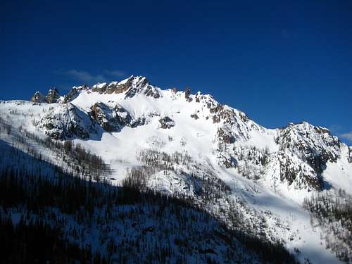 The Kangaroo from 6,000 feet in Willow Creek The Kangaroo from 6,000 feet in Willow Creek |
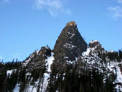 Unnamed Tower from Willow Creek Unnamed Tower from Willow Creek |
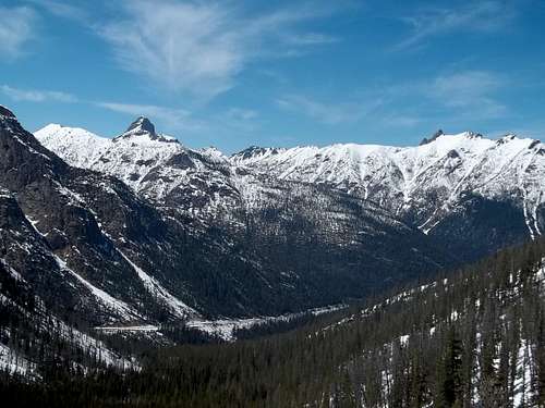
 Tower Mountain Tower Mountain |
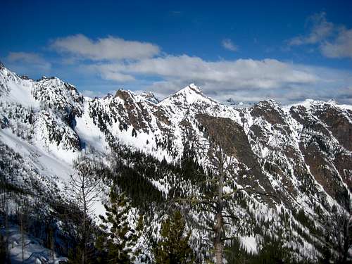 View above Willow Creek View above Willow Creek |
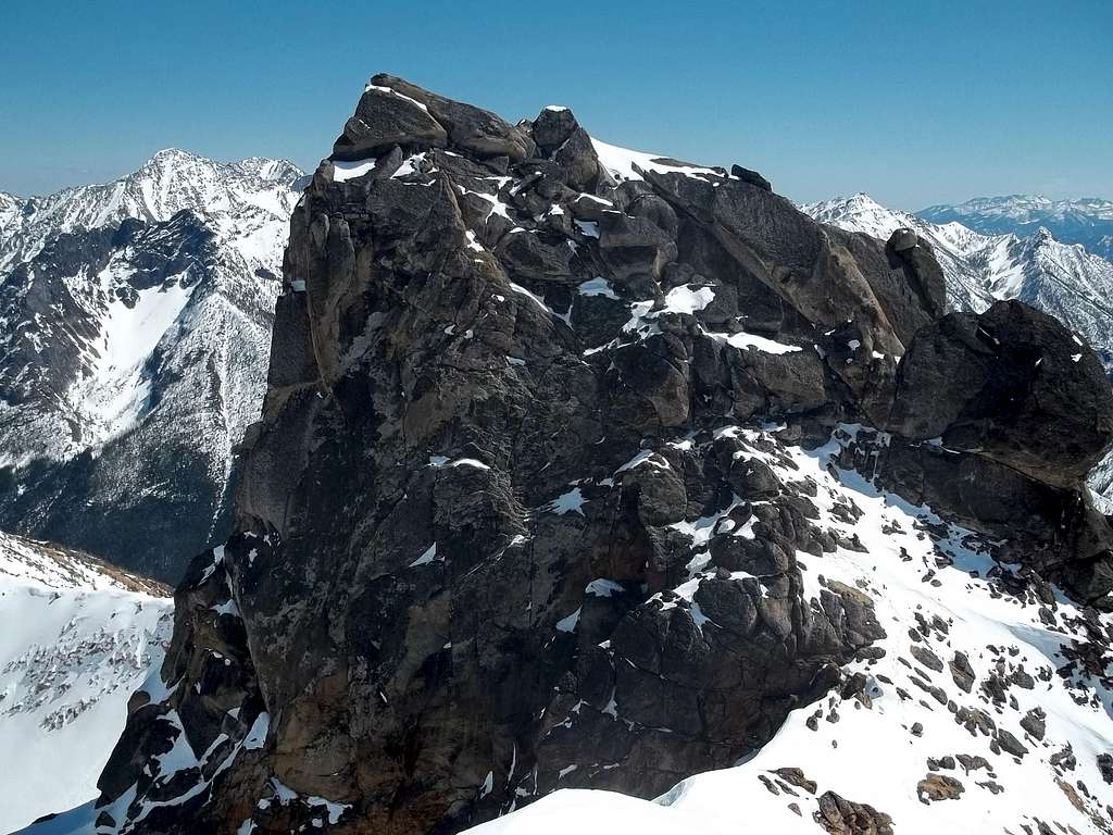
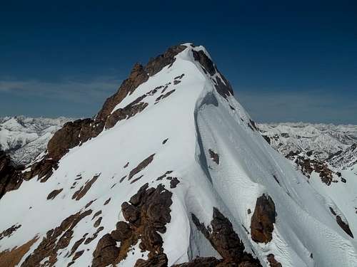
The Climb
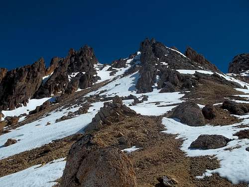
Now that you have reached the west ridge the fun begins. Only 900 feet separate you from the summit. Follow the ridge east as it gently climbs up on easy terrain. The high point furthest to the right that you can see is the summit. The small peak just left is Willow Tooth. The obvious saddle between them is you next destination if you plan to climb the rappel route. You can stay mainly on the crest of the ridge much of the way or veer just off to the right (south) side. Traversing right and up the final 100 feet to the saddle is more kitty litter so exercise caution. Once you are at the saddle at 8,250 feet, you can see a couple 4th class chimney type routes leading up about 50 feet to the base of the summit slab. These can be scrambled without too much difficulty if you are a confident on rock. If you are not refer to the gully variation below.
Once you have climbed up one of the cracks, you enter the upper part of the gully right at the base of the summit slab. Traverse around to the south side of this 20 foot tall slab and either make one 5.7-5.8 unprotected slab climbing move or stand on your partners shoulders to gain the upper part of the slab. This move only has about 5 feet of exposure but is difficult to make on your own. Once on the slab itself, there is a large rock with some webbing underneath it to use as an anchor to belay someone up/rappel down. The top of the slab typically has black lichen on it so be careful not to slip as you friction climb up the final 10 feet to the highest point with room for just a couple people to sit on. Do not confuse this summit slab from the slightly lower east peak located very close by. This peak can be scrambled up with Class 3 climbing to a very small summit and it provides a great view of the true summit slab itself. Since few people make the extra effort to climb this 20 foot peak it has loose rocks. The exposure off the north side is breathtaking though!
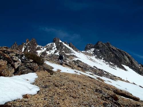
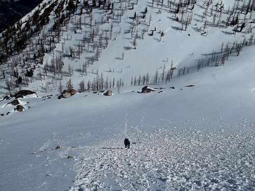 Greg ascending the final slope to the west ridge Greg ascending the final slope to the west ridge |
 Looking up to Willow Tooth in the center Looking up to Willow Tooth in the center |
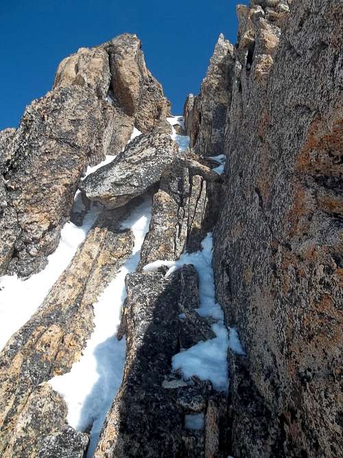
 Looking at the chimney I climbed just above the saddle on the summit block Looking at the chimney I climbed just above the saddle on the summit block |
 Greg hiking up the ridge with Big Snagtooh on the right Greg hiking up the ridge with Big Snagtooh on the right |
 Looking at the summit slab from the lower east summit. The rock and anchor in the middle Looking at the summit slab from the lower east summit. The rock and anchor in the middle |
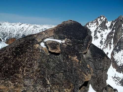
 Silver Star Peak from the summit Silver Star Peak from the summit |
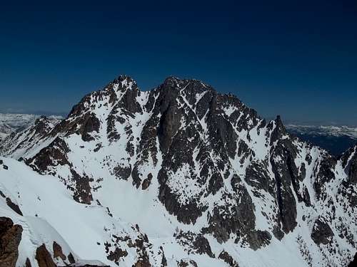
 A look at the summit pyramid from Willow Tooth. The route starts at the end of the snow in center-right and climbs easy cracks past the two snow ledges and up to the big triangle shaped snow ledge at the top just right of the summit. From that snow ledge you traverse around to the other side for the summit slab climb.
Gully Variation
If you wish to bypass the first crack 4th class scramble section, instead of heading all the way up to the saddle, traverse right below the saddle and the summit cliffs on Big Snagtooth and locate a steep Class 3 gully heading right through the cliffs on the south side of the peak. Continue up this gully for about 100 feet past a chalkstone (some difficulty...maybe Class 4) right to the base of the summit slab.
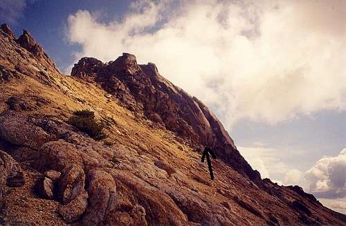 The view of Big Snagtooth from just below the Willow Creek saddle to the west. The big black arrow marks the bottom of the gully, which is class 3 at the bottom and class 3+ in the vicinity of the two chockstones halfway up. Photo by Klenke
Descent
From the summit of the slab, friction climb down 10 feet to the anchor and rappel the short section to the rocks at the base. A 30 meter rope would be more than enough. You can then traverse back around to the west and rappel the crack you climbed up from a blue piece of webbing around a constriction in a couple rocks that I placed in May 2013. Again, a 30 meter rope is plenty. Return the way you came.
 Looking down the west ridge with the Kangaroo Looking down the west ridge with the Kangaroo |
 Willow Tooth from the base of the summit pyramid. Simply climb the ridge just left of the cornice. In summer there is some Class 3 friction slab moves. Willow Tooth from the base of the summit pyramid. Simply climb the ridge just left of the cornice. In summer there is some Class 3 friction slab moves. |
Willow Tooth
If you made all the effort to climb Big Snagtooth you might as well also spend the extra 10 minutes to climb Willow Tooth as it gives a great view of Silver Star and the summit block of Big Snagtooth. From the saddle between the two peaks, simply walk west up for 70 feet or so to Willow Tooth following the crest of the ridge. There is some Class 3 slab friction climbing moves at the top. You can also climb up a Class 2+ gully on the south side of Willow Tooth which you can access from below the saddle lower down on the west ridge.
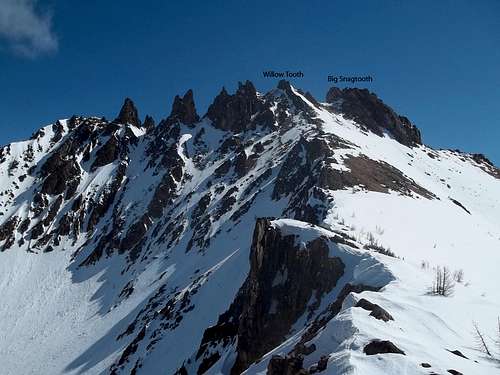 Labeled photo showing Big Snagtooth and Willow Tooth Labeled photo showing Big Snagtooth and Willow Tooth |
 Looking up the Class 2+ gully leading right to the summit of Willow Tooth Looking up the Class 2+ gully leading right to the summit of Willow Tooth |
Map
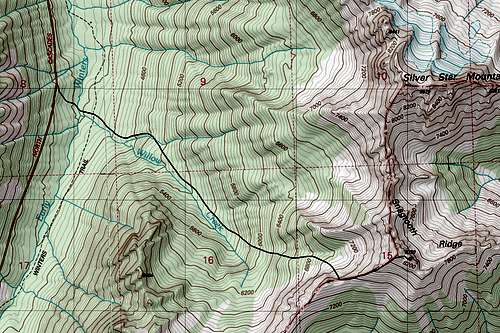 Topo map showing the route up Big Snagtooth
Red Tape
North Cascades Sunrise
215 Melody Lane
Wenatchee, WA 98801
(509) 664-9200