
-
 5528 Hits
-
 85.24% Score
-
 20 Votes
|
|
Mountain/Rock |
|---|---|
|
|
39.46857°N / 105.69878°W |
|
|
Park County |
|
|
Hiking |
|
|
10220 ft / 3115 m |
|
|
Overview
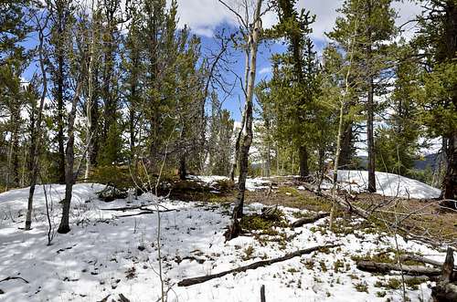
Summit area (May 2013)
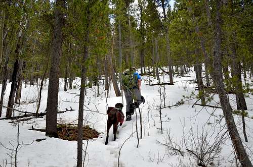
Hiking toward summit. (May 2013)
Webster Benchmark is nice little peak overshadow with numbers of well known bigger and higher mountains in Mt. Evans Wilderness to the north and Lost Creek Wilderness to the south. Webster Benchmark is not much of mountain,summit is hardly protruding above tree line, but yet this little peak can be hiked year around. Webster Benchmark is wedged in between US Highway 285 and Guanella Pass, though this peak is rising above junction, can’t be seen from neither roads unless one is standing on top of the higher peaks in Mount Evans Wilderness or Lost Creek Wilderness. Easy access makes this peak great winter hike, but most likely during winter and springtime last ¾ of mile going thru the trees can be slug thru deep snow. For those who wants to experience high altitude in no time, someone who loves to hike unknown and less popular peaks, someone who is in peak bagging business or due to bad weather in high country Webster Benchmark is right choice. Most of visitors to this area or campers in one of nearby campgrounds are not aware oft his easy and pleasant hike. Less than 4 miles and roughly 1400 ft of elevation gain will do to summit this peak. Views from summit are mostly obscured with small aspen and pine trees around summit area, but still you can get glimpse of some peaks in the neighborhood. Surprisingly there is register sheet, neatly placed in small jar located at very small summit cornice. Some of summit signings goes back as twenty years ago.
Elevation: 10220 ft / 31135 m, CO Ranks Rank: 2181, County: Park, Quad: Mount Logan
Latitude/Longitude: 39.468568, -105.698776
More information about Webster Benchmark can be find here at these websites:
Getting There
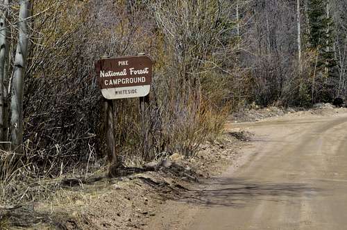
Webster Benchmark , Trailhead.
Whiteside trail. (May 2013)
Trailhead:
The Whiteside Campground is located approximately 2.5 miles northwest of the small town of Grant,Colorado on County Road 62 (Guanella Pass Scenic Byway). The elevation here is 8,900 feet.There are five tent only campsites located on both sides of Geneva Creek. Two campsites are next to the parking area near the road and the other three can be accessed via a foot bridge on the other side of the creek. Large spruce trees and aspen provide some shade to the campsites. There are no defined tent pads but most spots are fairly flat. There is a disabled access vault toilet near the parking area. Drinking water is not available. This campground is very popular and fills most weekends in the camping season. Reservations are not accepted for sites in this campground. Open May through September.
Getting There:
From Denver take Highway 285 to Grant. Turn northon County Road 62 (Guanella Pass Scenic Byway), andtravel about 2.5 miles to the campground. The Whiteside Campground is locatedapproximately 2.5 miles northwest of the small town of Grant.
Route
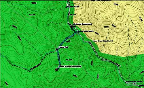
GPS Track (May 2013)
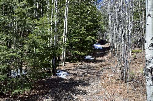
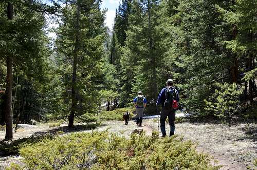
Whiteside trail (May 2013)
 End of trail End of trail |  Bushwhacking Bushwhacking |  Summit area Summit area |  Toward summit Toward summit |
Red Tape
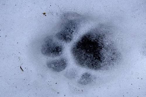
Mountain Loin tracks (May 2013)
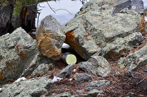
Summit register. (May 2013)
Evidence of Mountain Lion Activity:
To reduce the chances of encountering a Mountain Lion:
- Avoid hiking alone, especially between dusk and dawn, when lions normally do their hunting. Make plenty of noise while you hike so as to reduce the chances of surprising a lion.
- Always keep children in sight while hiking and within arm's reach in areas that can conceal a lion. Mountain Lions seem to be drawn to children.
- Hike with a good walking stick; this can be useful in warding off a lion.
Toreduce the chances of an attack when encountering a Mountain Lion:
- Do not approach a lion, especially if it is feeding or with its young. Most lions will avoid confrontation. Give them a way to escape.
- Stay calm and face the lion. Do not run because this may trigger the lion's instinct to attack. Try to appear larger by raising your hands.
- Pick up small children so they don't panic and run. This will also make you appear larger. Avoid bending over or crouching.
- If the lion acts aggressively, throw rocks, branches, or whatever can be obtained without turning your back or bending over.
- Fight back if attacked. Since a mountain lion usually tries to bite the head or neck, try to remain standing and face the attacking animal. People have successfully fought back with rocks, sticks, or bare hands.
Camping
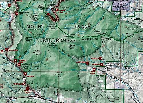
Campgrounds map
Whiteside Campground:
This campground has 5 campsites for TENT CAMPING ONLY. It is located at 8,900 feet. The campground is open year round and is first-come, first-served basis. There is no wateravailable at this site.
Tents Only. Please drive slowly and enjoy the trip. This road is not actively maintained during the winter. Also, the following restrictions apply to this campground:
- Maximum 8 persons per site, 2 tents and 2 vehicles or 1 recreation vehicle.
- Maximum 24' RV
- Dogs must be leashed at all times.
- No discharge of firearms or fireworks.
- Only licensed vehicles can operate inside campground.
- Camping is NOT ALLOWED behind a LOCKED GATE.
External Links
- Weather.com- CDOT
-