
|
|
Mountain/Rock |
|---|---|
|
|
35.78650°N / 82.34624°W |
|
|
Yancey, Buncombe |
|
|
Hiking |
|
|
Spring, Summer, Fall, Winter |
|
|
5961 ft / 1817 m |
|
|
Overview
One peak that I wanted to bag, and one that has been on my to-hike list for many, many years is Big Butt Mountain. It's one of those peaks that lots of people ignore because it's not quite a 6,000-foot summit. My GPS reading came out at 5,961 feet which is, I think, pretty accurate. I calibrated it as nearly as I could before I hit the trail.The peak is a major one by any standards here in the South. But because the summit is a tad less than Sixer standards, and because there is no official trail to the summit, it's largely ignored. But this is a really good thing if you're hunting for solitude. The Big Butt Trail doesn't seem to get a lot of traffic. I hiked it on a wonderful June Sunday with great weather and I did not encounter a single human until I got back to the trail head at the end of the day! So if you're looking for great scenery and some real solitude, I can recommend this trail and this summit for those qualities.
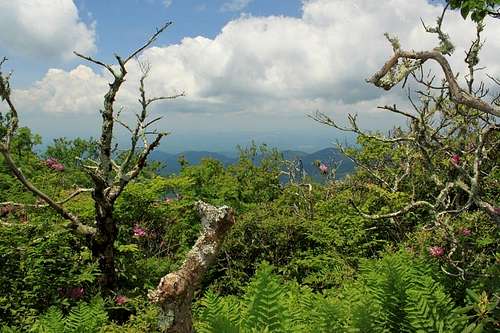
Views?
One thing that is strange to me is that the summit is clothed in hardwoods and rhododendron rather than spruce and balsam trees like most of the rest of the Black Mountain high summits. What's different about this mountain from other Black Mountain summits that are at, or above, 6,000 feet in elevation?
The Black Mountains, when viewed from the perspective of a topo map or from high in the sky, present a "J" or fish hook shape. Big Butt lies almost at the end of the shorter side of that "J". It has been suggested that the Black Mountains underwent some relatively recent tectonic activity when a separate and small sub-plate was driven through the area, giving these peaks both their current height and that distinctive "J" shape of the range.
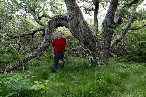
Gnarly birch
GETTING THERE:
(Somehow, the template for "Getting There" vanished. Had to add my own.)
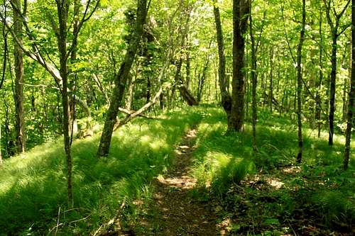
The best and easiest way to access Big Butt Mountain is from either end of the Big Butt Trail. If you want to use the northern terminus you have to drive up the long and torturous NC 97 which becomes a gravel road after leaving Barnardsville. Getting to the northern terminus by car does take a long time. And from there (Cane River Gap) the trail ascends steeply with lots of switchbacks. Look for a slog of about 1700 vertical feet to gain the ridge.
Easier than that is to use the southern terminus of the Big Butt Trail which begins on the Blue Ridge Parkway just south of the Mount Mitchell State Park (NC 128) at the Balsam Gap turnout (also known as the Walker Knob turnout).
Classic
Route
The Big Butt Trail.Red Tape
None. This is all National Forest land. You can camp wherever you can find a spot to comfortably pitch a tent or hang a hammock.There is jealously guarded private land on the vast tract between the ridges of the Blacks. This land is obviously posted and no trespassing should be attempted. You'll know where that land is (Big Tom Preserve) because the owners have left MANY posted signs.
When to Climb
All year. Both access roads to the trail can be closed in winter during bad weather. Especially the Blue Ridge Parkway.Camping
Camp anywhere. There are good campsites just below the summit of Big Butt and an even finer one at the cliffs of Little Butt.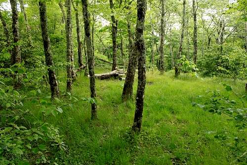
Campsite