
|
|
Mountain/Rock |
|---|---|
|
|
40.83181°N / 110.18269°W |
|
|
Summit |
|
|
Hiking, Skiing |
|
|
Spring, Summer, Fall |
|
|
12726 ft / 3879 m |
|
|
Overview
South Burro Peak is located in the Uinta Mountains of Utah, 10.7 miles east northeast of Kings Peak, the state's highpoint. At 12,726', it is the 27th highest peak in the state, yet sees few visitors. As a contrast, (as of July-4-2013) the 27th highest peak of Colorado, Mount Sneffels, has 427 logged ascents registered in ListsofJohn, while South Burro Peak has 2.From a distance, the summit does not appear to be very distinct. It is merely the highpoint of a 1.4 mile spur ridge that runs north of the main east-west Uinta crest.
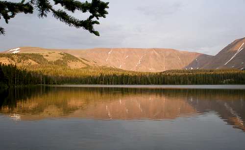
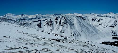
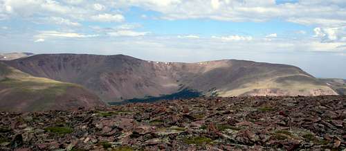
The Burro ridge viewed over Beaver Lake
About 1 mile north of South Burro Peak is North Burro Peak which appears considerably more distinct when viewed from the west side, but is 40' lower. One distinguishing feature of the two Burros is that they have official names. Most Uinta 12000 footers do not.
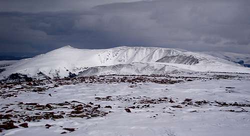
North Burro is the obvious point at left, South Burro is in the middle.
North Burro Peak from South Burro Peak
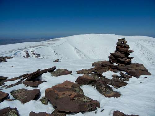
The western Uintas are very rugged, but the eastern Uintas where South Burro is located has long gentle ridge lines, but steep faces, mostly consisting of loose boulders.
Gentle ridge leading to the Burros on the skyline
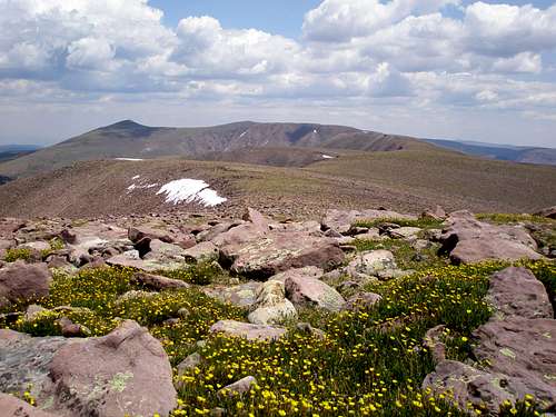
From the summit area of South Burro one can see the Kings-Emmons Ridge to the southwest and down into the Burnt Fork drainage to the east.
Looking over Mount Davis at the Kings-Emmons Ridge.
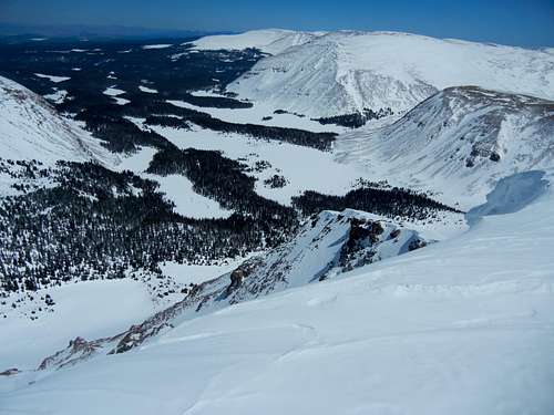
The Burnt Fork drainage
Getting There
Heading to Lonetree on Wyoming State Highway 414
South Burro Peak is most easily accessed via the Middle Beaver trailhead which is located south of Lonetree Wyoming. It takes just under 3 hours to get there from the Salt Lake City area.
If not coming from Salt Lake, find your way to Lonetree Wyoming and follow the directions from there.
If coming from Salt Lake, head east on I80 to Wyoming. Once in Wyoming, take exit 34 towards Fort Bridger. Go through Fort Bridger about 5.1 miles to a 4 way intersection with a blinking red light. Turn right onto Wyoming State Route 414. Go through the town of Mountain View where there is a 24 hour Maverick gas station, a ShopKo, a Pizza Hut, and a Subway. At the south end of Mountain View bear left to stay on 414. Go a total of about 26.4 miles on 414, from the blinking red light, to just past Lonetree, Wyoming which has no services and only a few buildings. Turn right onto a dirt road at the sign which says "Hole in the Rock" and "Hoop Lake". After making the turn, you will see a fence in front of you which says "Lone Tree Ranch". Immediately bear left onto Uinta County Road 295.
Note that there is another right turn off of 414 shortly before the one mentioned above that is an alternate route, but the road is a little less good.
Once on #295, go south. After about 4.5 miles, the alternate route will join on the right. Bear slightly left at this intersection and continue south 2.8 miles to a signed intersection. The sign says left to "HOOP LAKE 4" and right to "MID BEAVER CR. 1". Go right and continue for 3.3 miles on the main road to the trailhead. The last 10th of a mile is a little rough but is still suitable for passenger cars. The trailhead is barebones and obviously doesn't get much use as it more resembles a field than a parking lot. There are 2 trails leaving here. You want the one leaving from the far left corner.
The turn south onto the dirt road off of Wyoming 414 is at N41.04826 W110.12578.
Route
A separate route page is coming soon.Start at the Middle Beaver Trailhead. If in summer, follow the trail to where the highline trail splits off to the east. Take the highline trail to the base of the west ridge of North Burro Peak. Start out following the ridge, and then contour along its south side and make a beeline for South Burro Peak.
The route is essentially the same for a ski ascent, but only follows the exact trail at the beginning. It cuts out some unnecesary ups and downs by contouring.
En route to South Burro Peak, Coffin Benchmark lies ahead
Red Tape
South Burro Peak is located within the High Uinas Wilderness Area so normal wilderness rules imply. In particular, do not camp within 200' of the trail or a water source.When to Climb
The Burro ridge viewed from the southwest from West Burnt Fork Peak
The normal hiking season runs from about the end of June through the end of September. The best time to hike in the Uintas is late August through the beginning of September, after the mosquitos have died down and before it gets too cold.
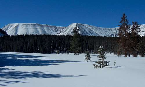
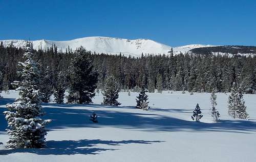
Heading to South Burro at the beginning of May
The access road is unlikely to be plowed, so a winter ascent could be as much as an additional 10.6 miles one way. However, in late April through early May, much of the road will be melted out, making South Burro a reasonable one day ski trip destination. How far you'll be able to drive depends upon current snow conditions. To give you some idea of what to expect, on May 6, 2007 we drove to within 1.6 miles of the trailhead with no difficulties. On April 21, 2013 we drove to 3.9 miles of the trailhead where we got stuck and decided that was a good place to start. 11 days later, on May 2, I was able to drive 1.9 miles farther. Expect more of the road to melt while you are out skiing, necessitating some muddy road walking on the return.
Camping
The closest developed campground is the Hoop Lake Campground. You'll see the signed turn to it on your way to the trailhead. It is a 4 mile side trip to the campground.If backpacking, there are many places to camp along the trail, but it might not be trivial to find one, because there are numerous blowdowns along some sections. Remember that you need to be 200' away from the trail and any water source.
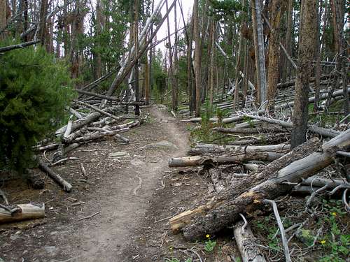
Lots of downed trees
Mountain Weather
In the summer you need to be wary of thunderstorms which happen almost daily in the late afternoon.For a spring ski ascent you have three concerns, precipitation, temperature, and wind speed. It is easy to find a day with no predicted chance of precipitation, or a minimal chance. It is surprisingly hard to find a day that is cold enough. Ideally, the predicted high at the trailhead should not be above 40F and there should be a very cold night, 10-20F the night before. If it is not cold enough, you will be sinking in an unpleasant amount on the way out. Your other big concern is windspeed as you will be out in the open for 2.3 miles one way. On a typical early spring day, predicted windspeeds will be 20-40MPH, but if you are patient and flexible, days do occur where it is less than 10MPH.
Here is a link to the current 7 day forecast for South Burro Peak.