
|
|
Mountain/Rock |
|---|---|
|
|
44.36721°N / 114.34396°W |
|
|
Custer |
|
|
Hiking, Mountaineering, Scrambling |
|
|
Spring, Summer, Fall, Winter |
|
|
10313 ft / 3143 m |
|
|
Overview

Bald Mountain's Summit
Regardless of the name, Bald Mountain is a beautiful and prominent peak. With 2,013 ft. of prominence it comes in as the 99th most prominent peak in Idaho. According to Tom Lopez in his Idaho A Climbing Guide the peak rises more that 5,000 vertical feet in 3.2 miles from the Salmon River below making it one of the steepest mountains in Idaho. At 10,313 ft. it is also the 4th highest peak in the Salmon River Mountains. The view from the top is nothing less than extraordinary. Many of Idaho's major ranges are visible from the summit.
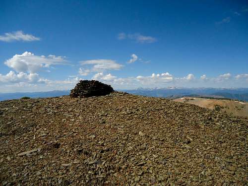
Bald Mountain Cairn
It is an enjoyable hike with no major obstacles. The hike is further facilitated by an old mining road leading into the basin below the peak. This road is open to vehicles, but be warned, it is VERY steep, narrow, and rocky.
Bayhorse

Bayhorse Building

Bayhorse Kilns
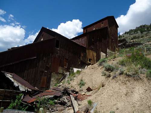
Bayhorse Mill
Bayhorse is one of several ghost towns in the area and along with Custer and Bonanza is a unit of
Skylark Mine
Management
Bald mountain is a patchwork of State, BLM, and Forest Service property. The historic mining areas are owned by the state while much of the lower slopes of the mountain are managed by the BLM. Only the very upper slopes of Bald Mountain are within the Salmon-Challis National Forest.
Climate
Challis is the nearest town of any size and sits in a dry basin between the Salmon River Mountains and the Lost River Range. The lower slopes of Bald Mountain, especially on the Salmon River side are very dry and barren while the mid to upper slopes are forested and alpine. The highest parts of the mountain are above treeline and are barren and windswept.

Getting There
From Sun Valley
Take highway 75 north through Stanley and continue East following the Salmon River. A Few miles before you reach Challis there will be a signed turnoff for Bayhorse and Bayhorse lake. Take this turnoff and proceed on the bridge across the Salmon River. The Bayhorse town site is 4 miles up this road. Continue past the town to the Challis National Forest boundary. The Bald Mountain road begins immediately past the forest boundary on the left side of the road.
From Eastern Idaho
Take Highway 20 from Idaho Falls or 26 from Blackfoot to Arco. From here proceed North on highway 93 up the Big Lost River Valley, Through Mackay and on to Challis. At the junction of 75 and 93 on the outskirts of Challis turn West onto 75 and follow it along the Salmon River for a few miles to the Bayhorse/Bayhorse Lake turnoff. Refer to directions above for the rest of this info.
Bald Mountain Road
This road is an old mining road that is very steep and very narrow. It is also rocky and brushy in places but a good vehicle with 4WD and high clearance can make it with careful driving. The road is open to ATVs and vehicles over 50 inches wide but it doesn't seem to get as much use as other roads in the area. WARNING: do not take a passenger car or even a Subaru up this road. You will need more clearance and power then these vehicles have. Also turnaround points are few and far in between so once you start up the road you are committed.
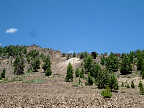
Bayhorse Mill From Bald Mountain Road
Route
There are a number of possibilities for climbing Bald Mountain. If you do not have a sturdy enough vehicle or just want to enjoy the extra 1500 feet of gain you can park at the bottom of the road and walk the entire distance. While the road is tough on vehicles it is a superb foot path and helps you gain elevation quickly and easily.East Ridge

East Ridge Road

East Ridge
Northeast Ridge
Refer to this trip report on Idahosummits.com.
Basin Direct

Bald Mountain Basin
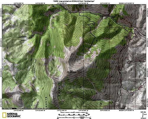
Map
Red Tape
Bald Mountain Road
Once again, this road is ONLY for 4WD and high clearance vehicles with enough power to pull you up steep grades. I made it up in a 4X4 Ford Ranger. This is a very committing road and is not recommended for the faint hearted. If you meet someone coming the opposite direction one of you will be backing up a long ways. I would also not recommend it for large trucks. The road is narrow enough that my Ranger barely fit and the hairpin turns required some three or more point turns that a larger vehicle would have trouble with.
Weather
The upper slopes of Bald Mountain are barren and treeless. It is not a place to be caught in a thunderstorm. Always watch for clouds building up and get off the mountain as fast as possible if you see an approaching storm.

When to Climb
This mountain is best climbed in the spring, summer, and fall when snow is not an issue. However, due to the presence of the road and the gentle nature of the upper ridges, a winter ascent with careful route finding would certainly be conceivable.Camping
There are two excellent camping facilities located nearby.Bayhorse Recreation Site
The Bayhorse Recreation Site is only a mile or so towards Challis on the Salmon River. It has picnic tables and toilet facilities. It costs $10 per night. BLM Bayhorse Recreation Site
Bayhorse Lake Campground
This campground is 4 miles past Bayhorse and is a very pleasant and beautiful area. It is located at a beautiful lake in the forest at 8500 ft. and seems to be off the beaten path as usage is very light. The toilet facilities are excellent and the area is green and shady. At this time there is no fee to camp! I would highly recommend this area.Bayhorse Lake Campground

Bayhorse Lake

Bayhorse Lake
External Links
Trip Report on Splattski.com: Bald MountainYankee Fork Ranger District Salmon-Challis National Forest.
More info about Bayhorse
Make sure to practice Leave No Trace
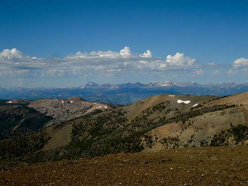
White Cloud View
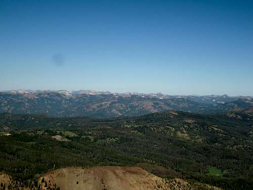
Salmon River Mountains View
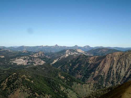
White Mountain/Twins View