
-
 18715 Hits
-
 81.18% Score
-
 13 Votes
|
|
Mountain/Rock |
|---|---|
|
|
35.13940°N / 83.5775°W |
|
|
Macon |
|
|
Hiking |
|
|
Spring, Summer, Fall, Winter |
|
|
5220 ft / 1591 m |
|
|
Overview
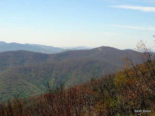
A great view of Siler Bald from Wesser Bald | 15 May 2013
Siler Bald is an amazing, wide-open perch from which to take in views of the surrounding North Carolina mountains. A top-100 North Carolina ranked peak with over 1,000 feet of vertical prominence and serving up amazing scenery, it’s a bit shocking that this peak is not better-known.
Rumor is that the Nantahala National Forest authorities now mow the bald to maintain the grassy opening and keep bushes and trees at bay. Regardless of the means, the result is broad big-sky views relatively rare in this region.
This peak is not to be confused with Silers Bald to the north, however according to this website both peaks are named after the same area family.
Siler Bald is easily accessed from AT trailheads, and makes a fine "no-brainer" side-trip for those already hoofin' it on the Appalachian Trail. The rewards for the short stroll to this open summit are more than worth the small effort to get there!
Rank: 89th highest mountain in North Carolina
Prominence: 1,080 feet
USGS Quad: Waya Bald
Planning Map: Nantahala National Forest| Bly Gap to Fontana Dam | North Carolina (The Appalachian Trail Conservancy)
Peak stats data source: Lists of John
Rank: 89th highest mountain in North Carolina
Prominence: 1,080 feet
USGS Quad: Waya Bald
Planning Map: Nantahala National Forest| Bly Gap to Fontana Dam | North Carolina (The Appalachian Trail Conservancy)
Peak stats data source: Lists of John
Summit Views
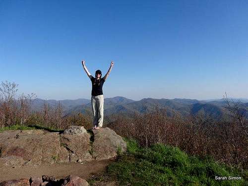
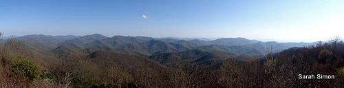 Great North Carolina views from the summit of Siler Bald | 15 May 2013
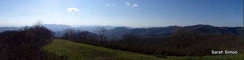 More fine Southern Appalachian views from the summit of Siler Bald
Getting There & Route Information
Looking up the slopes from the base of Siler Bald
Beginning our initial afternoon descent from near the summit
Looking down-slope beginning the descent from the summit
•From Siler Bald Shelter: 1.5 miles roundtrip
•From Wayah Gap: 4 miles roundtrip
•From Winding Stair Gap: 9 miles roundtrip
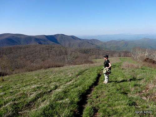
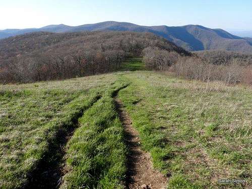
From any of these approaches, hike into a clearing below the bald. Ascend roughly 1/3 mile through the grass to the summit. Though a use path exists up the slope, the Forest Service requests that visitors spread out and walk off-trail through the grass to avoid beating a (worse) path through the vegetation.
Driving Directions to Trailheads
Wayah Gap:
From intersection of US Hwy 64 W and US Hwy 23/441, north of the town of Franklin, NC:
•Follow Hwy 64 westbound towards Murphy, NC for approximately 3.8 miles to Old Murphy Rd (SR 1448) on the right
•Drive down a hill briefly for less than 0.2 miles to Wayah Road (SR 1310) on left (Note Loafers Glory gas station at intersection)
•Continue on Wayah Rd. for 9.1 miles to FR (Forest Road) #69 on right (Wayah Gap)
Trailhead Coordinates
Latitude: 35.1534256
Longitude: -83.5804404
Winding Stair Gap:
From the town of Franklin, NC:
Follow US 64 10 miles westbound to Winding Stair Gap, notable by a big rock cut in mountain. Parking is on the left.
Trailhead Coordinates
Latitude: 35.120682
Longitude: -83.547218
Red Tape
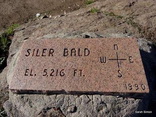
A nice directional plaque on the summit of Siler Bald | 15 May 2013
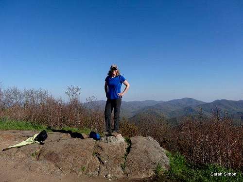
Me on Siler Bald summit
SP member shreddeb
1. Plan Ahead and Prepare
2. Travel and Camp on Durable Surfaces
3. Dispose of Waste Properly
4. Leave What You Find
5. Minimize Campfire Impacts
6. Respect Wildlife
Weather & Seasons
 Click for weather forecast |
Spring and Fall are considered by many the most pleasant time to visit the Southern Appalachians. Spring: In the Spring, daytime temperatures and warm and evenings are cool while the flowering shrubs are in bloom and the waterfalls are running. Water sources such as springs are most reliable this time of year. Fall: In the fall, the broadleaf deciduous trees put on a bright display of autumn color, though waterfalls may not be as impressive and springs and other water sources less reliable. The air is cooler and crisper and visibility should be prime for long-range views. Summer: in this part of the country can be oppressively hot and humid and even the higher elevation and ample tree cover will not keep the hiker from feeling overheated, sticky and dirty. High humidity and haze plus deep leaf cover mean limited long-range vistas, though it is in summer that the term “temperate rainforest” will have the most meaning to and be most appreciated by the visitor. Winter: in the South Appalachians can range from cool and damp to cold and severe with bouts of deep snow following major storms. In other words, while this range may be relatively low in elevation and southern in latitude, mountains are still mountains and can bring unpredictable and potentially dangerous weather. |
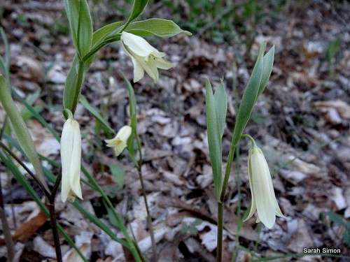 Nice yellow flowers on the slopes of Siler Bald | 15 May 2013 Nice yellow flowers on the slopes of Siler Bald | 15 May 2013 |
Camping
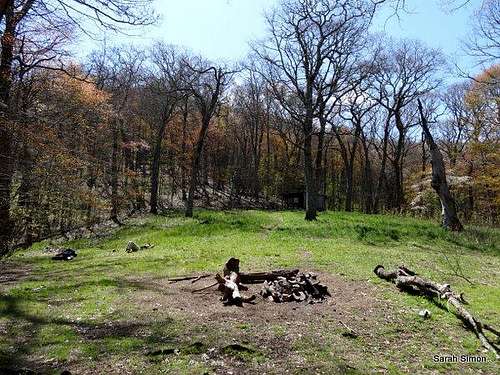
Looking up the hill at Siler Bald shelter from the tent camping area
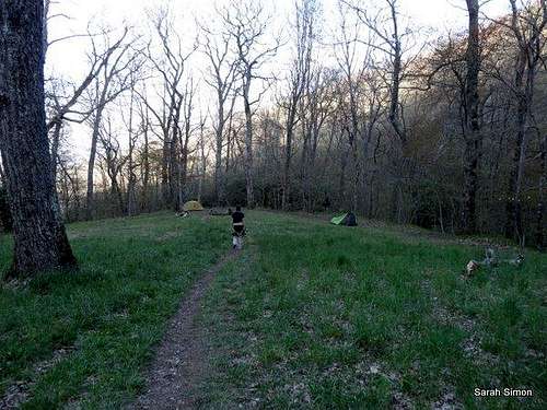
Tent camping near Siler Bald shelter
External Links & Related Information

Views south

Views east

Views west

Views north