
|
|
Mountain/Rock |
|---|---|
|
|
39.28784°N / 120.329°W |
|
|
Placer |
|
|
Hiking |
|
|
Spring, Summer, Fall, Winter |
|
|
8383 ft / 2555 m |
|
|
Overview
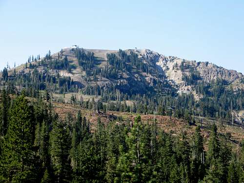
Mount Lincoln north face from the PCT
Mount Lincoln is an accessible peak near Donner Pass, to the north of Lake Tahoe. The summit is very frequently accessed during winter months as the main summit at the Sugar Bowl Ski Resort. A tram is on top of the mountain. It is less frequently accessed during summer months, but makes a great summer hike, if just wanting a short hike with fantastic views.
Mount Lincoln can be reached from the ski area itself during summer months if just going up the ski runs from Sugar Bowl Road. However, the more scenic, and standard route is to take the Pacific Crest Trail.
The views from the summit are excellent. The mountain is quite open, with great views appearing quickly once you start the hike. Part of the trail is in the forest, but with so many open spots, this merely becomes a welcome respite in the shade.
Mount Lincoln can often be combined with Donner Peak 8,019' or Mount Judah 8,243’.
Mount Lincoln is accessible for hikers starting usually in late May through late November or whenever ski season ends and begins, or whenever sufficient snow melts.
Getting There
There are two starting points for Mount Lincoln. For either, take I-80 West from Reno, or I-80 East from Sacramento, and exit at 180 for Donner Lake Road. Take Donner Lake Road down towards lake level and take a right on Donner Pass Road. Head a few short miles up a windy road, and you will be at Donner Pass.For the ski area route, continue past Donner Pass and turn left on Sugar Bowl Road. During summer it is simply a closed ski resort. So you can walk up the ski runs if you’d like.
For the Pacific Crest Trail, drive up to Donner Pass, and on the left side of the road is a parking area and a gravel road. Take it about 0.2 miles to the PCT trailhead.
Route
From Sugar Bowl Road, you can pretty much just walk up the ski slopes. Mount Lincoln is the highpoint of the ski area and has a tram on top. It is no more than 2 miles or so to the summit if hiking, and probably closer to 1 ½ miles via the shortest route. But you gain about 1,400’.From the Pacific Crest Trailhead, take the trail as it winds up a very rocky section, and eventually returns to forest. There are a couple turn-offs to Mount Judah, but if just doing Lincoln, stay on the PCT. After the 2nd turnoff to Mount Judah you stay in the forest, and then come to an open spot. Mount Lincoln is right ahead of you. You can head up the northeast side gaining about 400’ in less than 0.4 miles. Or continue another 1/3 mile on the PCT and head up a use trail on the southeast side of Mount Lincoln, which is less steep, but about the same distance. For a loop around the summit area, I recommend taking the northeast side up and descending via the southeast side back to the PCT. If you do that, the total round trip distance is about 7 miles. Elevation gain is about 1,450’.
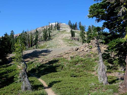
Northeast approach from the PCT
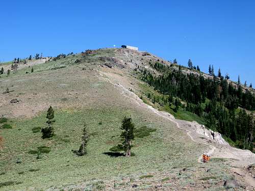
Southeast approach from the PCT