
|
|
Mountain/Rock |
|---|---|
|
|
48.27517°N / 121.47118°W |
|
|
Snohomish |
|
|
5678 ft / 1731 m |
|
|
Overview
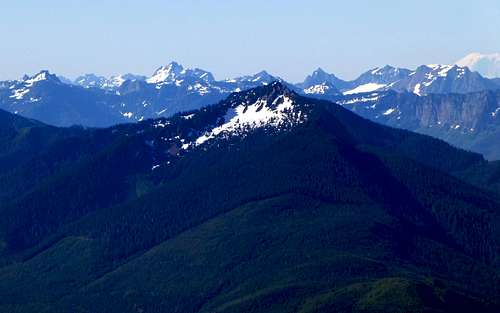
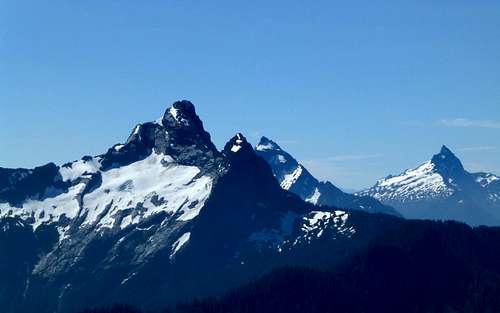
Prairie Mountain from Illabot Peaks
Getting There
Follow SR530 east until reaching the town of Darrington. Follow SR530 another 0.3 miles north from Darrington's main intersection, and turn right on Sauk Prairie Road. Follow Sauk Prairie Road 1.9 miles east, and turn right on FR24, a well defined gravel road. Follow FR24 8.0 miles, until reaching a major three-way intersection - turn left onto FR2430. Stay on the main road, crossing over Decline Creek after 2.5 miles. Continue on the main road, ignoring spurs, for another 3.1 miles past Decline Creek, where the road will abruptly become undriveable (N48 15.198 W121 29.236 Elev. 3300').Route
There will most likely be some temptation to continue following the old road bed to 4000', as shown on the USGS maps. This is, in fact, what I did on the way in, and I have the scratches to prove it. Were I to do it all over again, I would have gone straight east from the end of driveable road, until reaching the 4850' saddle between Point 5028 and Point 5260. If you insist on following the old road bed, follow the hogsback SE from the road end at 4000'. Continue to the top of Point 5260. The photo below looks north from Point 5260.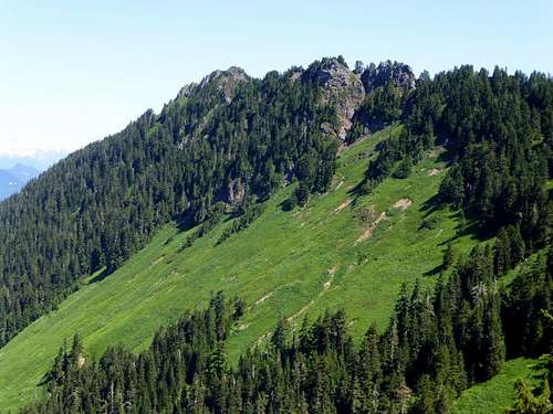
Prairie Mountain summit on the left, Point 5586 on the right. The temptation may be to scramble through the meadows on either side of the ridge, but it's much easier to stay near the ridge crest (Please, take my word for it!).
Follow the ridge crest north towards Point 5586. On the way in, I dropped a few hundred feet below the ridge to the east, thinking that travel along the ridge would be difficult. As it turns out, traversing the 30-40 degree meadow slopes was a much more difficult proposition. The photo below looks south, back towards Point 5260.
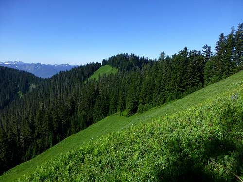
These meadows may look inviting for travel, but traversing the 30 to 40 degree slopes was an exercise in frustration. I followed the ridge crest on the way out, and had a much better traveling experience.
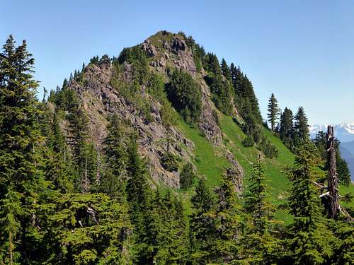
The scramble to the top goes basically up the center as seen in this photo - mostly class 2 with a couple class 3 moves.
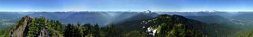
Prairie Mountain summit pano
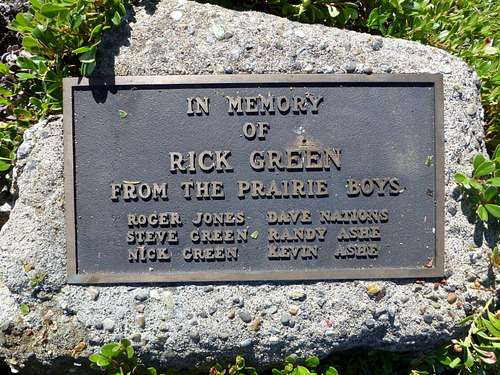
Plaque on summit
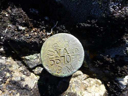
I'm not sure if I've ever seen one this small before - only about the size of a quarter.
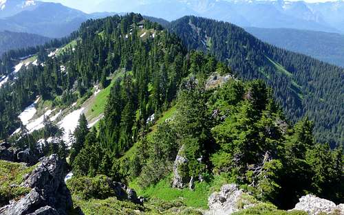
This view looks back at the south approach. Just left of center is Point 5586. Just right of center is Point 5260. The best route is up and over both points, deviating slightly east for any gendarmes. A game trail may be followed for a good portion of this route.
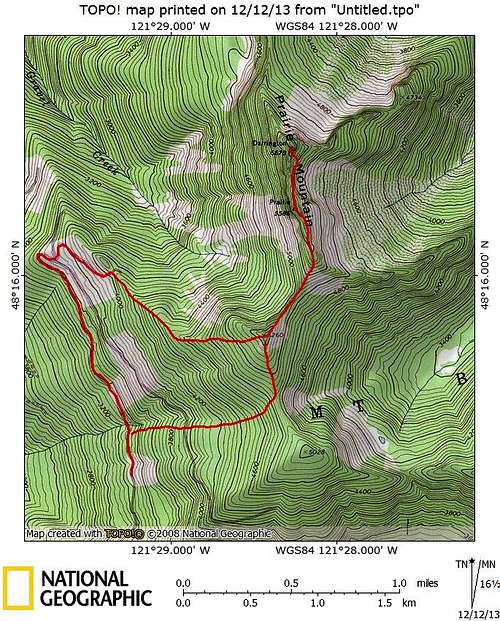
Prairie Mountain route map. Continuous line shows my route up the old road (nasty brush). Disconnected line shows what would probably be a much better alternative.