
|
|
Mountain/Rock |
|---|---|
|
|
44.33981°N / 70.93046°W |
|
|
Download GPX » View Route on Map |
|
|
Oxford |
|
|
Hiking |
|
|
Summer |
|
|
2850 ft / 869 m |
|
|
Overview
With spectacular views and low crowds, Caribou Mountain is a good hike for those who just want to get away.
Located at the far east end of The White Mountain National Forest, this area gets few visitors, and has some great hikes.
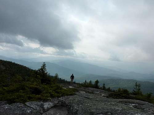
Caribou Mountain summit is at 2850 ft, and it has an elevation gain of 1990 feet. the top is pretty flat and has a lot of area above treeline for your leisure. ![looking to the clouds]()
The Caribou Muddy Brook loop trail is around 7 miles, and I recommend taking the Caribou trail for the accent because it is steeper with slippery rocks and brooks and waterfall crossings.
There are great views of Mount Washington to the west, Evans Notch to the south, and Grafton Notch to the north. Also, Kezar lake is in plain view.
Getting There
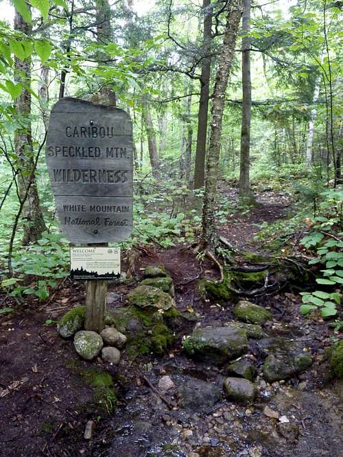
Take route 113 from Fryburg Maine to the trail head just before the Evans Brook crossing.The road is gated off in the winter, so only accessible by a mode of snow transportation. Or from the eastern trail head at the end of Bog Rd.
The trail head is good sized, so it can hold a good amount of vehicles.
Route
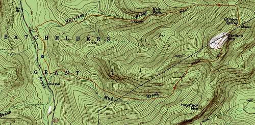
Caribou trail and Muddy brook loop from the west. This is the only loop that I have done, and when I do it again, I will take the Caribou trail for the accent, and Muddy brook to descend.Muddy Brook trail wasn't as muddy as I had expected. The trail is very gradual, and in my opinion a very easy climb with few slippery rocks.
Caribou trail on the other hand, gets steep in places and it crosses Morrison brook more than a few times. Most of the trail keeps a lonely hiker occupied with the sound of babbling water and the
curiosity that some local resident might not hear you approaching!
Either way you choose to go, you will be richly rewarded at treeline with nice views, and the awesome feeling of being there!
Click for a larger image
Bog rd to the east. http://www.fs.usda.gov/recarea/whitemountain/recreation/hiking/recarea/?recid=74427&actid=51
Red Tape
The White Mountain National Forest has rules for backpacking. you can check this link for them, and also any road closures ect. http://www.fs.usda.gov/recarea/whitemountain/recreation/hiking/recarea/?recid=74427&actid=51When to Climb
Year round, but Rt 113 is closed in the winter, so the only access is via Bog rd, Gilead, MECamping
Hastings Campground is about 2 miles north of the trail head, and Cold River and Basin campgrounds are to the south about 4 miles.Backpacking is permitted. you need to be 100 yards off the road in order to have a fire, and you can not camp above treeline except for in winter, and on top of 2' of snow. on the Caribou trail there
are plenty of places for frssh water on the way up, and you may choose to camp near one of the pools at the base of multiple cascading waterfalls on the way up.![100' water falls!]()
There were two very nice waterfalls on the Caribou trail. There is also a clearing just before
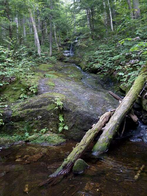
There were two very nice waterfalls on the Caribou trail.
treeline that would make a good tent site. Use caution because it looked like a well used game trail!