
|
|
Mountain/Rock |
|---|---|
|
|
48.19570°N / 121.5996°W |
|
|
Snohomish |
|
|
5840 ft / 1780 m |
|
|
Overview
Disclaimer: We did this scramble a few years ago, and I'm getting to be middle-aged. The information presented will be accurate to the best of my memory, but that memory is not as sharp as it used to be. If you have been up Jumbo recently, feel free to correct any errors I may have made.
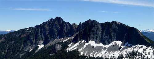
![Jumbo Mountain as seen from SR530]()
Jumbo Mountain as seen from SR530
Take SR530 east to the town of Darrington. Make the first available right hand turn after entering town (Fullerton Ave.). After four blocks, make another right hand turn onto Darrington Street. This road will turn into Squire Creek Road. Follow it for about three miles to the "new" trailhead for FS Trail #654 (N48 13.271 W121 37.523 Elev. 1180'). Old maps will show the road continuing for some distance past this point, however, the roadbed was destroyed by a huge landslide just a short distance from the parking location. Follow the trail/old roadbed for approximately 0.9 miles, where you will notice a rock cairn and survey tape on the left hand side of the road (N48 12.516 W121 37.723 Elev. 1460'). This will be the start of the Jumbo Mountain trail. It can be easy to miss - if you reach a prominent creek bed with a large, exposed culvert, you have gone about 200' too far. Do not be tempted to use this creek drainage to access the upper mountain. I have been informed that things will not go well for you if you go this way.
Getting There
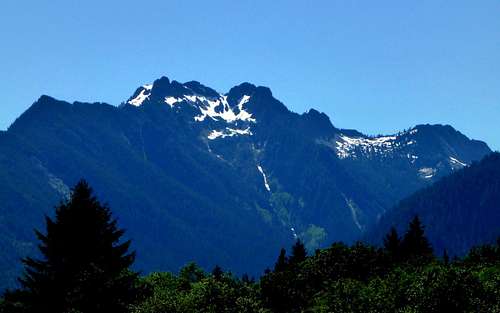
Jumbo Mountain as seen from SR530
Route
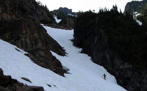
Poke around in the brush a little bit above the aforementioned cairn until finding the faint climber's path starting uphill. For some unknown reason, the first few hundred feet are poorly defined - after that, it will get a little better. This path does not goof around - it goes uphill, and it goes uphill quick. After 2000-2500' of elevation gain, the trail will fade out. At this point, you will have a well defined gully on your right. We chose to cross this gully directly, and start a near level traverse to the next gully over (as recommended by another climber we had spoken to).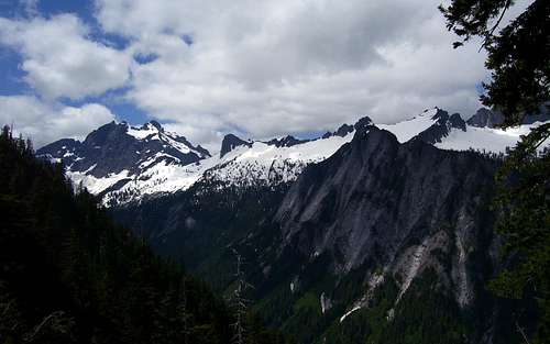
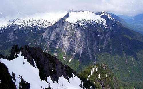
Three Fingers, Salish Peak, Ohio Peak, Buckeye Peak, and Squire Creek Wall as seen from the first gully crossing on Jumbo Mountain.
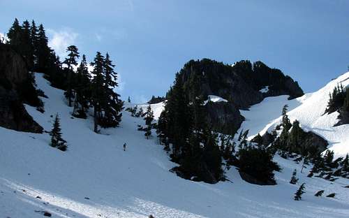
Upon reaching the second gully, we scrambled up it several hundred feet, until just below the cliff band near the top of Jumbo's north ridge. From here, we turned right out of the gully, and scrambled up to a small notch. From this point, we had the view as seen in the photo below.
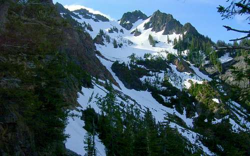
Jumbo Mountain as seen from the top of the second gully.
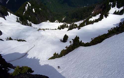
Make a near level traverse along the base of the cliff, until you find a good place to start up towards the summit. We chose the the short gully that is in the center of the picture above.
Starting up towards the summit of Jumbo Mountain after passing the cliff band.
Unfortunately, I forgot my instep crampons, and the snow was very hard and icy. I got to spend a few minutes perfecting my step cutting tecnique to make it up this slope. On the way down, we sidestepped to the south to bypass this section. Once on top of this section, the grade eased up a bit, and the next 500' were fairly easy. (BTW, these photos are from early July - most of this snow cover will be gone in late season.)
Jumbo Mountain at 5000'
The slope will once again get steep for the final few hundred feet to the summit block (BTW, the middle summit is the true summit). Once again, the snow was hard, and I found myself wishing for the crampons that were packed safely away at home. The photo below looks down at this slope from the summit.
Last steep snow scramble as seen from Jumbo Mountain summit
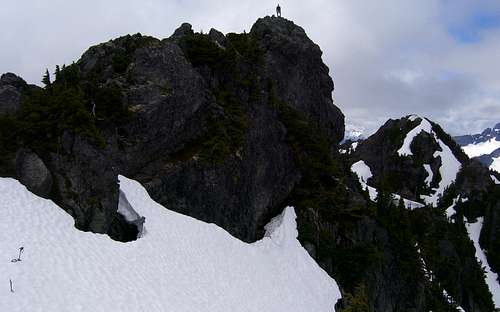
Jumbo Mountain summit block
Unfortunately, things got a bit cloudy as we summited, so I have no good summit pano. If anyone does have a good summit pano from Jumbo, please feel free to contribute to the cause. The following is a smattering of photos taken in different directions from the summit:
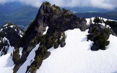
Jumbo Mountain North Summit from the Middle Summit
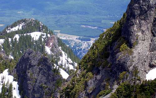
Darrington as seen from Jumbo Mountain Middle Summit
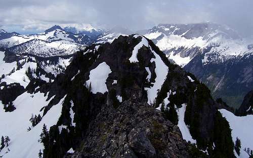
Jumbo Mountain South Summit form Middle Summit
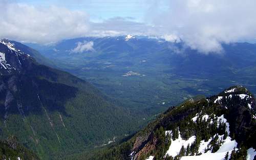
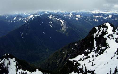
Round Mountain and North Fork Stillaguamish River Valley from Jumbo Mountain
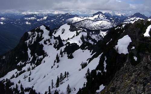
Squire Creek Wall from Jumbo Mountain
Clear Creek Valley from Jumbo Mountain
Liberty and Big Bear (right side of photo) from Jumbo Mountain
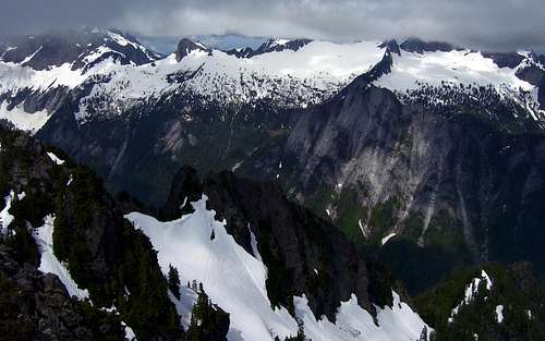
Ridge connecting Three Fingers and Whitehorse from Jumbo Mountain
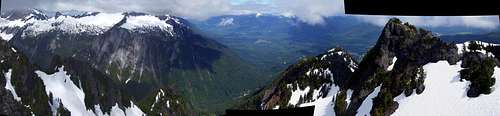
Jumbo Mountain view - Southwest through North. Sorry for the poor stitching - these images were not originally intended for a pano.
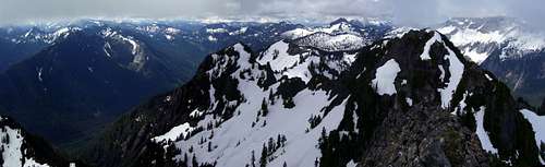
Jumbo Mountain view - East through Southwest
The photo below shows our approximate route on the mountain - albeit with a lot less snow.
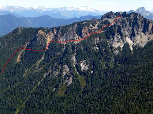
Jumbo Mountain from Salish Peak. Red line shows our route to the summit.