
|
|
Mountain/Rock |
|---|---|
|
|
65.62448°N / 17.06796°W |
|
|
Hiking |
|
|
Summer |
|
|
1719 ft / 524 m |
|
|
Overview
The Vindbelgjarfjall is a mountain in the North of Iceland (fjall = mountain in Icelandic), near the lake Mývatn. Mývatn (277m) means mosquito lake (hence the large population of little mosquito’s) and is popular by tourists because of the diversity and beautifulness of nature in the surrounding area. There are pseudocraters (Skútustaðir), explosion craters (Hverfell), lava formations (Dimmuborgir, Klasar), hot springs/sulphur fields (Hverir, also known as Námaskarð), large lava fields (Leirhnjúkur) and volcano’s (Krafla). Basically the Vindbelgjarfjall is also a volcano, although it is extinct for several thousand years. While above mentioned nature phenomena are situated east of Mývatn, the Vindbergjarfjall is situated on the western shore of the lake. Over there, it is the only elevation in the surrounding, providing an excellent summit view. An easy hike via a marked path brings you via the west face to the summit.
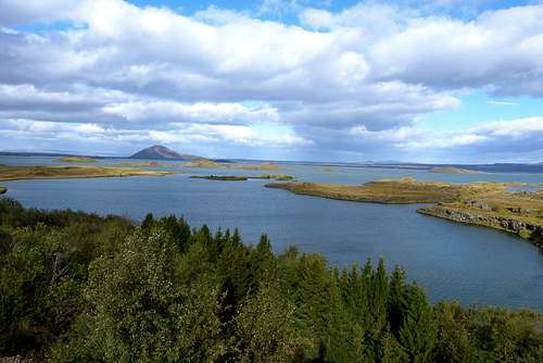
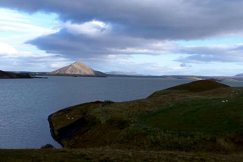
The Vindbelgjarfjall seen from Höfði on the other side of lake Mývatn
The Vindbelgjarfjall seen from Skútustaðir with the lake of Mývatn in the foreground
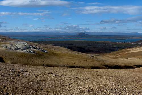
Western view from Námafjall, with left some of the hot sulphur springs of Námaskarð, in the center the Vindbelgjarfjall and at the right the village of Reykjahlíð where you can camp.
Getting There
On Iceland there is a main route around the island, which has road number 1.
From northwest: follow road number 1 from Akureyri to Mývatn, just before you reach the lake the road splits, turn left which is following the new variant of road 1. On older maps the road number could be 848. You are now driving on the western border of lake Mývatn, follow this road for approximately 3,5 - 4 km. Immediately after a curve to the right there is a sign with ‘Vindbelgur’ on it pointing to the left, where is a small parking lot.
From northeast: follow road number 1 from Egilsstaðir to Mývatn, in the village of Reykjahlið at Mývatn turn right towards Húsavik. A few kilometres ahead road 1 turns left, keep following it. You are now driving west of lake Mývatn and on your right hand you will see the Vindbelgjarfjall already. About 300m after the farm Vagnbrekka there is a sign with ‘Vindbelgur’ on it to a small parking lot at the right side of the road.
Start of the hiking trail to the Vindbelgjarfjall
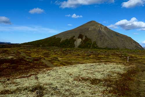
The extinct volcano Vindbelgjarfjall in the Mývatn region of north Iceland.
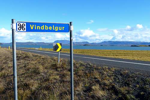
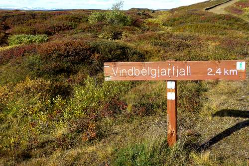
Sign along the road near parking lot for the hike to Vindbelgjarfjall
Route
From the parking lot there is a marked trail up to the mountain with a length of 2,4 km. It is marked with small yellow stumps. First part of the trail is relatively flat and runs through land covered with low shrubberies. At the base of the mountain there is a small lake, from there the trail goes partly steep and partly flat up the mountain. First through high shrubberies, later through rock fields. In the rock fields the path is steeper and becomes a real mountain hike but there are no technical difficulties and the route to the summit is not long.
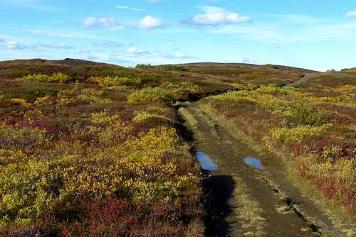
The first part of the Vindbelgjarfjall trail which is rather flat.
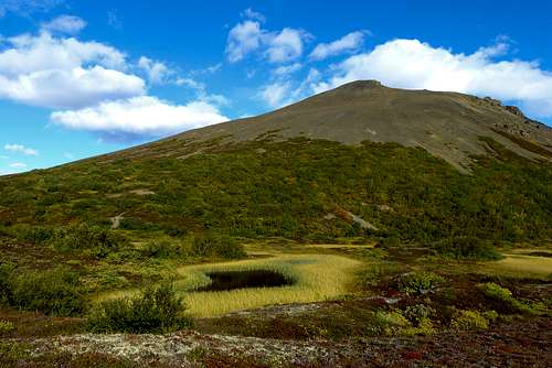
One of the many tiny lakes surrounding the Vindbelgjarfjall
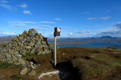
The summit of Vindbelgjarfjall with a NE view towards Mývatn
Red Tape/Camping
The area around Mývatn is protected and therefore wild camping is not allowed, near the village of Reykjahlið is a campground (~10km drive).
When to Climb
From June to September, depending on the weather conditions you can go somewhat earlier or later. Despite the hike is along the paved main road number 1, check also the road conditions on www.road.is before travelling.
Maps
Mál og Menning Sérkort 8, Akureyri – Mývatn – Dettifoss, 1:120.000, there is a detailed map (1:50.000) on the backside of Mývatn and Dettifoss areas. On this map there is a direct route via the south face to the summit drawn, this route is not present and surely not marked.