
-
 10347 Hits
-
 81.18% Score
-
 13 Votes
|
|
Mountain/Rock |
|---|---|
|
|
35.25140°N / 83.5673°W |
|
|
Macon |
|
|
Hiking |
|
|
Spring, Summer, Fall, Winter |
|
|
5100 ft / 1554 m |
|
|
Overview
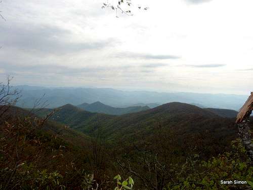
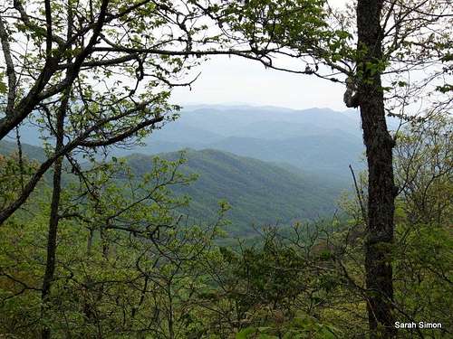
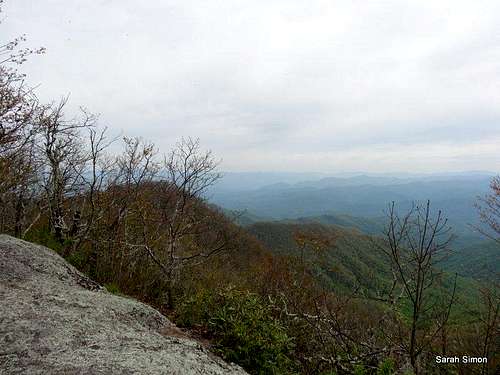
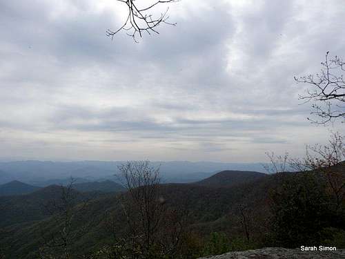
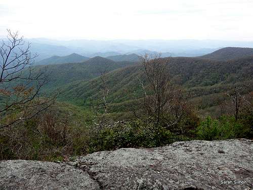
Views from the top of Rocky Bald
North Carolina Rank: Unranked
Prominence: 200 feet
USGS Quad: Wesser
Planning Map: Nantahala National Forest | Bly Gap to Fontana Dam | North Carolina (The Appalachian Trail Conservancy)
Peak stats data source: Lists of John
Driving Directions and Route Overview
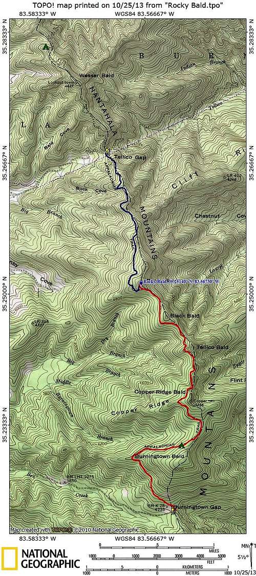
Route options to the summit of Rocky Bald | 16 May 2013
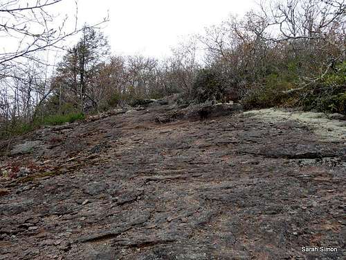
Blazed trail over bare rock
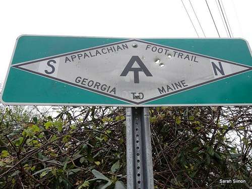
AT at Tellico Gap
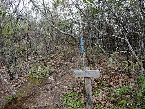
Trail spur
From Burningtown Gap (Rt 1397) – Longer and more rolling approach
One-Way Distance: 3.25
Net Elevation Gain: 1260 feet
Driving Directions: This trailhead can only be accessed from State Road 1310 (Wayah Road), which runs between US64 4 miles West of Franklin, and US19 at the Nantahala River rafting put-in location. Take 1310 to the sign for Burningtown Gap, and follow the signs. The road starts as macadam, turns to gravel, then dirt, then at the end is just a track (sometimes passable by car, sometimes only by 4-wheel, high clearance vehicle). The road ends at Burningtown Gap, and AT blazes are visible at both ends of the old orchard clearing. AT North and South match the compass here.
From Tellico Gap (Rt 1365) – Shorter, more direct approach
One-Way Distance: 1.75 miles
Net Elevation Gain: 1260 feet
Driving Directions: Reached from SR1310 (see above) or from US28 that runs from Franklin to US19 near Bryson City. The road in from 1310 (Otter Creek Rd.) is a good dirt road, while the road in from US28 (Tellico Rd.) starts fine, but is a very steep, rough road before reaching the Gap. From 1310, turn at sign for Tellico Gap, and follow Otter Creek road to Gap, which is top of climb, and has parking areas bounded by railroad-tie walls.
From 28, 11.9 miles North of Franklin, turn left across white concrete bridge (Tellico Road). Follow Tellico Rd., as it goes from pavement to dirt to steep & winding, to top of gap and parking. Again, AT North and South match compass directions.
Red Tape
1. Plan Ahead and Prepare
2. Travel and Camp on Durable Surfaces
3. Dispose of Waste Properly
4. Leave What You Find
5. Minimize Campfire Impacts
6. Respect Wildlife
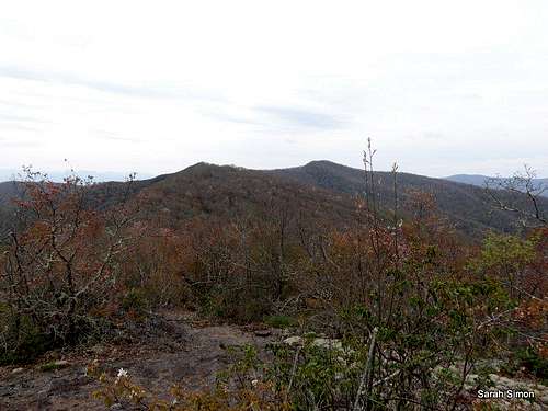
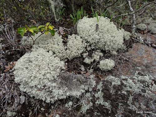
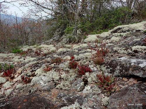
| LOVELY VIEWS FROM TOP | ||||
 |  |  |  |  |
Camping
About 2 miles to the south
GPS Coordinates: 35.23109,-83.55996
Elevation: 4,920 feet
Capacity: Sleeps 6
A lot of nice tent camping with pleasant ridgeline views above the shelter.
Wesser Bald Shelter
About 4 miles to the north
GPS Coordinates: 35.28248,-83.58211
Elevation: 4115 feet
Capacity: Sleeps 8
Weather and Seasons
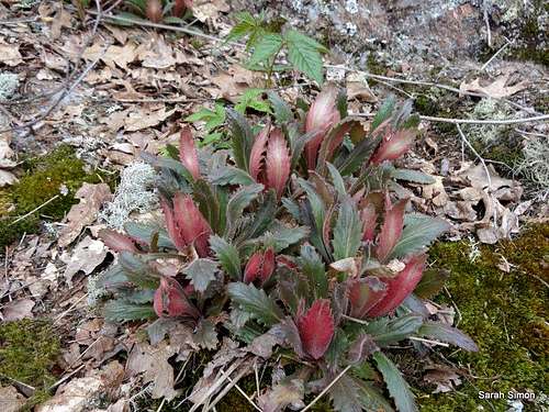
 Click for weather forecast | Spring and Fall are considered by many the most pleasant time to visit the Southern Appalachians. Spring: In the Spring, daytime temperatures and warm and evenings are cool while the flowering shrubs are in bloom and the waterfalls are running. Water sources such as springs are most reliable this time of year. Fall: In the fall, the broadleaf deciduous trees put on a bright display of autumn color, though waterfalls may not be as impressive and springs and other water sources less reliable. The air is cooler and crisper and visibility should be prime for long-range views. Summer: in this part of the country can be oppressively hot and humid and even the higher elevation and ample tree cover will not keep the hiker from feeling overheated, sticky and dirty. High humidity and haze plus deep leaf cover mean limited long-range vistas, though it is in summer that the term “temperate rainforest” will have the most meaning to and be most appreciated by the visitor. Winter: in the South Appalachians can range from cool and damp to cold and severe with bouts of deep snow following major storms. In other words, while this range may be relatively low in elevation and southern in latitude, mountains are still mountains and can bring unpredictable and potentially dangerous weather. |  Lady Slipper near the NC-GA border |
External Links and Related Information
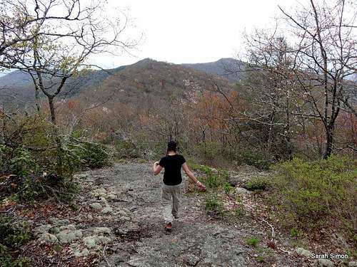
Descending Rocky Bald back toward the AT