
-
 9419 Hits
-
 83.75% Score
-
 18 Votes
|
|
Mountain/Rock |
|---|---|
|
|
37.84250°N / 122.53°W |
|
|
Marin |
|
|
Hiking |
|
|
Spring, Summer, Fall, Winter |
|
|
970 ft / 296 m |
|
|
Overview
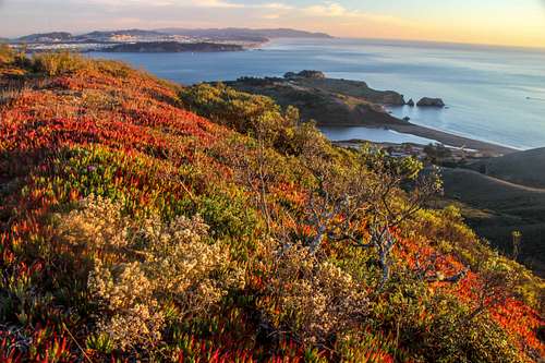
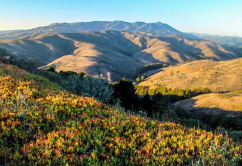
Golden Gate from Wolf Ridge
A 4.5 mile round trip moderate hike starts out by Rodeo Lagoon and circles the hill with a brief diversion to the top and back on down above the coast to the Lagoon again.
There are outstanding views of the Golden Gate Channel and past Ocean Beach in SF as far as Montara Mountain as well as the Rodeo Lagoon below. To the north Mt. Tamalpais rules the horizon beyond the headlands.
Getting There
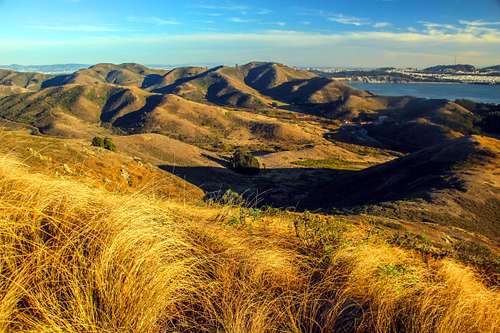
Main Headlands hills from Wolf Ridge
Turn left on Bunker Rd. (at the brown visitor center sign).
Drive through the one way tunnel approximately 2.5 miles.
Park on the right next to the buildin across the road from the Lagoon.
From North Bay:Take 101 south through the Waldo Tunnel.
Take the last Sausalito exit right before the Golden Gate Bridge.
Go right at end of exit ramp and pass under 101.
At the stop sign go straight onto Alexander Ave.
Turn left on Bunker Hill Rd. follow the rest of the directions highlighted above.
From the East Bay:Take 580 west to the Richmond/San Rafael Bridge.
Take 2nd exit after the bridge.
go through Larkspur and get on 101 south.
Follow the rest of the directions from the North Bay.
Map of the Headlands with trails.
Click on the link and go to the map and click again.
![Miwok Trail in Gerbode Valley]()
Miwok Trail start of hike in Gerbode Valley From the trailhead parking take the Miwok Trail which starts out in Gerbode Valley and climbs counterclockwise up to the Wolf Ridge Trail at 1.5 miles. Go left on the Wolf Ridge Trail .7 miles and take a sharp left up the fenced corridor and through the gate with the latch to the summit area.
Continue on back down on the Wolf Ridge Trail which becomes the Coastal Trail and follow it counterclockwise back to the trailhead parking at another 2.3 miles.
Route
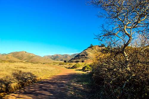
Miwok Trail start of hike in Gerbode Valley
Continue on back down on the Wolf Ridge Trail which becomes the Coastal Trail and follow it counterclockwise back to the trailhead parking at another 2.3 miles.
Of course you can do the route in reverse but the ocean and Golden Gate views are more enjoyable coming down.
Red Tape
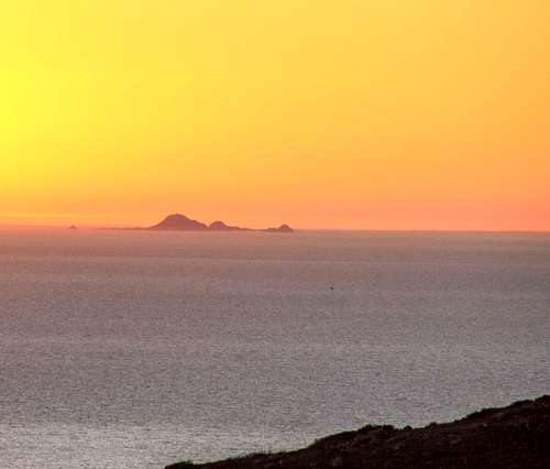
Farallon Islands from the Coastal Trail
Please observe off limits natural habitat areas.
The Visitor Center is open daily from 9 am to 4:30 except Christmas and Thanksgiving.
When to Climb
Mt. Tam from Wolf Ridge
Camping
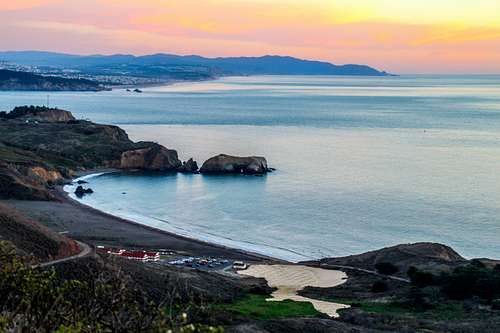
Rodeo Beach at dusk from the Coastal Trail