
-
 20495 Hits
-
 85.52% Score
-
 21 Votes
|
|
Mountain/Rock |
|---|---|
|
|
47.68386°N / 120.93276°W |
|
|
Chelan |
|
|
Hiking, Scrambling |
|
|
7993 ft / 2436 m |
|
|
Overview
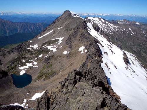
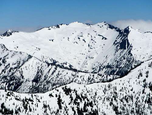
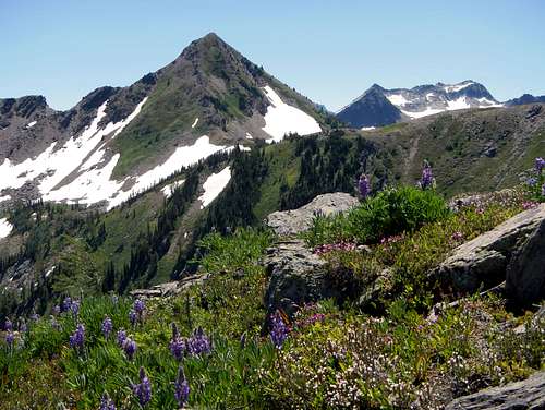
Big Chiwaukum seen from the northeast peak
 The south face seen from Ladies Peak | 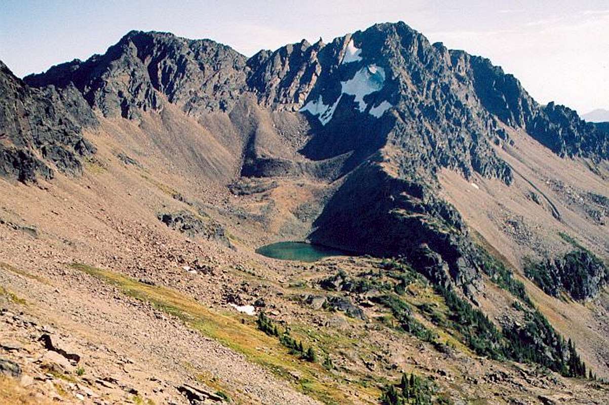 The north face of Snowgrass Mountain |
There are two main ways to access the peak. The Whitepine Creek approach can be taken to access the south ridge at some point north of Ladies Peak and involves some scrambling along the ridge. Whitepine Creek is the best choice if you wish to do Snowgrass in combination with Big Chiwaukum. Icicle Creek and Frosty Pass is another option. But the standard route begins on the Chatter Creek trail and is class 2. See the route section for more information. Snowgrass Mountain sees fewer ascents compared to other Leavenworth area peaks. The reason for this is that it is isolated and there is no trail to the summit. Also it lacks substantial prominence. From Ladies Pass to the summit and back requires roughly 3.5 miles of traversing across loose scree and talus along with a varying amount of snow depending on the season. As of July 2013 there was a brass Mountaineers cannister style register.
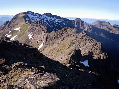
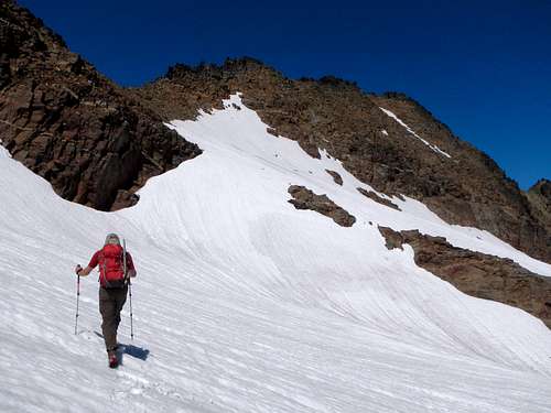
Scrambling above Grace Lakes to the northeast peak
 The Southeast Face | 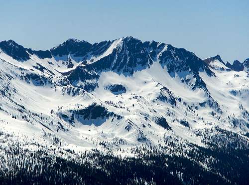 The Northwest Face |
Chatter Creek Route
From the Chatter Creek trailhead follow the trail through forest to 4370 feet. Cross the creek and continue along the trail on the east side of the creek. Break out of the trees at 5000 feet and you will have a view of the east face of Grindstone Mountain. Continue through meadows and then brushy slopes towards the pass at 6660 feet, northeast of Grindstone Mountain.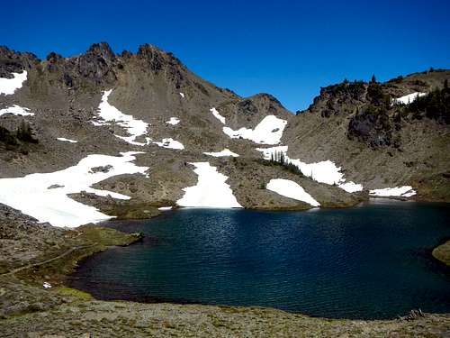
Lake Edna
Just before the pass, at 6200 feet, the trail passes near Chatter creek and crosses some rocky slabs. Be careful not to lose the sight of the route here and if in doubt, head straight uphill until the trail is visible again. When you reach the pass at 6660 feet you will have a view of Big Jim Mountain to the northeast and the Index Creek drainage down below.
![Ladies Snowgrass Panorama]()
Ladies Pass, Ladies Peak and Snowgrass Mountain
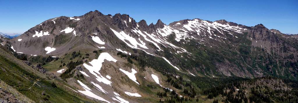
Ladies Pass, Ladies Peak and Snowgrass Mountain
Follow the trail down 540 feet to a junction at 6140 feet and turn left onto the Icicle Ridge trail. You will have to regain this 540 feet on the trek out. Snow and tarns linger in this area late into the summer. Continue east on the trail and gain another 600 vertical feet to reach Lake Edna with plentiful camping spots.
![Cape Horn and Flowers]()
Cape Horn and Grindstone Mountain
![The Northeast Peak]()
Approaching the northeast peak
![Craggy Ridge]()
Rugged terrain near the top of the northeast peak
![The Northeast Summit]()
On the summit of the northeast peak![Grindstone Mountain North Face]()
Grindstone Mountain as viewed from the vicinity of Ladies Pass
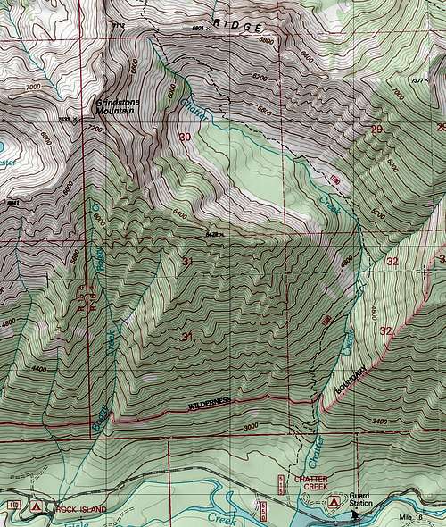 Map 1 |  Map 2 | 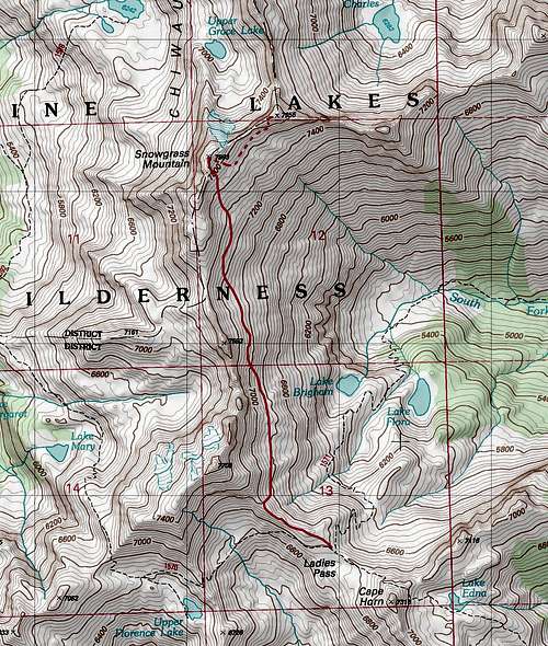 Map 3 |
Follow the trail beyond Lake Edna through talus to another pass located at 7000 feet on the northeast shoulder of Cape Horn. From here you will have your first view of Ladies Peak as well as Snowgrass Mountain. Take a note of the two distinct summits. From this vantage the left one is the one you want. Continue beyond the pass and down to Ladies Pass where you will come to another trail junction and an ancient sign.
Cape Horn and Grindstone Mountain
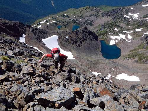
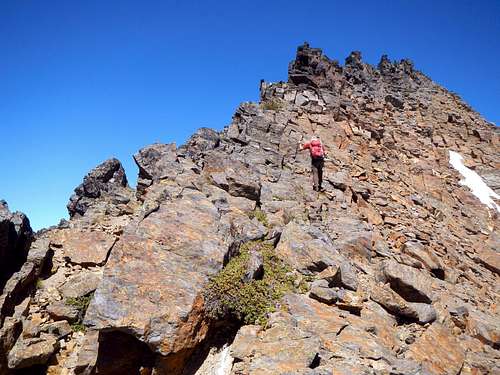
Continue beyond the junction leave the trail and follow the southeast ridge of Ladies Peak (Point 7708 on maps) for two tenths of a mile to elevation 7720 feet and then drop 100 feet over the north side to access the broad slope which is the east face of Snowgrass. Once you have dropped down, the slope ahead makes for easy travel, but getting to it from the ridge of Ladies is the crux of the trip (class 2). It's steep and perhaps a challenge for those who don't like scree.
Approaching the northeast peak
It's further than it looks from Ladies Pass to the summit, roughly 1.8 miles. The traverse goes across lots of talus and some scree with a few bands of vegetation for good measure. It's advantageous to do the climb in June or July so as to avoid some of the loose talus when it is covered with snow. Do not linger below the north ridge of Ladies Peak for rockfall is a danger there. From the beginning of the traverse to the summit there is a gain of 1200 feet.
Rugged terrain near the top of the northeast peak
For those who also wish to continue from the true summit to the craggy northeast peak, descend a few hundred feet and traverse for a half mile along the southeast slope to a point below the south face. Climb blocky 3rd class rock with some exposure on the south face to reach the crest of the ridge, then find a talus ramp on the north face and follow it east. Just below the northeast peak, scramble back to the crest of the ridge and scramble a short distance to the summit.
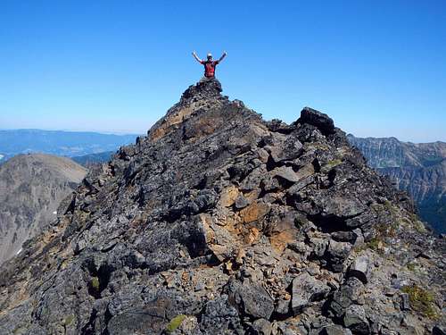
On the summit of the northeast peak
Getting There / Driving Directions
From the town of Leavenworth on Highway 2, take Icicle Creek road 15 miles to the Chatter Creek trailhead located on the right (north) side of the road.Video Trip Report
Red Tape / Camping
A northwest Forest pass required to park at the Chatter Creek trailhead. DO NOT camp on the shore of Lake Edna. Regulations require require a distance of at least 500 feet to reduce soil erosion. Also remember to fill out the free Alpine Lakes Wilderness permit at the trailhead and carry it with you.External Trip Reports
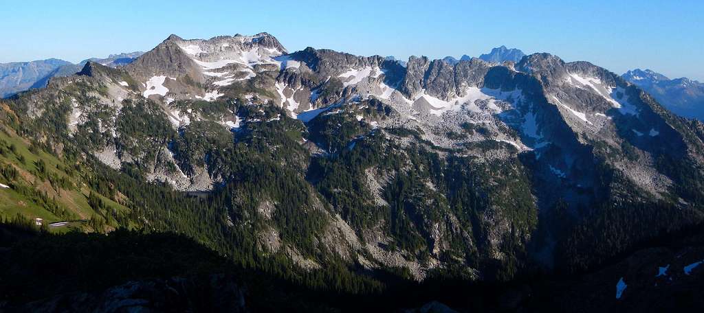
Grindstone Mountain as viewed from the vicinity of Ladies Pass
- July 2013 trip report by Bryan
- July 2010 trip report by Opus
- September 2006 trip report by Justus
- September 2006 trip report by Randy
- August 2006 trip report by Wenatchee Outdoors