
|
|
Mountain/Rock |
|---|---|
|
|
40.24440°N / 115.1395°W |
|
|
Elko |
|
|
Hiking |
|
|
Spring, Summer, Fall, Winter |
|
|
9249 ft / 2819 m |
|
|
Overview
High Bald
It is also wild horse country supreme. We saw a lot of wild horses on this one and they seemed to resent our intrustion. I tried to count the number of horses and I quit after seeing over 100 in many scattered small herds. If you want to see wild horses and a lot of them, this is the place.
High Bald is located in the area east of the Humboldt Mountains and south of Wells. It is a small range but the main attraction for peakbaggers is that this peak has over 2500 feet of prominence, placing it at #98 in the top 100.
To get to this one, you need to drive a lot of miles of dirt roads, and be aware that you probably won't see anyone else during your visit.
Getting There
I would suggest that you have a copy of the Nevada Benchmark map book and do your homework in determining waypoints that will help you. Thanks to Ken Jones for the following:"The drive is the crux of this one. Sorry, I did not record mileages but I can describe the driving route as follows:
Get yourself to the intersection of county roads 783 and 784 in Butte Valley, right by Quilici Spring. There are several ways to do this - you could come in via Cherry Creek and drive north on CR 21, west on BLM 4015, and north on county 784. Or you could leave US 93 on county 783 ("Butte Valley Road") and follow it to the intersection. There are many other ways to get here, and they vary in quality of road and length of drive. But you can reach this point on good gravel roads.
Just north of the intersection (<100 yards) a lesser road heads west towards Medicine Spring. There was a BLM sign on the ground at this point when we visited. Follow this road (high clearance) as it winds to the SW quarter of section 18. Go south and follow the road toward Mud Spring (decent road to here) and beyond (much rougher; we used 4WD). Keep left at the junction marked 2104 meters on the topo and continue as far as you are comfortable. We went beyond the end of the mapped road and found a very nice camping spot on the ridge where the GPS track begins."
See Ken's GPS track for additional aid. It can be found HERE.
 Our car camp at 7825' Our car camp at 7825' |  The route up The route up |  Ken heads up Ken heads up |
Route
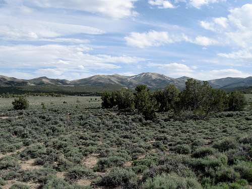
The route is obvious from where we parked at the 7800 foot elevation. It is not difficult, ranging from just class 1 or 2, all the way to the summit on this gentle sloped mountain. With an elevation gain of not quite 1500 feet in 1.5 miles, it is an easy hike if you are able to drive as far up the mountain as we were able to. Plan to spend some time at the summit and enjoy the expansive views, particularly to the west where the snowcapped Humboldt mountains vie for your attention.So technically, its just a walk in the park so to speak and as mentioned earlier, the hard part is the getting to the trailhead.
 Wild Horses checking us out Wild Horses checking us out |  On the way up On the way up |  Dennis & I on the summit Dennis & I on the summit |
Red Tape
This is on BLM land and other than one little section of Indian reservation land that the road passes through, nothing is problematic. For more information: Click hereWells Field Office
Bryan Fuell, Field Manager
3900 E. Idaho Street
Elko, NV 89801
Phone: 775-753-0200
Fax: 775-753-0385
Office hours: 7:30 am-4:30 pm, M-F
 The Benchmark The Benchmark |  Register page Register page |  Ken & I on the summit Ken & I on the summit |
When to Climb
With the gentle nature of this mountain range, it is probable that you could climb it in just about any month of the season. One stopper would be rain. It could turn the roads back there into impassable situations so avoid traveling in this part of Nevada during or shortly after a rain storm. Check the forecast so you don't get caught by a storm and have to sit it out for a day or two while the roads dry out.  Looking south Looking south |  Looking NE Looking NE |  Looking West Looking West |
Wells Nevada weather

Click for weather forecast

Click for weather forecast
Camping
There are no campgrounds in this area of Nevada and yet it is easy to find places to camp. We car camped at the trail head (end of the jeep road)and for those who need accomodations, either Ely or Wells would be able to provide you with motels.On BLM land, you can camp just about anywhere. However, it is best to choose places where others have camped before you and always practice the "leave no trace" ethics.
 North North |  Heading down Heading down |  Close to our vehicles. Close to our vehicles. |
Summit Register
The summit register was placed by Gordon MacLeod and Barbara Lilley in late June of 1997. The next visitor to sign it was none other than John Vitz in June of 2003, six years later. Then a Michael Brago from Ely Nevada signed in 2007 later and in 2012, Greg Jagielski and Kadee Smith from SLC signed the register. Ken Jones, Dennis Poulin and I were the next to sign it in 2013.Very few make it to this interesting area's summit so in 16 years, there have only been 9 of us. Another lonely Nevada summit. So, if you find yourself climbing this mountain someday, please sign my summitpost register to the left and which way you climbed it. We did it from the north, Brago did it from the east and Vitz climbed it from the south.


Update: Since our visit in 2013, there were two parties that visited this one in 2014. Richard Carey, Adam Helman and Bob Packard followed by a December ascent by Kelly and Terry Lister. That ascent shows that often some of these really isolated Nevada peaks can be visited even as late as December. So far in 2015, three more have made the effort to get this one, Andy Martin, Mark Nichols and a month later, Bob Sumner.
 Pic taken by Terry and Kelly in December
 Disclaimer
Make certain that you have plenty of gas (gas up in Wells or Ely) and are self sufficient. A good spare is recommended and it is best to let someone know where you are heading as cell coverage is spotty or non existant in this part of Nevada. Ideally, it is nice to have at least two vehicles as you travel these lonely roads. In the time we were out there over the Memorial day weekend, we did not see another car once we left pavement. No one else. There is a small indian reservation with a couple dwellings near Quillici Spring but that was all the "civilization" we saw in our visit. Take time to study maps and acquaint yourself with the area and hopefully this Summitpost page will give you a feel for the area but is only for information purposes and can offer you no guarantee of success. Plan accordingly.As road conditions can change and hiking or traveling in this type of country can be inherently dangerous, the above information is provided only as a courtesy. You accept all risk and responsibility for your activities in this area and I recommend that you let others know of your plans and where you will be hiking/climbing prior to heading to this area. Be self sufficient and carry plenty of food, water and shelter in the event of a breakdown. Good quality tires are a necessity on the rough and rocky roads you will encounter as is a vehicle in good condition. Having said all that, have a good trip and please let the author of this page know of changes that you encounter.