
|
|
Mountain/Rock |
|---|---|
|
|
48.44976°N / 121.81347°W |
|
|
Skagit |
|
|
5100 ft / 1554 m |
|
|
Overview
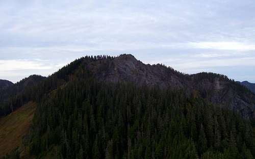
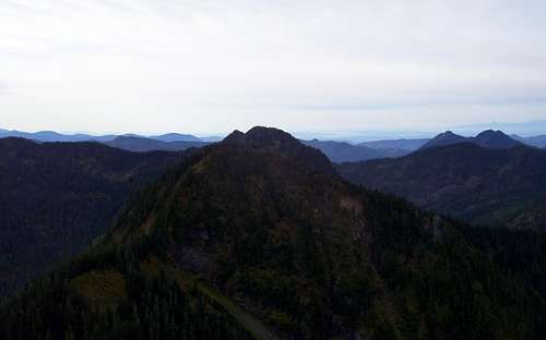
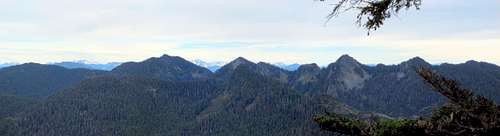
Big Gee from Point 4600+ (one mile east)
Despite the fact that Big Gee is the fourth most prominent peak in Skagit County (a whopping 3160' of prominence), it receives very little attention from hikers and scramblers in the area. This is most likely due to the fact that there is a well-defined trail leading to Gee Point, a high point located 1.5 miles to the south. For most hikers, the view from Gee Point is perfectly adequate, leaving Big Gee as the domain of obsessive-compulsive peakbagger types. It is tempting to think that one would be able to connect to Big Gee via the ridge from Gee Point, but steep terrain makes an approach from the northeast more appealing. Gee Point was once a lookout site for the USFS. A small cabin was built in 1930, followed by a more conventional lookout in 1934 - this was abandoned in 1964.
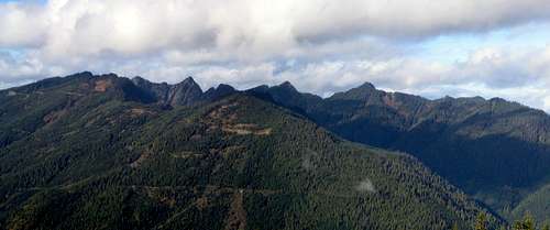
"The Gees" from "Anxious Groom Mountain" - five miles to the southeast. L to R - Point 4880+, Gee Point, Gee Peak, Golly Peak (center), Big Gee, Point 4600+.
Disclaimer: My scramble up Big Gee was done several years ago, before I started contributing to Summitpost. My apologies in advance if the photos and route details are a little sparse. The information presented will be accurate to the best of my failing memory. Please feel free to add photos and comments as necessary. Additionally, I will gladly give up ownership of Big Gee and/or Gee Point if someone else desires to build pages for them.
Getting There
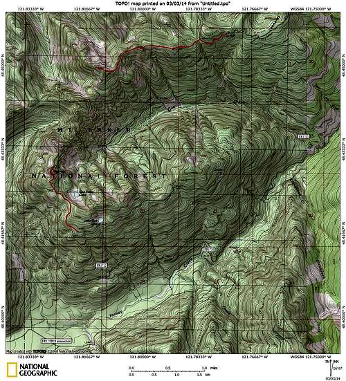
Big Gee/Gee Point route map
FR1705 (for Big Gee) starts 5.4 miles northeast of the intersection of FR17 and FR18. According to my old notes, I followed FR1705 7.2 miles to an elevation of 4100' (I can't remember if I stopped here because of road condition, windfall, etc.). The area where I parked is marked with a quarry on the USGS map.
Note: I have been advised that the condition of FR1705 has deteriorated rapidly in the last few years. Expect a number of water bars, and limited availability of turn-around spots. A high-clearance vehicle (and preferably 4wd) is recommended.
FR1720 (for Gee Point) starts 2.9 miles northeast of the intersection of FR17 and FR18. Follow FR 1720 2.1 miles, then stay right on FR1722. Follow FR1722 5.4 miles to the Gee Point trailhead. The Gee Point trail was at one time FS Trail #612. I'm having a difficult time locating it on the USFS web site, which leads me to believe it may not be 'officially' in service.
Route
For Big Gee, walk the undriveable portion of FR1705, until at a 4050' saddle just east of Point 4600+. From here, plunge into the woods at whatever point looks best for you, and scramble to the top of Point 4600+. There will be a little bit of low-exposure class 3 to get to the top of this point, but it is better to go over the top than going around. From here, you will have a good view of your objective, one mile to the west (actually, this point has surprisingly good views in all directions).Big Gee from Point 4600+ (one mile east)
For the final scramble to the summit, simply follow the ridge crest, staying to the left (south) side of the ridge in the exposed areas. Total distance to the summit will be 1.5 to 2.0 miles, depending on where you park.
Note: After creating this page, I found this Summitpost page, which has a trip report from Klenke describing a 2004 ascent of Big Gee.
Special thanks to Redwic for the following comments, which make up for the gaps in my memory:
1. There are multiple pinnacles along the ridgetop. At the final pinnacle it might be best to drop down off the north side approximately 50'-60' to bypass below cliffs before heading back up to the ridge for the final summit ascent. Of course, people have done this route using different variations, depending on conditions, experience, and comfort level.
2. Big Gee should never be attempted when wet. There are a lot of steep, exposed areas along the ridgetop which would be very dangerous when wet.
2. Big Gee should never be attempted when wet. There are a lot of steep, exposed areas along the ridgetop which would be very dangerous when wet.
Exposure near summit of Big Gee
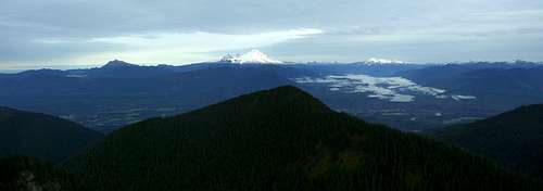
North pano from Big Gee
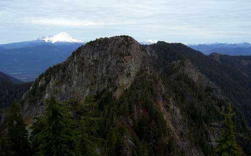
Big Gee south view. Gee Point is the smaller of the two points just left of center. Big Deer and Little Deer are on the right side of the photo.
Looking north from Gee Point. Mount Baker and Mount Shuksan in the distance. Big Gee right of center just to the right of Shuksan.
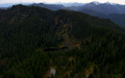
Looking southeast from Gee Point. The summit trail follows the ridge seen to the right of Gee Point Lake.
Here is an amazing sunrise photo on Gee Point taken by beaudaddy85 (used with permission):
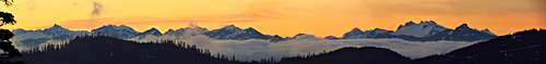
North Cascades Pano (View Fullsize)
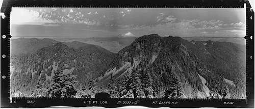
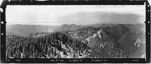
Gee Point N view - 8/3/1936
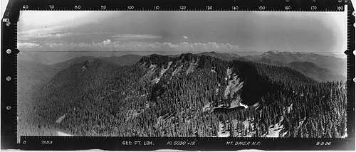
Gee Point SE view - 8/3/1936
Gee Point SW view - 8/3/1936