
|
|
Mountain/Rock |
|---|---|
|
|
38.54140°N / 115.4717°W |
|
|
Nye |
|
|
Hiking |
|
|
Spring, Summer, Fall |
|
|
9561 ft / 2914 m |
|
|
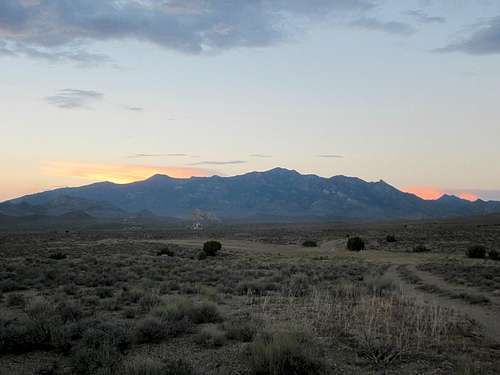
Morning hits the Grant Range
Overview
Blue Eagle Mountain is a huge mountain as seen from US 6 as it heads between Ely and Tonopah. It belongs to the Grant range with Troy Peak to the west being the highest member of the range and the summit of Blue Eagle is marked with a benchmark that is marked as "Grant", not Blue Eagle. The name of the mountain however comes from what is known as the Blue Eagle ranching district and not after an eagle that was found with an unusual coloring.This mountain is sought after for its prominence, as with close to 2300' of prominence places it as the 125th most prominent mountain in the state of Nevada. However, as is often the case at this moment of time, this is a seldom climbed mountain. We found ourselves being the first peakbaggers to sign the register in almost 11 years. Yikes, talk about isolation.
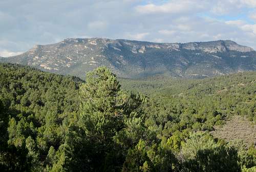
Blue Eagle Mountain has a different look from the east side
Getting There
From Ely or Tonopah, find your way to the small town (almost a ghost town) of Currant. There is a good dirt road that heads south out of town toward Box Canyon and Red Mountain and here is a few comments from Dennis regarding our visit:"Dean and I accessed Blue Eagle from the east. We turned off of Hwy 6 in Currant and followed a gravel road into Box Canyon. This is a long drive of 25 miles on roads that turn to goo when wet. We used 4WD a few times in the muddy sections. We drove all the way past Andrew Spring and Log Spring to Tank Summit. Tank Summit was our trailhead."
I recommend the use of the Benchmark mapbook for Nevada and topo's for locating the roads. Here are some of the waypoints that worked for Dennis and I.
US 6 turn off in Currant and head SW toward Red Mountain. Drive past Red Mountain to a turn off onto a lesser road after 13 miles from US 6. Waypoint is 38.6146 115.3403 (elev 6250) Stay on this narrower dirt track for close to 2.4 miles to a fork and stay right. After another 1.5 miles, take the right fork at waypoint 38.5765 115.3788 (6685'). Drive another 1.7 miles and watch for a turnoff heading south toward Andrew Spring. This turnoff is
38.5918 115.3995 (6850'). Its only about 3/4ths of a mile to Andrew Spring, 38,5840 115,4062, take the lower road that descends a bit through the spring and drive another 2 miles to near where Log Spring is located but stay on the main track and continue to head south as it heads for Tank Summit, another 3 miles to go. Log Spring waypoint 38.5721 115.4296 (7245)
Tank Summit is at 7785' and the waypoint is 38.5357 115.4342. From US 6, it is close to 23 miles to get to our trailhead.
 Map one Map one |  Tank Summit Trailhead Tank Summit Trailhead |  Map 2 Map 2 |
Route
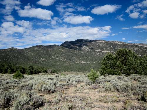
Blue Eagle in the center beckons to us to come climb it
Eastern Approach: From Tank Summit on the east side, the hike was first up over a small saddle and then down into a drainage that contains Cazier Spring. This part is mostly following cow/horse trails through sage brush. Then we hiked up to the south ridge of Blue Eagle through mostly a pine and juniper forest. Hiking was easy and continued to be easy once on the ridge. The ridge has several ups and downs and then past point 8830 on the topo we encountered a steep rocky area. This area is white on the topo. Some of this is vertical rock. We found the easiest route was more to the east side where the rock and forest meet. The final ascent was up a steep rocky gully that was not technical.
On the descent we took a more direct route down and towards the trailhead. I would use the direct route if I were to climb this one again. Great climb, great views. See Dennis's GPS track
Totals: 2400 elevation gain in 6.3 miles (roundtrip) You gain elevation to the ridgeline, then drop down to the next valley as you begin the ascent up the summit. Coming back out, you will need to regain the elevation back up to the ridgeline. No route map will be provided as Dennis's GPS track linked just above will show the way we went very nicely.
The book, (now out of print), "Hiking the Great Basin" by John Hart mentions a route up via Box Canyon. It looks like you can still purchase a used copy via Amazon and if you are interested in another route, I'd recommend getting the book, it would be worth the few bucks that it would cost you. He provides some information on page 237 that might be helpful but a careful study of topo maps might allow you to discern a route. I had the book but opted to use the advice I had received from John Vitz who mentioned accessing the mountain from its east side and going in from Andrew and Log Springs. The route we mapped out worked well and elevation gain wise might be a bit easier.
 A ridge and valley away A ridge and valley away |  Forested slopes to deal with Forested slopes to deal with |  Summit is not all that far now Summit is not all that far now |

The summit is up there
Red Tape
BLM LandSince this mountain is on BLM land, you might contact the BLM office in Ely for more information if you need it:
Ely District Office
702 N. Industrial Way
HC 33 Box 33500
Ely NV 89301
Phone: 775-289-1800
Office Hours: 7:30 am - 4:30 pm M-F

Last obstacle
 Coming up the chute Coming up the chute |  Almost on the summit plateau Almost on the summit plateau |  At the summit At the summit |
When to Climb
This mountain is a long way from nowhere and I wouldn't venture into the area without getting the most recent weather report and plan accordingly. On our way into Tank summit, we encountered several mud areas where we might have gotten stuck if they had been much longer than they were. In other words, do not drive out here when it is wet or rainy, the roads can become impassable. We'd had a storm the day before and the roads really hadn't dried out enough and we found several areas of that were affected by flash flooding.Also be sure to have plenty of gas, water and supplies as you more than likely will not encounter anyone else (we didn't) from the time you leave US 6 to the time you return. Let others know of your plans and taking two vehicles would be a good safety net. I wouldn't even think about doing this one during the winter from the east side as we did.
In John Hart's book, "Hiking the Great Basin", he mentions that he climbed the mountain in December via Box Canyon. So, it is seemingly possible that this mountain can be climbed in most months of the year.
 Looking north Looking north |  Troy Peak to the west Troy Peak to the west |  Currant Peak in the distance Currant Peak in the distance |
Camping & Weather
No formal campgrounds are available in the area but it is legal to car camp on BLM land if you will observe the "leave no trace" ethics.
Click for weather forecast

Click for weather forecast
My birthday hike and summit log

Summit cairn & register
Following John Vitz's tips, we drove in via the Andrew Spring way and the roads were nasty with one mud section I almost got stuck in on the way in and on the way out. Ugly road conditions but we had been promised by the weather report that the weather was going to be better (it was). We parked near Tank Pass and made our way up and over some ridges to get on the mountain proper. Dennis once again led a good route (see his GPS track) and it worked well for our needs. Wonderful views from the summit and I celebrated my 73rd birthday with the summit as a gift. Dennis was patient with my slow progress both up and down this one as I was feeling everyone of those years on this hike. One huge negative was losing my camera with all my pictures from this trip on the way down. One treasure lost was all the pics I had taken of summit register pages and this one. I will attempt to reconstuct the log utilizing the information found on both peakbagger.com and lists of John.
John Hart - year unknown
Ted Brasket - year unknown
Frederick Johnson - 1992
John Vitz and Barbara Sheets - 2000
Gordon MacLeod and Barbara Lilley - 2002
Dennis Poulin and Dean Molen 2013
Since our visit in 2013, two others followed in 2014 and five more so far in 2015.
That's it. I'm sure many others, locals and hunters and those who placed the benchmark originally visited this one but as far as what is recorded, the above list is it.
Picture credits

All the pictures used on this SP page are thanks to Dennis Poulin and his generousity in letting me use them. My camera with all my pictures were lost on this mountain on the descent and so it is with my appreciation that I am able to present the information on this page. Thank you Dennis.