
|
|
Mountain/Rock |
|---|---|
|
|
46.93750°N / 10.11290°E |
|
|
Hiking, Mountaineering, Trad Climbing, Scrambling |
|
|
Spring, Summer, Fall |
|
|
9229 ft / 2813 m |
|
|
Overview
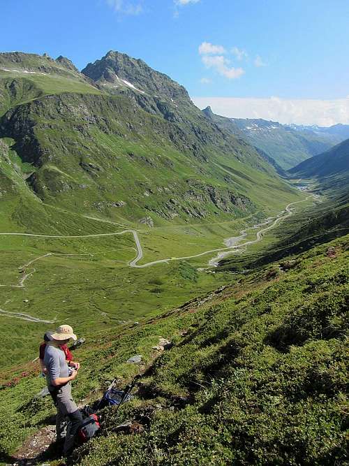
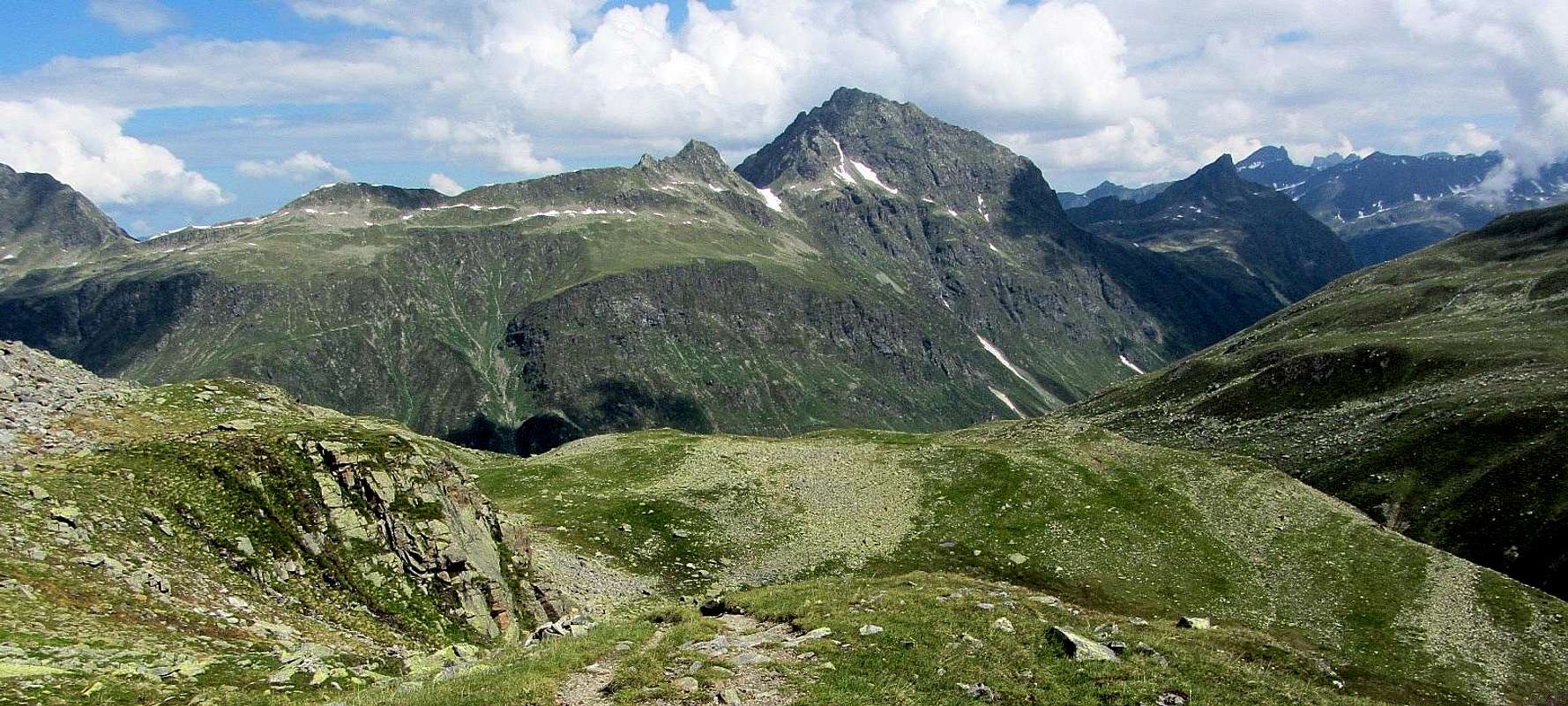
Vallüla towering over the Kleinvermunt valley, which lies at the end of the Paznaun valley. This is from the SSW. Bielerhöhe is just out of view on the left.
See that patch of old snow high up? Right above there, hidden from view, is a steep couloir. If there is snow below the couloir, there certainly must be snow in there too. And that's a good sign, for the normal route ascends that couloir, and old snow covering the loose rocks makes it a bit safer.
The key saddle is Bielerhöhe (2037m), not far away to the southwest. This wide area connects the Montafon and Paznaun valleys, and at the same time forms the northern shore of the scenic Bieler Stausee, a big dammed lake. Bordering the Vallüla group on the north is the Kops Stausee (1809m), another, smaller, dammed lake. However, from Vallüla itself this lake is hidden from view by the ridge between the Breitspitze (2196m) and Ballunspitze (2671m).
Since it's the highest in the immediate area, Vallüla offers excellent views, especially towards the Bieler Stausee and the high glaciated peaks beyond. From the higher slopes the scenery is already pretty impressive, but the best views are reserved for scramblers and climbers: the easiest way up is UIAA grade II, and the difficulties start shortly above 2500 m.
Three Steep Ridges
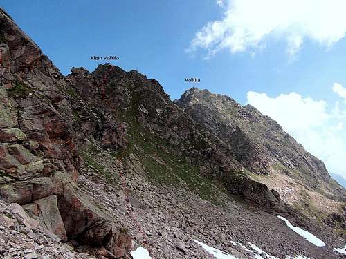
The peak has three main ridges. A steep one starts out to the east and gradually turns northeast. After about a kilometer the terrain gets easier, and over the next kilometer it crosses a broad saddle (±2270m), before rising sharply again to the aforementioned Ballunspitze. Another steep ridge extends for a little over a kilometer to the NW. The steepest of all is the short and jagged south ridge, which, after turning towards the southwest lower down, leads to the Vallülascharte (2515m) ("Scharte" = saddle). From there it rises quickly once more, to Klein Vallüla (2643m) - "klein" meaning small. Sometimes Vallüla itself is referred to as Groß Vallüla - "groß" meaning big.
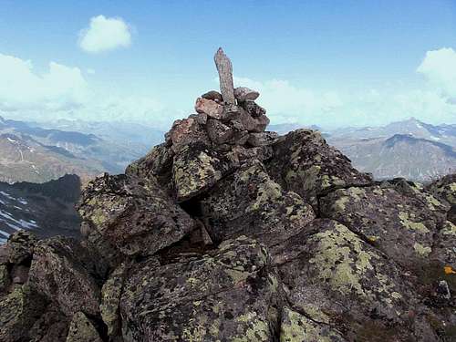
Vallüla summit cross
A big, old wooden cross marks the top. It's not a big summit, but there is room enough around it to accommodate a small group of people.
Getting There
Bielerhöhe is served by the Silvretta Hochalpenstraße. This is a toll road, but on the plus side, parking is free, and there is ample space for that. Frequent buses drive along the road. In winter the road is closed.
The toll part is between the Austrian villages of Partenen in the Montafon and Galtür in the Paznaun valley. The only way to get to Partenen is from Bludenz, to the northwest. Similarly, the main road to Galtür is from Landeck, to the northeast. Both Bludenz and Landeck have a train station. For detailed travel information, check out OEBB. You can search directly for Bielerhöhe.
Routes
OSM map of the surrounding trails. The shorter, more direct trail between Partenen and the Vallülascharte is missing.
Normal Route
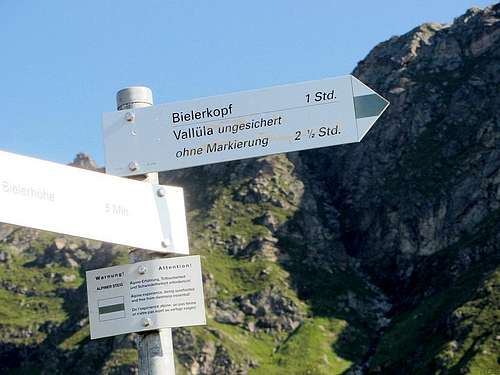
A sign at the Bielerhöhe trailhead incorrectly states that the trail to Vallüla is unmarked. Sure, the sparse markings high on the mountain leave room for improvement, but there are markings.
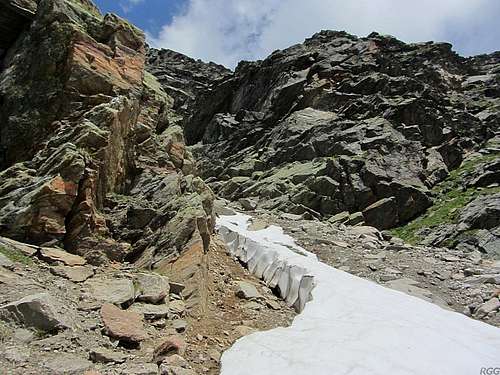
Old snow on the normal route, just below the couloir
Looking down from the top of the couloir. Here it was free of snow, but lower down, where the couloir was more shaded, there was still a lot.
Right before reaching the scharte, the trail from Bielerhöhe to Vallüla heads east, traversing the scree below the steep southern slopes of the upper part of the mountain. Cairns and paint marks show the way. After a couple of minutes, gaining just a little altitude, the route reaches the base of a steep couloir. Even though it faces south, it's well shaded on both east and west, and snow can linger well into the summer. Old, hard packed snow means you'll need crampons and ice axe, and a rope if you're not real quick at self arrest. If there is little snow, rockfall is a definite hazard, for there is lots of loose stuff. Be careful, especially if there are other climbers around. Some climbing moves are required in a couple of places on the rocks on the side of the couloir.
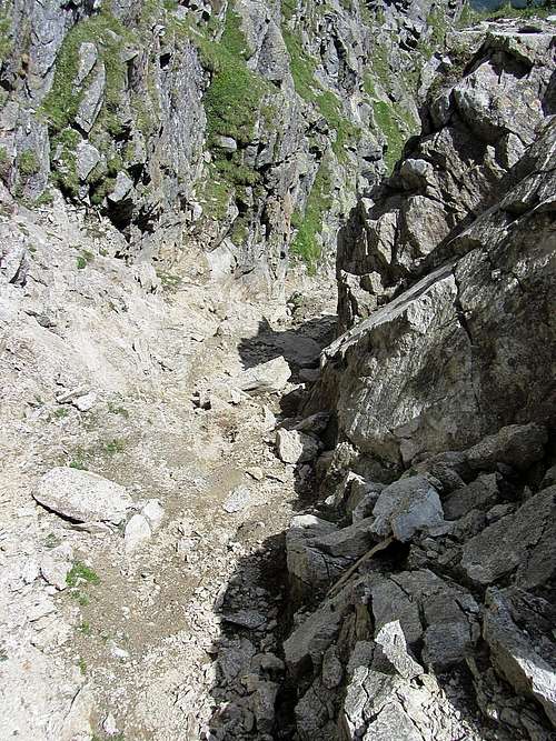
At the top, the couloir ends at a small saddle on the south ridge. The route stays near the crest of the ridge from there, but doesn't quite follow it. First it climbs a bit on the west face right below it, with a few short scrambling sections (up to UIAA grade II, mostly easier).
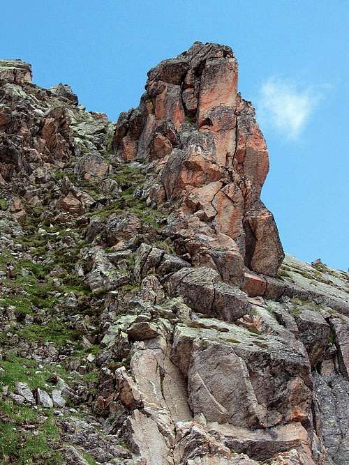
Above the couloir, the rock quality is decent.

A bolt! A clear sign that this is no mere hiking route anymore!
While the part just above the couloir is technically slightly harder, the couloir itself is the most dangerous part of the route. Without snow, there is the rockfall hazard to contend with. A helmet is no unnecessary luxury for this section. With good snow cover the main danger is falling: unless the snow is soft, it's too steep for self arrest. When I arrived at the base of the couloir, which had a nice layer of old snow, a small group of hikers came down. Apparently without knowledge of the route, they had ventured up just a little bit before realizing it was well beyond hiking, and they were visibly shaken. They were clearly far out of their comfort zone and the look on their faces showed they had made the right decision in turning back.
Note: In 2013, at the trail junction of the routes to the Bielerspitze and Vallülla a makeshift sign said that the trail to Vallülla was out of order. I ascended via the Bielerspitze, which I planned to do anyway, but came down the normal way and didn't see a problem with the trail.
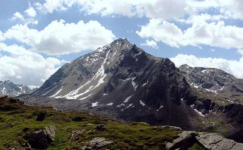
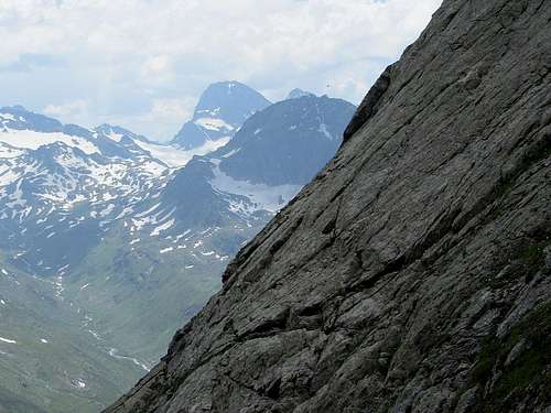
Bielerspitze (the flat summit on the left), Klein Vallüla and Vallüla from the south, from the slopes of Hohes Rad.
The lower half of the couloir hosting the normal route is visible as a thin white line, a clear indication that it still has plenty of snow.
Vallüla from the north, from the Breitspitze. The E ridge is on the left, the NW ridge on the right.
Other Routes
The Northwest is a little harder than the normal route, with climbing up to UIAA grade III. Partenen or Bielerhöhe are both suitable trailheads for the way up, but from Partenen takes longer because it is much lower. With a car I would prefer Bielerhöhe, because descending the normal route back down there is much shorter than all the way back to Partenen. When traveling by public transport, I would prefer Partenen, but descend to Bielerhöhe.The East ridge is slightly harder than the Northwest ridge. Unless you know the area, you may not find the easiest way to the base of the East ridge from just looking at the map: the nearest trailhead is the big parking lot on the NW side of the Kops Stausee. To get to the base of the Vallüla East ridge, start by heading up the clear trail the Breitspitze. Once you reach the crest of the broad Breitspitze east ridge, turn east and follow the signs to the Vallüla See (2149m), a small natural lake, one kilometer north of the base of the ridge.
Klein Vallüla
A gendarme on the ridge between the Bielerspitze and Klein Vallüla: this was one of the reasons I decided to leave the ridge
Klein Vallüla doesn't have a summit cross - just a small cairn
Red Tape
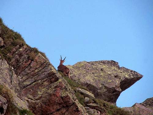
A mountain goat climbing Klein Vallüla, close to the summit
When to Climb
The normal route is best climbed when there is some hard, old snow in the couloir, to minimize the rockfall hazard. The mountain is steep on all sides, so in winter and early spring, avalanche danger is very real.Accommodation
There are several options at Bielerhöhe, such as the Madlenerhaus, a mountain refuge just a little bit away from the road. The nearby villages such as Partenen, Galtür and especially Ischgl are part of a lively ski scene in winter, and consequently there will be plenty of room in summer.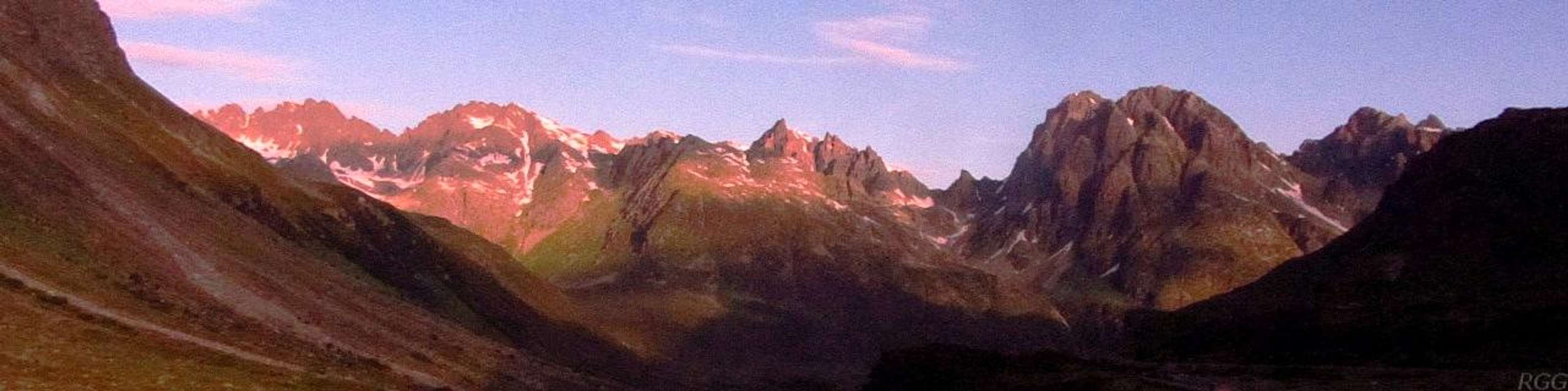
The views from the Madlenerhaus are pretty good. This is to the west, at sunrise, with the Valgragges Spitzen
Books and Maps
A good (German) guidebook for the area is the Silvretta Alpenvereinsführer, Günther Flaig, Rother Verlag. ISBN 978-3-7633-1097-5.The best map is the Alpenvereinskarte Silvrettagruppe, 1:25 000.
A fine alternative is the Freytag&Bernd map WK 374, 1:50 000, which covers a larger area.
See also the external links section.
External Links
| Bielerhöhe | In German and English. |
| Vallüla on hikr.org | In German. |
| Swisstopo online | An excellent online map, even though Vallüla lies well north of the Swiss-Austrian border. |
 Piz Buin and Hohes Rad from high on Vallüla | 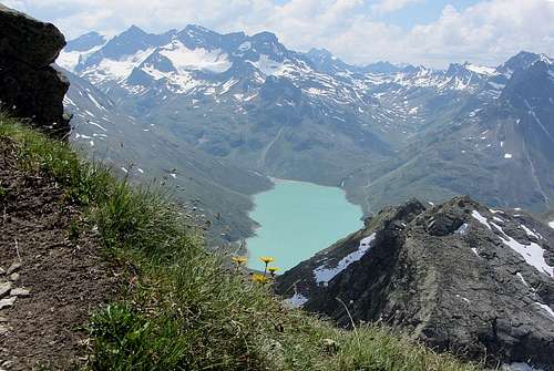 Silvretta Stausee from high on Vallüla - on the right is Klein Vallüla |