
-
 5222 Hits
-
 81.84% Score
-
 14 Votes
|
|
Mountain/Rock |
|---|---|
|
|
47.40438°N / 15.35962°E |
|
|
Hiking |
|
|
Spring, Summer, Fall, Winter |
|
|
5341 ft / 1628 m |
|
|
Topographic isolation: 7 km
Nearest higher peak: Hochlantsch (1720 m)
Prominence: 628 m![The valley of Mur with the rocks of Rennfeld]()
The rocks of RennfeldThough Rennfeld is only the 5th highest named peak of the Fischbach Alps, it can be considered as the 2nd "most important" peak. Why? Each of the summits of Amundsenhöhe, Pretul and Grazer Stuhleck have smaller prominence than 75 m, while Rennfeld has an impressive prominence of 628 m. With this value the mountain is the 37th on the top prominence list of Styria.![The valley of Mur]()
The valley of MurThe mass of Rennfeld is very impressive, especially when looking at it from the valley of Mur or from the peak of Hochlantsch. The valley of Mur at Perneck, at the foot of Rennfeld is only on 475 m above see level. As the peak of Rennfeld is 1628 m high, the relative height of the mountain is 1153 m. The mass of the mountain is bordered by the valley of Mur from west. But also from north and from south it is border by deep valleys: by the valley of Mürz and by the valley of Breitenauer Bach. All these waters within the drainage basin of Mur. As already mentioned, Rennfeld is the westernmost mountain of the long chain of the Fischbach Alps. It is separated from the other parts of the mountain range by the Eibeggsattel (1001 m).![Praktisch]()
On BuchecksattelHikers can get to the foot of Rennfeld very easily because the city Bruck an der Mur is a traffic junction both for car drivers or for those who travel by train. Direct and quick trains go here from Graz and from Vienna, and there is highway/speedway connection for car drivers, too. The distance from Graz is 45 km, while the distance from Vienna is 150 km.
So the most convenient starting point of a hike to Rennfeld is from Bruck an der Mur if we consider only the road and trail network. For hikers travelling with train also the railway station of Pernegg can be a convenient place to start a tour.
Car drivers have more opportunity: the easiest hike is from Frauenberg (939 m a.s.l.). From southeast they can start a tour also from Feisterergraben or from St.Jakob - Breitenau.
The network of hiking trails is dense here. They have no technical difficulty. Still they have some steep sections, and also the elevation gain is considerable if the final goal is to get to the peak.![Excellent view]()
Excellent viewThe summit area has grassy areas and some open fields of blueberry with spotted trees. Due to the big prominence and the limited number of trees it gives excellent panoramic view around. The highest point is a rocky pile with a metallic table on it with information about all peaks that can be seen around in 360 degree.
View from the summit –some more exposed nearby mountains:![Rennfeld summit cross]()
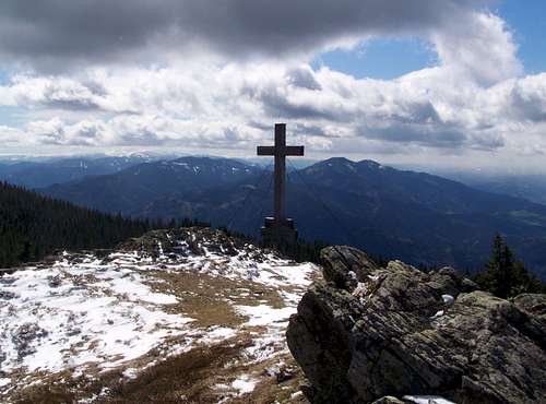
Rennfeld summit crossThe “mandatory” summit cross is erected some dozen meters further on another rocky pile. This pile is a bit lower than the other. The cross is dedicated to the victims of the two world wars.
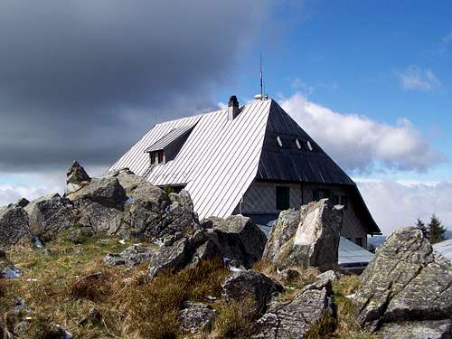
Some hundreds meter further to north besides the 3rd rocky pile you can find the Ottokar-Kernstock Tourist Hut. There is also a radio transmission station on the summit, but fortunately it doesn’t much disturbs the view. And finally, 500 meter southwest to the peak you can visit the best rock formations of Rennfeld.![Snow is usual in April in this altitude]()
Snow is usual in April hereAny time of the year. In winter and in early spring expect deep snow![Neues Ottokar-Kernstock-Haus]()
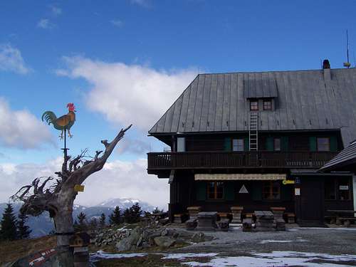
Neues Ottokar-Kernstock-HausCamping Lanzmaierhof
Address: Frohnleiten, Ungersdorf 16
Tel. 03126/2360
Click here for website
![Neues Ottokar-Kernstock-Haus]()
Neues Ottokar-Kernstock-HausRaddörfl Gasthof Pichler / Camping
Address: Bruck an der Mur, Bruckerstrasse 110
03862/51418
www.gasthofpichler.at
Ottokar-Kernstock-Haus (1610 m)
Tel. 0664/2175225
Click here for website
In summer: constantly opened between 1 June – 31 October
In winter between 1 November - 31 May it is opened during weekends (Fri-Mon). Always closed on 25 December.
GH Prieselbauer-Alm (741 m)
Tel. 0664/5253974 (closed on Wednesdays and Thursdays)
www.prieselbauer.com
![Crocus albiflorus]()
Crocus albiflorusRother-Wanderführer Guidebook:
Günter und Luise Auferbauer, „Grazer Hausberge“ – www.rother.de
Touris Map:
Freytag und Berndt, FB, WK 131; Österreichische Karte (ÖK)
Please click here for online touris map
Nearest higher peak: Hochlantsch (1720 m)
Prominence: 628 m
Overview
Rennfeld is the westernmost mountain of the 45 km long chain of the Fischbach Alps. The highest peaks of the Fischbach Alps are the following:
- Stuhleck (1782 m)
- Amundsenhöhe (1666 m)
- Pretul (1656 m)
- Grazer Stuhleck (1635 m)
- Rennfeld (1629 m)
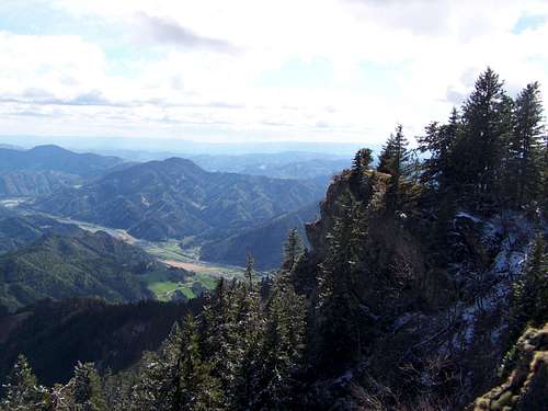
The rocks of Rennfeld
Rennfeld is considered as being part the 3 "Hausbergs" of the well known city Bruck and der Mur. Actually Rennfeld is the highest among them. The other two mountains of this club are Hochanger (1304 m) and Madereck (1050 m).
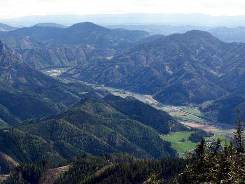
The valley of Mur
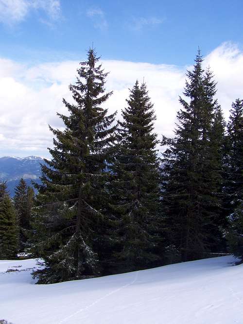
Most of the mountain is covered with spruce forests. Only the summit area has grassy areas and some open fields of blueberry. The main ridge of Rennfeld is stretchibg from west to east. The southern slopes of the mountain is much steeper than the northern slopes. On the southern slopes there are several rock outcrops and rock formations, and here you can see that these rocks are made of schist.
Getting There and Routes
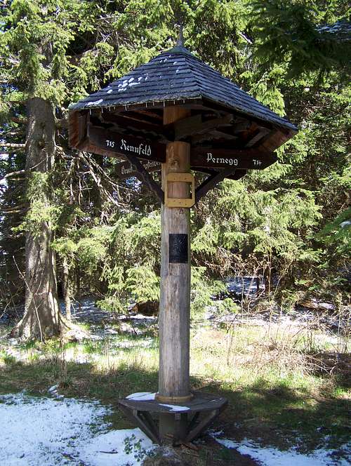
On Buchecksattel
So the most convenient starting point of a hike to Rennfeld is from Bruck an der Mur if we consider only the road and trail network. For hikers travelling with train also the railway station of Pernegg can be a convenient place to start a tour.
Car drivers have more opportunity: the easiest hike is from Frauenberg (939 m a.s.l.). From southeast they can start a tour also from Feisterergraben or from St.Jakob - Breitenau.
The network of hiking trails is dense here. They have no technical difficulty. Still they have some steep sections, and also the elevation gain is considerable if the final goal is to get to the peak.
On the Summit
Excellent view
View from the summit –some more exposed nearby mountains:
- NW: Hochschwab (2277 m)
- N: Veitschalpe (1981 m)
- NE: Schneealpe (1903 m) and Rax (2007 m)
- SE: Hochlantsch (1720 m)
- SW: Wetterkogel (1643 m) and Speikkogel (1988 m)
- W: Gösseck (2214 m)
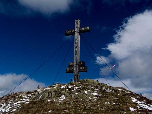
Rennfeld summit cross
Some hundreds meter further to north besides the 3rd rocky pile you can find the Ottokar-Kernstock Tourist Hut. There is also a radio transmission station on the summit, but fortunately it doesn’t much disturbs the view. And finally, 500 meter southwest to the peak you can visit the best rock formations of Rennfeld.
When to Climb
Snow is usual in April here
Camping
Neues Ottokar-Kernstock-Haus
Address: Frohnleiten, Ungersdorf 16
Tel. 03126/2360
Click here for website
Neues Ottokar-Kernstock-Haus
Address: Bruck an der Mur, Bruckerstrasse 110
03862/51418
www.gasthofpichler.at
Ottokar-Kernstock-Haus (1610 m)
Tel. 0664/2175225
Click here for website
In summer: constantly opened between 1 June – 31 October
In winter between 1 November - 31 May it is opened during weekends (Fri-Mon). Always closed on 25 December.
GH Prieselbauer-Alm (741 m)
Tel. 0664/5253974 (closed on Wednesdays and Thursdays)
www.prieselbauer.com
Maps and Books
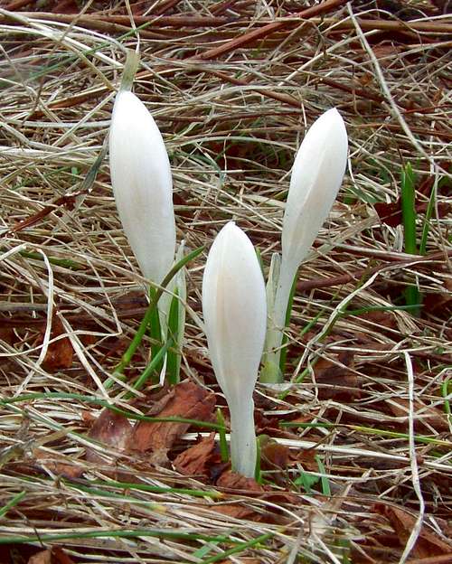
Crocus albiflorus
Günter und Luise Auferbauer, „Grazer Hausberge“ – www.rother.de
Touris Map:
Freytag und Berndt, FB, WK 131; Österreichische Karte (ÖK)
Please click here for online touris map