
|
|
Mountain/Rock |
|---|---|
|
|
48.25180°N / 120.34297°W |
|
|
Okanogan |
|
|
Hiking, Mountaineering, Scrambling |
|
|
Spring, Summer, Fall |
|
|
8464 ft / 2580 m |
|
|
Overview
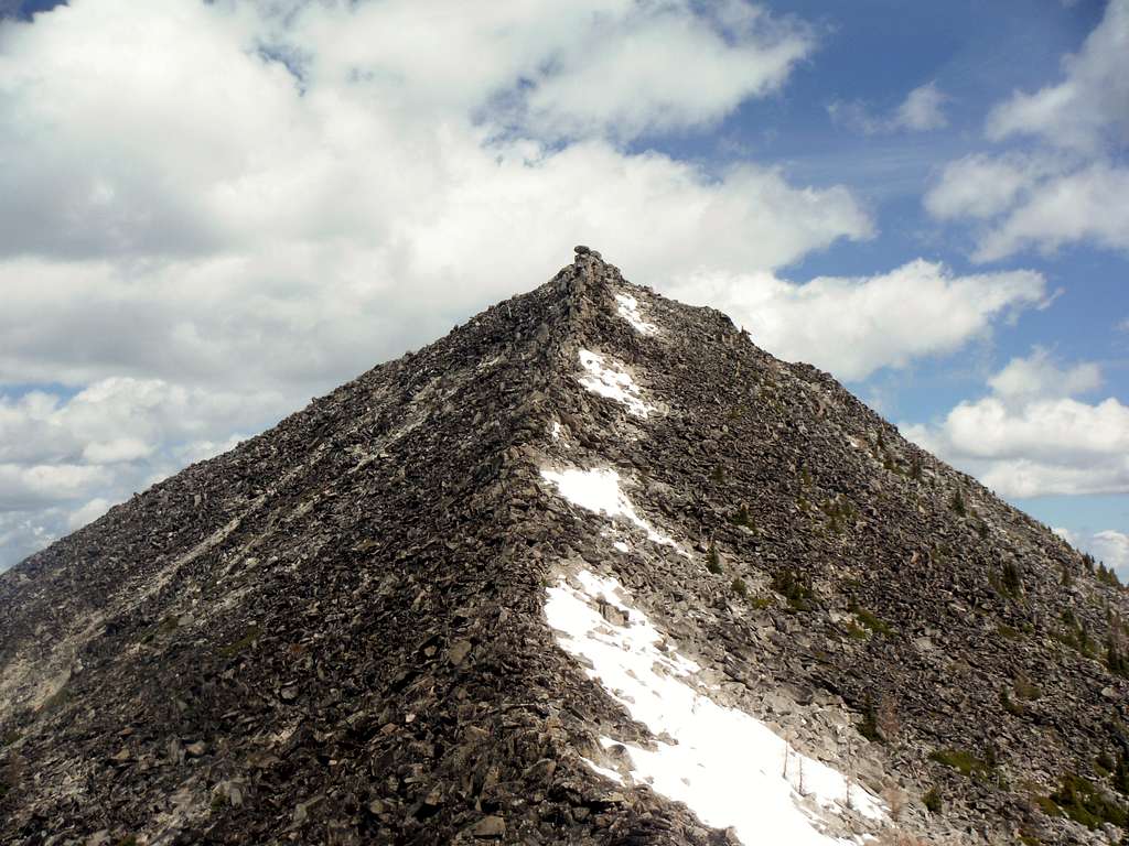
The ridge to Hoodoo Peak
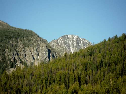 First appearance of Hoodoo Peak | 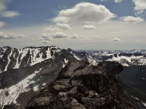 Summit picture |
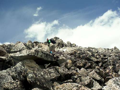
At 12 miles and over 4000 feet of elevation gain you do have to do some work to get to summit. The summit ridge, which is Class 2, is a constant boulder scramble from the ridgeline to the summit. Not all the boulders heading up to this summit are steady so while you are going up please check rock before putting weight on it. The blow down that was on the Libby Lake Trail until summer 2014 has now been cleared. This blow down used to be a major hassle for climbers.
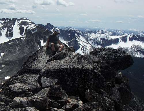 Checking out the terrain | 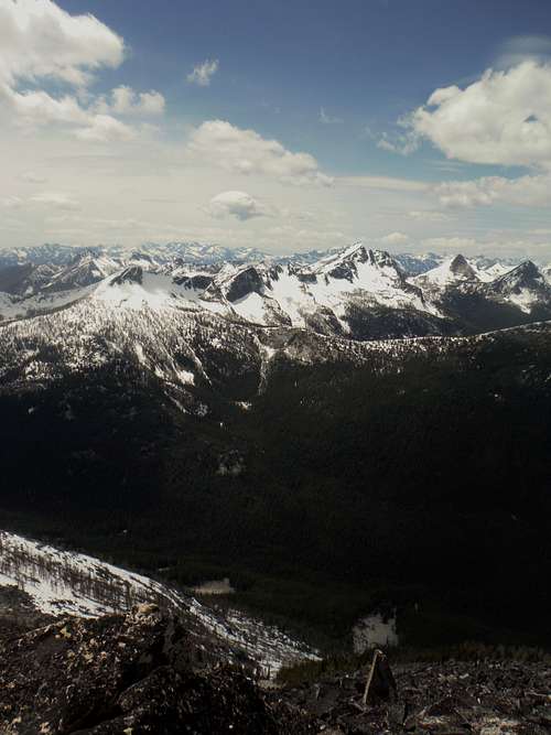 Typical amazing summit shots. |
The views from the summit of Hoodoo Peak are fantastic. One can see at least 30 Bulger summits and hundreds of other summits from Hoodoo Peak. Peak such as nearby Raven Ridge and Oval Peak, Courtney Peak and Star Peak can easily be recognized from Hoodoo Peak. The Enchantment Range and many of the northern Cascades can be seen from Hoodoo Peak. Hoodoo has a complete 360 degree panorama like almost Bulger summits in Washington State. You have a great chance on having the entire summit to yourself due to how far this peak is away from every major town.
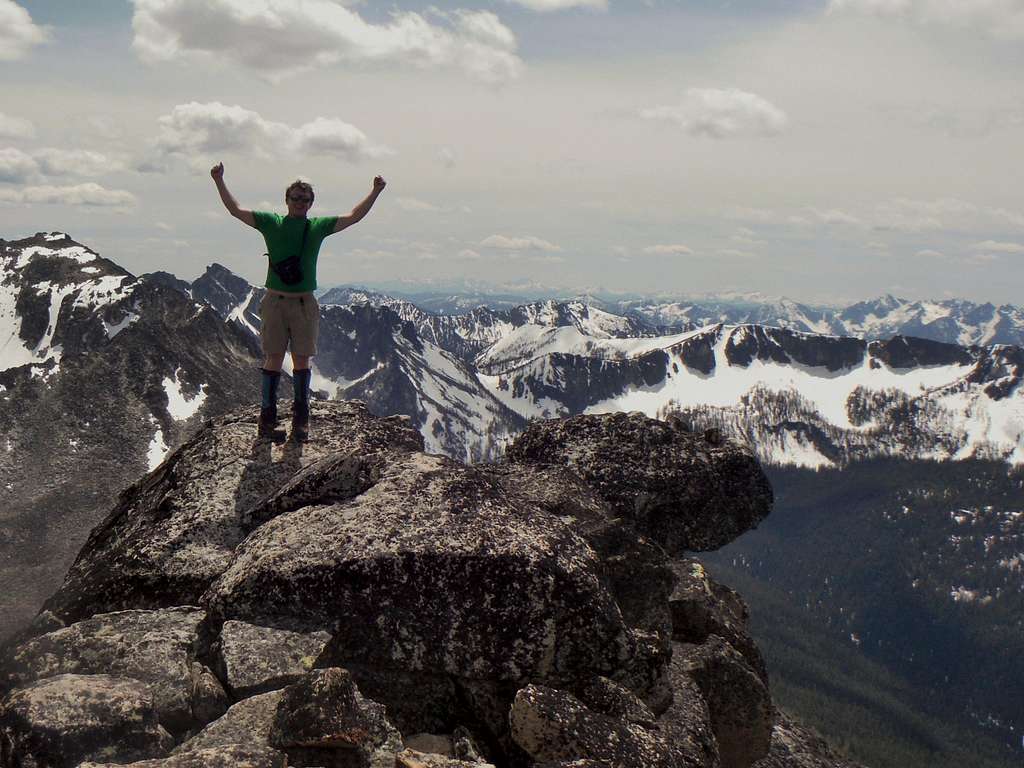
Josh Lewis grabs victory!!
Getting There
VIA THE LIBBY LAKE TRAILHEAD: From Wenatchee head east on Route 2/97 for two miles. Make a left onto 97 toward Okanogan and and stay on the road for 53 miles. Make a left onto WA-153 and go 21 miles. From there make a left on Libby Creek Road and go 2.5 miles. Make a slight left onto Black Pine Lake Road which will then turn into NF-43. Stay on this road from 3.2 miles and watch out for cattle grazing on the road. Make yet another slight left onto NF 4340 for 1.2 miles. Then make a right onto NF-700 and go one mile to a sign pointing to the Libby Lake Trailhead on the left side. Take that road all of the way to the trailhead.Route
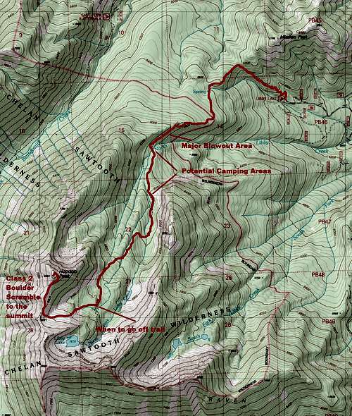
Map of the Route (note: the blowout area has been cleared)
Class 2 (Boulder Scramble)
Distance: 12 miles
Elevation Gain: 4200 feet
This route starts out from the Libby lake Trailhead, it goes up quickly yet gently up with a number of nice switchbacks up to the gap between a smaller peak called Mission Peak and the ridge that leads to Libby Lake and Hoodoo Peak. The trail will start out very narrow as it passes through a field of Indian Paintbrush and Balsamroot. This section of trail is delightful in early June. Take this trail for 5+ miles. You will cross Libby Creek and continue up the well paced trail where you will then recross Libby Creek and then one of its tributaries until you will continue to hike up until you see that same tributary again.
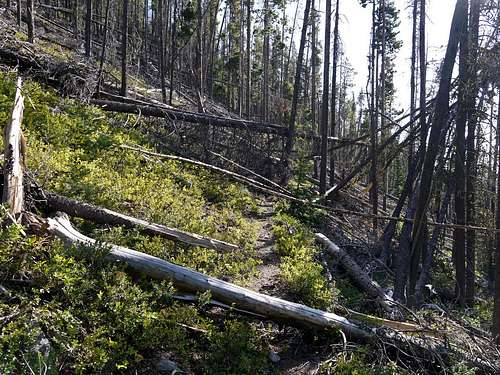 This is not a pretty shot but a shot showing you what conditions are for a mile along the normally tame Libby Creek Trail. THIS HAS NOW BEEN CLEARED!! | 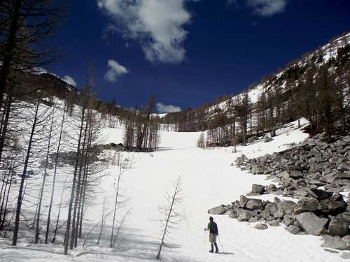 Finally off the trail and heading up the gully |
There is where you will then go off-trail this may be hard to see in spring due to the spring snow so pay attention to the geography of the region. From there scramble up to the ridge. This will either be snow in spring or boulders in summer and fall. You will then finish the climb from the ridge with a constant Class 2 boulder scramble. Exposure on this peak is minimal but one must really pay attention to where your hands and feet on the boulder scramble in order to make sure of no loose rocks or twisted ankles. Once you get towards the summit you want to right of the summit for easiest ascent to the top. There is a nice area below where one can rest but beware of biting ladybugs which Josh Lewis and I experience on Hoodoo Peak.
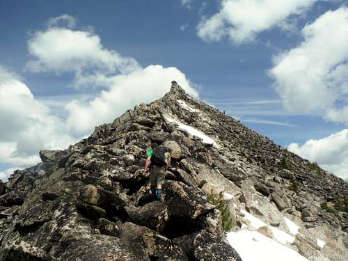
 Josh Lewis heading up Hoodoo Peak | 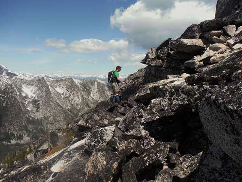 Josh Lewis scrambling up Hoodoo Peak |
Alternative Route
It should also be noted that according to Matt Lemke there is a much easier route up Hoodoo Peak than the one listed above. He recommends the Southeast Face to the summit of Hoodoo Peak instead of the southwest ridge because the scramble up is much less tedious due to all the boulder scrambling on the southwest ridge.
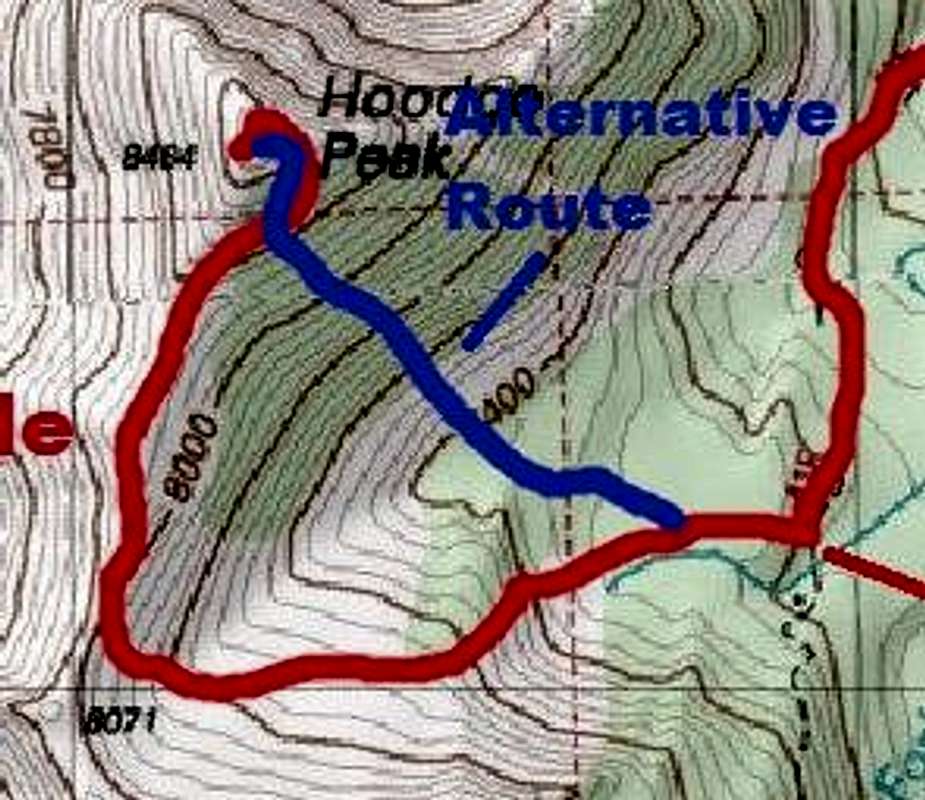
Alternative Route
Red Tape
Unlike most trailheads in Washington State as of 2014 this trailhead is still free.When to Climb
Josh scrambling up Hoodoo Peak
wsashby - Nov 8, 2015 8:14 pm - Hasn't voted
Trail all clearAs of Oct 2015 the trail to Hoodoo & Raven Ridge is completely clear of blow down. Smooth sweet trail all the way to the cabin and beyond to the lake.
EastKing - Nov 11, 2015 10:08 pm - Hasn't voted
Re: Trail all clearNice! Thanks for the update!!
ryanmolden - May 23, 2017 6:15 pm - Hasn't voted
Re: Trail all clearIt is back as of 5/20/17, blow down city, lots of fun :P
kmccrohan - Oct 2, 2017 11:21 am - Hasn't voted
Traverse to Raven RigeWe did the traverse from Raven Ridge to Hoodoo. It is spectacularly fun, with one decently long section of exposed class 4 (definitely no-slip area) on the knife edged ridge. Additionally, if you are going from Raven to Hoodoo, you will encounter a 5.7 overhanging boulder problem partway through that may give shorter members trouble. I managed it in runnings shoes with a heel hook, but my shorter partner needed a boost. There is a rap sling above so if you are going the other way, 30 ft of cord is enough to rap the move. But you can also downclimb the move, which I did, because the handholds are so good. You might be able to avoid this problem by dropping lower on the west side of the ridge, but it looked very loose and less fun.