
|
|
Mountain/Rock |
|---|---|
|
|
38.40113°N / 109.26148°W |
|
|
San Juan |
|
|
Mountaineering |
|
|
11817 ft / 3602 m |
|
|
Overview
The La Sal Mountains of south-eastern Utah are said to be the second highest range in the state (after the Uinta Mountains). The peaks offer excellent views of the surrounding Colorado Plateau country - stark rock landscapes as well as the pinyon forest which surrounds the La Sals like an apron.
South Mountain is the southernmost tall peak of the La Sals (11817' or 3602m elevation). It is the only named peak of the range south of Forest Road 73 (La Sal Pass road). There are a few sub-peaks - apparently not of enough prominence for official names.
As pointed out by another user, the hike I outline below is probably the easiest way - other routes are mentioned below...
Getting There
The route recommended here starts from the La Sal Pass area (Forest Road 73). Elevation here is a little over 10,000' (a little over 3048m). From Moab, drive south on Utah Highway 191 a little over 20 miles to the junction with Utah Highway 46 ("La Sal Junction"). Head east on UT46 for ~12.8 miles (passing through the small town of La Sal) to the gravel road signed as "La Sal Pass" (this is County Road 154). Turn north (left) onto this road, and after another 2 miles you will reach Forest Road 73 on the left (west). Another ~7.4 miles on this road will take you to La Sal Pass. There is an un-bridged crossing of La Sal Creek a couple miles into FR 073 - here it is broad and cobbly and should not be a problem for a low-clearance vehicle during low flow periods. During spring snowmelt, call the Moab Forest Service District Office for road conditions.
My Route
There is no maintained trail. Recommended beginning point is at the La Sal Pass area - my group started from our campsite at nearby Medicine Lakes. We took ~2.5 hours from there to get to the summit. Although it is not a long hike, a compass & map are recommended since one will be starting in mostly dense woods with rolling terrain, talus & deadfall. Our plan was to head directly south from Medicine Lakes to the east ridge of the mountain, and up the broad, open ridge. The expansive views on this final ascent are truly supreme.
Descent route: recommend a reverse of the above. My party decided to make a loop of it: we descended directly north to a rocky saddle (or arete), topped the next hill (elevation listed as 11290' [or 3441m] on USGS 7.5' topographic map: "Mount Tukuhnikivatz" 1987 edition), and bush-whacked back down a heavily forested slope, through a swampy area, back to Medicine Lakes. The granite rock at the saddle was dangerously loose and prone to sliding.
![route - South Mountain]()
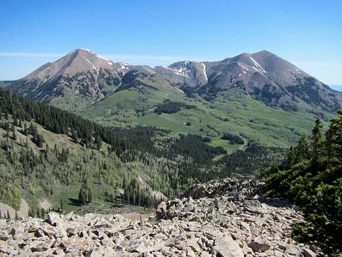
note starting point in basin below: Medicine Lakes. Visible on spur road off La Sal Pass road.
![route - South Mountain]()
Easterly view of the Ridge.
note starting point in basin below: Medicine Lakes. Visible on spur road off La Sal Pass road.
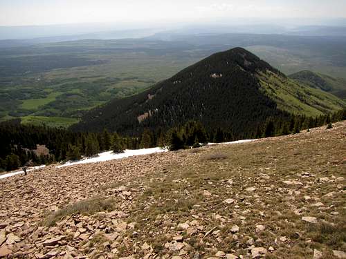
Easterly view of the Ridge.
Other viable routes
Going north on Forest Road 73, an earlier (left, west) turn gets you on Forest Road 128. Two trailheads are encountered on this road: for Doe Canyon trail (100, merges later with 035), and Pole Canyon trail (035). A short off-trail hoof from trail 035 will get you on the summit. It has been done. This area is plainly represented with detail on the NatGeo "Manti La-Sal" map 703 (revised in 2008).
Further along (north) on Forest Road 73, another trailhead serves the Beaver Lake Medicine trail (trail 029). This trail merges with the Pole Canyon trail. Like the other routes mentioned (that I did not do), it is significantly longer and with more elevation gain.