
-
 10506 Hits
-
 70.59% Score
-
 1 Votes
|
|
Mountain/Rock |
|---|---|
|
|
46.71206°N / 121.35286°W |
|
|
Yakima |
|
|
Hiking |
|
|
Summer, Fall |
|
|
6340 ft / 1932 m |
|
|
Overview
Tumac Mountain is located on the high lakes plateau north of White Pass and south of Bumping Lake. Trails from the north and south access the summit of this cinder cone volcano.
Tumac Mountain is thought to have erupted ~12,000 years before present. Cinder cones only erupt once and are done, so don't worry about it erupting again.
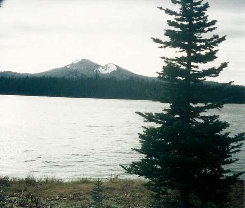
Tumac Mtn. from Twin Sisters Lake - Oct. 1998
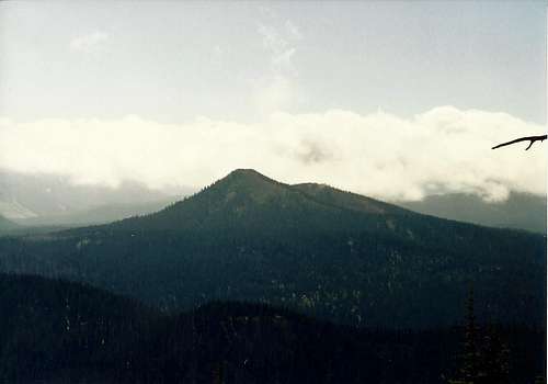
Tumac Mtn. from Pear Butte
Getting There
Deep Creek Rd. Trailhead:
Take SR-410 to the Bumping River Rd. east of Chinook Pass. Bumping River Rd. eventually becomes a forest service road that follows Deep Creek. The road was fully reopened Labor Day 2013 after being closed in 2006 because of severe flooding.
Dog Lake Trailhead:
Take US-12 to Dog Lake just east of White Pass.
Other approaches:
Could also access from the PCT (White or Chinook Pass), Indian Creek, or Jug Lake trailheads.
Route
Deep Creek Rd. Trailhead:
Roundtrip Distance: ~7.5 miles
Elev. Gain: ~2050 ft.
Hike on trail past the smaller Twin Lakes (at ~1.5 miles) and south to the summit (another ~2.25 miles).
Dog Lake Trailhead:
Roundtrip Distance: ~15.5 miles
Elev. Gain: ~2200 ft.
Hike on trail around Dog Lake, past Cramer Lake (~3.5 miles on-way) and connect on a different trail leading to the summit (another ~4.25 miles).
Other approaches:
Other trail connections are possible. Cross country hiking/scambling from Blankenship Lakes is also possible.
Red Tape
- Wilderness permit required
- Free and can be obtained at the trailhead.
- Typical wilderness regulations (12 heart beat limit, no wheeled devices [e.g. bicycles, game carriers], etc).
- U.S. Forest Service Northwest Forest Pass is required at the Deep Creek Trailhead.
- For a list of Wenatchee-Okanogan National Forest trailheads requiring a Northwest Forest Pass for parking please see their website.
- To avoid checking this website for every trip I recommend one of two things:
- Buy an annual pass and leave in your glove box so you have it either way (assuming you are going on more than a couple hikes for the year).- Park at least 1/4 of a mile from the trailhead (some trailheads have signs posted just before arriving at the trailhead).
When to Climb
Later summer and fall.
Trail may be snow free by late July, but there is a reason why the area to the east is called Mosquito Valley.
Late August and September is the best time to visit this area when the bugs are dead and before the snow flies for the next winter.
Camping
Camping at any number of nearby lakes is great. Twin Sisters Lakes and Cramer Lake are popular. 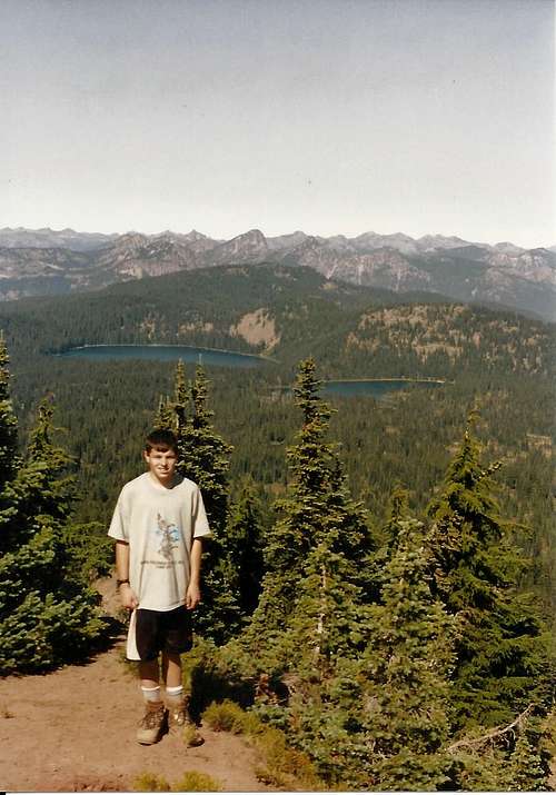
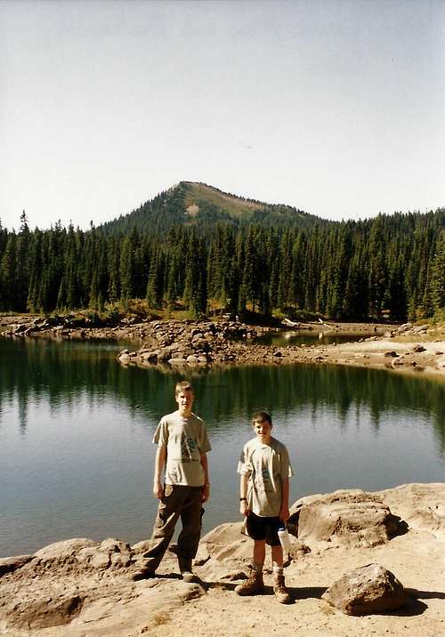
Twin Sisters Lakes from Tumac Mtn.
There is a U.S. Forest Service campground at the Deep Creek Road trailhead.
]
Tumac Mtn. from Blankenship Lakes